


Why visit Rhondda
Townapedia lists 25 museums and landmarks, 41 parks and trails, 209 places to eat, 7 places to stay and 35 attractions in and around town.
Highlights include Pont-y-gwaith, Pont-y-Cafnau, Rhondda Heritage Park and Grave of Guto Nyth Bran.
Weather in Rhondda
Forecast from MET Norway (CC BY 4.0). Full forecast
About Rhondda
Rhondda , or the Rhondda Valley (Welsh: Cwm Rhondda [kʊm ˈr̥ɔnða]), is a former coalmining area in South Wales, historically in the county of Glamorgan. It takes its name from the River Rhondda, and embraces two valleys – the larger Rhondda Fawr valley (mawr, 'large') and the smaller Rhondda Fach valley (bach, 'small') – so that the singular "Rhondda Valley" and the plural are both commonly used. The area forms part of the South Wales Valleys. From 1897 until 1996 there was a local government district of Rhondda.
From the Wikipedia article Rhondda (this version), under CC BY-SA 4.0.
Photos of Rhondda

Things to do35

Pont-y-gwaith
Bridge · 5.1 mi
Historical bridge over the River Taff near Edwardsville, Merthyr Tydfil, Wales


Pontypridd Bridge
Bridge · 6.0 mi
Grade I listed bridge in Pontypridd, south Wales

Coliseum Theatre
Cinema and theater · 4.3 mi
Theatre and cinema in Aberdare, Wales

Iron Tram Bridge, Robertstown
Bridge · 4.4 mi
Grade II listed building in Aberdare
Parc and Dare Hall
Cinema and theater · 2.5 mi
Theatre in Treorchy, Wales
Pontypridd Market and Town Hall
Cinema and theater · 6.1 mi
Grade II listed building in Pontypridd. In the town centre, uphill from and W of the attached Market Chambers
Royal Cinema
Cinema and theater · 2.4 mi
Former cinema in Tonypandy, Wales

23 more on the map.
Museums and landmarks25

Rhondda Heritage Park
Museum · 4.2 mi
Tourist attraction and museum in Trehafod, Rhondda, Wales, United Kingdom
Coed Cae Road, Trehafod


Paul Kirner's Music Palace
Museum · 2.9 mi
South Street, Porth
"By appointment to groups of 15-80 or public events several times a year"

13 more on the map.
Parks, trails and playgrounds41




Parc Abercynon
Park · 5.0 mi
Parc Abercynon, Abercynon
Mo 06:30-21:00; Tu 08:30-21:00; We 06:30-21:00; Th 08:30-21:00; Fr...
Ynysangharad War Memorial
Park · 6.2 mi
Public park in Pontypridd, Wales

Belle Vue Park
Park · 3.1 mi
Public park with decent sized grass areas for plenty of activities and dog exserize, plus playground and basketball court and a swimming pool.
24/7
29 more on the map.
Restaurants and cafes209
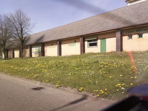
Woods
Restaurant · British · 3.4 mi
Dyffryn Road, Mountain Ash
Mo off; Tu-We 12:00-16:00; Th-Fr 12:00-20:00; Sa 12:00-16:00; Su...
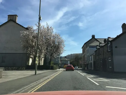
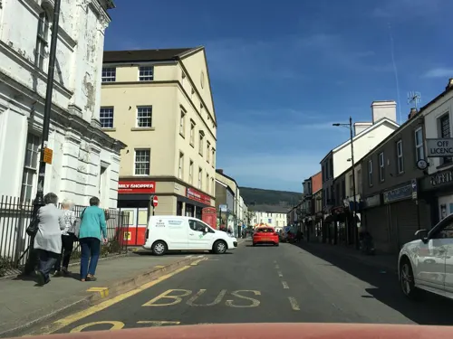


Welfare Hall Cafe
Cafe · Coffee Shop · 1.0 mi
East Road, Tylorstown
Mo off; Tu 09:30-12:30; We off; Th 09:30-12:30; Fr off; Sa off; Su off
Cambrian Lakeside Cafe Bar
Cafe · 2.5 mi
Glan-Y-Llyn, Clydach Vale
Mo 10:00-20:00; Tu-We 10:00-17:00; Th 10:00-21:00; Fr 10:00-22:30;...

Jac's Music Venue
Bar and pub · 3.7 mi
Wind Street, Aberdare
Mo-Th off; Fr 16:00-23:30; Sa 14:00-23:30; Su 14:00-23:00
The Ynyscynon Inn
Restaurant · 3.6 mi
Cwmbach Road
Mo-We 12:00-15:00,18:00-23:00; Th 12:00-15:00,18:00-00:00; Fr,Sa...
197 more on the map.
More about Rhondda
Arts and culture
With an economy largely dependent on a single industry, there was a scarcity of paid jobs for women in Rhondda's coalmining heyday. The Encyclopaedia of Wales notes that the image of the Welsh Mam, a wife and mother constantly at home and exalted as the queen of the household, was essentially a Rhondda creation. However the Rhondda did produce the suffragette and social reformer Elizabeth Andrews, one of nine women among a list of a hundred great Welsh heroes chosen by ballot in 2004.
Social amenities were rudimentary even before the Rhondda Urban District Council was formed in 1897. Due to the geographic layout of the valleys, land was a scarce resource, and so leisure pursuits that took up little space, time and money were sought. This resulted in activities such as greyhound racing, cockfighting, open-air handball (often attached to a public house), boxing, foot racing and rugby union.
From the Wikipedia article Rhondda, under CC BY-SA 4.0.
Notable people from Rhondda
 Nathan JonesWelsh association football player and manager (born 1973)Photo: James Boyes from UK, CC BY 2.0
 Jeffrey WeeksBritish historian and sociologistPhoto: Mark McNestry, CC BY 4.0
 David Stoddart, Baron Stoddart of SwindonBritish politician (born 1926)Photo: Chris McAndrew, CC BY 3.0
 Anne RasaBritish ethologistPhoto: South African Tourism from South Africa, CC BY 2.0
 Rhys GillWelsh rugby union playerPhoto: Daxipedia, CC BY-SA 3.0
- Trevor EdwardsWelsh footballer (1937–2024)
- Ralph Evansboxer
- Daniel EvansWelsh actor
- Steve JonesBritish television presenter
- Leslie DilleyProduction designer (1941—2025)
- Alan EvansWelsh darts player (1949-1999)
- Chris EvansWelsh footballer (born 1962)
Born in Rhondda, according to Wikidata (CC0). Each name links to its Wikipedia article.
Where to stay7
Churches and places of worship110
Hope Church Rhondda
Church · Protestant · 2.7 mi
Unit 1-2 Dunraven Street, Tonypandy
Shopping33
Gas and EV charging8
Schools, colleges and libraries81
Healthcare21
Forest View Medical Centre
Clinic and pharmacy · 3.1 mi
Abergorki Industrial Estate, Treorchy
Map of Rhondda
250 places. The map loads OpenStreetMap tiles when you open it.
Getting there and nearby towns
Cardiff Airport (CWL) is the nearest airport with scheduled flights listed in OpenStreetMap, 19 miles away.
- Treharris 6 mi east, about 10 min by car
- Tredegar 12 mi northeast, about 19 min by car
- Whitchurch 14 mi southeast, about 23 min by car
- Risca 15 mi east, about 25 min by car
- Ystalyfera 16 mi northwest, about 26 min by car
- Cardiff 17 mi southeast, about 27 min by car
- Newport 20 mi east, about 32 min by car
- Swansea 21 mi west, about 34 min by car
- Clevedon 29 mi southeast, about 47 min by car
- Weston-super-Mare 30 mi southeast, about 48 min by car
Drive times are estimates from straight-line distance, not routes.
Towns near Rhondda


Keep exploring
Local news
Headlines from INDB.
Reviews, tips and questions
Loading what members have shared...
Sources and licences
- GeoNames (CC BY 4.0): population, coordinates, regions and time zone
- Mapillary (see each image): photos
- OpenStreetMap contributors (ODbL 1.0): places, airports, map data
- Wikidata (CC0 1.0): elevation, founding date, time zone, website, landmarks and historic places
- Wikimedia Commons (see each image): photos
- Wikipedia (CC BY-SA 4.0): overview and history text
Photo credits
- Maerdy, Rhondda, Unknown author, Public domain
- Pontygwaith, The original uploader was Varitek at English Wikipedia ., CC BY-SA 3.0
- Pont y Cafnau iron rail bridge and aqueduct, John Wilson, CC BY-SA 2.0
- The Old Bridge, Pontypridd, Varitek, CC BY-SA 3.0
- Darevalleycountrypark-photo-by-aberdare-blog, Darren Wyn Rees at Aberdare Blog, CC BY-SA 4.0
- Trecynon St Fagans Church by Aberdare Blog, Darren Wyn Rees, CC BY-SA 3.0
- Y tu mewn i gapel Bethania, Aberpennar, GeraintTudur2, CC BY-SA 3.0
- Bethania Aberdare in 2014, Macs15, CC BY-SA 3.0
- Guto Nyth Brân gravestone in St Gwynno's Church graveyard, Llanwynno, Verbcatcher, CC BY-SA 3.0
- Lord Merthyr Aberdare Park by Aberdare Blog, Darren Wyn Rees at Aberdare Blog, CC BY-SA 3.0
- Blanchinn, Unknown author, Public domain
- Rhondda Transport bus 457 (457 KTG), Rhondda Heritage Park, 3 April 2013, Chris Sampson, CC BY 2.0
- Street-level photo, southglos, CC BY-SA 4.0
- Street-level photo, toho, CC BY-SA 4.0
- Street-level photo, southglos, CC BY-SA 4.0
- Street-level photo, victuallers, CC BY-SA 4.0
- Street-level photo, toho, CC BY-SA 4.0
- Street-level photo, victuallers, CC BY-SA 4.0
- Street-level photo, victuallers, CC BY-SA 4.0
- Street-level photo, southglos, CC BY-SA 4.0
- Street-level photo, southglos, CC BY-SA 4.0


Page built November 10, 2026. Spotted a mistake? Tell us or suggest a place.