


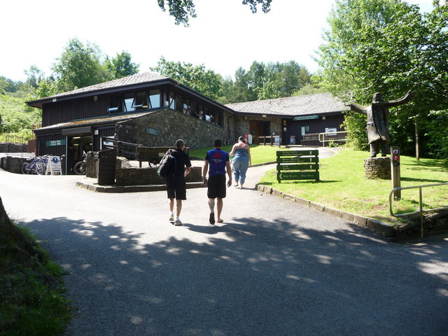

Why visit Maesteg
Townapedia lists 15 museums and landmarks, 6 parks and trails, 36 places to eat, 1 place to stay and 23 attractions in and around town.
Highlights include Town Hall, Foel Fawr, Margam Stones Museum and South Wales Miners' Museum.
Weather in Maesteg
Forecast from MET Norway (CC BY 4.0). Full forecast
About Maesteg
Maesteg (English: ; Welsh: [maisˈteːɡ] ) is a town and community in Bridgend County Borough, Wales. Maesteg lies at the northernmost end of the Llynfi Valley, close to the border with Neath Port Talbot. In 2011, Maesteg had a population of 20,612. The English translation of Maesteg is 'fair field'.
From the Wikipedia article Maesteg (this version), under CC BY-SA 4.0.
Travel tips from other travellers: Maesteg on Wikivoyage (CC BY-SA 4.0).
Things to do23

Town Hall
Cinema and theater
Town hall, theatre and cinema in Maesteg, Wales

11 more on the map.
Museums and landmarks15

Margam Stones Museum
Museum · 4.4 mi
Museum in former schoolhouse in Neath Port Talbot, Wales

South Wales Miners' Museum
Museum · 2.9 mi
Mining museum in Port Talbot, South Wales


3 more on the map.
Parks, trails and playgrounds6





Restaurants and cafes36

The Sawyer's Arms
Bar and pub
3-6 Commercial Street, Maesteg
Mo,Tu,We,Th,Su 08:00-24:00; Fr,Sa 08:00-25:00

24 more on the map.
History
Before the development of industry in the 1820s, the Llynfi Valley was a sparsely populated area of scattered farms. The nearest settlement was the village of Llangynwyd, located on the hillside about two miles (three kilometres) south of the present-day town centre of Maesteg. Close to Llangynwyd is an extensive earthwork known as Y Bwlwarcau ("the bulwarks"), an Iron Age enclosure that is probably a remnant of the earliest settlement in the Llynfi district.
During the Middle Ages, the valley was part of Tir Iarll (the Earl's Land), an area "famous for its game coverts, its woods and sparkling streams" that was set aside as a hunting reserve by Robert Fitzhamon, Earl of Gloucester, the Norman conqueror of Glamorgan. Up to the 18th century, many of the farms of the Llynfi Valley were centres of local culture. For example, Llwydarth, the home of the influential Powell family, was a centre for writers and poets in Glamorgan in the 17th century.
According to the Daily Telegraph, Maesteg was the first place in the UK where Japanese knotweed was spotted in the wild, sometime before 1886.
From the History section of Maesteg on Wikipedia, under CC BY-SA 4.0.
More about Maesteg
Economy
Maesteg Market was situated at the ground floor level of Maesteg Town Hall and offered a variety of goods until the final stallholder left in 2018. This space has now home to Maesteg's library.
Arts and culture
Maesteg has a tradition of music and theatre, including a rich tradition of singing. At present, there are two male voice choirs – Cor Meibion Maesteg A'r Cylch (Maesteg and District Male Voice Choir) and Maesteg Gleemen Male Voice Choir. Regarding competitions and awards, Maesteg Gleemen is the most successful MVC in the Llynfi Valley and Bridgend County Borough Council area.
There is also a women's choir: Harmony Ladies Choir. There are two mixed groups, Noteworthy Choir and Take Note contemporary vocal group.
Maesteg Musical Theatre Society (previously Maesteg Amateur Operatic Society) is a multi-award winning society which performs a musical and concert every year in Maesteg.
Maesteg Children's Choir hosts many concerts throughout the year, and Curtain Up Youth Theatre has been performing musicals since the turn of the millennium.
The Welsh national anthem "Hen Wlad Fy Nhadau" was first performed in Maesteg, in the vestry of the original Capel Tabor which is now Maesteg Workingmen's Club.
The artist Christopher Williams was born in Maesteg in 1873: seven of his paintings are on display in the town hall.
Education
Maesteg has six English language state primary schools: Cwmfelin, Plasnewydd, Caerau, Nantyffyllon, Llangynwyd and Garth. Plasnewydd is one of the biggest primary schools in the Llynfi Valley, with just over 400 pupils, and is an Eco-School. There is also a Catholic primary school, St. Mary's and St. Patrick's, and a Welsh-medium school, Ysgol Cynwyd Sant.
There are two comprehensive schools in Maesteg. The English-medium Ysgol Maesteg School, previously known as Maesteg Comprehensive School, recently moved to a new site, at a cost of £17,000,000. The Welsh-medium Ysgol Gyfun Gymraeg Llangynwyd then relocated to the former school's previous premises.
The pupils of St. Mary's and St. Patrick's pursue their secondary education in Archbishop McGrath Catholic Comprehensive School, located in Brackla, a few miles to the south.
From the Wikipedia article Maesteg, under CC BY-SA 4.0.
Notable people from Maesteg
 Christopher WilliamsWelsh artist (1873-1934)Photo: Christopher Williams, Public domain
 Siân LloydBritish television presenter and meteorologistPhoto: Jonathan Ashman, CC BY 3.0
 Mark Daviesrugby playerPhoto: National Assembly for Wales from Wales, CC BY 2.0
- William Cowhiggymnast (1887-1964)
- Steve WatkinWelsh born, English Test and County cricketer
- Vernon WatkinsWelsh poet (1906–1967)
- Tony SimmonsBritish long-distance runner
- Marie NovelloWelsh classical pianist
- Gwyn RichardsEnglish cricketer
- Howell EvansWelsh actor, comedian and singer
- Gavin JonesWelsh squash player
- Anthony WilliamsWelsh footballer (born 1977)
Born in Maesteg, according to Wikidata (CC0). Each name links to its Wikipedia article.
Where to stay1
Churches and places of worship15
Shopping5
Gas and EV charging1
Schools, colleges and libraries13
Healthcare5
Map of Maesteg
120 places. The map loads OpenStreetMap tiles when you open it.
Getting there and nearby towns
Swansea Airport (SWS) is the nearest airport with scheduled flights listed in OpenStreetMap, 17 miles away.
- Pyle 7 mi south, about 11 min by car
- Neath 7 mi northwest, about 12 min by car
- Porthcawl 9 mi south, about 15 min by car
- Rhondda 10 mi east, about 15 min by car
- Swansea 12 mi west, about 20 min by car
- Ystalyfera 12 mi northwest, about 19 min by car
- Mountain Ash 13 mi northeast, about 21 min by car
- Pontypridd 14 mi east, about 22 min by car
- Treharris 16 mi east, about 25 min by car
- Nelson 16 mi east, about 26 min by car
Drive times are estimates from straight-line distance, not routes.
Towns near Maesteg


Keep exploring
Local news
Headlines from INDB.
Reviews, tips and questions
Loading what members have shared...
Sources and licences
- GeoNames (CC BY 4.0): population, coordinates, regions and time zone
- Mapillary (see each image): photos
- OpenStreetMap contributors (ODbL 1.0): places, airports, map data
- Wikidata (CC0 1.0): elevation, founding date, time zone, website, landmarks and historic places
- Wikimedia Commons (see each image): photos
- Wikipedia (CC BY-SA 4.0): overview and history text
Photo credits
- Maesteg in 2005, Chris Shaw, CC BY-SA 2.0
- Maesteg Post Office, FruitMonkey, CC BY-SA 3.0
- Maesteg town centre, Cymru123, CC BY-SA 4.0
- Margam Stones Museum, Wales, RobinLeicester, CC BY-SA 3.0
- Afan Forest Park Visitor Centre, Jeremy Bolwell, CC BY-SA 2.0
- Afan Forest Park 1, Purple128, CC BY-SA 3.0
- Margam Park - Orangery Gardens, FruitMonkey, CC BY-SA 3.0
- Margamabbey-wyrdlight-7458, Antony McCallum, CC BY-SA 4.0
- Maesteg comprehensive, Randomperson2010, CC BY-SA 3.0
- Llangynwyd Castle gateway, FruitMonkey, CC BY-SA 4.0
- Street-level photo, southglos, CC BY-SA 4.0


Page built November 10, 2026. Spotted a mistake? Tell us or suggest a place.