
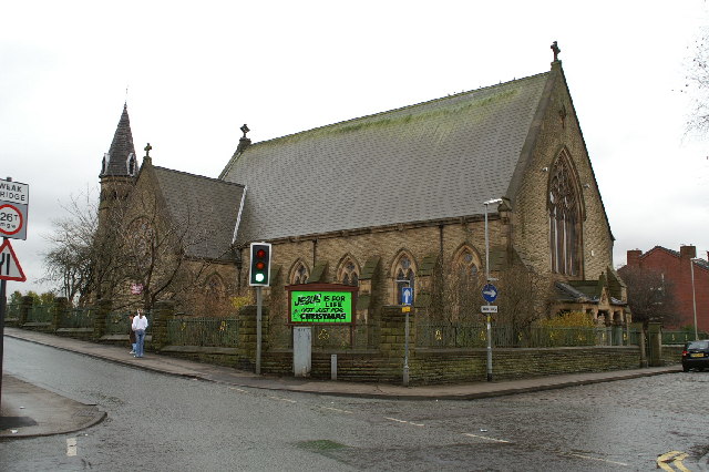


Ince-in-Makerfield, United Kingdom
Ince-in-Makerfield is a town of 11,185 people in England, United Kingdom.
Why visit Ince-in-Makerfield
Townapedia lists 24 museums and landmarks, 12 parks and trails, 134 places to eat, 2 places to stay and 4 attractions in and around town.
Highlights include Adam Viaduct, Museum of Wigan Life, Walmesley Monument and Mesnes Park.
Weather in Ince-in-Makerfield
Forecast from MET Norway (CC BY 4.0). Full forecast
About Ince-in-Makerfield
Ince-in-Makerfield or Ince is a town in the Metropolitan Borough of Wigan, in Greater Manchester, England. The population of the Ince ward at the 2011 census was 13,486, but a southern part of Ince was also listed under the Abram ward (north of Warrington Road in this ward). Adding on this area brings the total in 2011 to 15,664.
From the Wikipedia article Ince-in-Makerfield (this version), under CC BY-SA 4.0.
Photos of Ince-in-Makerfield


Things to do4

Adam Viaduct
Bridge · 1.4 mi
Railway bridge in Wigan, Greater Manchester, England, UK


Museums and landmarks24

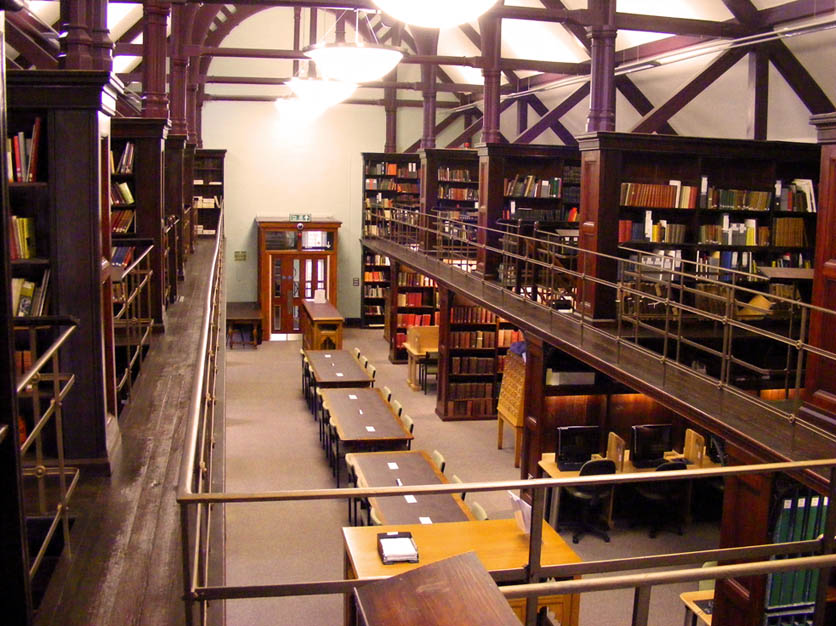
Museum of Wigan Life
Museum · 0.9 mi
Centre in Wigan, Greater Manchester, England, United Kingdom
Library Street, Wigan



Wigan War Memorial
Monument and historic site · 1.1 mi
War memorial in Wigan, England

Gidlow Hall moated site
Monument and historic site · 2.7 mi
Archaeological site in Wigan, Greater Manchester, England, UK
Walk of Fame
Monument and historic site · 1.0 mi
Public walkway in Wigan, England
12 more on the map.
Parks, trails and playgrounds12

Mesnes Park
Park · 1.5 mi
Park in Wigan, Greater Manchester, England, United Kingdom

Three Sisters Recreation Area
Park · 1.8 mi
Nature reserve and park in Wigan, Greater Manchester, England, UK
Platt Bridge Community Green
Park · 1.2 mi
Long planned community space now formally designated. See...

Restaurants and cafes134
Eight Restaurant
Restaurant · 1.0 mi
Bretherton Row, Wigan
Fr 17:00-20:00; Sa 17:00-20:00; Su 14:00-18:30
Mahabharat Restaurant
Restaurant · Indian · 1.5 mi
Former Ebenezer Particular Baptist Chapel now in use as restaurant and club
136 Market Street, Wigan

Galloways
Bakery · 1.2 mi
Unit 1 Walthew Lane, Wigan
Mo-Sa 07:30-17:30; Su 10:00-16:00; BH 10:00-16:00


India Lounge
Restaurant · Indian · 1.0 mi
Vauxhall Road, Wigan
Mo-Th 17:30-22:30; Fr-Sa 17:30-23:30; Su 16:30-22:30
Feast At The Mills
Restaurant · Pizza, Curry, Burger · 1.1 mi
Swan Meadow Road, Wigan
Fr 17:00-00:00; Sa 12:00-00:00; Su 12:00-20:00
122 more on the map.
History
The earliest mention of the manor of Ince and the Ince family dates from 1202, at which point it was under the barony of Newton in Makerfield (Newton le Willows). There were four halls in Ince. Both the manor of Ince and the original hall on Warrington Road were held by a family of the same name, who also owned the manor of Aspull and had close ties to the Hindley family. The lineage was replaced by the Gerard family by marriage in the reign of Henry IV, who adopted the name Gerard family of Ince, and the manor remained with them for several centuries until William Gerard sold it to the Earl of Balcarres at some point between 1796 and 1825. It was of timber framed construction.
The township covered 2,221 acres. The underlying rocks contained strata of cannel and coal and many collieries were sunk. The early pits were 120 to 900 feet deep, and subsequently to 1,800 feet. Its coal pits included Moss, Ince Hall, Rose Bridge and Ince Collieries. Mining left a legacy of spoil heaps and flashes.
Stone was also quarried and used to build bridges on the railway. Ince became heavily industrialised in the Industrial Revolution. The Leeds and Liverpool Canal, the North Union and Liverpool and Bury railways passed through the township and a cotton mill was built.
From the History section of Ince-in-Makerfield on Wikipedia, under CC BY-SA 4.0.
Notable people from Ince-in-Makerfield
- John Ballfootballer, born 1925
- Jimmy BarringtonBritish association football player (born 1901)
- Neil WhitworthEnglish footballer (born 1972)
- Eric MartlewBritish politician (born 1949)
- Tommy SinclairEnglish footballer (1921-2015)
- Martin CromptonEnglish rugby league footballer and coach
- Andy GregoryEnglish rugby league footballer and coach
- Joe LydonEnglish rugby league footballer, and rugby union coach and administrator
- Bill AshurstEnglish rugby league footballer and coach
- Arthur RosbothamEnglish footballer
- Parry GordonEnglish rugby league footballer
- Ian GildartEnglish rugby league footballer
Born in Ince-in-Makerfield, according to Wikidata (CC0). Each name links to its Wikipedia article.
Where to stay2
Churches and places of worship44
Shopping26
Gas and EV charging4
Schools, colleges and libraries26
Healthcare12
Map of Ince-in-Makerfield
250 places. The map loads OpenStreetMap tiles when you open it.
Getting there and nearby towns
Liverpool John Lennon Airport (LPL) is the nearest airport with scheduled flights listed in OpenStreetMap, 17 miles away.
- Wigan 1 mi northwest, about 2 min by car
- Westhoughton 4 mi east, about 6 min by car
- Newton-le-Willows 6 mi south, about 9 min by car
- St Helens 7 mi southwest, about 12 min by car
- Bolton 8 mi northeast, about 13 min by car
- Little Hulton 8 mi east, about 13 min by car
- Warrington 10 mi south, about 16 min by car
- Kearsley 10 mi east, about 15 min by car
- Irlam 10 mi southeast, about 16 min by car
- Little Lever 10 mi east, about 16 min by car
Drive times are estimates from straight-line distance, not routes.
Towns near Ince-in-Makerfield


Keep exploring
Local news
Headlines from INDB.
Reviews, tips and questions
Loading what members have shared...
Sources and licences
- GeoNames (CC BY 4.0): population, coordinates, regions and time zone
- Mapillary (see each image): photos
- OpenStreetMap contributors (ODbL 1.0): places, airports, map data
- Wikidata (CC0 1.0): elevation, founding date, time zone, website, landmarks and historic places
- Wikimedia Commons (see each image): photos
- Wikipedia (CC BY-SA 4.0): overview and history text
Photo credits
- Christ Church, Ince-in-Makerfield, David Long, CC BY-SA 2.0
- Taylor Gallery at the Museum of Wigan Life, Hindleyite, CC BY 3.0
- War memorial at Wigan Parish Church, Rept0n1x, CC BY-SA 3.0
- Mesnes Park, Wigan, Plucas58, CC BY-SA 4.0
- St Michaels church, Swinley, Wigan, Plucas58, CC BY-SA 3.0
- St John the Divine, Pemberton, Wigan, Plucas58, CC BY-SA 4.0
- Wigan Parish Church and war memorial, Rept0n1x, CC BY-SA 3.0
- St James' Church, Wigan, S Parish, CC BY-SA 2.0
- Steam engine, Trencherfield Mill, Chris Allen, CC BY-SA 2.0
- Wigan Hall 2, Francis Franklin, CC BY-SA 4.0
- St Jude, Wigan, David Dixon, CC BY-SA 2.0
- Makinson Arcade Wigan, Baresi franco, CC BY-SA 4.0
- The Royal Arcade Wigan, Reading Tom from Reading, UK, CC BY 2.0
- All Saints Church Wigan, Francis C. Franklin, CC BY-SA 4.0
- Arriva bus 2685 VDL SB200 Wrightbus Pulsar CX58 EVG in Wigan, Greater Manchester 15 November 2008, David Long, CC BY-SA 2.0
- Coops Factory, Wigan, John Topping, CC BY-SA 2.0
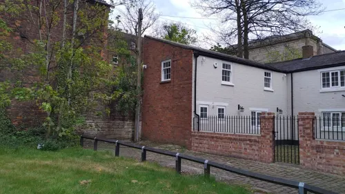
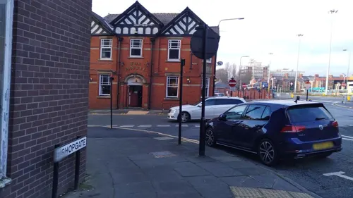
- Street-level photo, tonys999, CC BY-SA 4.0
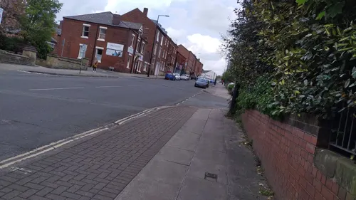
- Street-level photo, tonys999, CC BY-SA 4.0
- Street-level photo, tonys999, CC BY-SA 4.0
- Street-level photo, tonys999, CC BY-SA 4.0
- Street-level photo, tonys999, CC BY-SA 4.0
- Street-level photo, tonys999, CC BY-SA 4.0
- Street-level photo, tonys999, CC BY-SA 4.0
- Street-level photo, tonys999, CC BY-SA 4.0
- Street-level photo, tonys999, CC BY-SA 4.0
- Street-level photo, mappo2, CC BY-SA 4.0
- Street-level photo, tonys999, CC BY-SA 4.0
- Street-level photo, tonys999, CC BY-SA 4.0
- Street-level photo, tonys999, CC BY-SA 4.0
- Street-level photo, tonys999, CC BY-SA 4.0
- Street-level photo, mappo2, CC BY-SA 4.0


Page built November 10, 2026. Spotted a mistake? Tell us or suggest a place.