


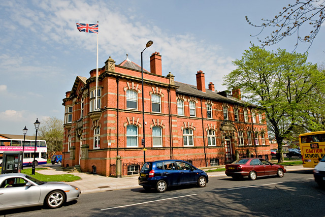
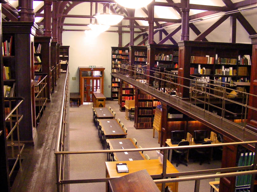


Why visit Hindley
Townapedia lists 5 museums and landmarks, 12 parks and trails, 57 places to eat and 1 attraction in and around town.
Highlights include Adam Viaduct, Museum of Wigan Life, Walk of Fame and Mesnes Park.
Weather in Hindley
Forecast from MET Norway (CC BY 4.0). Full forecast
About Hindley
Hindley is a town within the Metropolitan Borough of Wigan in Greater Manchester, England. It is three miles (4.8 km) east of Wigan and covers an area of 2,580 acres (1,044 ha). Within the boundaries of the historic county of Lancashire, Hindley (which includes Hindley Green) borders the towns and villages of Ince-in-Makerfield, Aspull, Westhoughton, Atherton and Westleigh in the former borough of Leigh. In 2001, Hindley had a population of 23,457, increasing to 28,000 at the 2011 Census.
From the Wikipedia article Hindley, Greater Manchester (this version), under CC BY-SA 4.0.
Things to do1

Adam Viaduct
Bridge · 2.7 mi
Railway bridge in Wigan, Greater Manchester, England, UK
Museums and landmarks5

Museum of Wigan Life
Museum · 2.0 mi
Centre in Wigan, Greater Manchester, England, United Kingdom
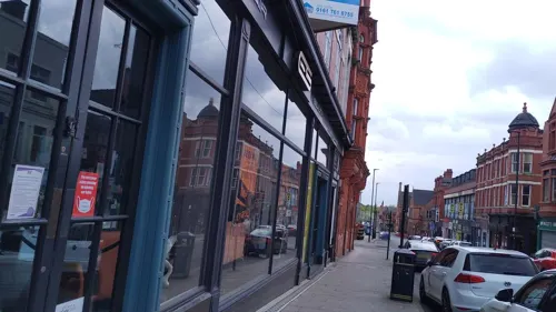
Walk of Fame
Monument and historic site · 2.1 mi
Public walkway in Wigan, England

Wigan War Memorial
Monument and historic site · 2.2 mi
War memorial in Wigan, England

Gidlow Hall moated site
Monument and historic site · 1.9 mi
Archaeological site in Wigan, Greater Manchester, England, UK
Parks, trails and playgrounds12

Mesnes Park
Park · 2.5 mi
Park in Wigan, Greater Manchester, England, United Kingdom


Three Sisters Recreation Area
Park · 2.5 mi
Nature reserve and park in Wigan, Greater Manchester, England, UK
Platt Bridge Community Green
Park · 1.1 mi
Long planned community space now formally designated. See...

Restaurants and cafes57
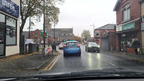
Mahabharat Restaurant
Restaurant · Indian
Former Ebenezer Particular Baptist Chapel now in use as restaurant and club
136 Market Street, Wigan

Galloways
Bakery · 1.1 mi
Unit 1 Walthew Lane, Wigan
Mo-Sa 07:30-17:30; Su 10:00-16:00; BH 10:00-16:00



45 more on the map.
History
The name Hindley is derived from the Old English hind and leah, meaning a "clearing frequented by hinds or does".
The town is first recorded as Hindele in 1212 and then variously as "Hindeleye" [1259], "Hyndeley" [1285 and 1332],Hindelegh[1301], "Hyndelegh" [1303 and 1375]. The first recorded use of its current spelling, Hindley, was in 1479.
Hindley was one of 15 berewicks of the royal manor of Newton before the Norman conquest in 1066. After the conquest, it formed part of the Barony of Makerfield.
The area was held by free tenants until 1330 when Robert Langton, Baron Makerfield, gave the lordship of the manor to his younger son. His descendants were lords of the manor until 1765 when it was sold to the Duke of Bridgewater.
From the Middle Ages until the 18th century the land was a mixture of pastoral, farming and woodland and the farmers were tenants of a variety of lords.
Parish registers from the end of the 17th century reveal that residents were Yeomen, independent farmers who supplemented their income by spinning and weaving. There are also references to Blacksmiths, whitesmiths, nailers and wheelwrights. Hindley was noted for its nail making between the 17th and 19th centuries.
Read more of the history
The first recorded coal mine was in 1528 and by the end of the 19th century, there were over 20 collieries in the area. Ladies Lane Colliery belonging to the Wigan Coal and Iron Company employed 282 underground and 40 surface workers in 1896. At the start of the 20th century, profitable coal seams were nearly exhausted and concerns were raised regarding the need to diversify industry and further develop the cotton mills. Peak production of coal was achieved just before the First World War. The period between the First and Second world wars was marked by the closure of most collieries and mills including Hindley Field and Swan Lane collieries in 1927, Hindley Green Colliery in 1928; Lowe Hall Colliery in 1931; Lowe Mill closing in 1934 and Worthington Mill was demolished. During the post-war period, the Hindley workings became part of the large colliery complexes developed at Bickershaw, Parsonage and Golborne.
Cotton manufacturing became important from the end of the 17th century until the middle of the 20th century. Hand-loom weaving was one of the chief industries, each cottage having a weaving shop attached and as the Industrial Revolution developed, larger mills were built. The first cotton factory was built in 1785 by Richard Battersby at Lowe Mill, a former water corn-mill. In 1822, John Pennington constructed his first power-driven mill. He was a significant employer of hand-loom weavers in the late 18th and early 19th century.
In 1790 Market Street, then known as Mill Lane, remained unmetalled and undeveloped but by 1835 John Leyland provided an insight into the growth of the town when he wrote, "Mr Pennington is extending his works, and a new mill is being built by Mr Walker. When these get completed a large increase in inhabitants must follow. In a small time it will doubtless rank as a small town."
The population of Hindley increased during the 19th century from 2,300 in 1811 to 23,000 in 1911 reflecting the transformation of the town from a country village to a small densely populated industrial town. The economic depression of the 1920s and 1930s hit Hindley hard, and by the time of the Second World War the population had declined to 19,000.
The coal mining and cotton spinning have all disappeared and most residents of Hindley now work in Wigan, Bolton, St Helens and Warrington or commute to Manchester or Liverpool.
From the History section of Hindley, Greater Manchester on Wikipedia, under CC BY-SA 4.0.
More about Hindley
Geography
Hindley covers an area of 2,527 acres (3.9 sq mi; 10.2 km2), mostly pasture and the underlying rocks are the coal measures. Some ancient woodland remains today in Borsdane Wood which is protected as a Local Nature Reserve.
Hindley town centre is approximately three miles east of Wigan and adjoins Leigh on its south-east side. The pattern of roads is little changed from medieval times, the road from Prescot to Bolton, A58, and road linking Ormskirk with Boothstown, the A577 cross near the town centre.
Education
Hindley and Abram Grammar School established in 1632 survived until the 1990s when, as Park High School, it was closed. The building survives as a teachers' centre on Park Road. The original school was situated in "Lowe Hall" and the first edition of the Ordnance Survey map (1848) shows it was at the end of a short track off Stony Lane, now Liverpool Road. It was known as "The Lowe School". The school relocated to Park Road in 1856 Originally pupils attended without payment but by 1829 the master was at liberty to make charges for instruction in Latin, writing and arithmetic. By 1882 the building consisted of a large schoolroom, a smaller classroom and a headmaster's house. Between 1900 and its closure Hindley and Abram grew in size. The school was supported by a charitable foundation which continues to operate.
Mornington High School was established in the early 1960s and became a comprehensive in 1976. The school was renamed Hindley High School in 2006, and became Outwood Academy Hindley in 2022.
From the Wikipedia article Hindley, Greater Manchester, under CC BY-SA 4.0.
Notable people from Hindley
 Lily BraytonBritish actor and singer (1876–1953)Photo: C.J. Frank, Public domain
 Oliver GildartBritish rugby league playerPhoto: Heathy94, CC BY-SA 4.0
- John CrankBritish mathematician (1916-2006)
- Edwin Ashtonassociation football player (1893-1970)
- Fred BroadhurstEnglish footballer (1888-1953)
- Syd FarrimondEnglish footballer (born 1940)
- Joe MurnanEnglish darts player
- Ted RobinsonEnglish footballer (1903-1972)
- Bert BithellThe Great England Samuel Bert Bithell (1900-1969)
- John WallbanksBritish association football player (1905-1987)
- Arthur FarrimondBritish distance runner
- Syd AbramEnglish rugby league footballer (1906–1988)
Born in Hindley, according to Wikidata (CC0). Each name links to its Wikipedia article.
Churches and places of worship29
Shopping9
Gas and EV charging3
Schools, colleges and libraries19
Healthcare4
Map of Hindley
139 places. The map loads OpenStreetMap tiles when you open it.
Getting there and nearby towns
Liverpool John Lennon Airport (LPL) is the nearest airport with scheduled flights listed in OpenStreetMap, 17 miles away.
- Ince-in-Makerfield 1 mi west, about 2 min by car
- Wigan 2 mi west, about 4 min by car
- Westhoughton 3 mi northeast, about 4 min by car
- Horwich 5 mi north, about 8 min by car
- Newton-le-Willows 6 mi south, about 9 min by car
- Bolton 7 mi northeast, about 11 min by car
- Little Hulton 7 mi east, about 11 min by car
- St Helens 8 mi southwest, about 14 min by car
- Kearsley 8 mi east, about 13 min by car
- Warrington 10 mi south, about 16 min by car
Drive times are estimates from straight-line distance, not routes.
Towns near Hindley


Keep exploring
Local news
Headlines from INDB.
Reviews, tips and questions
Loading what members have shared...
Sources and licences
- GeoNames (CC BY 4.0): population, coordinates, regions and time zone
- Mapillary (see each image): photos
- OpenStreetMap contributors (ODbL 1.0): places, airports, map data
- Wikidata (CC0 1.0): elevation, founding date, time zone, website, landmarks and historic places
- Wikimedia Commons (see each image): photos
- Wikipedia (CC BY-SA 4.0): overview and history text
Photo credits
- St Peter, Hindley, David Dixon, CC BY-SA 2.0
- Former Bridgewater Arms pub in Hindley, Manchester, England, David Long, CC BY-SA 2.0
- Hindley Town Hall, Dave Green, CC BY-SA 2.0
- Taylor Gallery at the Museum of Wigan Life, Hindleyite, CC BY 3.0
- War memorial at Wigan Parish Church, Rept0n1x, CC BY-SA 3.0
- Mesnes Park, Wigan, Plucas58, CC BY-SA 4.0
- Wigan Parish Church and war memorial, Rept0n1x, CC BY-SA 3.0
- Christ Church, Ince-in-Makerfield, David Long, CC BY-SA 2.0
- St Michaels church, Swinley, Wigan, Plucas58, CC BY-SA 3.0
- St James' Church, Daisy Hill, David Long, CC BY-SA 2.0
- St James' Church, Wigan, S Parish, CC BY-SA 2.0
- St John's Church, Abram, S Parish, CC BY-SA 2.0
- St Jude, Wigan, David Dixon, CC BY-SA 2.0
- Street-level photo, mappo2, CC BY-SA 4.0
- Street-level photo, mappo2, CC BY-SA 4.0
- Street-level photo, tonys999, CC BY-SA 4.0
- Street-level photo, davidsong, CC BY-SA 4.0
- Street-level photo, mappo2, CC BY-SA 4.0


Page built November 10, 2026. Spotted a mistake? Tell us or suggest a place.