


Haltwhistle, United Kingdom
Haltwhistle is a town of 3,791 people in England, United Kingdom.
Why visit Haltwhistle
Townapedia lists 14 museums and landmarks, 3 parks and trails, 18 places to eat, 7 places to stay and 7 attractions in and around town.
Highlights include Bellister Bridge, Blue Bridge, Aesica and Bellister Castle.
Weather in Haltwhistle
Forecast from MET Norway (CC BY 4.0). Full forecast
About Haltwhistle
Haltwhistle is a market town and civil parish in Northumberland, England, 23 miles (37 kilometres) east of Carlisle and 37 miles (60 kilometres) west of Newcastle upon Tyne. It had a population of 3,811 at the 2011 Census.
From the Wikipedia article Haltwhistle (this version), under CC BY-SA 4.0.
Travel tips from other travellers: Haltwhistle on Wikivoyage (CC BY-SA 4.0).
Things to do7


Blue Bridge
Bridge
Bridge in Haltwhistle, Northumberland, England, UK
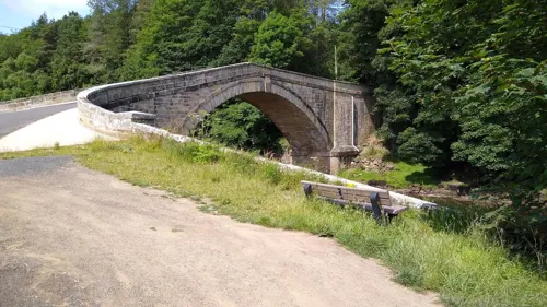
Featherstone Bridge
Bridge · 2.5 mi
Bridge in Featherstone, Northumberland, England, UK

Featherstone Castle Footbridge
Bridge · 2.8 mi
Bridge in United Kingdom
Haltwhistle A69 Bridge (East)
Bridge · 0.4 mi
Bridge in United Kingdom

Haltwhistle A69 Bridge (West)
Bridge · 0.8 mi
Bridge in United Kingdom

Museums and landmarks14

Aesica
Monument and historic site · 1.6 mi
Roman fort, archaeological site in Northumberland, England, UK

Haltwhistle Burn Temporary Camp 1 and Fortlet
Monument and historic site · 1.3 mi
2 more on the map.
Parks, trails and playgrounds3

Restaurants and cafes18
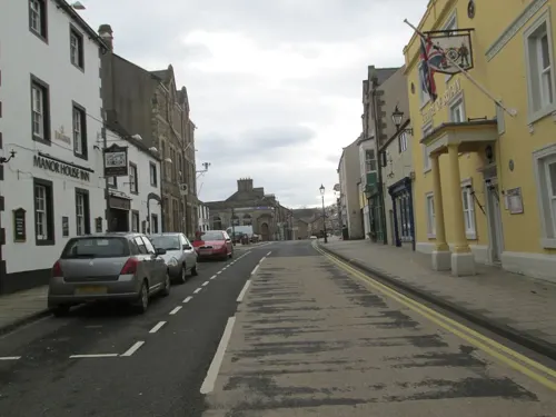
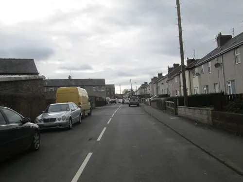
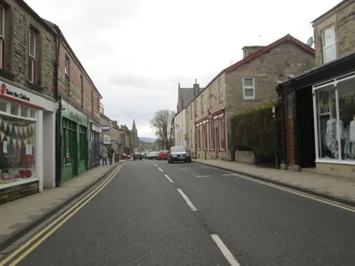
Bonnie's
Cafe
16 Westgate, Haltwhistle
Mo-Tu, Th-Sa 10:00-15:00; Su, We 10:00-14:00
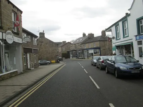
The Pillar Box Cafe
Cafe
Main Street, Haltwhistle
Mo,Tu,Th,Fr,Sa 09:30-14:00; We 09:30-13:00; Su off

Herding Hill Farm Tea Room
Restaurant · 0.8 mi
Shield Hill, Haltwhistle
Sa-Th 09:00-10:00,14:00-16:00; Fr 09:00-10:00,14:00-20:00


6 more on the map.
History
Haltwhistle was probably in existence in Roman times, as it is one of the closest approaches of the River South Tyne in its upland reaches to Hadrian's Wall. The old Roman road known as the Stanegate, which is thought to predate Hadrian’s Wall by some forty years or so, passes just two miles (three kilometres) to the north of the town.
The town web site summarizes an important part of the history (late Middle Ages) of the community as: "for many centuries, the constant marauding of English and Scots caused turmoil in Haltwhistle and throughout the Borders".
In 1598, "the infamous Armstrongs of Liddesdale fired and plundered Haltwhistle". Another important raid on Haltwhistle was made in 1601 by the Scots "who carried away prisoners and all their goods"; they were later reclaimed by a raid on Liddesdale. Scots, particularly the Armstrongs, later returned and burned many houses; that led to "years of feuds between the Armstrongs and the Ridley's of Haltwhistle".
Read more of the history
Celia Fiennes did not entirely enjoy her visit in the 1690s:"This Hartwhistle is a Little town, there was one Inn but they had noe hay nor would get none, and when my servants had got some Else where they were angry and would not Entertaine me, so I was forced to take up in a poor Cottage wch was open to ye Thatch and no partitions but hurdles plaistered. Indeed ye Loft as they Called it wch was over the other roomes was shelter'd but wth a hurdle; here I was fforced to take up my abode and ye Landlady brought me out her best sheetes wch serv'd to secure my own sheetes from her dirty blanckets, and Indeed I had her fine sheete to spread over ye top of the Clothes; but noe sleepe Could I get, they burning turff and their Chimneys are sort of fflews or open tunnills, yt ye smoake does annoy the roomes. This is but 12 miles [19 km] from another part of Scotland, the houses are but a Little better built, its true the inside of them are kept a Little better."
Dorothy, Lady Capell, endowed a school in Haltwhistle in her will of 1721.
The development of the town benefited from its location on the main Newcastle to Carlisle road and on the Newcastle and Carlisle Railway line.
The expansion of Haltwhistle in the 18th and 19th centuries was due to coal mining in the area and to a lesser extent the use of Haltwhistle as a loading point for metal ores coming from the mines on Alston Moor to the south. In 1836 while some workmen were quarrying stone for the Directors of the Newcastle and Carlisle Railway, on the top of Barcombe, a high hill in the township of Thorngrafton and Parish of Haltwhistle, one of them found a copper vessel containing 63 coins, 3 of them gold and 60 copper. The gold coins were, one of Claudius Caesar, reverse Nero Claudius Drusus Germanicus; one of Nero and one of Vespasian. The find is known as the Thorngrafton Hoard and the empty arm-purse can still be seen in the museum at Chesters Fort.
More recently, paint manufacture became a major commercial force in the town, but has now stopped major production. Current local employers include factories making plastic bottles and de-icing products.
In the 21st century, the tourist industry dominates the economy with Hadrian's Wall and walking and rambling counting among the principal interests of tourists. The Town web site summarizes the appeal of the area which is "within easy reach of Newcastle and Carlisle". Skirted by the Northumberland National Park and the North Pennines range, Haltwhistle is ideal for activity and family holidays, walking, cycling, fishing and climbing. Close to where the North & South Tynes meet, with many pretty villages dotted along both river valleys...
From the History section of Haltwhistle on Wikipedia, under CC BY-SA 4.0.
Notable people from Haltwhistle
 Paul BoertienEnglish footballerPhoto: en:user:TuborgLight, CC BY-SA 3.0
 Alan EmersonEnglish speedway riderPhoto: Lawson Speedway, CC BY-SA 4.0
- Steve ElliottBritish footballer (born 1958)
- George HopeEnglish footballer (born 1954)
- Shaun ElliottEnglish footballer (born 1957)
- Bill RoutledgeEnglish association football player (1907-1972)
- Arnold Walkerassociation football player (born 1932)
- William D. ClarkBritish economist (1916–1985)
- William Lisle Blenkinsopp CoulsonEnglish army officer and animal welfare campaigner
- William Martineccentric and self-proclaimed philosopher (1772-1851)
- Ralph RidleyFootballer (born 1904)
- James Blackett-OrdBritish barrister and judge
Born in Haltwhistle, according to Wikidata (CC0). Each name links to its Wikipedia article.
Where to stay7
Churches and places of worship4
Shopping2
Gas and EV charging1
Schools, colleges and libraries3
Healthcare2
Map of Haltwhistle
61 places. The map loads OpenStreetMap tiles when you open it.
Getting there and nearby towns
Carlisle Lake District Airport (CAX) is the nearest airport with scheduled flights listed in OpenStreetMap, 14 miles away.
- Haydon Bridge 8 mi east, about 13 min by car
- Alston 11 mi south, about 18 min by car
- Hexham 14 mi east, about 23 min by car
- Acomb 14 mi east, about 22 min by car
- Bellingham 14 mi northeast, about 23 min by car
- Great Corby 16 mi southwest, about 26 min by car
- Wetheral 16 mi west, about 26 min by car
- Corbridge 17 mi east, about 28 min by car
- Scotby 18 mi west, about 28 min by car
- Carlisle 20 mi west, about 32 min by car
Drive times are estimates from straight-line distance, not routes.
Towns near Haltwhistle


Keep exploring
Local news
Headlines from INDB.
Reviews, tips and questions
Loading what members have shared...
Sources and licences
- GeoNames (CC BY 4.0): population, coordinates, regions and time zone
- Mapillary (see each image): photos
- OpenStreetMap contributors (ODbL 1.0): places, airports, map data
- Wikidata (CC0 1.0): elevation, founding date, time zone, website, landmarks and historic places
- Wikimedia Commons (see each image): photos
- Wikipedia (CC BY-SA 4.0): overview and history text
Photo credits
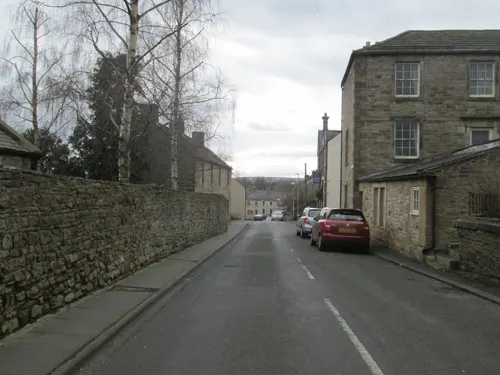
- MAin Street Haltwhistle, Unknown author, Public domain
- Bellister Bridge, Andrew Curtis, CC BY-SA 2.0
- Tyne Bridge Haltwhistle2, Mike Quinn, CC BY-SA 2.0
- Footbridge over River South Tyne near Featherstone Castle, Andrew Curtis, CC BY-SA 2.0
- Haltwhistle A69 Bridge, West from Bellister Bridge, Andrew Curtis, CC BY-SA 2.0
- Roman Altar at Aesica Roman Fort (17836111855), marsupium photography, CC BY-SA 2.0
- Street-level photo, dudone, CC BY-SA 4.0
- Street-level photo, dudone, CC BY-SA 4.0
- Street-level photo, jethro10, CC BY-SA 4.0
- Street-level photo, victuallers, CC BY-SA 4.0
- Street-level photo, dudone, CC BY-SA 4.0
- Street-level photo, dudone, CC BY-SA 4.0
- Street-level photo, dudone, CC BY-SA 4.0
- Street-level photo, dudone, CC BY-SA 4.0
- Street-level photo, dudone, CC BY-SA 4.0
- Street-level photo, dudone, CC BY-SA 4.0
- Street-level photo, dudone, CC BY-SA 4.0
- Street-level photo, dudone, CC BY-SA 4.0
Page built November 10, 2026. Spotted a mistake? Tell us or suggest a place.