


Corbridge, United Kingdom
Corbridge is a town of 2,946 people in England, United Kingdom.
Why visit Corbridge
Townapedia lists 14 museums and landmarks, 1 park or trail, 18 places to eat, 4 places to stay and 3 attractions in and around town.
Highlights include Corbridge Bridge, Hexham Bridge, Aydon Castle and Corbridge Roman Town Fort.
Weather in Corbridge
Forecast from MET Norway (CC BY 4.0). Full forecast
About Corbridge
Corbridge is a village and civil parish in Northumberland, England, 16 miles (26 km) west of Newcastle and 4 miles (6 km) east of Hexham. In 2011 the parish had a population of 3672. Villages nearby include Halton, Acomb, Aydon and Sandhoe.
From the Wikipedia article Corbridge (this version), under CC BY-SA 4.0.
Travel tips from other travellers: Corbridge on Wikivoyage (CC BY-SA 4.0).
Things to do3
Corbridge Bridge
Bridge
Grade I listed bridge in Corbridge, Northumberland, England

Hexham Bridge
Bridge · 3.0 mi
Fourth bridge across the Tyne at Hexham

Queen's Hall Arts Centre
Cinema and theater · 3.4 mi
Arts centre (built as Town Hall and Corn Exchange, now an arts centre)
Museums and landmarks14

Aydon Castle
Monument and historic site · 1.4 mi
Fortified manor house near Corbridge, Northumberland, England, UK
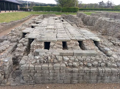
Coria
Monument and historic site · 0.6 mi
Archaeological site in Corbridge, Northumberland, England, UK

Hexham Old Gaol
Museum · 3.3 mi
Former prison in Hexham, Northumberland, England, UK

Vicar's Pele
Monument and historic site
14th century fortified dwelling, now in use as a micro-pub


2 more on the map.
Parks, trails and playgrounds1

Restaurants and cafes18



6 more on the map.
History
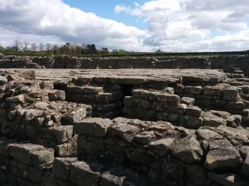
Coria was the most northerly town in the Roman Empire, lying at the junction of the Stanegate and Dere Street, the two most important local Roman roads.
The first fort was established c. AD 85, although there was a slightly earlier base nearby at Beaufront Red House. By the middle of the 2nd century AD, the fort was replaced by a town with two walled military compounds, which were garrisoned until the end of the Roman occupation of the site. The best-known finds from the site include the stone Corbridge Lion and the Corbridge Hoard of Roman armour and sundry other items. In Rudyard Kipling's Puck of Pook's Hill, the town of Hunno on the Wall is probably based on Corstopitum.
In February 1735, Isabel Cutter, the 9 year old daughter of a local cobbler found the silver Corbridge Lanx on the banks of the River Tyne near Corbridge. . Over a period of about 30 years in the early eighteenth century, a number of silver objects were found in the vicinity, which were probably part of a large Roman hoard.
The Roman Town is now managed by English Heritage on behalf of HM Government. The site has been largely excavated and features a large museum and shop. The fort is the top-rated attraction in Corbridge and is open daily between 10 and 6 in the summer and at weekends between 10 and 4 in the winter.
Read more of the history
The Church of England parish church of Saint Andrew is thought to have been consecrated in 676. Saint Wilfrid is supposed to have had the church built at the same time as Hexham Abbey. It has been altered several times since, with a Norman doorway, and a lychgate built as a First World War memorial. The Church is built largely from stone taken from Hadrian's Wall to the north, and the entrance to the Church is through glass doors given by Rowan Atkinson (known for Blackadder and Mr. Bean) and etched in memory of his mother, a parishioner.
There are only three fortified vicarages in the county, and one of these is in Corbridge. Built in the 14th century, the Vicar's Pele is to be found in the south-east corner of the churchyard, and has walls 1.3 metres (4 ft) in thickness. The register for St Andrew's dates from 1657. Later on in the town's history, Wesleyan, Primitive and Free Methodist chapels were all built too.
Even older than the Vicar's Pele is Corbridge Low Hall, dating from the late 13th or early 14th century, with one end converted to a pele tower in the 15th century. The main block was remodelled in the 16th and 17th centuries, and the building restored c. 1890. Corbridge Town Hall was designed by Frank Emley and completed in 1887.
A number of fine Victorian mansions were developed on Prospect Hill to house successful industrialists and local businessmen in the late 19th century, after the arrival of the railway facilitated commuting to Newcastle.
Corbridge suffered, as did many other settlements in the county, from the border warfare which was particularly prevalent between 1300 and 1700. Raids were commonplace, and it was not unusual for the livestock to be brought into the town at night and a watch placed to guard either end of the street for marauders. In 1297, Scots led by William Wallace laid waste to Northumberland from Hexham up to the walls of Newcastle upon Tyne, burning Corbridge and many other towns. A bridge over the Tyne was built in the 13th century, but this original has not survived. The present bridge, an impressive stone structure with seven arches, was erected in 1674.
From the History section of Corbridge on Wikipedia, under CC BY-SA 4.0.
Notable people from Corbridge
 Steve BruceEnglish professional football manager and former playerPhoto: Ronnie Macdonald, CC BY 2.0
 David MackenzieBritish film directorPhoto: Thierry Sollerot from Vernon (Eure,..., CC0
 Graeme LowdonBritish businessmanPhoto: David Merrett from Daventry, England, CC BY 2.0
 Nigel SinclairBritish film producerPhoto: Encyclopedia2001, CC BY-SA 4.0
- Mary PollaEnglish killer (born 1957)
- Keith ArmstrongEnglish-Finnish association football player and coach
- Diane BellBritish judoka
- Graham CarrEnglish footballer and manager (born 1944)
- Mick BuxtonEnglish footballer and manager (born 1943)
- Peter AtkinsonBritish politician (born 1943)
- Alan BrownEnglish footballer (1914–1996)
- Kevin GlendinningEnglish footballer (born 1962)
Born in Corbridge, according to Wikidata (CC0). Each name links to its Wikipedia article.
Where to stay4
Churches and places of worship2
Shopping10
Gas and EV charging1
Schools, colleges and libraries4
Healthcare1
Map of Corbridge
58 places. The map loads OpenStreetMap tiles when you open it.
Getting there and nearby towns
Newcastle International Airport (NCL) is the nearest airport with scheduled flights listed in OpenStreetMap, 14 miles away.
- Hexham 3 mi west, about 6 min by car
- Acomb 4 mi west, about 6 min by car
- Stocksfield 5 mi southeast, about 8 min by car
- Prudhoe 7 mi east, about 11 min by car
- Wylam 8 mi east, about 13 min by car
- Haydon Bridge 9 mi west, about 15 min by car
- Heddon on the Wall 9 mi east, about 15 min by car
- Newburn 11 mi east, about 18 min by car
- Consett 11 mi southeast, about 18 min by car
- Blaydon-on-Tyne 12 mi east, about 19 min by car
Drive times are estimates from straight-line distance, not routes.
Towns near Corbridge


Keep exploring
Local news
Headlines from INDB.
Reviews, tips and questions
Loading what members have shared...
Sources and licences
- GeoNames (CC BY 4.0): population, coordinates, regions and time zone
- Mapillary (see each image): photos
- OpenStreetMap contributors (ODbL 1.0): places, airports, map data
- Wikidata (CC0 1.0): elevation, founding date, time zone, website, landmarks and historic places
- Wikimedia Commons (see each image): photos
- Wikipedia (CC BY-SA 4.0): overview and history text
Photo credits
- Corbridge, pant in Market Place 099, RHaworth, CC BY-SA 3.0
- Ordnance Survey Benchmark on the corner of Front Street and Princes Street, Corbridge, UK, Benjamin Shaw, CC BY-SA 4.0
- Aydon Castle (inner court), Hadrianus1959, CC BY-SA 4.0
- Hexham Old Gaol, Steven Fruitsmaak, Public domain
- Hexham - Abbey church - 01, Benjamin Smith, CC BY-SA 4.0
- Corbridge Vicar's Pele 105, RHaworth, CC BY-SA 4.0
- Dilston Castle, Peter Brooks, CC BY-SA 2.0
- Black Bull Inn corbridge, Victuallers, CC BY-SA 4.0
- The Golden Lion Public House, Victuallers, CC BY-SA 4.0
- Hexham Bridge viewed from Tyne Green - panoramio, somaliayaswan, CC BY 3.0
- Street-level photo, victuallers, CC BY-SA 4.0
- Street-level photo, victuallers, CC BY-SA 4.0
- Street-level photo, victuallers, CC BY-SA 4.0
- Street-level photo, victuallers, CC BY-SA 4.0
- Street-level photo, victuallers, CC BY-SA 4.0
- Street-level photo, victuallers, CC BY-SA 4.0
- Street-level photo, firefishy, CC BY-SA 4.0
- Street-level photo, victuallers, CC BY-SA 4.0
- Street-level photo, mapz4lolz, CC BY-SA 4.0
- Street-level photo, victuallers, CC BY-SA 4.0
- Street-level photo, victuallers, CC BY-SA 4.0
- Street-level photo, victuallers, CC BY-SA 4.0
- Street-level photo, victuallers, CC BY-SA 4.0
- Street-level photo, firefishy, CC BY-SA 4.0
- Street-level photo, victuallers, CC BY-SA 4.0
- Street-level photo, victuallers, CC BY-SA 4.0
- Street-level photo, victuallers, CC BY-SA 4.0
- Street-level photo, firefishy, CC BY-SA 4.0
- Street-level photo, victuallers, CC BY-SA 4.0
- Street-level photo, victuallers, CC BY-SA 4.0
- Street-level photo, mapz4lolz, CC BY-SA 4.0
- Street-level photo, victuallers, CC BY-SA 4.0
- Street-level photo, victuallers, CC BY-SA 4.0
Page built November 10, 2026. Spotted a mistake? Tell us or suggest a place.