


Why visit Scotby
Townapedia lists 1 museum or landmark, 2 parks and trails, 16 places to eat, 2 places to stay and 2 attractions in and around town.
Highlights include Corby Bridge, Harraby Theatre, The Tullie and Carlisle Golf Club.
Weather in Scotby
Forecast from MET Norway (CC BY 4.0). Full forecast
About Scotby
Scotby is a village in the Cumberland unitary authority area of Cumbria, England. It is separated from Carlisle by the M6 motorway, and it is close to other dormitory villages in the area, such as Wetheral, Cumwhinton and Aglionby. It is part of the Wetheral civil parish. In 2018 it had an estimated population of 2366.
From the Wikipedia article Scotby (this version), under CC BY-SA 4.0.
Things to do2


Museums and landmarks1

The Tullie
Museum · 2.6 mi
Grade I listed natural history museum in Carlisle, Cumbria, England, UK
Parks, trails and playgrounds2


Restaurants and cafes16

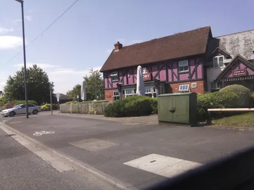




4 more on the map.
History
During the Second World War, on 11 March 1943, a village dance was being held in the village hall when a bomb penetrated the hall roof which resulted in a local farmer being killed.
In the field on the opposite side of the Tyne Valley Line to the Church, rubber tubes were laid out so as to represent railway lines to make the German Luftwaffe think that it was a major railway sidings of Carlisle. It is thought that the Luftwaffe, which was returning from a bombing raid on the munitions factory at Gretna, released their bomb load on to the fake sidings in the hope of destroying them, and also to lighten their plane load for their flight home. On the same night, a bomb also landed near to the War Memorial in the churchyard. Although it did not explode, damage was done to some of the church windows.
From the History section of Scotby on Wikipedia, under CC BY-SA 4.0.
Where to stay2
Churches and places of worship8
Our Lady and St. Wilfrid's Roman Catholic church, Warwick Bridge
Church · 2.4 mi
Shopping4
Schools, colleges and libraries7
Healthcare3
Map of Scotby
45 places. The map loads OpenStreetMap tiles when you open it.
Getting there and nearby towns
Carlisle Lake District Airport (CAX) is the nearest airport with scheduled flights listed in OpenStreetMap, 4 miles away.
- Wetheral 2 mi east, about 3 min by car
- Carlisle 3 mi west, about 4 min by car
- Dalston 5 mi southwest, about 9 min by car
- Burgh by Sands 8 mi west, about 12 min by car
- Penrith 16 mi south, about 26 min by car
- Alston 18 mi east, about 29 min by car
- Dearham 26 mi southwest, about 42 min by car
- Haydon Bridge 26 mi east, about 41 min by car
- Shap 26 mi south, about 42 min by car
- Dumfries 32 mi northwest, about 51 min by car
Drive times are estimates from straight-line distance, not routes.
Towns near Scotby


Keep exploring
Local news
Headlines from INDB.
Reviews, tips and questions
Loading what members have shared...
Sources and licences
- GeoNames (CC BY 4.0): population, coordinates, regions and time zone
- Mapillary (see each image): photos
- OpenStreetMap contributors (ODbL 1.0): places, airports, map data
- Wikidata (CC0 1.0): elevation, founding date, time zone, website, landmarks and historic places
- Wikimedia Commons (see each image): photos
- Wikipedia (CC BY-SA 4.0): overview and history text
Photo credits
- Carlisle-Cumbria-1, Neil Boothman from Carlisle, United Kingdom, CC BY 2.0
- Magpie public house, Carlisle, Brian Norman, CC BY-SA 2.0
- Corby Bridge, Wetheral, Ian S, CC BY-SA 2.0
- Tullie House1, David P from Lancaster, United Kingdom, CC BY-SA 2.0
- Street-level photo, southglos, CC BY-SA 4.0
- Street-level photo, southglos, CC BY-SA 4.0
Page built November 10, 2026. Spotted a mistake? Tell us or suggest a place.