


Carlisle, United Kingdom
Carlisle is a town of 78,470 people in England, United Kingdom.
Why visit Carlisle
Townapedia lists 21 museums and landmarks, 28 parks and trails, 217 places to eat, 24 places to stay and 5 attractions in and around town.
Highlights include Corby Bridge, Vue Carlisle, Carlisle Castle and Guildhall Museum.
Weather in Carlisle
Forecast from MET Norway (CC BY 4.0). Full forecast
About Carlisle
Carlisle ( kar-LYLE, locally KAR-lyle; from the Cumbric: Caer Luel) is a city located in the Cumberland district of Cumbria, England. It is the largest settlement and only city in Cumbria. In 2021, it had a population of 77,730.
From the Wikipedia article Carlisle (this version), under CC BY-SA 4.0.
Travel tips from other travellers: Carlisle on Wikivoyage (CC BY-SA 4.0).
Things to do5



Museums and landmarks21

Carlisle Castle
Monument and historic site
"different hours throughout the year, check signage or website"
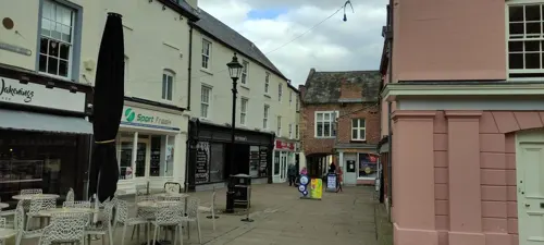

The Tullie
Museum
Grade I listed natural history museum in Carlisle, Cumbria, England, UK


A World In Miniature
Museum · 2.5 mi
Houghton, Carlisle
Mo-We,Fr,Sa 09:00-18:00; Th 09:00-19:30; Su 10:30-16:30

Historic Carlisle Victorian & Turkish Baths
Monument and historic site · 0.4 mi
James Street, Carlisle
9 more on the map.
Parks, trails and playgrounds28

Brunton Park
Sports field and stadium · 1.0 mi
Warwick Road, Carlisle






16 more on the map.
Restaurants and cafes217
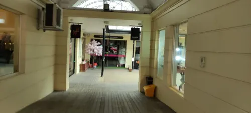
The Old Bank Gastro House
Restaurant · Local
34 Fisher Street, Carlisle
Tu-Sa 09:00-15:00, 17:30-22:30; Su 12:00-17:00
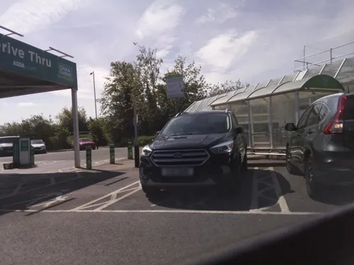
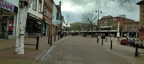
Costa
Cafe · Coffee Shop
72 Scotch Street, Carlisle
Mo-Fr 07:30-18:00; Sa 08:00-18:00; Su 09:00-17:00
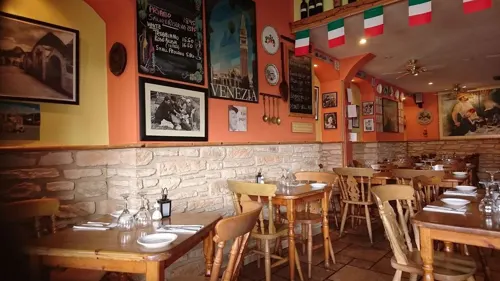
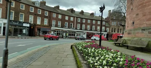
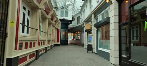
PizzaExpress
Restaurant · Pizza
21 Lowther Street, Carlisle
Mo-Th 11:30-22:00; Fr,Sa 11:30-22:30; Su 11:30-22:00
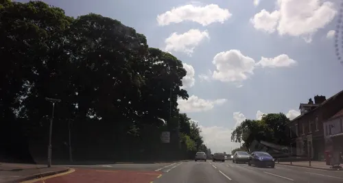
Spider & Fly
Restaurant · Burger, Steak House · 0.6 mi
1 Scotland Road, Carlisle
We-Th 10:30-23:00, Fr-Sa 10:30-00:00, Su 10:30-23:00
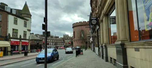
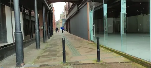
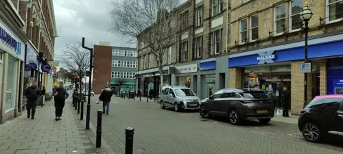
John Watts & Son
Cafe · Coffee Shop
11 Bank Street, Carlisle
Mo-Fr 09:00-16:30; Sa 08:00-17:00; Su,PH off
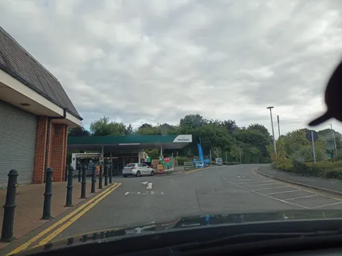
Morrisons Cafe
Cafe · Coffee Shop · 1.3 mi
Kingstown Road, Carlisle
Mo-We 08:00-18:00; Th-Fr 08:00-19:00; Sa 08:00-18:00; Su 09:30-15:30

205 more on the map.
History
The ancient history of Carlisle is derived mainly from archaeological evidence and the works of the Roman historian Tacitus. The earliest recorded inhabitants in the area were the Carvetii tribe of Britons who made up the main population of ancient Cumbria and North Lancashire. According to the mediaeval historians Boethius and John of Fordun, Carlisle existed before the arrival of the Romans in Britain and was one of the strongest British towns at the time. In the time of the emperor Nero, it was said to have burned down. The Roman settlement was named Luguvalium, based on a native name that has been reconstructed as Brittonic *Luguwaljon, "[city] of Luguwalos", a masculine Celtic given name meaning "strength of Lugus".
Excavations undertaken along Annetwell Street in the 1970s dated the Roman timber fort constructed at the site of present Carlisle Castle to the winter of AD 73. It protected a strategic location on the Roman road to the north and overlooking the confluence of the Caldew and Eden rivers.
The fort at Carlisle was reconstructed in AD 83 using oak timbers from further afield, rather than local alder as a possible result of the increased Roman control of the area. At this time the Roman fort was garrisoned by a 500-strong cavalry regiment, the Ala Gallorum Sebosiana.
Read more of the history
By the early 2nd century, Carlisle was established as a prominent stronghold. The 'Stanegate' frontier, which consisted of Luguvalium and several other forts in a line east to Corbridge, was proving a more stable frontier against the Picts than those established deeper into Caledonia. In AD 122, the province was visited by Hadrian, who approved a plan to build a wall the length of the frontier. A new fort, Petriana, was therefore built in the Stanwix area of the city north of the river on Hadrian's Wall. It was the largest fort along the wall and was completed in stone by around AD 130. Like Luguvalium, which lay within sight, Petriana housed a nominal 1,000-strong cavalry regiment, the Ala Gallorum Petriana, the sole regiment of this size along the wall. Hadrian's successor Antoninus Pius abandoned the frontier and attempted to move further north; he built the Antonine Wall between the firths of Forth and Clyde. It was not a success and, after 20 years, the garrisons returned to Hadrian's Wall.
At one time, Carlisle broke off from Rome when Marcus Carausius assumed power over the territory. He was assassinated and suffered damnatio memoriae, but a surviving reference to him has been uncovered in Carlisle. Coins excavated in the area suggest that Romans remained in Carlisle until the reign of Emperor Valentinian II, from AD 375 to AD 392.
The period of late antiquity after Roman rule saw Cumbria organised as the native British kingdom of Rheged. It is likely that the kingdom took its name from a major stronghold within it; this has been suggested to have been broadly coterminous with the Civitas Carvetiorum, Carlisle. King Urien and his son and successor Owain became the subjects of a great deal of Arthurian legend. Their capital has been identified as the Cair Ligualid listed by Nennius among the 28 cities of Britain, which later developed into Caer-luel, whence the city's modern Welsh name Caerliwelydd. Rheged came under Northumbrian control before 730, probably by inheritance after Rienmelth, daughter of Royth and great-granddaughter of Urien, married Oswy, King of Northumbria. For the rest of the first millennium, Carlisle was an important stronghold contested by several entities who warred over the area, including the Brythonic Kingdom of Strathclyde and the Anglian kingdom of Northumbria. In 685, St Cuthbert, visiting the Queen of Northumbria in her sister's monastery at Carlisle, was taken to see the city walls and a marvellously constructed Roman fountain.
By the time of the Norman Conquest of England in 1066, Carlisle was in the possession of the Scots. It was not recorded in the 1086 Domesday Book. This changed in 1092, when William the Conqueror's son William Rufus invaded the region and incorporated Carlisle into England. The construction of Carlisle Castle began in 1093 on the site of the Roman fort, south of the River Eden. The castle was rebuilt in stone in 1112, with a keep and the city walls. The walls enclosed the city south of the castle and included three gates to the east, south, and north called the Irish or Caldew Gate, the English or Botcher Gate, and the Scotch or Ricker Gate respectively. The names of the gates exist in road names in Carlisle today. Carlisle Cathedral was founded as an Augustinian priory and became a cathedral in 1133. In 1157, Carlisle became the seat of the new county of Carliol (a name that was originally an abbreviation of Latin Carlioliensis, meaning "[Bishop] of Carlisle"); in 1177 the county was renamed Cumberland.
The conquest of Cumberland was the beginning of a war between Scotland and England which saw the region centred around Carlisle change hands a number of times. It was a major stronghold after the construction of the castle. During the wars, the livelihood of the people on the borders was devastated by armies from both sides. Even when the countries were not at war, tension remained high, and royal authority in one or the other kingdom was often weak. The uncertainty of existence meant that communities or peoples kindred to each other sought security through their own strength and cunning, and they improved their livelihoods at their enemies' expense. These peoples were known as the Border Reivers and Carlisle was the major city within their territories.
From the History section of Carlisle on Wikipedia, under CC BY-SA 4.0.
More about Carlisle
Geography
Carlisle is situated on a slight rise, in the Cumberland Ward, at the confluence of the rivers Eden, Caldew and Petteril.
An important centre for trade, it is located 56 mi (90 km) west of Newcastle upon Tyne, 71 mi (114 km) north of Lancaster, 90 mi (140 km) south-east of Glasgow, 93 mi (150 km) south of Edinburgh, 120 mi (190 km) north-west of York, and 300 mi (480 km) north-north-west of London. Nearby towns and villages include Longtown (north), Penrith (south), Brampton (east), Wigton (west), Haggbeck, Harker, Carwinley, Blackford, Houghton, Scotby, Wreay and Rockcliffe.
Carlisle experiences an oceanic climate (Köppen climate classification Cfb).
In January 2005, Carlisle was hit by strong gales and heavy rain, and on Saturday 8 January 2005 all roads into Carlisle were closed owing to severe flooding, the worst since 1822, which caused three deaths.
Arts and culture
Carlisle is twinned with Flensburg in Schleswig-Holstein, Germany, and Słupsk in Pomeranian Voivodeship, Poland.
The Tullie House Museum and Art Gallery was opened in 1893 by the Carlisle Corporation. The museum features resident exhibits detailing the history of Roman occupancy of the region, Hadrian's Wall and the Border Reivers. Tullie House, named after the Jacobean mansion in which it is located, hosts travelling exhibitions. The museum has received many awards and was expanded in 1990 and 2000.
The city's Guildhall Museum is based in a 14th-century house, and the Border Regiment Military Museum is in the castle.
Sands Centre Sports Hall is Carlisle's main entertainment venue which sometimes hosts touring musicians, theatre and comedians. The West Walls Theatre is situated in the city centre, an amateur theatre. The Old Fire Station opened in 2015 after being converted into a performing arts venue, it hosts touring bands, live stand-up comedy, dramas and art exhibitions. Brunton Park stadium has hosted live music including an Elton John concert in 2007.
Education
The University of Cumbria has four campuses in Carlisle on Fusehill Street, Brampton Road, Paternoster Row and Newcastle Street. The university provides a wide range of degree courses in higher education such as information technology, applied psychology, art, business, law, media, social work and teacher education.
Carlisle College is the further education establishment based in the city.
The secondary schools within Carlisle are: Richard Rose Central Academy, Richard Rose Morton Academy, Austin Friars St Monicas (Roman Catholic Private School), Trinity School and St John Henry Newman Catholic School.
Richard Rose Central Academy replaced St Aidan's County High School and Specialist sports and science college, and North Cumbria Technology College (NCTC, formerly Harraby School). It is sponsored by Eddie Stobart owner Andrew Tinkler, and local businessman Brian Scowcroft. It opened in September 2008. In January 2009, there were protests by parents and pupils regarding poor quality education and school facilities. The school was found to be failing and was placed in Special Measures, with the headmaster and chief executive being immediately replaced.
From the Wikipedia article Carlisle, under CC BY-SA 4.0.
Notable people from Carlisle
 Grant HoltEnglish professional footballer (born 1981)Photo: Jon Candy, CC BY-SA 2.0
 Kevin BeattieEnglish footballer (1953-2018)Photo: Tony Grunberg, Public domain
 Nicki FrenchBritish singerPhoto: Christopher Matthew Thiemann, Columbus, Ohio, CC BY-SA 2.5
 Mandell CreightonEnglish historian and clergyman (1843–1901); bishop of the Church of England from 1897 to 1901Photo: Hubert von Herkomer, Public domain
 Eleanor DickinsonBritish female road and track cyclistPhoto: Nicola, CC BY-SA 4.0
 Melvyn BraggBritish broadcaster and author (born 1939)Photo: Chris McAndrew, CC BY 3.0
 Jancis RobinsonBritish wine writer and journalistPhoto: Financial Times, CC BY 2.0
 Lauren Smithbadminton playerPhoto: Nardisoero, CC BY-SA 4.0
- Mike FiggisEnglish filmmaker, musician, and composer
- George MacDonald FraserEnglish-born author of Scottish descent
- Peter ThompsonEnglish footballer (1942-2018)
- Graham StuartBritish politician (born 1962)
Born in Carlisle, according to Wikidata (CC0). Each name links to its Wikipedia article.
Where to stay24
Churches and places of worship38
Shopping47
Gas and EV charging8
Schools, colleges and libraries40
St Margaret Mary Catholic Primary School, Carlisle
School · Roman Catholic · 1.4 mi
Kirklands Road, Carlisle
The Bishop Harvey Goodwin School (Church of England Voluntary Aided)
School · Anglican · 1.1 mi
Harold Street, Carlisle
Healthcare18
Map of Carlisle
250 places. The map loads OpenStreetMap tiles when you open it.
Getting there and nearby towns
Carlisle Lake District Airport (CAX) is the nearest airport with scheduled flights listed in OpenStreetMap, 6 miles away.
- Penrith 17 mi southeast, about 28 min by car
- Workington 30 mi southwest, about 48 min by car
- Hexham 34 mi east, about 54 min by car
- Whitehaven 35 mi southwest, about 57 min by car
- Kendal 40 mi south, about 1 h by car
- Prudhoe 43 mi east, about 1 h 15 min by car
- Consett 44 mi east, about 1 h 15 min by car
- Newburn 48 mi east, about 1 h 15 min by car
- Stanley 49 mi east, about 1 h 15 min by car
- Blaydon-on-Tyne 49 mi east, about 1 h 15 min by car
Drive times are estimates from straight-line distance, not routes.
Towns near Carlisle


Keep exploring
Local news
Headlines from INDB.
Reviews, tips and questions
Loading what members have shared...
Sources and licences
- GeoNames (CC BY 4.0): population, coordinates, regions and time zone
- Mapillary (see each image): photos
- OpenStreetMap contributors (ODbL 1.0): places, airports, map data
- Wikidata (CC0 1.0): elevation, founding date, time zone, website, landmarks and historic places
- Wikimedia Commons (see each image): photos
- Wikipedia (CC BY-SA 4.0): overview and history text
Photo credits
- Carlisle Cathedral from the Air, Alex, CC BY-SA 2.0
- Becket Sword Replik in Carlisle Cathedral Mike Krüger 100302 1, Mike Krüger, CC BY-SA 4.0
- Carlisle Cathedral (48971739707), Michael D Beckwith from England, CC0
- Carlisle Cathedral Ceiling (22026054586), Michael D Beckwith, CC0
- Carlisle Cathedral St Wilfrids Chapel (21449975053), Michael D Beckwith, CC0
- CarlisleCathedral-Cumbria-1, Catriona Savage from Paris, France, CC BY 2.0
- Carlisle-Cumbria-1, Neil Boothman from Carlisle, United Kingdom, CC BY 2.0
- Brunton Park Welcome, Jameboy, CC BY-SA 3.0
- Carlisle Cathedral Exterior, Cumbria, UK - Diliff, Diliff, CC BY-SA 3.0
- Rickerby Park Gatehouse, Michael Wills, CC BY-SA 2.0
- Carlisle - County Hotel - 20180916141018, AlwynapHuw, CC BY-SA 4.0
- The Church of St Aidan, Carlisle (2695411944), Robert Cutts from Bristol, England, UK, CC BY 2.0
- Carlisle - Crown And Mitre Hotel - 20230529183957, Crowsus, CC BY-SA 4.0
- Carlisle Castle, CompleteAnonymity, CC BY-SA 4.0
- Corby Bridge, Wetheral, Ian S, CC BY-SA 2.0
- Tullie House1, David P from Lancaster, United Kingdom, CC BY-SA 2.0
- Tullie House, Carlisle, Frombowen, CC BY-SA 4.0
- Street-level photo, jethro10, CC BY-SA 4.0
- Street-level photo, jethro10, CC BY-SA 4.0
- Street-level photo, jethro10, CC BY-SA 4.0
- Street-level photo, jethro10, CC BY-SA 4.0
- Street-level photo, jethro10, CC BY-SA 4.0
- Street-level photo, jethro10, CC BY-SA 4.0
- Street-level photo, jethro10, CC BY-SA 4.0
- Street-level photo, cartoonhead1970, CC BY-SA 4.0
- Street-level photo, hobgoblin, CC BY-SA 4.0
- Street-level photo, xdTAGCLAN, CC BY-SA 4.0
- Street-level photo, southglos, CC BY-SA 4.0
- Street-level photo, jethro10, CC BY-SA 4.0
- Street-level photo, jethro10, CC BY-SA 4.0
- Street-level photo, jethro10, CC BY-SA 4.0
- Street-level photo, jethro10, CC BY-SA 4.0
- Street-level photo, jethro10, CC BY-SA 4.0
- Street-level photo, jethro10, CC BY-SA 4.0
- Street-level photo, jethro10, CC BY-SA 4.0
- Street-level photo, jethro10, CC BY-SA 4.0
- Street-level photo, jethro10, CC BY-SA 4.0
- Street-level photo, jethro10, CC BY-SA 4.0
- Street-level photo, southglos, CC BY-SA 4.0
- Street-level photo, xdTAGCLAN, CC BY-SA 4.0
- Street-level photo, hobgoblin, CC BY-SA 4.0
- Street-level photo, xdTAGCLAN, CC BY-SA 4.0


Page built November 10, 2026. Spotted a mistake? Tell us or suggest a place.