


Harrow Weald, United Kingdom
Harrow Weald is a town of 14,300 people in England, United Kingdom.
Why visit Harrow Weald
Townapedia lists 14 museums and landmarks, 30 parks and trails, 99 places to eat, 1 place to stay and 3 attractions in and around town.
Highlights include Grosvenor Theatre, Harrow Arts Centre, Headstone Manor and The Weald Stone.
Weather in Harrow Weald
Forecast from MET Norway (CC BY 4.0). Full forecast
About Harrow Weald
Harrow Weald is a suburban district in Greater London, England. Located about 2 miles (3.2 km) north of Harrow, Harrow Weald is formed from a leafy 1930s suburban development along with ancient woodland of Harrow Weald Common. It forms part of the London Borough of Harrow.
From the Wikipedia article Harrow Weald (this version), under CC BY-SA 4.0.
Photos of Harrow Weald

Things to do3

Grosvenor Theatre
Cinema and theater · 2.9 mi
Former cinema and theatre in Harrow, London, now a Zoroastrian Centre


Oxhey Lane Farm Shop
Farm and orchard · 1.4 mi
Oxhey Lane, Pinner
Museums and landmarks14

Headstone Manor
Museum · 1.3 mi
Grade I listed manor house in the London Borough of Harrow, England,UK

The Weald Stone
Monument and historic site · 0.4 mi
Date unknown. Irregular sarsen stone set in the paving. Traditionally giving the locality its name. Transferred to present site in 1934.

Bushey Museum and Art Gallery
Museum · 2.7 mi
Museum and gallery in Hertfordshire, England, United Kingdom

Headstone Manor and Museum
Museum · 1.4 mi
Museum in London Borough of Harrow, United Kingdom

Heath Robinson Museum
Museum · 2.5 mi
Museum in northwest London, United Kingdom, about W. Heath Robinson


The Brick Church
Monument and historic site · 1.0 mi
This church was built in 1632. By 1850 it had proved to be too small, so when St John the Evangelist opened it was demolished. However,...

Chandos Mausoleum
Monument and historic site · 2.1 mi
Part of St Lawrence Whitchurch in Harrow, London

2 more on the map.
Parks, trails and playgrounds30

Bentley Priory Nature Reserve
Park · 0.8 mi
Nature reserve in the London Borough of Harrow, England


Harrow Weald Common
Park · 1.0 mi
Nature reserve in Harrow Weald, Greater London, England

Hilfield Park Reservoir LNR
Park · 2.7 mi
Local Nature Reserve between Bushey and Elstree in Hertfordshire, England

Masons Field
Park · 3.3 mi
Local Nature Reserve in London Borough of Brent




Hartsbourne Country Club
Golf course · 1.5 mi
18 hole Par 71 Main Course & 9 hole Par 35 Hunt Course
Hartsbourne Avenue, Bushey
18 more on the map.
Restaurants and cafes99
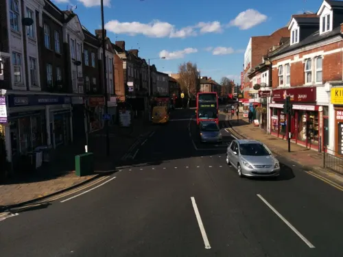
Taste of Asia
Restaurant · Indian · 1.2 mi
"Sri Lankan & Indian Cuisine; Restaurant & Take Away; Specialists in Catering for Parties, Weddings & Functions"
3 Masons Avenue, Harrow

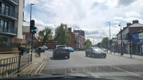
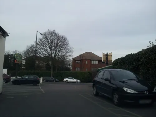

Caffe Pascucci
Cafe · Ice Cream · 1.5 mi
385 Uxbridge Road, Pinner
Mo-Th 07:00-19:00, Th,Fr 07:00-22:00, Su 08:00-19:00


87 more on the map.
More about Harrow Weald
Geography
Ancient woodland on high ground fills most of the northern part of Harrow Weald on the border of Greater London (and the traditional county of Middlesex) with Hertfordshire. The area is one of the highest in Greater London; the highest point in Middlesex is near the woods at 502 feet (153 m). The eastern part of the woods merges into those of Stanmore and encompasses Bentley Priory. The priory's grounds are now Bentley Priory Nature Reserve, a biological Site of Special Scientific Interest. Along the southern edge of the high ground runs the road Old Redding and a car park here gives views over parts of London. The western part of the woodland forms Harrow Weald Common, which adjoins Harrow Weald SSSI, a geological Site of Special Scientific Interest. Other smaller woods surround the Grim's Dyke Hotel, the former country house of W. S. Gilbert. Gilbert and Sullivan's comic operas are frequently performed here. The house is named after the nearby earthwork Grim's Ditch, a 3-mile (4.8 km) long ancient monument that runs from Harrow Weald to Pinner Green. The monument remains largely mysterious but is known to have been named in the Saxon era. The ditch hints at a long history of habitation in the area and many artefacts have been found on the common to support this.
From the Wikipedia article Harrow Weald, under CC BY-SA 4.0.
Notable people from Harrow Weald
- Ray PickrellBritish motorcycle racer (1938–2006)
Born in Harrow Weald, according to Wikidata (CC0). Each name links to its Wikipedia article.
Where to stay1
Churches and places of worship32
Shopping13
Gas and EV charging4
Schools, colleges and libraries30
Healthcare8
Map of Harrow Weald
234 places. The map loads OpenStreetMap tiles when you open it.
Getting there and nearby towns
RAF Northolt (NHT) is the nearest airport with scheduled flights listed in OpenStreetMap, 5 miles away.
- Harrow 2 mi south, about 4 min by car
- Pinner 2 mi southwest, about 4 min by car
- Watford 4 mi northwest, about 6 min by car
- Northwood 4 mi west, about 6 min by car
- Sudbury 4 mi south, about 6 min by car
- Ruislip 4 mi southwest, about 7 min by car
- Northolt 4 mi south, about 7 min by car
- Ickenham 6 mi southwest, about 9 min by car
- Totteridge 6 mi east, about 10 min by car
- Rickmansworth 6 mi west, about 10 min by car
Drive times are estimates from straight-line distance, not routes.
Towns near Harrow Weald


Keep exploring
Local news
Headlines from INDB.
Reviews, tips and questions
Loading what members have shared...
Sources and licences
- GeoNames (CC BY 4.0): population, coordinates, regions and time zone
- Mapillary (see each image): photos
- OpenStreetMap contributors (ODbL 1.0): places, airports, map data
- Wikidata (CC0 1.0): elevation, founding date, time zone, website, landmarks and historic places
- Wikimedia Commons (see each image): photos
- Wikipedia (CC BY-SA 4.0): overview and history text
Photo credits
- Ace Cinema, Rayners Lane, Bernard Burns, CC BY-SA 3.0
- Headstone Manor, Bernard Burns, CC BY-SA 3.0
- Bushey Museum, Rudolph Road, Bushey, Richard Kelly, CC BY-SA 4.0
- Heath Robinson Museum exterior 2 by Tom Fish, Sharonpink2, CC BY-SA 4.0
- Bentley Priory Summerhouse Lake 1, Dudley Miles, CC BY-SA 3.0
- Edgware Way Grassland, Dudley Miles, Public domain
- Edgwarebury Park Pinetum, Dudley Miles, Public domain
- Harrow Weald Common path, Dudley Miles, CC BY-SA 3.0
- Hilfield Park Reservoir 14, Dudley Miles, CC BY-SA 4.0
- Northwick Park open space and hospital, David Howard, CC BY 2.0
- Oxhey Woods 3, Dudley Miles, CC BY-SA 3.0
- St John the Baptist's Church, Pinner, Middlesex (3960273702), Robert Cutts from Bristol, England, UK, CC BY 2.0
- St Margaret of Antioch Edgware, Nigel Cox, CC BY-SA 2.0
- Parish Church of St Mary, Harrow on the Hill, Bernard Burns, CC BY-SA 3.0
- Harrow Museum Tithe Barn, Bernard Burns, CC BY-SA 3.0
- Aerial Photo Bentley Wood, Bentley Wood high School for girls have giving me permission to upload this to wiki., CC BY-SA 4.0
- Grims-dyke-main, Jack1956, CC0
- Elliott Hall image, London Borough of Harrow, CC BY-SA 3.0
- Salvatorian College, Mx. Granger, CC0
- Harrow Central Mosque, Robert Cutts from Bristol, England, UK, CC BY 2.0
- Abercorn Arms Public House, MrsEllacott, CC BY-SA 4.0
- St Anselm's, Hatch End, Middlesex (3960601794), Robert Cutts from Bristol, England, UK, CC BY 2.0
- Weald Stone from the north, Timothy Michael Baker, CC BY-SA 4.0
- Grim's Ditch, Middlesex, view facing south, Matt westwood ( talk ) ( Uploads ), CC BY-SA 3.0
- Headstone Manor manor house, Mx. Granger, CC0
- The Sacred Heart RC Language College, Mx. Granger, CC0
- Masons Field 6, Dudley Miles, CC BY-SA 4.0
- Ruin of St John the Evangelist old brick church 2024-04-15, Matt Brown, CC BY 2.0
- St Lawrence Whitchurch, Canons Park, Simon from London, United Kingdom, CC BY 2.0
- GOC Harrow Weald–Bushey 080 Grims Dyke Golf Club (34402553415), Peter O'Connor aka anemoneprojectors, CC BY-SA 2.0
- Street-level photo, mappo2, CC BY-SA 4.0
- Street-level photo, mappo2, CC BY-SA 4.0
- Street-level photo, firefishy, CC BY-SA 4.0
- Street-level photo, mappo2, CC BY-SA 4.0
- Street-level photo, firefishy, CC BY-SA 4.0
- Street-level photo, tomphills, CC BY-SA 4.0
- Street-level photo, firefishy, CC BY-SA 4.0
- Street-level photo, firefishy, CC BY-SA 4.0
- Street-level photo, firefishy, CC BY-SA 4.0
- Street-level photo, firefishy, CC BY-SA 4.0
- Street-level photo, dmmap, CC BY-SA 4.0
- Street-level photo, mappo2, CC BY-SA 4.0
- Street-level photo, gness, CC BY-SA 4.0
- Street-level photo, mappo2, CC BY-SA 4.0
- Street-level photo, firefishy, CC BY-SA 4.0
- Street-level photo, adam2, CC BY-SA 4.0
- Street-level photo, tomphills, CC BY-SA 4.0


Page built November 10, 2026. Spotted a mistake? Tell us or suggest a place.