


Northwood, United Kingdom
Northwood is a town of 11,300 people in England, United Kingdom.
Why visit Northwood
Townapedia lists 12 museums and landmarks, 18 parks and trails, 60 places to eat and 3 attractions in and around town.
Highlights include Watford Palace Theatre, Headstone Manor, Headstone Manor and Museum and Cassiobury Park.
Weather in Northwood
Forecast from MET Norway (CC BY 4.0). Full forecast
About Northwood
Northwood is a town located in the London Borough of Hillingdon, located 14.5 miles (23 kilometres) northwest of Charing Cross. It is formerly part of the ancient parish of Ruislip, Middlesex, until 1st April 1965, and shares post towns with parts of Hertfordshire. It has also been within the Metropolitan Police District since 1840. The Northwood Headquarters, despite being named after the area, is located in the bordering area of Eastbury in Hertfordshire.
From the Wikipedia article Northwood, London (this version), under CC BY-SA 4.0.
Photos of Northwood


Things to do3
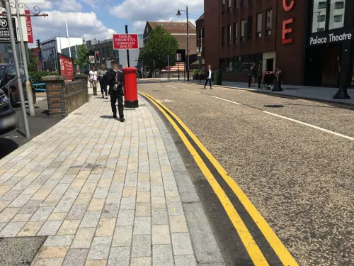
Watford Palace Theatre
Cinema and theater · 3.4 mi
Theatre and cinema in Watford, Hertfordshire, England, UK

Museums and landmarks12

Headstone Manor
Museum · 3.2 mi
Grade I listed manor house in the London Borough of Harrow, England,UK

Headstone Manor and Museum
Museum · 3.2 mi
Museum in London Borough of Harrow, United Kingdom

Heath Robinson Museum
Museum · 2.1 mi
Museum in northwest London, United Kingdom, about W. Heath Robinson


Parks, trails and playgrounds18

Cassiobury Park
Park · 3.3 mi
Park in Watford, Hertfordshire, England, UK


Prestwick Road Meadows
Park · 1.6 mi
Local Nature Reserve in South Oxhey, Hertfordshire, England, UK

Rickmansworth Aquadrome
Park · 2.7 mi
Park and nature reserve in Hertfordshire, England, UK



6 more on the map.
Restaurants and cafes60

Namaste Lounge
Restaurant · Indian · 1.0 mi
66 Joel Street, Northwood
Mo-Fr 12:00-22:00; Sa-Su 11:00-22:00

Bubbles
Cafe · Dessert
53 Green Lane, Northwood
Tu-Sa 12:00-17:00; Su 12:00-17:00
Cafe Hills
Cafe · 1.0 mi
69 Joel Street, Northwood
Mo-Fr 06:30-16:00; Sa 07:00-16:00; Su 08:30-16:00

Waters Edge
Bar and pub · Pizza, Carvery · 1.5 mi
Reservoir Road, Ruislip
Mo-Th 09:00-23:00; Fr-Su 08:00-23:00



Tastes of Portugal
Cafe · Portuguese · 0.5 mi
16 High Street, Northwood
Mo-Sa 07:00-19:00; Su 08:00-13:00
48 more on the map.
History
Northwood was first recorded in 1435 as Northwode, formed from the Old English 'north' and 'wode', meaning 'the northern wood', in relation to Ruislip and Ruislip woods.
In the Domesday Book of 1086, the Northwood-embracing parish of Ruislip had immense woodland, sufficient to support one parish with 1,500 pigs per year, and a park for wild beasts (parcus ferarum).
The hamlet of Northwood grew up along the north side of the Rickmansworth-Pinner road which passes across the north-east of the parish. Apart from this road and internal networks in areas of scattered settlement to the east and west, Ruislip had only three ancient roads of any importance of which Ducks Hill Road was the only one in the Northwood hamlet. This followed the course of the modern road from its junction with the Rickmansworth road in the northwest corner of the parish. It then ran south through Ruislip village as Bury Street and continued through the open fields as Down Barns Road (now West End Road) to West End in Northolt.
Read more of the history
Northwood had a manorial grange in 1248, which may have occupied the site of the later Northwood Grange. The monks of the Bec Abbey who lived at Manor Farm in Ruislip in the 11th century owned this grange. A few cottages at Northwood are mentioned in the 1565 manorial survey. Two hundred years later the shape of the hamlet, composed of a few farms and dwellings scattered along the Rickmansworth road, had altered little except for the addition of Holy Trinity church. Robert Cecil, 1st Earl of Salisbury had 568 acres (230 ha) of Ruislip cleared of forest.
Northwood, however, elevated and separated from the rest of the parish by a belt of woodland, took until the 19th century to form a village — 350 acres (140 ha) in the manor of St. Catherine's were inclosed under the Ruislip Inclosure Act 1769 (9 Geo. 3. c. 67 Pr.) privatizing land which lay west of Ducks Hill Road, including West Wood (now Mad Bess Wood) which was common ground. A further 3,000 acres (1,200 ha) of Ruislip parish were inclosed by the Ruislip Inclosure Act 1804 (44 Geo. 3. c. 45 Pr.). The character of the area in providing for Northwood and Northwood Hills to have the majority of open spaces as opposed to housing land was begun by transfers of open space land to the public as early as 1899. The open nature of the district attracted three hospitals to move or establish in this part of the parish: Mount Vernon Hospital, St. Vincent's Orthopaedic Hospital and Northwood, Pinner and District Hospital.
A land survey of Northwood conducted in 1565 by King's College, Cambridge, the new lords of the manor of Ruislip, recorded ten houses and several farms.
By 1881, the population of Northwood had reached 257, with 62 houses recorded from 41 people in 1841. David Carnegie owned the large Eastbury Park Estate in the north of the area in 1881. In 1887, the Metropolitan Railway was extended from Harrow-on-the-Hill to Rickmansworth and Carnegie sold his land to Frank Carew for development for £59,422. Northwood station opened in August that year. Carew stipulated the prices for the new housing he had built, with the cottages along the west side of the High Street priced at £120. He had hoped these would be owned by the staff of the larger houses. The High Street itself had been a track leading on from Rickmansworth Road to Gate Hill Farm. The first shops opened in 1895 on the east side of the road, and included a hairdresser, butchers and a fishmongers. Carew sold the majority of the estate to George Wieland in 1892.
By 1902, the population had reached 2,500 in 500 houses and running 36 shops. In 1904, the Emmanuel Church opened in Northwood Hills, designed by Sir Frank Elgood, a local architect. It had been built in 1895, originally to serve as a school. Elgood later served as chairman of the Ruislip-Northwood Urban District Council.
Northwood and Pinner Cottage Hospital was built in 1926 as a memorial to the First World War, using donations from the Ruislip Cottagers' Allotments Charity.
Northwood is home to Northwood Headquarters, in the grounds of Eastbury Park, the estate purchased by David Carnegie in 1857. The Royal Air Force took over the site in 1939 for the use of RAF Coastal Command which made use of Eastbury house and also created a network of underground bunkers and operations blocks, at which time the house was used as the leading Officers' Mess, though was subsequently damaged by fire. The RAF vacated the site in 1969, and it is now the location of the British Armed Forces Permanent Joint Headquarters (PJHQ) for planning and controlling overseas military operations, together with the NATO Maritime Command.
A new community centre on the town's high street, replacing an older building, was officially opened by the local MP Nick Hurd in September 2012. The new building was named the Kate Fassnidge Community Centre after the Uxbridge landowner who donated some of her land to the borough, and replaced a derelict dining club that had originally been a Ritz cinema.
Northwood was listed as the UK’s most expensive place to buy property because of its suburban setting and good transport links to Central London.
From the History section of Northwood, London on Wikipedia, under CC BY-SA 4.0.
More about Northwood
Geography
Northwood is in both Hillingdon and Hertfordshire. The town centre is situated in Greater London; however, the northern part of the town is situated in Hertfordshire. A triangular area of Northwood including the old High Street, Chester Road and Hallowell Road is a place of Local Architectural Special Interest, a restriction to protect the ornate Victorian houses made of high-quality brickwork. Dotted across the area are 22 listed buildings (for their architecture).
Elevations range between 177 feet (54m) to 374 feet (114m) AOD, with many ridges and folds in the land creating an undulating terrain.
Arts and culture
A local residents' association and chamber of commerce joined forces in May 2010 calling for greater recognition of the area. In May 2011, the London Borough of Hillingdon announced Northwood Hills would receive £400,000 in funding for regeneration work.
From the Wikipedia article Northwood, London, under CC BY-SA 4.0.
Notable people from Northwood
 Derek JarmanBritish film director and artist (1942-1994)Photo: Gorup de Besanez, CC BY-SA 3.0
 Penny Rimbaudwriter, poet, philosopher, painter, musician and activistPhoto: Dominic Thackray, CC BY-SA 4.0
 Nan ChauncyEnglish-Australian children's writer (1900-1970)Photo: Unknown author Unknown author, Public domain
 Richard Rosser, Baron RosserBritish trade unionist (born 1944)Photo: Roger Harris, CC BY 3.0
 Eric AumonierBritish sculptorPhoto: Unknown author, CC BY-SA 3.0
- Fearne CottonEnglish television and radio presenter
- Roger HiltonBritish artist (1911-1975)
- William DicksonRoyal Naval Air Service aviator (1898–1987)
- Maurice Allomcricketer (1906-1995)
- John GrandyMarshal of the RAF (1913–2004)
- Gary TibbsBritish musician
- David Quilteractor
Born in Northwood, according to Wikidata (CC0). Each name links to its Wikipedia article.
Churches and places of worship15
Shopping7
Gas and EV charging2
Schools, colleges and libraries21
Healthcare7
Map of Northwood
145 places. The map loads OpenStreetMap tiles when you open it.
Getting there and nearby towns
RAF Northolt (NHT) is the nearest airport with scheduled flights listed in OpenStreetMap, 4 miles away.
- Pinner 2 mi southeast, about 4 min by car
- Ruislip 3 mi south, about 4 min by car
- Rickmansworth 3 mi northwest, about 5 min by car
- Watford 3 mi north, about 5 min by car
- Harrow 5 mi southeast, about 7 min by car
- Sudbury 6 mi southeast, about 9 min by car
- West Drayton 8 mi south, about 13 min by car
- Slough 10 mi southwest, about 16 min by car
- Totteridge 10 mi east, about 16 min by car
- London 15 mi southeast, about 24 min by car
Drive times are estimates from straight-line distance, not routes.
Towns near Northwood


Keep exploring
Local news
Headlines from INDB.
Reviews, tips and questions
Loading what members have shared...
Sources and licences
- GeoNames (CC BY 4.0): population, coordinates, regions and time zone
- Mapillary (see each image): photos
- OpenStreetMap contributors (ODbL 1.0): places, airports, map data
- Wikidata (CC0 1.0): elevation, founding date, time zone, website, landmarks and historic places
- Wikimedia Commons (see each image): photos
- Wikipedia (CC BY-SA 4.0): overview and history text
Photo credits
- Former Post Office, Northwood, Middlesex, Julian Osley, CC BY-SA 2.0
- Northwood northbound platform 3, Oxyman, CC BY 2.5
- Hard 8, Northwood, HA6, Ewan-M, CC BY-SA 2.0
- Headstone Manor, Bernard Burns, CC BY-SA 3.0
- Harrow Museum Tithe Barn, Bernard Burns, CC BY-SA 3.0
- Heath Robinson Museum exterior 2 by Tom Fish, Sharonpink2, CC BY-SA 4.0
- Cassiobury Park 012, Panhard, CC BY 2.5
- Prestwick Road Meadows 4, Dudley Miles, CC BY-SA 4.0
- At Rickmansworth Aquadrome 2024 003, Photograph by Mike Peel ( www.mikepeel.net )., CC BY-SA 4.0
- Eastcote House Gardens Dovecote, Harrison49, CC BY-SA 3.0
- St John the Baptist's Church, Pinner, Middlesex (3960273702), Robert Cutts from Bristol, England, UK, CC BY 2.0
- St Giles' Church - April 2011, Harrison49, CC BY-SA 3.0
- St Mary's Church, Watford, Nigel Cox, CC BY-SA 2.0
- Oxhey Woods 3, Dudley Miles, CC BY-SA 3.0
- Moor Park Mansion, Nigel Cox, CC BY-SA 2.0
- At London 2025 763, Photograph by Mike Peel ( www.mikepeel.net )., CC BY-SA 4.0
- At London 2024 451, Photograph by Mike Peel ( www.mikepeel.net )., CC BY-SA 4.0
- Dews Farm Sand Pits 4, Dudley Miles, CC BY-SA 4.0
- At London 2024 493, Photograph by Mike Peel ( www.mikepeel.net )., CC BY-SA 4.0
- At London 2023 078, Photograph by Mike Peel ( www.mikepeel.net )., CC BY-SA 4.0
- At London 2024 489, Photograph by Mike Peel ( www.mikepeel.net )., CC BY-SA 4.0
- At London 2024 488, Photograph by Mike Peel ( www.mikepeel.net )., CC BY-SA 4.0
- At London 2024 494, Photograph by Mike Peel ( www.mikepeel.net )., CC BY-SA 4.0
- At London 2024 496, Photograph by Mike Peel ( www.mikepeel.net )., CC BY-SA 4.0
- At London 2026 0260, Photograph by Mike Peel ( www.mikepeel.net )., CC BY-SA 4.0
- At London 2025 1046, Photograph by Mike Peel ( www.mikepeel.net )., CC BY-SA 4.0
- At London 2025 1042, Photograph by Mike Peel ( www.mikepeel.net )., CC BY-SA 4.0
- At London 2024 503, Photograph by Mike Peel ( www.mikepeel.net )., CC BY-SA 4.0
- At London 2026 0261, Photograph by Mike Peel ( www.mikepeel.net )., CC BY-SA 4.0
- At London 2024 463, Photograph by Mike Peel ( www.mikepeel.net )., CC BY-SA 4.0
- At London 2025 1045, Photograph by Mike Peel ( www.mikepeel.net )., CC BY-SA 4.0
- At London 2025 1048, Photograph by Mike Peel ( www.mikepeel.net )., CC BY-SA 4.0
- At London 2024 495, Photograph by Mike Peel ( www.mikepeel.net )., CC BY-SA 4.0
- At London 2025 1043, Photograph by Mike Peel ( www.mikepeel.net )., CC BY-SA 4.0
- At London 2025 1047, Photograph by Mike Peel ( www.mikepeel.net )., CC BY-SA 4.0
- At London 2025 1044, Photograph by Mike Peel ( www.mikepeel.net )., CC BY-SA 4.0
- At London 2024 490, Photograph by Mike Peel ( www.mikepeel.net )., CC BY-SA 4.0
- At London 2024 491, Photograph by Mike Peel ( www.mikepeel.net )., CC BY-SA 4.0
- At London 2024 470, Photograph by Mike Peel ( www.mikepeel.net )., CC BY-SA 4.0
- At London 2025 1031, Photograph by Mike Peel ( www.mikepeel.net )., CC BY-SA 4.0
- Namaste Lounge, Northwood, HA6, Ewan-M, CC BY-SA 2.0
- Street-level photo, alfa145, CC BY-SA 4.0
- Street-level photo, 4004, CC BY-SA 4.0
- Street-level photo, themadcabbie, CC BY-SA 4.0
- Street-level photo, alfa145, CC BY-SA 4.0
- Street-level photo, alfa145, CC BY-SA 4.0
- Street-level photo, alfa145, CC BY-SA 4.0
- Street-level photo, alfa145, CC BY-SA 4.0


Page built November 10, 2026. Spotted a mistake? Tell us or suggest a place.