


Why visit Pinner
Townapedia lists 8 museums and landmarks, 29 parks and trails, 159 places to eat and 3 attractions in and around town.
Highlights include Compass Theatre, Grosvenor Theatre, Heath Robinson Museum and Headstone Manor.
Weather in Pinner
Forecast from MET Norway (CC BY 4.0). Full forecast
About Pinner
Pinner is a suburb in the London Borough of Harrow, northwest London, England, 12 miles (19 km) northwest of Charing Cross, close to the border with Hillingdon, historically in the county of Middlesex. The population was 38,698 in 2021.
From the Wikipedia article Pinner (this version), under CC BY-SA 4.0.
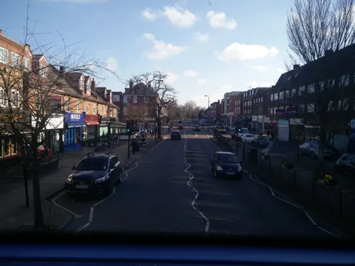
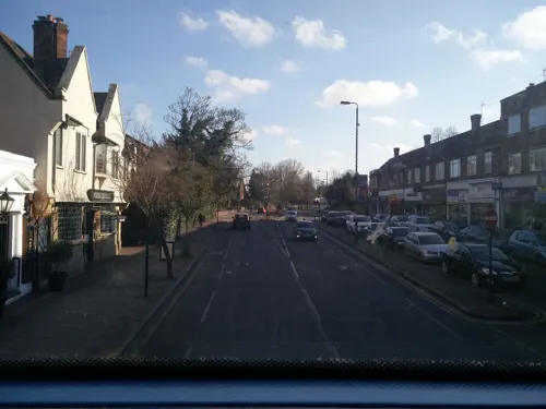
Photos of Pinner


Things to do3

Compass Theatre
Cinema and theater · 3.3 mi
Theatre in Ickenham, Hillingdon, London, England

Grosvenor Theatre
Cinema and theater · 1.5 mi
Former cinema and theatre in Harrow, London, now a Zoroastrian Centre

Museums and landmarks8

Heath Robinson Museum
Museum
Museum dedicated to showcasing the work of the world-renowned artist, illustrator, humorist and social commentator William Heath Robinson
West End Lane, Pinner
Th-Su 11:00-16:00

Headstone Manor
Museum · 1.2 mi
Grade I listed manor house in the London Borough of Harrow, England,UK

Headstone Manor and Museum
Museum · 1.2 mi
Museum in London Borough of Harrow, United Kingdom


Polish Air Force Memorial
Monument and historic site · 3.2 mi
War memorial in South Ruislip, London Borough of Hillingdon, United Kingdom
Parks, trails and playgrounds29

Bentley Priory Nature Reserve
Park · 3.0 mi
Nature reserve in the London Borough of Harrow, England


Grove Farm
Park · 3.3 mi
Local Nature Reserve in the London Borough of Ealing, England, UK

Harrow Weald Common
Park · 2.6 mi
Nature reserve in Harrow Weald, Greater London, England


Prestwick Road Meadows
Park · 1.7 mi
Local Nature Reserve in South Oxhey, Hertfordshire, England, UK



17 more on the map.
Restaurants and cafes159

The Case Is Altered
Bar and pub · 1.0 mi
High Road Eastcote, Pinner
Su-Th 11:00-23:00; Fr-Sa 11:00-00:00
Dona Theresa
Restaurant · Italian · 1.0 mi
451 Uxbridge Road, Pinner
Tu-Sa 12:00-15:00,18:30-22:30; Su 12:00-22:30

Namaste Lounge
Restaurant · Indian · 1.3 mi
66 Joel Street, Northwood
Mo-Fr 12:00-22:00; Sa-Su 11:00-22:00

Oddfellows Arms
Bar and pub
2 Waxwell Lane, Pinner
Mo-Th 17:00-23:00; Fr 17:00-24:00; Sa 12:00-15:00,17:00-24:00; Su...
Casa Mia
Restaurant · Italian · 1.0 mi
455 Uxbridge Road, Pinner
Tu-Sa 12:00-15:00,18:00-22:30; Su 12:00-22:30

The Woodman
Restaurant · Steak House · 1.2 mi
Joel Street, Pinner
Tu-Th 17:00-00:00; Fr 13:00-00:00; Sa 12:00-00:00; Su 12:00-22:00

Indulge
Cafe · Dessert
209-211 Marsh Road, Pinner
We 16:00-23:30; Th, Su 14:00-22:30; Fr, Sa 14:00-23:00
Tunnel Lounge by Flare
Restaurant · Pizza, Burger · 1.4 mi
273 Pinner Road, Harrow
Fr 12:00-23:59; Sa 00:00-02:00; Su 12:00-23:59

Pinnora Brewing
Brewery and winery
First formed in early 2016 in Pinner, a leafy suburb in North West London. Pinnora is Pinner’s first craft brewery and takes its name...
Sa 09:00-17:00

147 more on the map.
History
Pinner was originally a hamlet, first recorded in 1231 as Pinnora, although the already archaic -ora (meaning 'hill') suggests its origins lie no later than circa 900. The name Pinn is shared with the River Pinn, which runs through the middle of Pinner. Another suggestion of the name is that it means 'hill-slope shaped like a pin'.
The oldest part of the town lies around the fourteenth-century parish church of St. John the Baptist, at the junction of the present day Grange Gardens, High Street and Church Lane. The church was originally a chapel of ease to St Mary's Church, Harrow on the Hill, and was first mentioned in 1234. It was rebuilt in the early fourteenth-century, and rededicated in 1321. The parish became independent of St Mary's in 1766, when the first perpetual curate was appointed; not until the Wilberforce Act of 1868 did it appoint its first vicar, one William Hind. The earliest surviving private dwelling, East End Farm Cottage, dates from the late fifteenth century.
Read more of the history
The village expanded rapidly between 1923 and 1939, when a series of garden estates, including the architecturally significant Pinnerwood estate conservation area – encouraged by the Metropolitan Railway – grew around its historic core. It was largely from this time onwards that the area (including Hatch End, which forms the northeastern part of Pinner) assumed much of its present-day suburban character. The area is now contiguous with neighbouring suburban districts including Rayners Lane and Eastcote.
Pinner contains a large number of homes built in the 1930s Art Deco style, the most grand of which is the Grade II listed Elm Park Court at the junction of West End Lane and Elm Park Road. Pinner is also the site of one of the UK's oldest chartered fairs, called Pinner Fair, which has been held annually since 1336.
Pinner lay within the historic county of Middlesex; it was located at the western end of the hundred of Gore, before it was in the Hendon Rural District. In 1965 it became a part of the London Borough of Harrow in the newly formed ceremonial county of Greater London.
Pinner's St John the Baptist parish church was consecrated in 1321, but built on the site of an earlier Christian place of worship. The west tower and south porch date from the 15th century.
From the History section of Pinner on Wikipedia, under CC BY-SA 4.0.
More about Pinner
Geography
Pinner includes Pinner Village at its centre, along with the localities of Pinner Green and Pinnerwood Park Conservation Area to the north. To the north east is the larger area of Hatch End, served by Hatch End railway station (originally opened as Pinner).
The River Pinn flows through Pinner, flowing in a diagonal direction. Large parks and open spaces are Pinner Memorial Park, Pinner Village Gardens, Roxbourne Gardens, Pinner Wood (woodlands) and Pinner Park (farmland).
Pinner Memorial Park has a large house in it which includes a museum to Illustrator Heath Robinson as well as a cafe which hosts regular music events throughout the summer; while Roxbourne Gardens also hosts a pop-up cafe and music venue on Sundays year-round.
Much of Pinner has an elevation of about 148 feet (45 m) to 200 feet (60 m). Nower Hill rises to a peak of about 260 feet (80 m) above sea level while Pinner Park peaks at 203 feet (62 m). The semi-rural Pinnerwood area is steep, and rises to a peak of over 390 feet (120 m) around Pinner Hill Golf Course.
From the Wikipedia article Pinner, under CC BY-SA 4.0.
Notable people from Pinner
 Elton JohnBritish singer, songwriter and musician (born 1947)Photo: Raph_PH, CC BY 2.0
 Patrick MooreEnglish astronomer, broadcaster and writer (1923–2012)Photo: South Downs Planetarium, CC BY-SA 3.0
 Derek Bellracecar driverPhoto: Freewheeling Daredevil from Kingston, TN, USA, CC BY 2.0
 Marvin SordellEnglish association football player (born 1991)Photo: Jon Candy, CC BY-SA 2.0
 Peter Levene, Baron Levene of PortsokenLord Mayor of London (born 1941)Photo: Roger Harris, CC BY 3.0
- Ivy Compton-BurnettEnglish writer (1884–1969)
- Joseph RaphsonBritish mathematician
- Tony HatchEnglish composer for musical theatre and television; noted songwriter, pianist, arranger and producer
- Frederick Valentine Atkinsonmathematician (1916-2002)
- Peter Jacobsfencer
- Robert RossEnglish botanist (1912-2005)
- Charlie DoreEnglish female singer-songwriter
Born in Pinner, according to Wikidata (CC0). Each name links to its Wikipedia article.
Churches and places of worship32
Shopping26
Gas and EV charging3
Schools, colleges and libraries29
Healthcare11
Map of Pinner
250 places. The map loads OpenStreetMap tiles when you open it.
Getting there and nearby towns
RAF Northolt (NHT) is the nearest airport with scheduled flights listed in OpenStreetMap, 3 miles away.
- Harrow 2 mi southeast, about 4 min by car
- Ruislip 2 mi southwest, about 4 min by car
- Sudbury 4 mi southeast, about 6 min by car
- Watford 4 mi north, about 7 min by car
- Rickmansworth 5 mi northwest, about 8 min by car
- West Drayton 7 mi southwest, about 12 min by car
- Totteridge 8 mi east, about 13 min by car
- Archway 11 mi east, about 17 min by car
- Slough 11 mi southwest, about 17 min by car
- London 12 mi southeast, about 20 min by car
Drive times are estimates from straight-line distance, not routes.
Towns near Pinner


Keep exploring
Local news
Headlines from INDB.
Reviews, tips and questions
Loading what members have shared...
Sources and licences
- GeoNames (CC BY 4.0): population, coordinates, regions and time zone
- Mapillary (see each image): photos
- OpenStreetMap contributors (ODbL 1.0): places, airports, map data
- Wikidata (CC0 1.0): elevation, founding date, time zone, website, landmarks and historic places
- Wikimedia Commons (see each image): photos
- Wikipedia (CC BY-SA 4.0): overview and history text
Photo credits
- Zizzi, Pinner, HA5 (5653110760), Ewan Munro from London, UK, CC BY-SA 2.0
- Pinner tube station, Oxyman, CC BY 2.5
- Pinner- The Queens Head Pub - Memorial Plaque, Stefan Wolmarans, CC BY-SA 4.0
- Compass Theatre, Ickenham - April 2011, Harrison49, CC BY-SA 3.0
- Ace Cinema, Rayners Lane, Bernard Burns, CC BY-SA 3.0
- Heath Robinson Museum exterior 2 by Tom Fish, Sharonpink2, CC BY-SA 4.0
- Headstone Manor, Bernard Burns, CC BY-SA 3.0
- Bentley Priory Summerhouse Lake 1, Dudley Miles, CC BY-SA 3.0
- Eastcote House Gardens Dovecote, Harrison49, CC BY-SA 3.0
- Grove Farm, Ealing 1, Dudley Miles, CC BY-SA 3.0
- Harrow Weald Common path, Dudley Miles, CC BY-SA 3.0
- Northwick Park open space and hospital, David Howard, CC BY 2.0
- Oxhey Woods 3, Dudley Miles, CC BY-SA 3.0
- Prestwick Road Meadows 4, Dudley Miles, CC BY-SA 4.0
- St Giles' Church - April 2011, Harrison49, CC BY-SA 3.0
- Parish Church of St Mary, Harrow on the Hill, Bernard Burns, CC BY-SA 3.0
- Harrow Museum Tithe Barn, Bernard Burns, CC BY-SA 3.0
- St John the Baptist's Church, Pinner, Middlesex (3960273702), Robert Cutts from Bristol, England, UK, CC BY 2.0
- Elliott Hall image, London Borough of Harrow, CC BY-SA 3.0
- Case Is Altered, Eastcote, HA5 (19074292978), Ewan Munro from London, UK, CC BY-SA 2.0
- St Anselm's, Hatch End, Middlesex (3960601794), Robert Cutts from Bristol, England, UK, CC BY 2.0
- Grimsdyke School, Sylvia Avenue, Hatch End (5340803072), Robert Cutts from Bristol, England, UK, CC BY 2.0
- Headstone Manor manor house, Mx. Granger, CC0
- Islip Manor Meadows 6, Dudley Miles, CC BY-SA 3.0
- At London 2026 0275, Photograph by Mike Peel ( www.mikepeel.net )., CC BY-SA 4.0
- At London 2026 0276, Photograph by Mike Peel ( www.mikepeel.net )., CC BY-SA 4.0
- At London 2026 0274, Photograph by Mike Peel ( www.mikepeel.net )., CC BY-SA 4.0
- W Heath Robinson - 75 Moss Lane Pinner London HA5 3AZ, Spudgun67, CC BY-SA 4.0
- GOC Harrow Weald–Bushey 034 Stanmore Common, Stanmore (33368006003), Peter O'Connor aka anemoneprojectors, CC BY-SA 2.0
- Namaste Lounge, Northwood, HA6, Ewan-M, CC BY-SA 2.0
- Oddfellows Arms, Pinner, HA5 (5652546613), Ewan Munro from London, UK, CC BY-SA 2.0
- Street-level photo, tomphills, CC BY-SA 4.0
- Street-level photo, tomphills, CC BY-SA 4.0
- Street-level photo, RyanBush, CC BY-SA 4.0
- Street-level photo, tomphills, CC BY-SA 4.0
- Street-level photo, laye, CC BY-SA 4.0
- Street-level photo, tomphills, CC BY-SA 4.0
- Street-level photo, alfa145, CC BY-SA 4.0
- Street-level photo, tomphills, CC BY-SA 4.0
- Street-level photo, tomphills, CC BY-SA 4.0
- Street-level photo, alfa145, CC BY-SA 4.0
- Street-level photo, tomphills, CC BY-SA 4.0
- Street-level photo, RyanBush, CC BY-SA 4.0
- Street-level photo, alfa145, CC BY-SA 4.0


Page built November 10, 2026. Spotted a mistake? Tell us or suggest a place.