
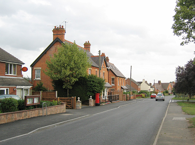

Harvington, United Kingdom
Harvington is a town of 1,680 people in England, United Kingdom.
Why visit Harvington
Townapedia lists 3 museums and landmarks, 3 parks and trails, 5 places to eat, 2 places to stay and 3 attractions in and around town.
Highlights include Bidford Bridge and Cleeve Hill.
Weather in Harvington
Forecast from MET Norway (CC BY 4.0). Full forecast
About Harvington
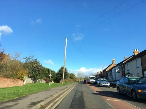
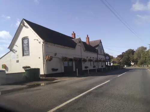
Harvington is a village near Evesham in Worcestershire, England. Bounded by the River Avon to the south and the Lench Hills to the north, three miles northeast of Evesham and now on the Worcestershire/Warwickshire border. The village today is an amalgamation of two smaller villages, Harvington and Harvington Cross, and has a population of around 1,750.
From the Wikipedia article Harvington (this version), under CC BY-SA 4.0.
Things to do3

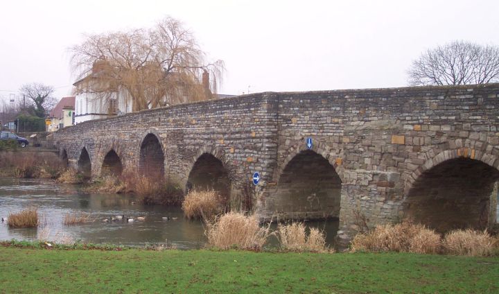
Bidford Bridge
Bridge · 3.2 mi
Bridge at Bidford-on-Avon, Warwickshire, England

Museums and landmarks3

Parks, trails and playgrounds3


Restaurants and cafes5

History
The name Harvington derives from the Old English herefordtūn meaning 'settlement by the ford which could be crossed by an army'.
Harvington is first mentioned in the Anglo Saxon charters of 709CE when it was known as Herverton; in the Middle Ages it was called Herwynton. In 1868 there was a curious old custom still observed at Harvington; the children used to go round to all the houses on St Thomas's Day and St Valentine's Day repeating a doggerel rhyme as follows:
On 30 August 1961, BAC Jet Provost 'XM423', from RAF Little Rissington in east Gloucestershire, hit 275kV 160ft pylons, on the transmission line from Ham Hall to Melksham. Both pilots ejected.
The Harvington Horse Hunt is a purported traditional event said to take place annually in the Worcestershire village of Harvington. According to local folklore, the tradition dates to 9 September 999 AD, when the young son of the Earl of Harvington was allegedly trampled to death by a horse. In remembrance of the incident, villagers are said to gather each year on 9 September and search the village for a horse which is then ceremonially captured and taken to one of the local public houses. The climax of the event involves the horse being beheaded inside the pub, after which the villagers celebrate late into the evening. The tradition is said to have continued for more than a thousand years.
Read more of the history
In more recent times, the event is held where a wooden, straw or piñata style horse is used, its hidden somewhere in the village then carried by the villagers into one of the two pubs in Harvington, at which point its head is chopped off by a man dressed as the Earl of Harvington.
From the History section of Harvington on Wikipedia, under CC BY-SA 4.0.
More about Harvington
Education
Harvington First School is a small school of approximately 180 pupils aged 5 – 10 years. Older pupils attend nearby St. Egwins Middle School and Prince Henry's High School which are in Evesham.
Harvey Bears Nursery & Preschool offers childcare to the residents of Harvington and surrounding communities.
From the Wikipedia article Harvington, under CC BY-SA 4.0.
Where to stay2
Churches and places of worship3
Schools, colleges and libraries1
Map of Harvington
20 places. The map loads OpenStreetMap tiles when you open it.
Getting there and nearby towns
Gloucestershire Airport (GLO) is the nearest airport with scheduled flights listed in OpenStreetMap, 20 miles away.
- South Littleton 2 mi southeast, about 4 min by car
- Evesham 4 mi south, about 6 min by car
- Inkberrow 6 mi northwest, about 9 min by car
- Wilmcote 9 mi northeast, about 14 min by car
- Stratford-upon-Avon 10 mi east, about 16 min by car
- Redditch 11 mi north, about 18 min by car
- Worcester 13 mi west, about 21 min by car
- Droitwich 13 mi northwest, about 21 min by car
- Tewkesbury 14 mi southwest, about 23 min by car
- Bromsgrove 15 mi northwest, about 24 min by car
Drive times are estimates from straight-line distance, not routes.
Towns near Harvington


Keep exploring
Local news
Headlines from INDB.
Reviews, tips and questions
Loading what members have shared...
Sources and licences
- GeoNames (CC BY 4.0): population, coordinates, regions and time zone
- Mapillary (see each image): photos
- OpenStreetMap contributors (ODbL 1.0): places, airports, map data
- Wikidata (CC0 1.0): elevation, founding date, time zone, website, landmarks and historic places
- Wikimedia Commons (see each image): photos
- Wikipedia (CC BY-SA 4.0): overview and history text
Photo credits
- Harvington, Dave Bushell, CC BY-SA 2.0
- Uk-bidford-on-avon-1, chris_j_wood, CC BY-SA 4.0
- Cleeve Hill, Tim Fennell, Public domain
- Street-level photo, southglos, CC BY-SA 4.0
- Street-level photo, southglos, CC BY-SA 4.0
- Street-level photo, southglos, CC BY-SA 4.0
- Street-level photo, southglos, CC BY-SA 4.0
- Street-level photo, editid, CC BY-SA 4.0
- Street-level photo, southglos, CC BY-SA 4.0
- Street-level photo, southglos, CC BY-SA 4.0
Page built November 10, 2026. Spotted a mistake? Tell us or suggest a place.