


South Littleton, United Kingdom
South Littleton is a town of 1,564 people in England, United Kingdom.
Why visit South Littleton
Townapedia lists 4 museums and landmarks, 4 parks and trails, 6 places to eat, 2 places to stay and 3 attractions in and around town.
Highlights include Cleeve Hill, The Almonry, Evesham and Tithe Barn.
Weather in South Littleton
Forecast from MET Norway (CC BY 4.0). Full forecast
About South Littleton
South Littleton is a village and civil parish located in the Wychavon district of Worcestershire, England.
From the Wikipedia article South Littleton (this version), under CC BY-SA 4.0.
Things to do3



Museums and landmarks4
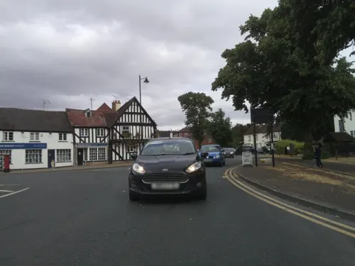
The Almonry, Evesham
Museum · 3.0 mi
Museum in Evesham, England, United Kingdom


Parks, trails and playgrounds4



Restaurants and cafes6



History
Though Neolithic human activity has been documented in the area, it is thought the first permanent settlements were constructed during Romano-British times (the important Roman road of Ryknild Street runs by the area). Other nearby Romano-British at Ullington, Blakes Hill and Littleton Pastures have been documented, and all were thought to be in continuous occupation until the late 4th century. Archeological evidence suggests the area was completely abandoned after the end of the Roman occupation of Britain.
The area had been repopulated to an extent by the time of the Domesday Book, which documents the Littletons twice. Later stone buildings remain in the villages today. The parish remained largely as an agricultural area until the late 1940s. Today, very few of the inhabitants of the parish are employed in agriculture.
From the History section of South Littleton on Wikipedia, under CC BY-SA 4.0.
Where to stay2
Churches and places of worship6
Shopping1
Schools, colleges and libraries3
Map of South Littleton
29 places. The map loads OpenStreetMap tiles when you open it.
Getting there and nearby towns
Gloucestershire Airport (GLO) is the nearest airport with scheduled flights listed in OpenStreetMap, 19 miles away.
- Evesham 3 mi southwest, about 5 min by car
- Stratford-upon-Avon 9 mi northeast, about 15 min by car
- Wilmcote 9 mi northeast, about 15 min by car
- Ettington 12 mi east, about 19 min by car
- Redditch 13 mi north, about 22 min by car
- Bishops Cleeve 14 mi southwest, about 22 min by car
- Tewkesbury 14 mi southwest, about 23 min by car
- Worcester 15 mi west, about 24 min by car
- Droitwich 15 mi northwest, about 25 min by car
- Cheltenham 17 mi southwest, about 27 min by car
Drive times are estimates from straight-line distance, not routes.
Towns near South Littleton


Keep exploring
Local news
Headlines from INDB.
Reviews, tips and questions
Loading what members have shared...
Sources and licences
- GeoNames (CC BY 4.0): population, coordinates, regions and time zone
- Mapillary (see each image): photos
- OpenStreetMap contributors (ODbL 1.0): places, airports, map data
- Wikidata (CC0 1.0): elevation, founding date, time zone, website, landmarks and historic places
- Wikimedia Commons (see each image): photos
- Wikipedia (CC BY-SA 4.0): overview and history text
Photo credits
- All Saints Church, Evesham (5139), Nilfanion, CC BY-SA 4.0
- Cleeve Hill, Tim Fennell, Public domain
- Offenham Church GradeII, Kenito1953, CC BY-SA 4.0
- Middle Littleton Tithe Barn, Evesham, Worcestershire (3820841923), IDS.photos from Tiverton, UK, CC BY-SA 2.0
- Street-level photo, southglos, CC BY-SA 4.0
- Street-level photo, southglos, CC BY-SA 4.0
- Street-level photo, southglos, CC BY-SA 4.0
- Street-level photo, southglos, CC BY-SA 4.0
Page built November 10, 2026. Spotted a mistake? Tell us or suggest a place.