
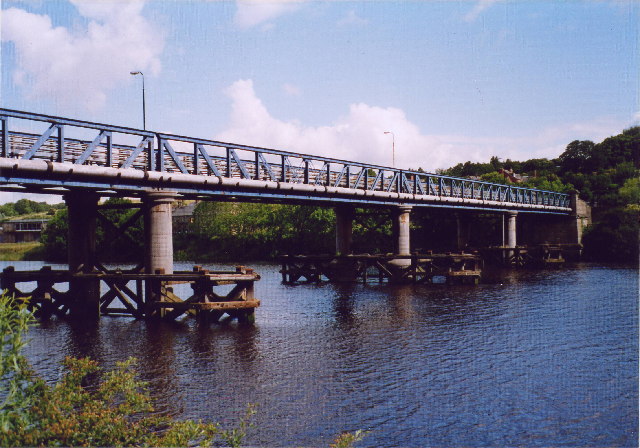


Heddon on the Wall, United Kingdom
Heddon on the Wall is a town of 1,318 people in England, United Kingdom.
Why visit Heddon on the Wall
Townapedia lists 10 museums and landmarks, 8 parks and trails, 5 places to eat, 4 places to stay and 4 attractions in and around town.
Highlights include Newburn Bridge, Wylam Bridge, Vindobala and Throckley Hall.
Weather in Heddon on the Wall
Forecast from MET Norway (CC BY 4.0). Full forecast
About Heddon on the Wall
Heddon-on-the-Wall is a village and civil parish in Northumberland, England, located on Hadrian's Wall. Heddon-on-the-Wall is roughly 9 miles (14 km) west of the centre of Newcastle upon Tyne, and just outside Throckley. In 2011 the parish had a population of 1563. The place-name 'Heddon' means 'hill where heather grew'.
From the Wikipedia article Heddon-on-the-Wall (this version), under CC BY-SA 4.0.
Things to do4


Wylam Railway Bridge
Bridge · 2.1 mi
Bridge in Wylam, Northumberland, England, UK

Museums and landmarks10

Vindobala
Monument and historic site · 1.3 mi
Ancient Roman fort at Northumberland, the fourth fort on Hadrian's Wall, after Segedunum (Wallsend), Pons Aelius (Newcastle) and...

Throckley Hall
Monument and historic site · 1.2 mi
Throckley Hall Manor House. Built c. 1820.


George Stephenson's Birthplace
Museum · 1.3 mi
Historic house museum in Wylam, Northumberland, England, UK

Rudchester Mithraeum
Monument and historic site · 1.4 mi
Mithraeum at Rudchester, Heddon-on-the-Wall, United Kingdom
Parks, trails and playgrounds8
Throckley Hall Grounds
Park · 1.3 mi
Private grounds of Throckley Hall Manor House.
Throckley, Newcastle upon Tyne


Close House Hotel & Golf Club
Golf course · 0.9 mi
18 hole Par 70 Filly Course & 18 hole Par 71 Colt Course
Heddon on the Wall, Newcastle upon Tyne

Restaurants and cafes5

Throckley Union Jack Social Club
Bar and pub · 1.5 mi
Hilda Terrace, Newcastle upon Tyne

Dhillons
Fast food · Fish And Chips · 1.4 mi
Hexham Road, Newcastle upon Tyne
Mo-Th 11:00-14:00,16:00-22:00; Fr,Sa 11:00-22:30; Su 17:00-22:00
History
A Roman milecastle on Hadrian’s Wall ('Milecastle 12') was located at the site of the present-day village, under what is now Town Farm, but no traces of it are currently visible. Prior to the 1960s, Heddon-on-the-Wall was a small village with an economy based strongly on traditional industry including farming and coal mining.
Large-scale coal mining close to the village began in the late 1950s with the opening of the Bays Leap, a 120 hectares (300 acres) opencast mine site located a short distance north of Heddon-on-the-Wall. The site supported seven coal seams at its peak, and evidence was found of earlier mine shafts. Bays Leap closed in 1966. Urban development west of Newcastle saw the village expand substantially during the 1960s.
Heddon-on-the-Wall grew up around Hexham Road, which until 1973 was the main road from Newcastle to Hexham. The new A69 road bypasses Heddon-on-the-Wall en route from Newcastle to Carlisle, also passing Hexham. Heddon-on-the-Wall benefits from its proximity to the A69 but is more popular with retired people rather than commuters due to its lack of a railway station, from which its close neighbour Wylam benefits. A railway station on the Scotswood, Newburn & Wylam Railway was opened in the village in 1881, but closed in 1958.
Read more of the history
Heddon-on-the-Wall came to prominence when it was revealed in February 2001 that the 2001 outbreak of Foot-and-mouth disease originated from a farm in the village. This severely affected Heddon-on-the-Wall's primary industry which is agriculture. Over the years, however, other industries have existed in Heddon-on-the-Wall. These include salmon fishing in the River Tyne, coal mining, the quarrying of sandstone and limestone, and brick making. Wylam Brewery was established at South Houghton Farm in 2000 before moving to Newcastle in 2016. A number of blacksmiths were in the village until recent times. In the 1970s there was a perfumery-manufacturing business.
From the History section of Heddon-on-the-Wall on Wikipedia, under CC BY-SA 4.0.
More about Heddon on the Wall
Arts and culture
Heddon-on-the-Wall attracts tourists passing through on tours of Hadrian's Wall. Heddon-on-the-Wall is located on the Hadrian's Wall Path, and contains the longest section of unbroken wall at its original and planned width, now known as Broad Wall. Later sections were not built to the full width to save time and money.
St Andrew's Church is located opposite the Swan Inn and parts of it are Saxon dating back to 680AD. It was originally consecrated in 630AD. The oldest parts of St Andrew's are still visible in some of the walls of the chancel behind the choir stalls. The original stone structure was built using recycled stone from Hadrian's Wall. Before St Andrew's church was built it is suggested that the site was used for pagan ceremonies, so the hilltop location may always have been of religious significance.
Heddon-on-the-Wall has two public houses, The Three Tuns and The Swan Inn.
From the Wikipedia article Heddon-on-the-Wall, under CC BY-SA 4.0.
Where to stay4
Churches and places of worship4
St Cuthbert's Catholic Church
Church · Roman Catholic · 1.5 mi
Hexham Road, Newcastle upon Tyne
Gas and EV charging1
Schools, colleges and libraries3
Heddon-on-the-Wall, St Andrew's Church of England Primary School
School · Anglican
Trajan Walk, Newcastle upon Tyne
Healthcare2
Map of Heddon on the Wall
41 places. The map loads OpenStreetMap tiles when you open it.
Getting there and nearby towns
Newcastle International Airport (NCL) is the nearest airport with scheduled flights listed in OpenStreetMap, 5 miles away.
- Newburn 2 mi east, about 3 min by car
- Wylam 2 mi southwest, about 3 min by car
- Prudhoe 3 mi southwest, about 5 min by car
- Blaydon-on-Tyne 4 mi southeast, about 6 min by car
- Ponteland 4 mi northeast, about 7 min by car
- Whickham 6 mi southeast, about 9 min by car
- Newcastle upon Tyne 7 mi east, about 12 min by car
- Gosforth 7 mi east, about 11 min by car
- Hazlerigg 7 mi northeast, about 11 min by car
- Gateshead 8 mi east, about 13 min by car
Drive times are estimates from straight-line distance, not routes.
Towns near Heddon on the Wall


Keep exploring
Local news
Headlines from INDB.
Reviews, tips and questions
Loading what members have shared...
Sources and licences
- GeoNames (CC BY 4.0): population, coordinates, regions and time zone
- Mapillary (see each image): photos
- OpenStreetMap contributors (ODbL 1.0): places, airports, map data
- Wikidata (CC0 1.0): elevation, founding date, time zone, website, landmarks and historic places
- Wikimedia Commons (see each image): photos
- Wikipedia (CC BY-SA 4.0): overview and history text
Photo credits
- Newburn bridge, Chris Bell, CC BY-SA 2.0
- Wylam Bridge3, Andrew Curtis, CC BY-SA 2.0
- Points Bridge Wylam, The original uploader was Craighennessey at English Wikipedia ., CC BY 2.5
- Befundskizze Kastell Rudchester, Veleius, CC0
- Heddon-On-the-Wall, has St Andrew's Church of England Primary School, Victuallers, CC BY-SA 4.0
- Throckley Hall Principal Elevation, ThrockleyH, CC0
- Heddon-on-the-Wall Hadrian's Wall seen from the west 1, Ymblanter, CC BY-SA 4.0
- Street-level photo, zuse, CC BY-SA 4.0
Page built November 10, 2026. Spotted a mistake? Tell us or suggest a place.