
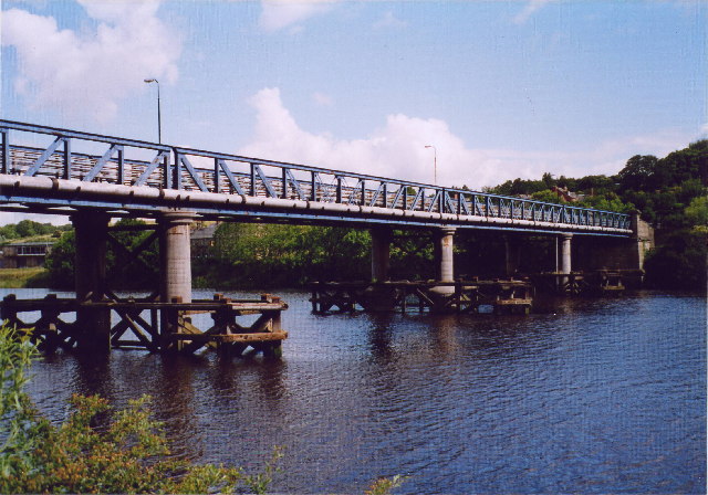


Why visit Newburn
Townapedia lists 16 museums and landmarks, 12 parks and trails, 35 places to eat, 4 places to stay and 5 attractions in and around town.
Highlights include Blaydon Bridge, Newburn Bridge, Vindobala and Throckley Hall.
Weather in Newburn
Forecast from MET Norway (CC BY 4.0). Full forecast
About Newburn
Newburn, also known as Newburn-upon-Tyne, is a village and district of Newcastle upon Tyne, in Tyne and Wear, England. Situated on the North bank of the River Tyne, it is built rising up the valley from the river. It is situated approximately 5 miles (8 km) from the city centre, 14 miles (23 km) east of Hexham and 13 miles (21 km) south south west of Morpeth. In the 2001 census, the population was given as 9,301, increasing to 9,536 at the 2011 Census.
From the Wikipedia article Newburn (this version), under CC BY-SA 4.0.
Things to do5


Scotswood Bridge
Bridge · 2.6 mi
Road bridge across the River Tyne in north east England


Museums and landmarks16

Vindobala
Monument and historic site · 3.4 mi
Ancient Roman fort at Northumberland, the fourth fort on Hadrian's Wall, after Segedunum (Wallsend), Pons Aelius (Newcastle) and...

Throckley Hall
Monument and historic site · 0.8 mi
Throckley Hall Manor House. Built c. 1820.


George Stephenson's Birthplace
Museum · 2.5 mi
Historic house museum in Wylam, Northumberland, England, UK

4 more on the map.
Parks, trails and playgrounds12
Throckley Hall Grounds
Park · 0.8 mi
Private grounds of Throckley Hall Manor House.
Throckley, Newcastle upon Tyne

Benwell Nature Park
Park · 3.1 mi
Park in Newcastle upon Tyne, United Kingdom



Restaurants and cafes35


The Keelman
Bar and pub · 0.4 mi
Grange Road, Newcastle upon Tyne
Su-Th 11:00-22:00; Fr,Sa 11:00-23:00

@ The Castle
Cafe · 1.1 mi
Stella Road, Blaydon-on-Tyne
Mo-Sa 09:00-18:00; Su 10:00-18:00
Miji Chinese Restaurant
Restaurant · Chinese · 1.3 mi
Widdrington Terrace, Blaydon-on-Tyne

23 more on the map.
History
Though some claim the area's name comes from the Old English for "New Fort or Castle" (burh or burg being the Old English for fort or castle), the name is more commonly thought to have come from the Dewley or New Burn, which runs through the area. This is somewhat substantiated by the fact that the settlement was recorded as Neuburna in 1121, rather than Neuburh.
Newburn was originally considered to have pre-eminence over Newcastle, as Newburn was the first point up from the mouth of the river that was fordable. The Romans marked this ford with a framework of stones, and may have built a fort to command the crossing. The area has other Roman connections, with the route of Hadrian's Wall cutting across its northern half, before running toward Throckley. From the eighth century, Newburn was a royal vill or town, and Newcastle didn't become a more important settlement until Plantagenet times.
Between 1332 and 1974 the Percy family were associated with Newburn, and Hugh Percy was the last to inherit Newburn Manor House, which was built in the 16th century. Also in the area at this time was Newburn Hall, which was built in the 15th century.
Read more of the history
On 28 August 1640, the Battle of Newburn took place. The Scottish Covenanters, led by Alexander Leslie, 1st Earl of Leven, planted guns at Newburn to protect them while fording the river, after which they defeated the English on the south side of the river at Stellahaugh, and subsequently occupied Newcastle upon Tyne. The Scottish claim this occupation to have been the prologue to the English Civil War. The name of Scotswood, one of the manufacturing areas between Newburn and the city centre, commemorates one of their positions.
Newburn and nearby Lemington had always been considered among the greenest areas of Newcastle, and in the eighteenth and nineteenth centuries, the majority of vegetables supplied to local markets came from Newburn and Hexham. Prior to the early 19th century, the majority of employment in the Newburn area was for fishermen, keelmen and miners.
The district has many associations with the early development of the railway. The famous engineer George Stephenson, who was born in Wylam a few miles to the west of Newburn, was twice married in Newburn Church, though he is buried in Chesterfield in Derbyshire, and worked in the Water Row pit in Newburn. The area is also the birthplace of an earlier steam pioneer William Hedley, whose first locomotive Puffing Billy was built in 1812, two years prior to his rival's first locomotive Blücher. A gravestone in Newburn churchyard marks Hedley's burial in 1843. The future railway engineers Joseph and George Armstrong both lived in the village from 1824, and found their first employment at nearby Walbottle Colliery.
In 1855, William Whellan's History, Topography, and Directory of Northumberland described the banks of the Tyne at this point having extensive iron works, coal staithes, brickyards, chemical works and other manufactories.
In 1822 John Spencer established Newburn Steelworks in a small mill for grinding files, on the Dewley Burn in the north of Newburn. Over the course of next hundred or so years his mill grew to take over much of Newburn as the demand for steel boomed with the growth of railways and other industries. By the late 19th century, the works had spread to the east of the area along the banks of the Tyne to such an extent Newburn Hall was "embedded" in them. In 1916 the mill had a weekly output of 1,500 tons. Steel plates for the liner RMS Mauretania were made by Spencers. However the industry was hit hard by the depression after the First World War and the steel works closed between 1924 and 1926, despite a large effort to raise £75,000 needed to save the works. The works' large number of 130-foot (40 m) high chimneys were demolished in 1933. A number of buildings connected with the works still stand today, although with new uses, including two large sheds which are now owned by H. Pringle, used as a large indoor scrapyard, and offices which are now used by the Multi-Lab company.
In the 1850s, the Newburn Brickworks was built as part of the North Wallbottle and Blucher Colliery Company. The works were situated near Spencer's early mill in the north of Newburn. It was connected to the colliery at Blucher by a small railway, which continued onto the staithes at Lemington. Newburn bricks were mainly used for industrial buildings such as sewers, tunnels and arches. The works closed in 1965 and demolished in 1979 to make way for a council-run recycling centre. Its sister plant, Throckley Brick Works, still operates.
In the early twentieth century, around 4,000 people lived in the area. A working men's club was built, with a library, reading rooms and lecture rooms for community meetings. By 1925 the building was used as a dole office, and in 1990 adapted for use as a residential care home.
In 1922, Newburn U.D.C. High Street Fire Station was built. The building still stands today, but the Tyne and Wear Fire and Rescue Service moved to West Denton in December 1980.
From the History section of Newburn on Wikipedia, under CC BY-SA 4.0.
More about Newburn
Economy
Prior to its closure, Spencer's Steel Works was a major local employer. Newburn Industrial Park, and the Newburn Riverside business park are now two of the key local employers.
Arts and culture
In the late nineteenth century there was a funfair, known as Newburn Hoppings, set up near the area. This was similar to The Hoppings on Newcastle's Town Moor.
There was a wooden picturedrome on Westmacott Street in the early twentieth century. On 18 October 1911, the Imperial Cinema on Station Road opened. Designed by Thomas Eltringham of Throckley colliery, it originally had seating for 550. A 131-seat gallery was added later. By 1919, the cinema was doing so well, two shows a night could not satisfy demand. However, with the opening of the Lyric Cinema in Throckley in 1935, the cinema's audience was divided. Despite this the cinema was refurbished and given a modern façade. But with the impact of television, the Imperial Cinema was one of many small picture houses to close down, shutting in 1961. It was used as a bingo hall for a time, but is now owned by Industrial Engravers, producing signs, vehicle liveries and banners.
Education
Newburn Library was built in the 1960s. However, it has bad accessibility and so there are plans to build a new library near Newburn's community centre. The new library is expected to incorporate a doctor's surgery and pharmacy, costing £24 million, with a planned opening of 2012. Newburn Hall Motor Museum was situated in the north of Newburn. The museum was housed in buildings originally built in 1924 as a drill hall for the 4th Northumberland Fusiliers. It became derelict in 1979 but was renovated by car enthusiasts and opened in 1981 to house vintage cars and motorcycles. The museum closed during the Covid pandemic.
Newburn has a primary school and nursery called Newburn Manor Primary School, which has been part of the community since 1890.
From the Wikipedia article Newburn, under CC BY-SA 4.0.
Notable people from Newburn
 Henry Percy, 8th Earl of NorthumberlandEnglish politician and Earl (1532-1585)Photo: Anthony van Dyck, Public domain
 John RickmanEnglish statistician and civil servant (1771-1840)Photo: Samuel Lane, Public domain
- William HedleyBritish inventor and industrial engineer (1779-1843)
- Billy AllenEnglish footballer (1917-1981)
- Ralph Allenassociation football player (1906-1981)
- Dave BlakeyEnglish professional footballer (1929-2014)
- Norman CallenderEnglish footballer (1924-1990)
- Norman SmithEnglish footballer and manager (December 1897-1978)
- Matt ForsterEnglish footballer (1900-1976)
- Tommy HallEnglish footballer (1891-?)
- Robert ClarkEnglish footballer (born 1903)
- Sam WhiteEnglish footballer (born 1903)
Born in Newburn, according to Wikidata (CC0). Each name links to its Wikipedia article.
Where to stay4
Churches and places of worship14
Saint Mary the Virgin Throckley
Church · Anglican · 0.7 mi
310 Newburn Road, Newcastle upon Tyne
St Cuthbert's Catholic Church
Church · Roman Catholic · 0.8 mi
Hexham Road, Newcastle upon Tyne
St Mary and St Thomas Aquinas Catholic Church
Church · Catholic · 1.3 mi
Stella Lane, Blaydon on Tyne
Shopping7
Gas and EV charging1
Schools, colleges and libraries15
St Cuthbert's Catholic Primary School
School · Roman Catholic · 0.5 mi
The Green, Newcastle upon Tyne
St John Vianney Catholic Primary School
School · Roman Catholic · 1.5 mi
Hillhead Road, Newcastle upon Tyne
St Mary & St Thomas Aquinas Catholic Primary School
School · Roman Catholic · 1.3 mi
Stella Lane, Blaydon-on-Tyne
Healthcare5
Map of Newburn
114 places. The map loads OpenStreetMap tiles when you open it.
Getting there and nearby towns
Newcastle International Airport (NCL) is the nearest airport with scheduled flights listed in OpenStreetMap, 4 miles away.
- Blaydon-on-Tyne 2 mi southeast, about 3 min by car
- Whickham 4 mi southeast, about 6 min by car
- Ponteland 4 mi north, about 7 min by car
- Newcastle upon Tyne 5 mi east, about 8 min by car
- Prudhoe 5 mi southwest, about 7 min by car
- Gosforth 5 mi east, about 8 min by car
- Wallsend 8 mi east, about 13 min by car
- Stanley 8 mi south, about 14 min by car
- Hebburn 9 mi east, about 15 min by car
- Annfield Plain 9 mi south, about 14 min by car
Drive times are estimates from straight-line distance, not routes.
Towns near Newburn


Keep exploring
Local news
Headlines from INDB.
Reviews, tips and questions
Loading what members have shared...
Sources and licences
- GeoNames (CC BY 4.0): population, coordinates, regions and time zone
- Mapillary (see each image): photos
- OpenStreetMap contributors (ODbL 1.0): places, airports, map data
- Wikidata (CC0 1.0): elevation, founding date, time zone, website, landmarks and historic places
- Wikimedia Commons (see each image): photos
- Wikipedia (CC BY-SA 4.0): overview and history text
Photo credits
- Newburn bridge, Chris Bell, CC BY-SA 2.0
- ScotswoodBridge Side 2008, D.Garnys, Public domain
- Blaydon - Scotswood Railway Bridge, Chris Bell, CC BY-SA 2.0
- Wylam Bridge3, Andrew Curtis, CC BY-SA 2.0
- Befundskizze Kastell Rudchester, Veleius, CC0
- St michael and all angels newburn, Fintan264, CC BY 3.0
- Gateshead - Ryton village cross 160m south east of church - 20230924162621, Mainlymazza, CC BY-SA 4.0
- Throckley Hall Principal Elevation, ThrockleyH, CC0
- Street-level photo, southglos, CC BY-SA 4.0
- Street-level photo, toho, CC BY-SA 4.0
- Street-level photo, zuse, CC BY-SA 4.0
Page built November 10, 2026. Spotted a mistake? Tell us or suggest a place.