


Why visit Wylam
Townapedia lists 7 museums and landmarks, 17 parks and trails, 45 places to eat, 5 places to stay and 5 attractions in and around town.
Highlights include Newburn Bridge, Wylam Bridge, Vindobala and George Stephenson's Birthplace.
Weather in Wylam
Forecast from MET Norway (CC BY 4.0). Full forecast
About Wylam
Wylam is a village and civil parish in the county of Northumberland, England. It is located about 10 miles (16 km) west of Newcastle upon Tyne.
From the Wikipedia article Wylam (this version), under CC BY-SA 4.0.
Things to do5


Wylam Railway Bridge
Bridge
Bridge in Wylam, Northumberland, England, UK

Ovingham Bridges
Bridge · 1.9 mi
Pair of bridges that cross the River Tyne in Northumberland, United Kingdom
Museums and landmarks7

Vindobala
Monument and historic site · 1.7 mi
Ancient Roman fort at Northumberland, the fourth fort on Hadrian's Wall, after Segedunum (Wallsend), Pons Aelius (Newcastle) and...

George Stephenson's Birthplace
Museum · 0.7 mi
Historic house museum in Wylam, Northumberland, England, UK
Cherryburn
Museum · 2.8 mi
18th-century historic vernacular building in Mickley, Northumberland, England, UK

Rudchester Mithraeum
Monument and historic site · 1.7 mi
Mithraeum at Rudchester, Heddon-on-the-Wall, United Kingdom
Parks, trails and playgrounds17


Close House Hotel & Golf Club
Golf course · 0.9 mi
18 hole Par 70 Filly Course & 18 hole Par 71 Colt Course
Heddon on the Wall, Newcastle upon Tyne


5 more on the map.
Restaurants and cafes45



33 more on the map.
History
Once an industrial workplace with collieries and an ironworks, it is now a commuting village for Newcastle upon Tyne and Hexham, served by the Tyne Valley line.
The earliest reference to Wylam is in a record of 1158 that records that the settlement belonged to the priory at Tynemouth. It is thought that Guy de Balliol, Lord of Bywell, gave Wylam to the priory in 1085. In 1297, Scots led by William Wallace laid waste to Northumberland from Hexham up to the walls of Newcastle upon Tyneburning Wylam and a number of other towns.The priors of Tynemouth held lands in the village until the dissolution of the monasteries in the 16th century.
The Blackett family have had a long association with the village. In 1659 Christopher Blackett acquired the Lordship of the Manor of Wylam on the death of his wife's father, Thomas Fenwick. Following Christopher's death, his second son, John Blackett, took over the estate and purchased additional land in the area, including two farms at Wylam bought in 1685. These farms formed a modest estate and residence for the Blackett family until the third quarter of the 20th century. The Lordship also included mineral rights within the township. This allowed the family to develop the colliery and further increase their prosperity.
Read more of the history
An article in the Newcastle Courant of 17 January 1874 entitled "Our Colliery Villages" paints an unattractive image of the village – 'Wylam is the very worst colliery village that we have yet beheld ...'. The colliery has an important place in the history of the development of the locomotive. It is thought that the Wylam waggonway was opened in 1748 and was therefore one of the earliest waggonways in the North of England. The waggonway linked the colliery to the staiths at Lemington from where the coal was taken down the River Tyne on flat bottomed boats called keels to be loaded on the large coal ships further down the river.
Several famous engineers have had links with the village. George Stephenson was born at a small cottage at Wylam in June 1781. Timothy Hackworth's father was foreman blacksmith at the colliery and his son was born in the village in December 1786. Hackworth together with William Hedley and Jonathan Forster were involved in the development of the locomotive engine at the colliery. Perhaps the most famous of the engines to be developed was the Puffing Billy, which is now housed at The Science Museum in London, followed closely by Wylam Dilly which is on display at the National Museum of Scotland in Edinburgh. Wylam Railway Museum has lots more information on the village's unique place in railway history and is co-located with Wylam Library and has the same opening hours.
The late 18th century was a period of prosperity for the village – the colliery was thriving and an ironworks, a leadshot manufactury and a brewery were all established in the village. In 1864 the ironworks closed. Four years later the colliery was closed. The brewery ceased to operate sometime in the 1870s. This decline in the industry led to a change in the character of the village. By the 20th century the village was almost entirely a residential settlement.
Wylam has approximately 800 households, with a population of 2,100.
From the History section of Wylam on Wikipedia, under CC BY-SA 4.0.
More about Wylam
Geography
Wylam is located on the north and south sides of the River Tyne, in Northumberland, England. The riverside walks and country trails surrounding the village are popular for cyclists, runners and walkers alike and the view of Wylam Bridge from Wylam Wood Road towards the southwest is especially dramatic.
To the east of Wylam railway station is the mouth of the small brook known as Stanley Burn, which originates in the southern Prudhoe area and also forms the regional border between Northumberland to the west and the borough of Gateshead (Tyne and Wear). The traditional boundary between Northumberland and County Durham follows the River Tyne from this point.
Arts and culture
Wylam Winter Tales is a not-for-profit arts and culture festival held in the village every January/February. It features a week of varied events including music, storytelling, film, crafts and history at venues throughout the village. It is funded through small grants, donations and ticket sales and is run by volunteers.
From the Wikipedia article Wylam, under CC BY-SA 4.0.
Notable people from Wylam
 John Minto IVAmerican politician, poet and pioneer (1822–1915)Photo: Unknown author Unknown author, Public domain
- George StephensonEnglish civil and mechanical engineer and the "Father of Railways" (1781–1848)
- Timothy HackworthBritish steam locomotive engineer (1786-1850)
- John CallenderFootballer (1903-1980)
- Jack CallenderEnglish footballer (1923-2001)
- Tom CallenderEnglish footballer (1920-2002)
- Christine HoltBritish developmental neuroscientist
- Archibald Matthias DunnBritish architect
- Ken TraillEnglish rugby league footballer and coach (1926-2002)
- William McCulloughNew Zealand mayor
Born in Wylam, according to Wikidata (CC0). Each name links to its Wikipedia article.
Where to stay5
Churches and places of worship7
Crawcrook Centenary Methodist Church
Church · Methodist · 1.4 mi
Main Street, Ryton
Shopping8
Gas and EV charging2
Schools, colleges and libraries6
Healthcare6
Map of Wylam
108 places. The map loads OpenStreetMap tiles when you open it.
Getting there and nearby towns
Newcastle International Airport (NCL) is the nearest airport with scheduled flights listed in OpenStreetMap, 7 miles away.
- Prudhoe 2 mi southwest, about 3 min by car
- Newburn 3 mi east, about 5 min by car
- Blaydon-on-Tyne 4 mi east, about 7 min by car
- Ponteland 6 mi northeast, about 10 min by car
- Whickham 6 mi east, about 10 min by car
- Newcastle upon Tyne 8 mi east, about 13 min by car
- Gosforth 8 mi east, about 13 min by car
- Consett 8 mi south, about 14 min by car
- Gateshead 9 mi east, about 14 min by car
- Stanley 9 mi southeast, about 14 min by car
Drive times are estimates from straight-line distance, not routes.
Towns near Wylam


Keep exploring
Local news
Headlines from INDB.
Reviews, tips and questions
Loading what members have shared...
Sources and licences
- GeoNames (CC BY 4.0): population, coordinates, regions and time zone
- Mapillary (see each image): photos
- OpenStreetMap contributors (ODbL 1.0): places, airports, map data
- Wikidata (CC0 1.0): elevation, founding date, time zone, website, landmarks and historic places
- Wikimedia Commons (see each image): photos
- Wikipedia (CC BY-SA 4.0): overview and history text
Photo credits
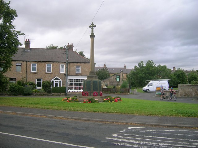
- Wylam war memorial, Newbiggin Hall Scouts, CC BY-SA 2.0
- Newburn bridge, Chris Bell, CC BY-SA 2.0
- Wylam Bridge3, Andrew Curtis, CC BY-SA 2.0
- Points Bridge Wylam, The original uploader was Craighennessey at English Wikipedia ., CC BY 2.5
- Befundskizze Kastell Rudchester, Veleius, CC0
- Wylam St Oswin's Church, Vesselina Garcheva, CC BY-SA 4.0
- Street-level photo, floatingboater, CC BY-SA 4.0
Page built November 10, 2026. Spotted a mistake? Tell us or suggest a place.