


Why visit Helmsley
Townapedia lists 9 museums and landmarks, 2 parks and trails, 23 places to eat, 3 places to stay and 2 attractions in and around town.
Highlights include Helmsley Bridge, Rievaulx Bridge, Helmsley Castle and Duncombe Park.
Weather in Helmsley
Forecast from MET Norway (CC BY 4.0). Full forecast
About Helmsley
Helmsley is a market town and civil parish in North Yorkshire, England. Historically part of the North Riding of Yorkshire, the town is located at the point where Ryedale leaves the moorland and joins the flat Vale of Pickering.
From the Wikipedia article Helmsley (this version), under CC BY-SA 4.0.
Travel tips from other travellers: Helmsley on Wikivoyage (CC BY-SA 4.0).
Things to do2
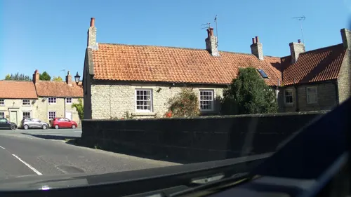
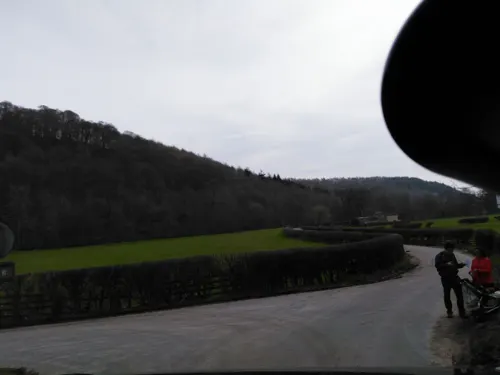
Rievaulx Bridge
Bridge · 2.6 mi
Bridge in Rievaulx, Ryedale, North Yorkshire, England, UK
Museums and landmarks9


Duncombe Park
Museum · 0.9 mi
Grade I listed historic house museum in Ryedale, United Kingdom

Rievaulx Abbey
Monument and historic site · 2.5 mi
Ruined medieval abbey in Yorkshire, England, UK


Memorial To Second Baron Feversham
Monument and historic site
Memorial in Helmsley, Ryedale, England, UK

Parks, trails and playgrounds2

Rievaulx Terrace
Park · 2.4 mi
Park and garden in North Yorkshire, England, UK

Restaurants and cafes23
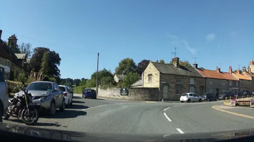
Helmsley Brewing Company
Bar and pub
North half mostly pub, south half (lino floor) mostly brewery, cocktail bar upstairs
18 Bridge Street, York
Mo-Sa 12:00-21:00; Su 12:00-19:00
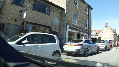





11 more on the map.
History
Archaeological discoveries indicate that the area around Helmsley was first settled in around 3,000 BC and small farming communities existed here throughout the Neolithic, Bronze and Iron Ages and into Roman times. Finds of beehive querns confirm local agriculture and the milling of grain since at least the Iron Age. There are also reports of finds of Roman pottery and a second-century Roman coin. On 30 June 2011, the BBC Two programme History Cold Case featured an archaeological investigation into four 2,000-year-old skeletons found in Windy Pits caves, concluding that at least one had been the victim of a ritual killing, including scalping. The findings, including the facial reconstruction of the scalping victim, were presented, at Duncombe Park, to local history experts.
Read more of the history
The ancient settlement, whose Old English name was Elmeslac, pre-dates the Domesday Book. It means ‘Helm’s forest clearing’ and indicates the nature of the landscape at that time. Vikings also left their mark in the Old Norse, "gate" ending of the names of many of the streets. The ownership of much of the town and its surrounding land has changed hands only twice since the Norman Conquest. After the conquest it was governed within the wapentake of Maneshou in the North Riding of Yorkshire, held by William the Conqueror’s half brother the Count of Mortain; land to the west of Helmsley was a royal deer park. The ancient pollarded oak trees in Duncombe Park date from this period and the park is now a national nature reserve. In about 1100 the estate passed to Walter Espec, founder of Rievaulx Abbey. Walter Espec’s heirs were the eldest surviving sons of his three sisters and the Helmsley properties devolved upon Robert De Ros, the son of the youngest sister, Adeline. In 1191 Robert de Ros granted Helmsley its Borough Charter, which established it as the market town.
The charter created the burgage plots – long, narrow plots which can still be seen in the property boundaries on the west side of Castlegate and east side of Bridge Street. Large-scale sheep farming, wool production and weaving were the mainstay of Helmsley’s economy for several centuries. Despite setbacks, including marauding Scots and the Black Death, Helmsley grew steadily throughout the Middle Ages. When wool production declined after the dissolution of Rievaulx Abbey, Helmsley’s weavers turned to flax, much of which was imported. The weavers were located on Bond and Bridge Streets. By the beginning of the 17th century the form of Helmsley was largely complete, and many buildings in use today date from this period. The oldest surviving house is Canon's Garth, a former vicarage. The town remained with the holders of the barony of De Ros through the Earls of Rutland and the Dukes of Buckingham until it was sold to the city financier, Sir Charles Duncombe in about 1689.
The ruined Norman castle is the most significant medieval survival of the buildings in the town, although parts of the parish church and Canon's Garth are medieval in origin. The 18th and 19th centuries saw major developments and expansion in the hands of the Duncombe family, beginning with the construction of Duncombe Park outside the town.
At the beginning of the 19th century the cottage weaving industry declined in the face of competition from new industrial cities. Despite this, the 19th century saw various major development in the town, notably the rebuilding of All Saints' Church, and at the end of the century, building of Helmsley Town Hall. More houses were built along Bondgate and, after the arrival of the railway in 1871, along Station Road. This period also saw older houses remodelled so that little thatch remained in the town. With the decline of weaving, agriculture became the mainstay of the economy.
From the History section of Helmsley on Wikipedia, under CC BY-SA 4.0.
More about Helmsley
Geography
Helmsley is situated on the southern boundary of the North York Moors National Park approximately 200 feet (61 m) above sea level. The town's geology is sandstone. To the west and the north of the settlement the moorland areas are predominantly limestone.
Helmsley lies in a hollow in undulating open countryside, flanked by heather moor to the north and the rolling farmland of the Howardian Hills to the south. The flat lowland of the Vale of Pickering stretches eastwards from the town towards Malton. The River Rye runs by the town to the south where it is joined at Rye Bridge by the Borough Beck flowing southwards through the town from the moors. Meadows south of the Rye form an important buffer and create an attractive setting for the town from the southern approach.
The area was affected by flash flooding on the night of 19 June 2005.
Economy
In the late 20th century a large amount of housing was built on backland sites in the older part of town and in residential developments outside its historic core and a small industrial estate was developed in the south-eastern corner.
Developments included award-winning council house development at Elmslac Road in the 1950s, a primary school, health centre, "affordable housing" at Storey Close, housing for the elderly at Elm Green and Pottergate and development of the industrial sector, particularly Thomas's Bakery and a veterinary surgery. The castle visitor centre provides an important attraction for the town. Helmsley is well provided with retail space but less well provided with office space. The main employers are Duncombe Park Estate, Thomas the Bakers and the North York Moors National Park Authority. The industrial estate is a vital economic asset of Helmsley.
Arts and culture
Helmsley Arts Centre has a 140-seat auditorium and 40-seat studio/exhibition space. It provides film screenings, live music, theatre performances, comedy clubs, art exhibitions and workshops/classes. The 1812 Theatre Company is the resident amateur theatre company at the centre. It mounts at least three productions per year in the main theatre and two in the studio. The 1812 Youth Theatre meets there on a regular basis, putting on two shows a year.
The five-acre (2 ha) Helmsley Walled Garden, originally built in 1756, is being restored as a working kitchen garden. A walled garden for the castle stood along the banks of the river to the south. Soon after the family moved out of the castle into Duncombe Park this walled garden was built. The garden incorporates glass houses designed in 1850 as a vine house. The ongoing programme of restoration uses appropriate plants where possible.
From the Wikipedia article Helmsley, under CC BY-SA 4.0.
Notable people from Helmsley
- Jane GloverBritish-born conductor and music scholar (born 1949)
- George Craigmusician and model
- Edward BentallEnglish association football player (1922-1947)
- John SimpsonCanada West politician, born 1807
Born in Helmsley, according to Wikidata (CC0). Each name links to its Wikipedia article.
Where to stay3
Churches and places of worship12
Shopping19
Gas and EV charging1
Schools, colleges and libraries2
Healthcare2
Map of Helmsley
75 places. The map loads OpenStreetMap tiles when you open it.
Getting there and nearby towns
Teesside International Airport (MME) is the nearest airport with scheduled flights listed in OpenStreetMap, 24 miles away.
- Sheriff Hutton 11 mi south, about 18 min by car
- Ingleby Greenhow 14 mi north, about 23 min by car
- Thornton Dale 14 mi east, about 22 min by car
- Haxby 16 mi south, about 26 min by car
- Northallerton 16 mi northwest, about 26 min by car
- Rillington 16 mi east, about 25 min by car
- Linton upon Ouse 16 mi southwest, about 25 min by car
- Skelton 17 mi south, about 28 min by car
- York 20 mi south, about 32 min by car
- Guisborough 20 mi north, about 32 min by car
Drive times are estimates from straight-line distance, not routes.
Towns near Helmsley


Keep exploring
Local news
Headlines from INDB.
Reviews, tips and questions
Loading what members have shared...
Sources and licences
- GeoNames (CC BY 4.0): population, coordinates, regions and time zone
- Mapillary (see each image): photos
- OpenStreetMap contributors (ODbL 1.0): places, airports, map data
- Wikidata (CC0 1.0): elevation, founding date, time zone, website, landmarks and historic places
- Wikimedia Commons (see each image): photos
- Wikipedia (CC BY-SA 4.0): overview and history text
Photo credits
- Rj helmsley, Mr R Jordan ( Mr R Jordan ), CC BY-SA 3.0
- Helmsley Castle - East Tower, Photograph by Mike Peel ( www.mikepeel.net )., CC BY-SA 4.0
- Duncombe Park, Kognos, CC BY-SA 4.0
- Rievaulx Abbey-001, Tilman2007/Dr. Volkmar Rudolf, CC BY-SA 4.0
- Tuscan Temple, Rievaulx, Wehha, CC BY-SA 3.0
- St John the Baptist's Church, Pockley, Gordon Hatton, CC BY-SA 2.0
- All Saint's Church, Helmsley, Yorkshire, Wehha, CC BY-SA 3.0
- All Saints Church 03, Alison Stamp, CC BY-SA 2.0
- Street-level photo, southglos, CC BY-SA 4.0
- Street-level photo, southglos, CC BY-SA 4.0
- Street-level photo, southglos, CC BY-SA 4.0
- Street-level photo, chris_debian, CC BY-SA 4.0
- Street-level photo, southglos, CC BY-SA 4.0
- Street-level photo, southglos, CC BY-SA 4.0
- Street-level photo, locator, CC BY-SA 4.0
- Street-level photo, locator, CC BY-SA 4.0
- Street-level photo, southglos, CC BY-SA 4.0
- Street-level photo, southglos, CC BY-SA 4.0
- Street-level photo, southglos, CC BY-SA 4.0
- Street-level photo, southglos, CC BY-SA 4.0
- Street-level photo, locator, CC BY-SA 4.0
- Street-level photo, southglos, CC BY-SA 4.0
- Street-level photo, southglos, CC BY-SA 4.0
- Street-level photo, chris_debian, CC BY-SA 4.0
- Street-level photo, southglos, CC BY-SA 4.0
- Street-level photo, southglos, CC BY-SA 4.0
- Street-level photo, southglos, CC BY-SA 4.0
- Street-level photo, southglos, CC BY-SA 4.0

Page built November 10, 2026. Spotted a mistake? Tell us or suggest a place.