


Why visit Skelton
Townapedia lists 16 museums and landmarks, 4 parks and trails, 21 places to eat, 7 places to stay and 4 attractions in and around town.
Highlights include Vue York, Joseph Rowntree Theatre, Barley Hall and Eboracum.
Weather in Skelton
Forecast from MET Norway (CC BY 4.0). Full forecast
About Skelton
Skelton is a village and civil parish in the unitary authority of the City of York, in North Yorkshire, England. It is four miles (6.4 km) north-north-west of the city of York, west of Haxby, and on the east bank of the River Ouse. Skelton was in the ancient royal Forest of Galtres and covers 977.3 hectares (3.77 mi2). Skelton was made a conservation area in 1973.
From the Wikipedia article Skelton, York (this version), under CC BY-SA 4.0.
Photos of Skelton

Things to do4

Joseph Rowntree Theatre
Cinema and theater · 2.9 mi
Grade II listed theatre in York, North Yorkshire, England, UK

Scarborough railway bridge
Bridge · 3.1 mi
Railway and pedestrian bridge in York, England

York Theatre Royal
Cinema and theater · 3.3 mi
Theatre in York, North Yorkshire, England, UK
Museums and landmarks16

Barley Hall
Museum · 3.4 mi
House museum in York, England, United Kingdom

Eboracum
Monument and historic site · 3.4 mi
Archaeological site and Roman provincial capital on the site of York, England

Mansion House, York
Museum · 3.4 mi
Grade I listed historic house museum in York, United Kingdom

National Railway Museum
Museum · 3.1 mi
National rail transport museum in York, England, United Kingdom

Second Boer War Memorial
Monument and historic site · 3.3 mi
Grade II* listed memorial in York, North Yorkshire, England, UK

The Norman House
Monument and historic site · 3.4 mi
Grade I listed building and scheduled monument in York, North Yorkshire, England, UK

Treasurer's House, York
Museum · 3.3 mi
Grade I listed historic house museum in York, United Kingdom


York City War Memorial
Monument and historic site · 3.3 mi
War memorial in York, North Yorkshire, England, UK

York Minster astronomical clock
Monument and historic site · 3.4 mi
Clock's operation uses the stars to commemorate the area's WWII airmen killed in action

York Museum Gardens
Museum · 3.2 mi
Botanical gardens in York, England. Contains the Yorkshire Museum and ruined St. Mary's Abbey

Richard III Experience at Monk Bar
Museum · 3.4 mi
Museum in the City of York, North Yorkshire, England
4 more on the map.
Parks, trails and playgrounds4




Restaurants and cafes21
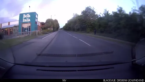
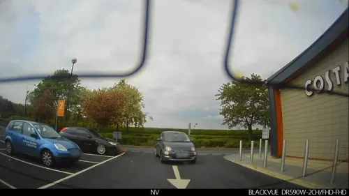
Costa
Cafe · Coffee Shop · 1.3 mi
Stirling Road, York
Tu-Fr 06:30-19:00; Sa 07:00-18:00; Su,Mo 08:00-17:00
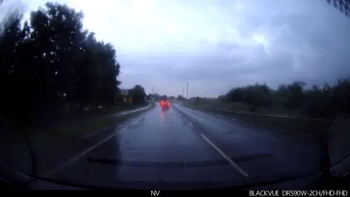

Bella Italia
Restaurant · Italian · 1.4 mi
Stirling Road, York
Mo-Th 12:00-21:00; Fr-Sa 12:00-22:00; Su 12:00-21:00

Poppleton Social
Cafe · Coffee Shop, Pizza · 1.4 mi
Mo 08:30-16:00; Tu-Fr 08:30-23:00; Sa 10:00-22:00

Lord Nelson
Bar and pub · 1.0 mi
9 Main Street, York
Closes at 2100 on Sundays
9 more on the map.
History
Skelton is mentioned in the Domesday Book, but its name indicates Anglo-Saxon and Danish influences.
Skelton Grange was built by the Place family originally in the 18th century and rebuilt after fire in 1866. 'The Grange' was finally sold in 1981 due to a lack of funds for upkeep. It was demolished by a local property developer for a large housing development on the site.
The York Corporation bought Fairfield House on the opposite side of the main road in 1918 and opened it as a tuberculosis sanatorium in the following year. It is now a hotel. (A tuberculosis dispensary was also opened in Castlegate in the City of York, in 1913, but no longer exists.)
From the History section of Skelton, York on Wikipedia, under CC BY-SA 4.0.
More about Skelton
Geography
The old village centre stands on a deposit of boulder clay, taking this part to a height some 25 metres above sea level, 10 metres more than the remainder of the village which is on strong clay, resting on gravel and sand. Within the settlement are several ponds, indicating a high water-table.
The flora and fauna was documented in two surveys, one in 1956 and then in 1971. In and around the village the surveys identified 100 species of bird, 328 species of trees and plants, 8 different ferns, 31 different types of moss, 9 fungi and amphibians including frogs, toads, the warty or crested newt and the smooth newt. Also recorded were 21 species of mammals including the whiskered bat and the long-eared bat. The bats and the crested newts in the village are protected species.
In the village open spaces have been cared for by the Parish Council and local volunteer groups and include The Green, Crooking Green, Orchard Field, The Pasture, Skelton Pond, the open spaces at Sycamore Close and Brecksfield.
The long, narrow plot boundaries extending back from the older houses are an example of the typical medieval pattern of 'toft and croft' agriculture.
Economy
The village was primarily agricultural in nature, but is now mostly residential with a small commercial district to the south west of the village. Local Services consist of a post office and general store, one public house and one social club, and a doctor's surgery.
Education
A school was built in 1872. It accommodated 120 children, and had an average attendance of about half that number. Now primary education is catered for at Skelton Community Primary School located in Brecksfield. The village is within the Local Education Authority catchment area for Vale of York Academy on Rawcliffe Drive in nearby Clifton Without.
From the Wikipedia article Skelton, York, under CC BY-SA 4.0.
Notable people from Skelton
- John NelsonEnglish Jesuit martyr, born 1535
Born in Skelton, according to Wikidata (CC0). Each name links to its Wikipedia article.
Where to stay7
Churches and places of worship23
Clifton Moor Church and Community Centre
Church · Anglican · 1.4 mi
Rivelin Way, York
Shopping4
Gas and EV charging4
Schools, colleges and libraries5
Healthcare1
Map of Skelton
89 places. The map loads OpenStreetMap tiles when you open it.
Getting there and nearby towns
Leeds Bradford Airport (LBA) is the nearest airport with scheduled flights listed in OpenStreetMap, 24 miles away.
- Haxby 3 mi east, about 4 min by car
- York 4 mi southeast, about 6 min by car
- Linton upon Ouse 6 mi northwest, about 9 min by car
- Sheriff Hutton 8 mi northeast, about 13 min by car
- Thorp Arch 10 mi southwest, about 15 min by car
- Wetherby 11 mi southwest, about 18 min by car
- Spofforth 13 mi west, about 21 min by car
- Knaresborough 14 mi west, about 22 min by car
- Selby 15 mi south, about 24 min by car
- Harrogate 16 mi west, about 26 min by car
Drive times are estimates from straight-line distance, not routes.
Towns near Skelton


Keep exploring
Local news
Headlines from INDB.
Reviews, tips and questions
Loading what members have shared...
Sources and licences
- GeoNames (CC BY 4.0): population, coordinates, regions and time zone
- Mapillary (see each image): photos
- OpenStreetMap contributors (ODbL 1.0): places, airports, map data
- Wikidata (CC0 1.0): elevation, founding date, time zone, website, landmarks and historic places
- Wikimedia Commons (see each image): photos
- Wikipedia (CC BY-SA 4.0): overview and history text
Photo credits
- Blacksmith's Arms, Skelton, DS Pugh, CC BY-SA 2.0
- East view of St Giles, Skelton, Warofdreams, CC BY 4.0
- Piscina and window at St Giles, Skelton, Warofdreams, CC BY 4.0
- View from chancel into nave, St Giles, Skelton, Warofdreams, CC BY 4.0
- The Cottage, Skelton, Warofdreams, CC BY 4.0
- Skelton Manor wall, Warofdreams, CC BY 4.0
- Joseph Rowntree Theatre York 02, Malcolmxl5, CC BY-SA 4.0
- Scarborough Railway Bridge York 2, Unknown author, Public domain
- York Theatre Royal2, Jhsteel, CC BY-SA 3.0
- Barley Hall external, jhartshorn (James Hartshorn), CC BY-SA 2.0
- Constantine York Minster, York Minster, CC BY-SA 2.0
- York - National Railway Museum - 04, Benjamin Smith, CC BY-SA 4.0
- South African War Memorial1, Jhsteel, CC BY-SA 3.0
- NormanHouseYork, BZ4brbr, CC BY-SA 3.0
- York - York Art Gallery, Benjamin Smith, CC BY-SA 4.0
- War memorial, York - DSC07862, Rept0n1x, CC BY-SA 3.0
- York Minster astronomical clock, Steven Fruitsmaak, Public domain
- Dean's Park, Drkirstyross, CC BY-SA 3.0
- Huntington church, James@hopgrove at English Wikipedia, Public domain
- Église Ste Helen Stonegate York 1, Chabe01, CC BY-SA 4.0
- Church of the Holy Redeemer, York, Warofdreams, CC BY-SA 4.0
- York St John University, Robert Dawson, CC BY-SA 4.0
- St Giles, Skelton, Alison Stamp, CC BY-SA 2.0
- Crookhill, Warofdreams, CC BY 4.0
- Mansion House York, Malcolmxl5, CC BY-SA 4.0
- The Blue Drawing Room of the Treasurer's House York Dec24, Malcolmxl5, CC0
- York - Museum Gardens - panoramio, PJMarriott, CC BY 3.0
- Bowling Green, West Bank Park, Gordon Hatton, CC BY-SA 2.0
- Street-level photo, lamaar639, CC BY-SA 4.0
- Street-level photo, lamaar639, CC BY-SA 4.0
- Street-level photo, Junguin, CC BY-SA 4.0
- Street-level photo, lamaar639, CC BY-SA 4.0
- Street-level photo, smsm1, CC BY-SA 4.0
- Street-level photo, Semir_Mapillary, CC BY-SA 4.0
- Street-level photo, lamaar639, CC BY-SA 4.0
- Street-level photo, lamaar639, CC BY-SA 4.0
- Street-level photo, lamaar639, CC BY-SA 4.0
- Street-level photo, choffee, CC BY-SA 4.0
- Street-level photo, lamaar639, CC BY-SA 4.0
- Street-level photo, lamaar639, CC BY-SA 4.0
- Street-level photo, lamaar639, CC BY-SA 4.0
- Street-level photo, lamaar639, CC BY-SA 4.0


Page built November 10, 2026. Spotted a mistake? Tell us or suggest a place.