


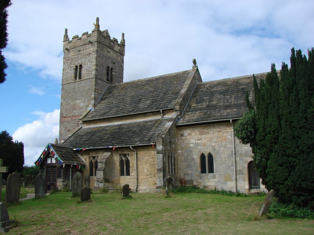
Linton upon Ouse, United Kingdom
Linton upon Ouse is a town of 1,008 people in England, United Kingdom.
Why visit Linton upon Ouse
Townapedia lists 1 museum or landmark, 2 parks and trails, 4 places to eat, 1 place to stay and 1 attraction in and around town.
Highlights include Aldwark Bridge and Beningbrough Hall.
Weather in Linton upon Ouse
Forecast from MET Norway (CC BY 4.0). Full forecast
About Linton upon Ouse
Linton-on-Ouse is a village and civil parish in the county of North Yorkshire, England, about eight miles north-west of York. It lies on the north bank of the River Ouse.
From the Wikipedia article Linton-on-Ouse (this version), under CC BY-SA 4.0.
Things to do1

Aldwark Bridge
Bridge · 1.6 mi
Bridge in Great Ouseburn, Harrogate, North Yorkshire, England, UK
Museums and landmarks1

Beningbrough Hall
Museum · 2.4 mi
Grade I listed historic house museum in Hambleton, North Yorkshire, England, UK
Parks, trails and playgrounds2


Restaurants and cafes4

The Dawnay Arms
Bar and pub · 1.4 mi
Tu-Fr 12:00-14:00,17:30-21:00; Sa 12:00-21:00; Su 12:00-16:00 open "Food"
Blacksmiths Arms
Bar and pub · 1.5 mi
Cherry Tree Avenue, Newton-on-Ouse
Mo-Th 15:00-22:00; Fr-Sa 12:30-23:00; Su 12:30-21:00

History
The village is mentioned in the Domesday Book as Luctone in the Bulford Hundred. The manor at this time was split between Thorfin of Ravensworth and Thorn of Linton. Afterwards, the manor was granted to Robert of Mortain. The manor passed to Thomas de Ros, 4th Baron de Ros, in the 14th century and remained in the family until the mid-16th century. In the early 18th century, the manorial rights were sold to University College, Oxford. The university built a school in the village in 1871.
In the mid-18th century, Acts of Parliament were passed to make the River Ouse navigable that included the building of a lock at Linton-on-Ouse, which is now a Grade II listed building.
There was a Catholic chapel in the village between 1700 and 1855.
Since 1937, Linton-on-Ouse has been home to a Royal Air Force station, RAF Linton-on-Ouse. Since 1957, the main role of the airfield has been the training of pilots, and with the main flying training ceasing from 2019, the Military Air Traffic Zone was rescinded in December 2020.
In the summer of 1960 and 1961, the perimeter track of the airfield was used to form the 1.7-mile (2.7 km) Linton-on-Ouse Motor Racing circuit.
In April 2022, the government announced its intention to convert the former RAF base into a reception, accommodation and processing centre for asylum seekers as a way of defraying the £4.7 million per day cost of hotels being used.
From the History section of Linton-on-Ouse on Wikipedia, under CC BY-SA 4.0.
More about Linton upon Ouse
Geography
The nearest settlements are Newton-on-Ouse 1.2 miles (1.9 km) to the south-east, Aldwark 2.5 miles (4.0 km) to the north-west and Thorpe Underwood 2.1 miles (3.4 km) to the south-west. Sandwath Beck joins Shorn Dike to the north-east of the village before flowing into the River Kyle just to the east of the school.
The 1881 UK Census recorded the population as 296. The 2001 UK Census recorded the population as 1,024, of which 723 were over the age of sixteen years. There were 388 dwellings, of which 134 were detached.
From the Wikipedia article Linton-on-Ouse, under CC BY-SA 4.0.
Where to stay1
Churches and places of worship14
Schools, colleges and libraries1
Map of Linton upon Ouse
24 places. The map loads OpenStreetMap tiles when you open it.
Getting there and nearby towns
Leeds Bradford Airport (LBA) is the nearest airport with scheduled flights listed in OpenStreetMap, 21 miles away.
- Haxby 8 mi east, about 12 min by car
- York 9 mi southeast, about 15 min by car
- Knaresborough 9 mi west, about 15 min by car
- Wetherby 10 mi southwest, about 16 min by car
- Sheriff Hutton 10 mi east, about 17 min by car
- Harrogate 12 mi west, about 20 min by car
- Ripon 13 mi northwest, about 21 min by car
- Garforth 18 mi south, about 30 min by car
- Chapel Allerton 19 mi southwest, about 31 min by car
- Leeds 21 mi southwest, about 34 min by car
Drive times are estimates from straight-line distance, not routes.
Towns near Linton upon Ouse


Keep exploring
Local news
Headlines from INDB.
Reviews, tips and questions
Loading what members have shared...
Sources and licences
- GeoNames (CC BY 4.0): population, coordinates, regions and time zone
- OpenStreetMap contributors (ODbL 1.0): places, airports, map data
- Wikidata (CC0 1.0): elevation, founding date, time zone, website, landmarks and historic places
- Wikimedia Commons (see each image): photos
- Wikipedia (CC BY-SA 4.0): overview and history text
Photo credits
- Beningbrough Hall 2010, Arvind, CC BY-SA 3.0
- Moor Monkton Church, Ken Crosby, CC BY-SA 2.0
- All Saints, Newton-on-Ouse, Tim Green, CC BY 2.0
- Whixley parish church, Martyn Gorman, CC BY-SA 2.0
- Church of St Mary the Virgin, Great Ouseburn, Bill Henderson, CC BY-SA 2.0
- Holy Trinity Church, Little Ouseburn, Bill Henderson, CC BY-SA 2.0
Page built November 10, 2026. Spotted a mistake? Tell us or suggest a place.