
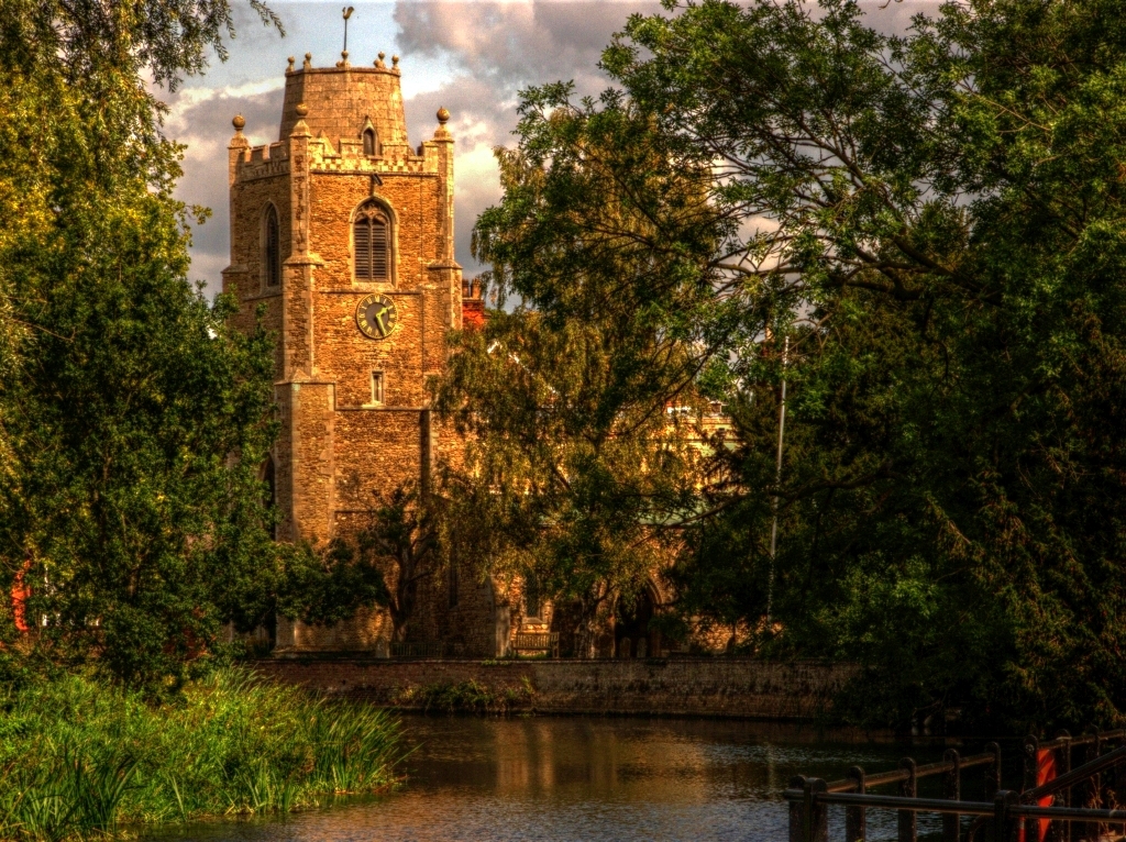


Hemingford Grey, United Kingdom
Hemingford Grey is a town of 3,163 people in England, United Kingdom.
Why visit Hemingford Grey
Townapedia lists 11 museums and landmarks, 20 parks and trails, 52 places to eat, 7 places to stay and 1 attraction in and around town.
Highlights include Godmanchester Chinese Bridge, Norris Museum, Oliver Cromwell and Fen Drayton Lakes.
Weather in Hemingford Grey
Forecast from MET Norway (CC BY 4.0). Full forecast
About Hemingford Grey
Hemingford Grey is a village and civil parish in Cambridgeshire, England. Hemingford Grey lies approximately 4 miles (6 km) east of Huntingdon. Hemingford Grey is situated within Huntingdonshire which is a non-metropolitan district of Cambridgeshire as well as being a historic county of England.
From the Wikipedia article Hemingford Grey (this version), under CC BY-SA 4.0.
Things to do1

Godmanchester Chinese Bridge
Monument and historic site · 3.2 mi
Bridge in the town of Godmanchester, Huntingdonshire, Cambridgeshire, England
Museums and landmarks11



Parks, trails and playgrounds20
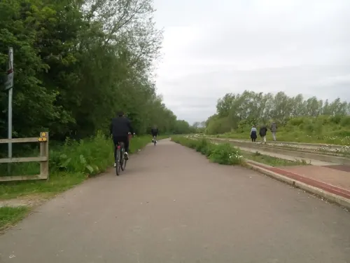
Fen Drayton Lakes
Park · 2.8 mi
RSPB nature reserve in the United Kingdom

Godmanchester Nature Reserve
Park · 2.4 mi
Nature reserve in the United Kingdom

Hemingford Grey Meadow
Park · 0.9 mi
Nature reserve in Hemingford Grey, Huntingdonshire, Cambridgeshire, England, UK

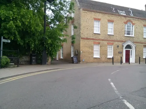


Jones Boatyard
Marina and boat launch · 1.1 mi
Facilities available: Approximately 160 fixed and floating moorings, mostly serviced with electricity, Shower block, Chemical waste...
Low Road, St Ives




8 more on the map.
Restaurants and cafes52
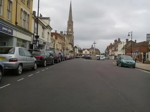
Ivo Lounge
Restaurant · British · 1.3 mi
9/10 Sheepmarket, St Ives
Su-Th 09:00-23:00; Fr-Sa 09:00-24:00




St Ives Dhaba
Restaurant · Indian · 1.1 mi
21 Bridge Street, St Ives
Su-Th 17:30-22:00; Fr-Sa 17:30-22:30


40 more on the map.
History
In Anglo-Saxon times the neighbouring villages of Hemingford Grey and Hemingford Abbots were a single estate. In the ninth century they were split into two. In 1066 "Little Hemingford", as it was known, was acquired by nearby Ramsey Abbey.
Hemingford Grey was listed in the Domesday Book of 1086 in the Hundred of Toseland in Huntingdonshire; the name of the settlement was written as alia Emingeforde and Emingeforde in the Domesday Book. In 1086 there were three manors at Hemingford Grey; the annual rent paid to the lords of the manors in 1066 had been £17 and the rent had fallen to £16 in 1086.
The Domesday Book does not explicitly detail the population of a place but it records that there were 29 households at Hemingford Grey. There is no consensus about the average size of a household at that time; estimates range from 3.5 to 5.0 people per household. Using these figures then an estimate of the population of Hemingford Grey in 1086 is that it was within the range of 101 and 145 people.
Read more of the history
The Domesday Book uses a number of units of measure for areas of land that are now unfamiliar terms, such as hides and ploughlands. In different parts of the country, these were terms for the area of land that a team of eight oxen could plough in a single season and are equivalent to 120 acres (49 hectares); this was the amount of land that was considered to be sufficient to support a single family. By 1086, the hide had become a unit of tax assessment rather than an actual land area; a hide was the amount of land that could be assessed as £1 for tax purposes. The survey records that there were 12.25 ploughlands at Hemingford Grey in 1086 and that there was the capacity for a further 2.75 ploughlands. In addition to the arable land, there was 90 acres (36 hectares) of meadows, two water mills and a fishery at Hemingford Grey.
The tax assessment in the Domesday Book was known as geld or danegeld and was a type of land-tax based on the hide or ploughland. It was originally a way of collecting a tribute to pay off the Danes when they attacked England, and was only levied when necessary. Following the Norman Conquest, the geld was used to raise money for the King and to pay for continental wars; by 1130, the geld was being collected annually. Having determined the value of a manor's land and other assets, a tax of so many shillings and pence per pound of value would be levied on the land holder. While this was typically two shillings in the pound the amount did vary; for example, in 1084 it was as high as six shillings in the pound. For the manors at Hemingford Grey the total tax assessed was 20 geld.
Listed as Emingeforde in the Domesday Book, the name Hemingford means "the ford of the people of Hemma or Hemmi", where Hemma is believed to be the name of a Saxon chief. The village was at different times known as East Hemingeford (11th century), Hamicheford (12th), Hemmingeforde Turbervill (13th–14th), Hemmingeforde Parva (13th–14th) and Hemingford Priors (14th–15th).
In around 1140 Payn of Hemingford began the construction of Hemingford Manor, one of the oldest inhabited buildings in England, as well as the present church. The manor was then owned by the Turberville family who for a while gave their name to the village.
In 1276 the village was given its present name by the de Grey family. The manor remained in the possession of the Greys until seized by Henry VII in the fifteenth century after George Grey, 2nd Earl of Kent was unable to settle his debts. The manor was subsequently leased by the crown to a number of people, including Sir Richard Williams (the great-grandfather of Oliver Cromwell); Sir George Howard; Helena, Marchioness of Northampton; and John, Earl of Holderness. In 1721 the manor was sold by the crown, together with half the manor of Hemingford Abbots, to James Mitchell of Fowlmere.
Hemingford Grey grew considerably in the 19th century especially in the area of the London Road which is about a mile east of the village centre and nearer to St Ives. Here there has been some industrial development, a petrol station and the St Ives Motel. The village continued to grow between the wars when simple and attractive bungalows with good–sized gardens were built followed, in more recent years, by several small estate developments.
From the History section of Hemingford Grey on Wikipedia, under CC BY-SA 4.0.
More about Hemingford Grey
Geography
It is situated on the southern bank of the River Great Ouse in the county of Cambridgeshire, with the northern bank occupied by the flood meadow. Until 1965 it was in Huntingdonshire and between 1965 and 1974 it was in the short-lived county of Huntingdon and Peterborough. It adjoins Hemingford Abbots to the west and St Ives on the north of the river and the A14 trunk road passes through the parish about a mile south of the main settlement.
Arts and culture
The centre of the village has an attractive mixture of buildings including thatched timber-framed cottages and the church with its unique truncated spire. Along the riverside path is the The Manor, which was constructed as earlier as the 1130s and is believed to be one of the oldest continuously-inhabited houses in the Britain. One of its notable residents was the children's book author Lucy Boston.
The village is home to a village shop, a primary school, and The Cock public house. The post office closed in 2003, but there is a post office run from St James' Parish Centre (Please note – this post office hosted by the Parish Centre has now moved to the village shop, Hemingford Stores. It has the same opening times as the shop) The 19th century Reading Room is still used for community meetings.
Hemingford Grey has a number of organisations providing recreation and sporting activities for residents. One notable event is the annual Hemingfords' Regatta. Founded in 1901 by the Vicar of Hemingford Grey, Rev. Byrom Holland, and artist Walter Dendy Sadler, the regatta is held annually with the adjoining village of Hemingford Abbots and is believed to be among the oldest village regattas in the country.
From the Wikipedia article Hemingford Grey, under CC BY-SA 4.0.
Notable people from Hemingford Grey
 Elizabeth Hamilton, 1st Baroness Hamilton of HameldonIrish belle, lady-in-waiting, and society hostess; (1733-1790)Photo: Francis Cotes (1726-1770), Public domain
- John ThornhillEnglish cricketer
Born in Hemingford Grey, according to Wikidata (CC0). Each name links to its Wikipedia article.
Where to stay7
Churches and places of worship13
Jamia Masjid St Ives Mosque
Place of worship · Sunni · 1.4 mi
22 Needingworth Road, St Ives
Shopping10
Gas and EV charging2
Schools, colleges and libraries9
Healthcare3
Map of Hemingford Grey
128 places. The map loads OpenStreetMap tiles when you open it.
Getting there and nearby towns
Cambridge City Airport (CBG) is the nearest airport with scheduled flights listed in OpenStreetMap, 14 miles away.
- Saint Ives 1 mi northeast, about 2 min by car
- Houghton 1 mi northwest, about 2 min by car
- Needingworth 3 mi east, about 5 min by car
- Huntingdon 4 mi west, about 6 min by car
- Swavesey 4 mi east, about 7 min by car
- Papworth Everard 5 mi south, about 8 min by car
- Over 5 mi east, about 8 min by car
- Somersham 6 mi northeast, about 10 min by car
- Earith 6 mi northeast, about 10 min by car
- Longstanton 7 mi east, about 11 min by car
Drive times are estimates from straight-line distance, not routes.
Towns near Hemingford Grey


Keep exploring
Local news
Headlines from INDB.
Reviews, tips and questions
Loading what members have shared...
Sources and licences
- GeoNames (CC BY 4.0): population, coordinates, regions and time zone
- Mapillary (see each image): photos
- OpenStreetMap contributors (ODbL 1.0): places, airports, map data
- Wikidata (CC0 1.0): elevation, founding date, time zone, website, landmarks and historic places
- Wikimedia Commons (see each image): photos
- Wikipedia (CC BY-SA 4.0): overview and history text
Photo credits
- Hemingford grey, sean hickin, CC BY 2.0
- The Anchor, Hemingford Grey, AnemoneProjectors, CC BY-SA 4.0
- Godmanchester to St Ives 100 Lodge Cottage, Hemingford Grey (22377806185), Peter O'Connor aka anemoneprojectors, CC BY-SA 2.0
- Godmanchester to St Ives 099 The Old Cottage, Hemingford Grey (22388549971), Peter O'Connor aka anemoneprojectors, CC BY-SA 2.0
- Godmanchester Chinese Bridge, Unknown author, Public domain
- Godmanchester Nature Reserve, Island Lake 2 cropped, Dudley Miles, CC BY-SA 4.0
- Hemingford Grey Meadow 4, Dudley Miles, CC BY-SA 4.0
- Cmglee St Ives Market Hill, Cmglee, CC BY-SA 3.0
- Hemingford Abbots church, Smb1001, CC BY-SA 3.0
- Cmglee Houghton Mill, Cmglee, CC BY-SA 3.0
- St Ives Golden Lion Hotel, MalBarrows, CC BY-SA 4.0
- The Church at Hemingford Grey, Jason Ballard, CC BY 2.0
- St Ives - Robin Hood, MalBarrows, CC BY-SA 4.0
- St Ives - Nelsons Head, MalBarrows, CC BY-SA 4.0
- St Ives White Hart public houes, MalBarrows, CC BY-SA 4.0
- Godmanchester to St Ives 158 The Norris Library and Museum, St Ives (21916232124), Peter O'Connor aka anemoneprojectors, CC BY-SA 2.0
- St Ives Priory Wall 2004 05 31, David Bartlett, CC BY-SA 2.0
- Oliver Cromwell, St Ives - 539283, Keith Evans, CC BY-SA 2.0
- Godmanchester to St Ives 134 Chapel of St Ledger, St Ives (22467589641), Peter O'Connor aka anemoneprojectors, CC BY-SA 2.0
- Godmanchester to St Ives 090 The Manor House gardens, Hemingford Grey (22164131578), Peter O'Connor aka anemoneprojectors, CC BY-SA 2.0
- Godmanchester to St Ives 198 Houghton Meadows (22653366042), Peter O'Connor aka anemoneprojectors, CC BY-SA 2.0
- Godmanchester to St Ives 192 The Thicket, St Ives (22630493805), Peter O'Connor aka anemoneprojectors, CC BY-SA 2.0
- Street-level photo, cyclestreets, CC BY-SA 4.0
- Street-level photo, adam2, CC BY-SA 4.0
- Street-level photo, cyclestreets, CC BY-SA 4.0
- Street-level photo, cyclestreets, CC BY-SA 4.0
- Street-level photo, cyclestreets, CC BY-SA 4.0
- Street-level photo, adam2, CC BY-SA 4.0
- Street-level photo, adam2, CC BY-SA 4.0
- Street-level photo, cyclestreets, CC BY-SA 4.0
- Street-level photo, cyclestreets, CC BY-SA 4.0
- Street-level photo, adam2, CC BY-SA 4.0
- Street-level photo, cyclestreets, CC BY-SA 4.0
- Street-level photo, coljay72, CC BY-SA 4.0
- Street-level photo, cyclestreets, CC BY-SA 4.0
- Street-level photo, cyclestreets, CC BY-SA 4.0
- Street-level photo, cyclestreets, CC BY-SA 4.0
- Street-level photo, cyclestreets, CC BY-SA 4.0
- Street-level photo, coljay72, CC BY-SA 4.0
- Street-level photo, adam2, CC BY-SA 4.0
- Street-level photo, cyclestreets, CC BY-SA 4.0
- Street-level photo, adam2, CC BY-SA 4.0
- Street-level photo, adam2, CC BY-SA 4.0
- Street-level photo, cyclestreets, CC BY-SA 4.0


Page built November 10, 2026. Spotted a mistake? Tell us or suggest a place.