


Maidstone, United Kingdom
Maidstone is a city of 107,627 people in England, United Kingdom.
Why visit Maidstone
Townapedia lists 24 museums and landmarks, 38 parks and trails, 195 places to eat, 14 places to stay and 8 attractions in and around town.
Highlights include Hazlitt Theatre, Odeon, Kent Life and Maidstone Museum.
Weather in Maidstone
Forecast from MET Norway (CC BY 4.0). Full forecast
About Maidstone
Maidstone is the largest town in the county of Kent in South East England, of which it is also the county town. Maidstone is historically important and lies 32 miles (51 km) east-south-east of London. The River Medway runs through the centre of the town, linking it with Rochester and the Thames Estuary. Historically, the river carried much of the town's trade as the centre of the agricultural county of Kent, which is known as the Garden of England.
From the Wikipedia article Maidstone (this version), under CC BY-SA 4.0.
Travel tips from other travellers: Maidstone on Wikivoyage (CC BY-SA 4.0).
Photos of Maidstone


Things to do8

Hazlitt Theatre
Cinema and theater · 0.5 mi
One of the main theatres in Maidstone, Kent
Earl Street, Maidstone

East Farleigh Bridge
Bridge · 1.6 mi
Grade I listed bridge in Kent, England, UK
Teston Bridge
Bridge · 3.1 mi
Grade I listed bridge in Teston, Kent, England

Museums and landmarks24


Coffin Stone
Monument and historic site · 3.6 mi
Archaeological artifact in Kent, England
Maidstone Museum and Bentlif Art Gallery
Museum · 0.7 mi
Regional museum, regimental museum, art gallery, heritage centre, historic house museum in Kent, England, United Kingdom

Medway megaliths
Museum · 3.5 mi
Group of long barrows in Kent, England

Queen's Own Royal West Kent Regiment Cenotaph
Monument and historic site · 0.7 mi
War memorial in Kent, England, UK

Smythe's Megalith
Monument and historic site · 3.5 mi
Neolithic monument in Kent, England

White Horse Stone
Monument and historic site · 3.4 mi
Two megaliths near Aylesford, Kent, England


Eccles Roman Villa
Monument and historic site · 4.1 mi
Roman villa in the UK
12 more on the map.
Parks, trails and playgrounds38

Maidstone United FC - Gallagher Stadium
Sports field and stadium · 0.9 mi




26 more on the map.
Restaurants and cafes195
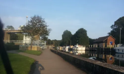
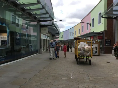
Maison Frederic
Restaurant · French · 0.6 mi
13-15 Earl Street, Maidstone
We-Sa 12:00-23:00; Su 12:00-18:00
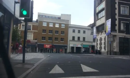
Buenos Aires Nights Steakhouse
Restaurant · Steak House, Burger, Sandwich, Chicken, Seafood · 0.4 mi
Buenos Aires Steakhouse offers the authentic Argentinian steaks in maidstone, Kent.
63 High Street, Maidstone
Fed on the Green
Cafe · 2.8 mi
The Green, Bearsted
Mo-Th 08:30-15:00; Fr-Sa 09:00-16:00; Su[1] 09:00-14:30


The Cellars Alehouse
Bar and pub · 0.4 mi
Buckland Road, Maidstone
Tu,We 17:00-21:00; Th 17:00-23:00; Fr,Sa 12:00-23:00; Su 12:00-18:00

183 more on the map.
History
Neolithic finds have revealed the earliest occupation of the area, and the Romans have left their mark in the road through the town and evidence of villas. The Normans set up a shire moot, and religious organisations established an abbey at Boxley, hospitals and a college for priests. Today's prosperous suburb of Penenden Heath was an historic site of legal proceedings (courts) and also a place of execution in medieval times.
Maidstone played a key role during the Peasants' Revolt of 1381. The rebel priest, John Ball, had been imprisoned there and was freed by Kentish rebels under the command of Wat Tyler, who is reputed to have been a resident of the town.
Read more of the history
Maidstone's charter as a town was granted in 1549; although briefly revoked, a new charter in 1551 created the town as a borough. The charter was ratified in 1619 under James I, and the coat of arms was designed, bearing a golden lion and a representation of the river (in heraldic terms: Or, a fess wavy Azure between three roundels Gules, on a chief Gules a leopard passant gardant Or). The arms also include the head of a white horse (representing Invicta, the motto of the county of Kent), a golden lion and an Iguanodon. The Iguanodon relates to dinosaur fossils discovered in Maidstone in 1834, then classified as Iguanodon but are now believed to belong to the related Mantellisaurus. The remains are currently held in the Natural History Museum in London. Maidstone has had the right to a town gaol since 1604.
During the English Civil War, the Battle of Maidstone took place in 1648, resulting in a victory for the Parliamentarians. Andrew Broughton, who was Mayor of Maidstone in 1649 (and also Clerk to the High Court of Justice) was responsible for declaring the death sentence on Charles I, and today a plaque in Maidstone Town Centre memorialises Broughton as 'Mayor and Regicide'.
Paper mills, stone quarrying, brewing and the cloth industry have all flourished here. The paper maker James Whatman and his son invented wove paper (Whatman paper) at Turkey Mill from 1740, an important development in the history of printing.
A permanent military presence was established in the town with the completion of cavalry barracks in 1798. Invicta Park Barracks is currently home to the 36 Engineer Regiment.
Maidstone Prison is north of the town centre and was completed in 1819.
In 1897–1898 the Maidstone typhoid epidemic killed at least 132 people, and was the largest typhoid epidemic at the time. Hundreds of nurses from around the country volunteered to care for the patients, and several nurses were sent by Eva Luckes, matron of The London Hospital, including Edith Cavell.
Modern Maidstone incorporates a number of outlying villages and settlements (see Geography below).
The county council offices at the front of the prison near Maidstone East station were built of Portland stone between 1910 and 1913. On 29 September 1975 a local pub serving the Invicta Park Barracks, The Hare and Hounds, was damaged by a bomb during an IRA campaign in England.
Maidstone General Hospital opened on the outskirts of the town in 1983, replacing the West Kent General Hospital, which opened 150 years earlier in Marsham Street, and the Victorian Ophthalmic ('Ear, Nose and Throat') Hospital which was nearby to it. The General Hospital is just to the north of Oakwood Hospital (originally the Kent County Asylum), which closed in the mid-1990s the site of which has now been developed for housing. It was at Maidstone General Hospital that the member of the Monty Python team Graham Chapman died of throat and spinal cancer in 1989 [ref. his biographer Bob McCabe].
Residents are mainly employed in the retail, administrative and service sectors; there are some industrial estates around the town providing employment. Some of the workforce commute to other towns, including to London.
From the History section of Maidstone on Wikipedia, under CC BY-SA 4.0.
More about Maidstone
Geography
The town is six miles downstream from where the River Medway, having flowed in a generally west–east direction, is joined by the Rivers Teise and Beult at Yalding and changes its course to a northerly one. It cuts through the ridge formed by the greensand, so that the town occupies a site on two opposite hills, the easterly one containing the town centre. Beyond that, and higher, is Penenden Heath.
The River Len joins the Medway at Maidstone. Though a short river, it provided the water to drive numerous watermills. The Loose Stream, which rises at Langley and joins at Tovil, once powered over 30 mills. Mill ponds on these rivers are a prominent feature of the landscape.
Maidstone has continued to grow. In doing so it has incorporated hitherto separate settlements, villages and hamlets within its boundaries. These include Allington, Barming, Bearsted, Penenden Heath, Sandling, Tovil and Weavering Street. Housing estates include Grove Green, Harbourland, Ringlestone, Roseacre, Shepway, Senacre and Vinters Park.
Economy
Until 1998, the Sharps toffee factory (later part of Cadbury Trebor Basset), was in central Maidstone and provided a significant source of employment.
Loudspeaker manufacturer KEF was founded in 1961 on the premises of the metal-working operation Kent Engineering & Foundry (hence KEF). KEF still occupies the same river-bank site. In the late 1990s KEF manufactured a loudspeaker called "the Maidstone".
The town centre has the largest office centre in the county and the area is a base for the paper and packaging industry. Many high-technology firms have set up in surrounding business parks.
Southern Water and Mid Kent Water operate the Maidstone water system.
Maidstone Borough Corporation began construction of Maidstone power station at Fairmeadow in 1900 and supplied electricity from 1901, firstly for street lighting then other uses. Upon nationalisation of the electricity industry in 1948 ownership of the station passed to the British Electricity Authority and then to the Central Electricity Generating Board. In 1966 the power station had a generating capacity of 13.125 MW and delivered 6,921 MWh of electricity. The CEGB later closed the station and it was demolished in 1973.
Arts and culture
A Twinning Association Committee meets every month. It organises annual trips to the Jeanne Hachette Festival in Beauvais. An annual sporting weekend is also held, with Maidstone and Beauvais taking it in turns to host the event.
The BBC Local Radio station which broadcasts to the town is BBC Radio Kent, on 96.7 FM.
There are several radio stations based in the town, or which broadcast to it. KMFM Maidstone, formerly CTR 105.6, is the local commercial station. It used to broadcast from studios on Mill Street, however now broadcasts from the studios of sister station KMFM Medway in Strood.
Hospital Radio Maidstone, which broadcasts from Maidstone Hospital, started broadcasting in 1963.
Invicta FM, now Heart South, used to broadcast from Canterbury but had a second studio in Earl Street.
Local news and television programmes are provided by BBC South East and ITV Meridian. Television signals are received from the Bluebell Hill TV transmitter on the crest of the North Downs which is situated north of the town.
Education
The town is served by 15 secondary schools, 23 primary schools, and two special schools. Non-selective secondary schools include Cornwallis Academy, The Maplesden Noakes School, New Line Learning Academy, St Augustine Academy, St. Simon Stock School and Valley Park School. Grammar schools serving the town include Maidstone Grammar School, Invicta Grammar School, Maidstone Grammar School for Girls and Oakwood Park Grammar School.
Alumni of the oldest school, Maidstone Grammar School (founded 1549), include James Burke, television presenter, and Lord Beeching, of the British railway cuts of the 1960s. William Golding, author of Lord of the Flies was once a teacher at the school.
The University for the Creative Arts (formerly Kent Institute of Art & Design) at which Turner Prize nominated artist Tracey Emin, fashion designer Karen Millen and television personality and artist Tony Hart studied, has a campus at the Maidstone TV Studios.
In the 2001 census, 15.7% of residents aged 16–74 had a higher education qualification or equivalent, below the national average of 19.9%. 27.5% had no academic qualifications, compared to the national figure of 28.9%.
From the Wikipedia article Maidstone, under CC BY-SA 4.0.
Notable people from Maidstone
 Robert FiskEnglish writer and journalist (1946–2020)Photo: Mohamed Nanabhay, CC BY 2.0
 Thomas WyattEnglish poet and diplomat (1503-1542)Photo: Hans Holbein the Younger, Public domain
 Jojo MoyesBritish novelist and journalistPhoto: Thesupermat, CC BY-SA 4.0
 Alessia RussoEnglish footballer (born 1999)Photo: Katie Chan, CC BY-SA 4.0
 Mackenzie CrookEnglish actor, director, comedian and writer (born 1971)Photo: Elyot Boudart, CC BY-SA 4.0
 John GribbinBritish science writerPhoto: AlJ1964, CC BY-SA 2.0
 Tamsin GreigBritish actress (born 1966)Photo: Episodes_cast_TCA_2010.jpg : Thomas..., CC BY 2.0
 Tom RileyEnglish actorPhoto: PhilipRomano, CC BY-SA 4.0
 Liv BoereeBritish model and poker playerPhoto: World Poker Tour, CC BY 3.0
 Andy TownsendIrish footballerPhoto: Jonesy702, CC BY-SA 4.0
- William HazlittEnglish essayist and writer (1778–1830)
- William Robert BrooksAmerican astronomer (1844–1921)
Born in Maidstone, according to Wikidata (CC0). Each name links to its Wikipedia article.
Where to stay14
Churches and places of worship52
Shopping37
Gas and EV charging15
Schools, colleges and libraries57
Healthcare16
Map of Maidstone
250 places. The map loads OpenStreetMap tiles when you open it.
Getting there and nearby towns
Rochester Airport (RCS) is the nearest airport with scheduled flights listed in OpenStreetMap, 6 miles away.
- Southend-on-Sea 21 mi northeast, about 33 min by car
- Sutton 31 mi west, about 51 min by car
- London 32 mi northwest, about 52 min by car
- City of Westminster 32 mi northwest, about 52 min by car
- Walthamstow 32 mi northwest, about 52 min by car
- Tottenham 34 mi northwest, about 55 min by car
- Saint Peters 39 mi east, about 1 h by car
- Woking 47 mi west, about 1 h 15 min by car
- Watford 48 mi northwest, about 1 h 15 min by car
- Worthing 50 mi southwest, about 1 h 15 min by car
Drive times are estimates from straight-line distance, not routes.
Towns near Maidstone


Keep exploring
Local news
Headlines from INDB.
Reviews, tips and questions
Loading what members have shared...
Sources and licences
- GeoNames (CC BY 4.0): population, coordinates, regions and time zone
- Mapillary (see each image): photos
- OpenStreetMap contributors (ODbL 1.0): places, airports, map data
- Wikidata (CC0 1.0): elevation, founding date, time zone, website, landmarks and historic places
- Wikimedia Commons (see each image): photos
- Wikipedia (CC BY-SA 4.0): overview and history text
Photo credits
- MaidstoneMedway0122, Clem Rutter, Rochester Kent, CC BY-SA 3.0
- Maidstone0162, Clem Rutter, Rochester Kent, CC BY-SA 3.0
- Maidstone & District 126, Boxley, CC BY 2.0
- Maidstone & District 128, Boxley, CC BY 2.0
- Maidstone & District 082, Boxley, CC BY 2.0
- Maidstone & District 098, Boxley, CC BY 2.0
- Maidstone & District 134, Boxley, CC BY 2.0
- 1250995 II Star STONEACRE, W front Otham 20250824 0007, Tilman2007, CC BY-SA 4.0
- Coffin Stone, Blue Bell Hill, Kent 01, Simon Burchell, CC BY-SA 4.0
- Three Medway Megaliths, Midnightblueowl at English Wikipedia, CC BY-SA 3.0
- Brenchley Gardens Cenotaph 0097, Photograph by Clem Rutter, Rochester, Kent. ( www.clemrutter.net )., CC BY-SA 3.0
- Smythe's Megalith field, Ethan Doyle White, CC BY-SA 3.0
- Upper White Horse Stone, Roger Smith, CC BY-SA 2.0
- VolunteersDoricTemple, Penny Mayes, CC BY-SA 2.0
- River Len LNR 4, Dudley Miles, CC BY-SA 4.0
- All Saints Church, West Farleigh, Sunhyll at en.wikipedia, Public domain
- St Peter, Boughton Monchelsea, Poliphilo, CC0
- St Peter and St Paul, Teston 01, Poliphilo, CC0
- Maidstone 034, Linda Spashett Storye_book, CC BY 3.0
- Maidstone Hospital, No machine-readable author provided. Danno uk assumed (based on copyright claims)., CC BY 3.0
- KIMS Hospital Entrance, Togarf, CC BY-SA 4.0
- Maidstone museum, Helmuc, CC BY-SA 4.0
- Cobtree museum, The original uploader was Mjroots at English Wikipedia . ( Original text: Danny Nicholson ), CC BY-SA 2.0
- Gallagher Stadium Main Stand, Nonleague123, CC BY-SA 3.0
- Low to the ground, Michael Palmer, CC BY-SA 4.0
- Street-level photo, paulbiv, CC BY-SA 4.0
- Street-level photo, southglos, CC BY-SA 4.0
- Street-level photo, tallguy, CC BY-SA 4.0
- Street-level photo, paulbiv, CC BY-SA 4.0
- Street-level photo, paulbiv, CC BY-SA 4.0
- Street-level photo, southglos, CC BY-SA 4.0
- Street-level photo, paulbiv, CC BY-SA 4.0
- Street-level photo, southglos, CC BY-SA 4.0
- Street-level photo, southglos, CC BY-SA 4.0
- Street-level photo, paulbiv, CC BY-SA 4.0
- Street-level photo, paulbiv, CC BY-SA 4.0
- Street-level photo, southglos, CC BY-SA 4.0
- Street-level photo, southglos, CC BY-SA 4.0
- Street-level photo, tallguy, CC BY-SA 4.0
- Street-level photo, paulbiv, CC BY-SA 4.0
- Street-level photo, paulbiv, CC BY-SA 4.0
- Street-level photo, southglos, CC BY-SA 4.0
- Street-level photo, southglos, CC BY-SA 4.0


Page built November 10, 2026. Spotted a mistake? Tell us or suggest a place.