


Holmfirth, United Kingdom
Holmfirth is a town of 1,980 people in England, United Kingdom.
Why visit Holmfirth
Townapedia lists 17 museums and landmarks, 6 parks and trails, 74 places to eat, 2 places to stay and 4 attractions in and around town.
Highlights include Picturedrome, Holme Valley war memorial and The Sculpture Lounge.
Weather in Holmfirth
Forecast from MET Norway (CC BY 4.0). Full forecast
About Holmfirth
Holmfirth () is a town in the Metropolitan Borough of Kirklees, West Yorkshire, England, 6 miles (9.7 km) south of Huddersfield and 14 miles (23 km) west of Barnsley; the boundary of the Peak District National Park is 2 miles (3.2 km) to the south-west. The town is on the A635 and A6024 roads in the Holme Valley, at the confluence of the River Holme and Ribble. It mostly consists of stone-built cottages nestled on the eastern slopes of the Pennine hills.
From the Wikipedia article Holmfirth (this version), under CC BY-SA 4.0.
Travel tips from other travellers: Holmfirth on Wikivoyage (CC BY-SA 4.0).
Things to do4



Museums and landmarks17

Holme Valley war memorial
Monument and historic site · 0.7 mi
English monument

5 more on the map.
Parks, trails and playgrounds6


Restaurants and cafes74
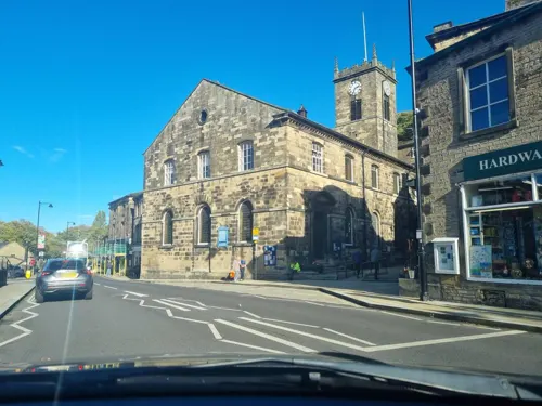
Lou & Joe's
Restaurant · Burger
11A Victoria Square, Holmfirth
Mo-Fr 17:00-21:00; Sa 12:00-21:00; Su 12:00-20:00
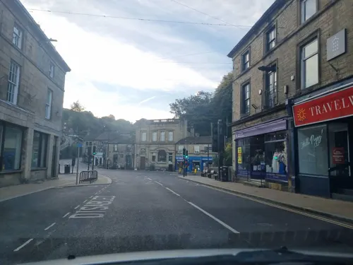
Holmfirth Tavern
Bar and pub
7 Norridge Bottom, Holmfirth
Mo-Th 17:00-22:30; Fr 16:00-23:30; Su 13:00-22:00
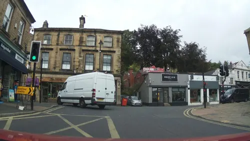
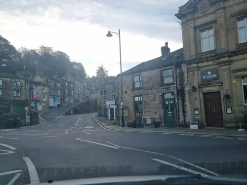
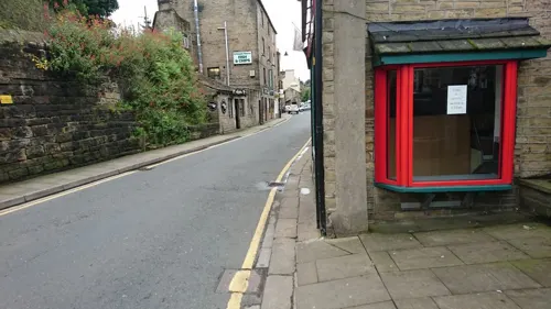
Bridlie Butties
Bakery
"Fresh sandwiches, hot & cold food, pies & pastries, freshly baked bread"
4 Hollowgate, Holmfirth


Sheveling Wine Estate
Restaurant · 1.4 mi
Woodhouse Lane, Holmfirth
Mo-Th 09:00-20:30; Fr-Sa 09:00-21:30; Su 09:00-20:00


Old Bridge Bakery
Bakery
"English and Continental Bread & Confectionery"
15 Victoria Street, Holmfirth
Mo,Tu 09:00-15:00; We-Sa 08:00-13:00
62 more on the map.
History
The name Holmfirth derives from Old English holegn ('holly'), in the name of Holme, compounded with Middle English frith ('wood'). It thus meant 'the woods at Holme'.
The town grew around a corn mill and bridge in the 13th century. Three hundred years later Holmfirth expanded rapidly as the cloth trade grew and the production of stone and slates from the surrounding quarries increased. The parish church was built in 1778 after the church built in 1476 was swept away in a flood the previous year. Dr Albert Lister Peace was the church's organist, at the age of nine, in the early 1850s. In 1850 Holmfirth railway station opened, on the branch line built by the Lancashire and Yorkshire Railway Company.
Local men who served and died in the First and Second World Wars are commemorated on the Holme Valley War Memorial found outside Holme Valley Memorial Hospital.
Holmfirth was the home of Bamforth & Co Ltd, who were well known for their cheeky seaside postcards – although around the time of the First World War, they produced postcards of a more sober nature. The printing works on Station Road has been converted into residential flats.
Read more of the history
Bamforth's company was early pioneer of film-making, before it abandoned the business in favour of postcards. During the early 1900s Holmfirth was well known for film making; during the periods 1898–1900 and 1913–1915, Bamforth and Co. produced what the British Film Institute describes as 'a modest but historically significant collection of films'.
Fooding has, at different times occurred in the Holme Valley affecting the town and other settlements in the valley. The earliest recorded Holmfirth flood was in 1738 and the most recent was 1944. The most severe flood occurred early on the morning of 5 February 1852, when the embankment of the Bilberry Reservoir collapsed, causing the deaths of 81 people. Following a severe storm in 1777 the River Holme burst its banks, sweeping away people and property with the loss of three lives; the stone church, built in 1476, was also swept away. A storm in 1821 again caused the river to burst its banks. The flooding on the night of 29 May 1944 was not nationally reported and was overshadowed by the D-Day landings the following week.
The former Lodge's supermarket building had been sitting empty in the heart of the town since the Co-op moved to new premises in Crown Bottom, formerly an open area used as a market and a place for public meetings: the suffragist Selina Cooper spoke there in 1913. Lodge's was built in the 1970s by the prominent local grocery company. It was opened by Radio 1 DJ Tony Blackburn and occupied an unusual location over the River Holme beside the town's small bus station. Lodge's was bought in the 1990s by Co-operative Retail Services who eventually closed the store down in 1997, after investing in a brand new £2 million supermarket for the town. Local residents, led by the Holme Valley Business Association, campaigned for its demolition. Their campaign was featured in the 2005 Channel 4 documentary, Demolition. The building has since been converted into several smaller shops, including a Sainsbury's Local store, with some accommodation on the top floor.
From the History section of Holmfirth on Wikipedia, under CC BY-SA 4.0.
More about Holmfirth
Economy
Holmfirth's economy is dominated by rural and tourism activities. A 2013 youth survey identified reducing opportunities for young adults in the area and an intention to leave to find employment. The survey resulted in a successful bid for lottery funding to create new opportunities and training to increase employment opportunities in the area. Tourism economic activity is increasing with several accommodation and tourist pursuits developing in the town including booking software to manage and market accommodation. New holiday accommodation includes that linked to the new Winery in Cartworth Moor.
Longley Farm, a manufacturer of dairy products founded in 1948, is a significant employer in the town.
Arts and culture
Holmfirth's Film Festival and Festival of Folk are held every May, and its Arts Festival takes place over two weeks in June.
An annual Holmfirth Feast, with amusements and bazaars, took place during the mid-nineteenth century at Crown Bottom. The feast is associated with an unusual choral folk song known as the Holmfirth Anthem.
Holmfirth Choral Society hold regular classical choral music concerts in Holmfirth Civic Hall and the Holme Valley Orchestra plays throughout the year.
Holmfirth's Film Festival and Festival of Folk are held every May, and its Arts Festival takes place over two weeks in June.
The town's cinema, the Picturedrome, which opened in 1912 as the Valley Theatre, is now a live music venue and has been nominated for the NME Best Small Venue. It hosts various music events. Acts such as Adam Ant, Bad Manners, Buzzcocks, Evile, Fish, Half Man Half Biscuit, Hawkwind, John Martyn, Ocean Colour Scene, the Red Hot Chilli Pipers, Ron Sexsmith, Saxon, Suzi Quatro and the Beat have performed.
Holmfirth Art Week, with its July exhibition in the Civic Hall, raises money for Macmillan Cancer Relief.
The Holmfirth Festival of Folk takes place in May of each year, featuring a wide selection of folk music and folk dance acts from around the UK. Performances take place in a variety of indoor and outdoor venues throughout the town.
Education
Holmfirth's only primary school is Holmfirth Junior, Infant, and Nursery School located on Cartworth Road; however, there are many other primary schools in villages and hamlets closely surrounding Holmfirth. In 2017, 82% of the school's student were achieving the expected standard for their age and 12% were exceeding the expected standard.
Holmfirth High School is a coeducational secondary school that takes in students from the local primary schools named above as well as students from neighbouring villages and hamlets. The school has over 1,300 pupils, split over five-year groups from years 7 to 11. As of June 2023, the school has an Ofsted rating of "outstanding".
From the Wikipedia article Holmfirth, under CC BY-SA 4.0.
Notable people from Holmfirth
 Jessica GunningBritish television and theatre actressPhoto: JaceMerlyn, CC BY-SA 4.0
 Gabriel CullaighBritish cyclistPhoto: Jérémy-Günther-Heinz Jähnick, CC BY-SA 3.0
 William Seniorpolitician, Senator for South Australia (1850–1926)Photo: Unknown author, Public domain
 DJ QBritish disc jockeyPhoto: PLAYvirtuoso, CC BY 3.0
- Richard HartleyBritish composer
- Roland BoyesBritish politician (1937-2006)
- David MayBritish computer scientist (born 1951)
- Frances NewsteadEnglish racing cyclist
- Frederick JakemanEnglish county cricketer (1920-1986)
- Daryl BrookEnglish footballer (born 1960)
- David LockwoodAmerican sociologist (1929-2014)
- Bob PlattEnglish county cricketer (born 1932)
Born in Holmfirth, according to Wikidata (CC0). Each name links to its Wikipedia article.
Where to stay2
Churches and places of worship16
Shopping16
Gas and EV charging1
Schools, colleges and libraries10
Healthcare5
Map of Holmfirth
151 places. The map loads OpenStreetMap tiles when you open it.
Getting there and nearby towns
Leeds Bradford Airport (LBA) is the nearest airport with scheduled flights listed in OpenStreetMap, 21 miles away.
- Upper Cumberworth 4 mi east, about 6 min by car
- Huddersfield 5 mi north, about 9 min by car
- Millhouse Green 6 mi southeast, about 9 min by car
- Penistone 7 mi southeast, about 11 min by car
- Scissett 7 mi east, about 11 min by car
- Emley 7 mi northeast, about 11 min by car
- Flockton 7 mi northeast, about 12 min by car
- Mirfield 8 mi northeast, about 13 min by car
- Elland 8 mi north, about 13 min by car
- Rastrick 8 mi north, about 14 min by car
Drive times are estimates from straight-line distance, not routes.
Towns near Holmfirth


Keep exploring
Local news
Headlines from INDB.
Reviews, tips and questions
Loading what members have shared...
Sources and licences
- GeoNames (CC BY 4.0): population, coordinates, regions and time zone
- Mapillary (see each image): photos
- OpenStreetMap contributors (ODbL 1.0): places, airports, map data
- Wikidata (CC0 1.0): elevation, founding date, time zone, website, landmarks and historic places
- Wikimedia Commons (see each image): photos
- Wikipedia (CC BY-SA 4.0): overview and history text
Photo credits
- Holmfirth 20060521(RLH), Richard Harvey, CC BY-SA 2.0 uk
- (Section of a) Memorial to the 1777 flood, Holmfirth (5765740803), Tim Green from Bradford, CC BY 2.0
- St David, Holmbridge 3 (3382582387), Tim Green from Bradford, CC BY 2.0
- Cricketers Arms, Deanhouse, Betty Longbottom, CC BY-SA 2.0
- Michael's Barber Shop - Flickr - grassrootsgroundswell, grassrootsgroundswell, CC BY 2.0
- Dare live at Holmfirth Picturedrome 14 December 2025, SurfaceAgentX2Zero, CC BY-SA 4.0
- Street-level photo, mappo2, CC BY-SA 4.0
- Street-level photo, southglos, CC BY-SA 4.0
- Street-level photo, mappo2, CC BY-SA 4.0
- Street-level photo, southglos, CC BY-SA 4.0
- Street-level photo, mappo2, CC BY-SA 4.0
- Street-level photo, mappo2, CC BY-SA 4.0
- Street-level photo, mappo2, CC BY-SA 4.0
- Street-level photo, mappo2, CC BY-SA 4.0
- Street-level photo, mappo2, CC BY-SA 4.0
- Street-level photo, mappo2, CC BY-SA 4.0
- Street-level photo, harry_wood, CC BY-SA 4.0
- Street-level photo, mappo2, CC BY-SA 4.0
- Street-level photo, harry_wood, CC BY-SA 4.0
- Street-level photo, southglos, CC BY-SA 4.0
- Street-level photo, mappo2, CC BY-SA 4.0
- Street-level photo, mappo2, CC BY-SA 4.0
Page built November 10, 2026. Spotted a mistake? Tell us or suggest a place.