


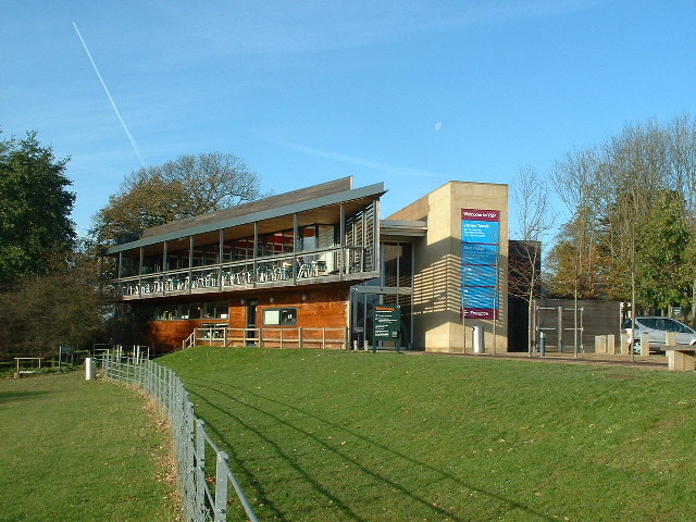


Why visit Flockton
Townapedia lists 6 museums and landmarks, 3 parks and trails and 9 places to eat in and around town.
Highlights include National Coal Mining Museum, Market Cross and Yorkshire Sculpture Park.
Weather in Flockton
Forecast from MET Norway (CC BY 4.0). Full forecast
About Flockton
Flockton is a village in the civil parish of Kirkburton, in Kirklees, West Yorkshire, England. It is halfway between Huddersfield and Wakefield. In 2020, the population of Flockton and Flockton Green was estimated to be 2,107.
From the Wikipedia article Flockton (this version), under CC BY-SA 4.0.
Photos of Flockton

Museums and landmarks6



National Coal Mining Museum for England
Museum · 1.2 mi
Coal mining museum in Yorkshire, England, United Kingdom

Parks, trails and playgrounds3

Yorkshire Sculpture Park
Park · 3.1 mi
Sculpture park in West Bretton, Yorkshire, United Kingdom


Restaurants and cafes9




Churches and places of worship5

Church In Bretton Park
Church · 3.4 mi
Church building in West Bretton, United Kingdom

St. Michael's Church, Emley
Church · Anglican · 1.1 mi
Church Street, Huddersfield
History
Flockton grew in a coal mining area, Flockton Collieries are closed. Locals could find mining jobs at nearby collieries such as Bullhouse, Shuttle Eye, Emley Moor, or Caphouse Colliery when the local pits were closed due to their inability to compete pricewise with collieries that were connected to the railways.
From the History section of Flockton on Wikipedia, under CC BY-SA 4.0.
More about Flockton
Geography
Flockton contains the once separate areas of Over and Nether Flockton and Flockton Green. The village is about 6 miles (10 km) east of Huddersfield and the same distance south-west of Wakefield. The village extends along the A637 Grange Moor to Barnsley road. At Flockton Green, at the eastern end of the village, there is a junction with the road from Overton. To the west is Flockton Moor, a rural area containing mainly farmhouses. Parkside is an area of council housing. In contrast there are stone-built private developments. House prices are above average for the area. Flockton is a commuter village because of its proximity to the M1 motorway, which brings with it a large amount of traffic.
It had a population of 800 in 1809. At the 1951 census (the last before the abolition of the parish), Flockton had a population of 1,318.
From the Wikipedia article Flockton, under CC BY-SA 4.0.
Schools, colleges and libraries3
Map of Flockton
26 places. The map loads OpenStreetMap tiles when you open it.
Getting there and nearby towns
Leeds Bradford Airport (LBA) is the nearest airport with scheduled flights listed in OpenStreetMap, 16 miles away.
- Mirfield 4 mi northwest, about 6 min by car
- Dewsbury 4 mi north, about 7 min by car
- Horbury 4 mi northeast, about 6 min by car
- Ossett 4 mi northeast, about 7 min by car
- Batley 5 mi north, about 8 min by car
- Heckmondwike 5 mi north, about 9 min by car
- Huddersfield 6 mi west, about 10 min by car
- Darton 6 mi southeast, about 9 min by car
- Liversedge 6 mi northwest, about 9 min by car
- Wakefield 7 mi northeast, about 11 min by car
Drive times are estimates from straight-line distance, not routes.
Towns near Flockton


Keep exploring
Local news
Headlines from INDB.
Reviews, tips and questions
Loading what members have shared...
Sources and licences
- GeoNames (CC BY 4.0): population, coordinates, regions and time zone
- Mapillary (see each image): photos
- OpenStreetMap contributors (ODbL 1.0): places, airports, map data
- Wikidata (CC0 1.0): elevation, founding date, time zone, website, landmarks and historic places
- Wikimedia Commons (see each image): photos
- Wikipedia (CC BY-SA 4.0): overview and history text
Photo credits
- BarnsleyRoadA637Flockton(HumphreyBolton)Jul2008, Humphrey Bolton, CC BY-SA 2.0
- The Sun, Flockton (16646948854), Tim Green from Bradford, UK, CC BY 2.0
- TheYorkshireSculpturePark(NigelHomer)Nov2005, Nigel Homer, CC BY-SA 2.0
- Bretton Chapel, J3Mrs, CC BY-SA 3.0
- Market Cross At Junction With Upper Lane, Peter Broster, CC BY-SA 4.0
- National Coal Mining Museum, Maurice Miner, CC BY-SA 4.0
- The Sun (17422102568), Tim Green from Bradford, UK, CC BY 2.0
- White Horse, Emley (17081642328), Tim Green from Bradford, UK, CC BY 2.0
- Street-level photo, cuttlebug, CC BY-SA 4.0
- Street-level photo, cuttlebug, CC BY-SA 4.0
- Street-level photo, cuttlebug, CC BY-SA 4.0
- Street-level photo, cuttlebug, CC BY-SA 4.0
- Street-level photo, cuttlebug, CC BY-SA 4.0
- Street-level photo, cuttlebug, CC BY-SA 4.0
- Street-level photo, cuttlebug, CC BY-SA 4.0
Page built November 10, 2026. Spotted a mistake? Tell us or suggest a place.