


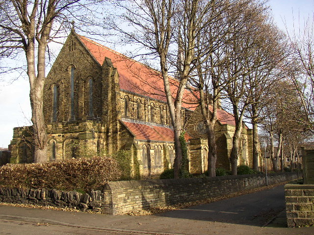

Holywell Green, United Kingdom
Holywell Green is a town of 3,178 people in England, United Kingdom.
Why visit Holywell Green
Townapedia lists 10 museums and landmarks, 13 parks and trails, 63 places to eat, 3 places to stay and 5 attractions in and around town.
Highlights include Broster's of Lindley Moor, Scammonden Bridge, Calderdale Industrial Museum and Colne Valley Museum.
Weather in Holywell Green
Forecast from MET Norway (CC BY 4.0). Full forecast
About Holywell Green
Holywell Green is a village in the civil parish of Stainland and District, in the Calderdale district in the county of West Yorkshire, England. The village is situated approximately 1.4 miles (2 km) south-west of Elland, 3.3 miles (5 km) south of Halifax and 3.9 miles (6 km) north-west of Huddersfield. Holywell Green is part of the Greetland and Stainland Ward of Calderdale Council.
From the Wikipedia article Holywell Green (this version), under CC BY-SA 4.0.
Things to do5
Broster's of Lindley Moor
Farm and orchard · 1.1 mi
Haigh House Hill, Huddersfield
Mo-Fr 08:00-17:00; Sa 08:00-16:30; Su 09:30-15:30
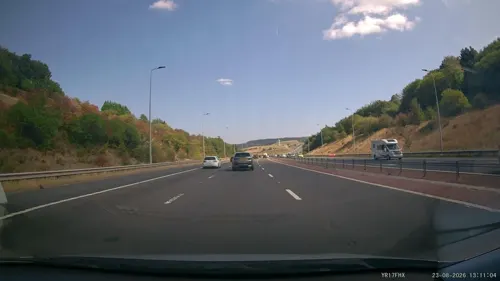

Victoria Theatre
Cinema and theater · 3.2 mi
Theatre in Halifax, England


Museums and landmarks10
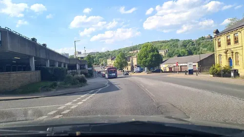
Calderdale Industrial Museum
Museum · 3.4 mi
Museum in Halifax, West Yorkshire, England, United Kingdom

Colne Valley Museum
Museum · 2.5 mi
Historic house museum, United Kingdom


Slack Roman fort
Monument and historic site · 1.4 mi
Archaeological site in Kirklees, West Yorkshire, England, UK
Parks, trails and playgrounds13

Greenhead Park
Park · 3.4 mi
Park in Huddersfield, West Yorkshire, England, UK

People's Park
Park · 3.1 mi
Park in Halifax, West Yorkshire, England, UK

Savile Park
Park · 2.6 mi
Open space in Halifax, West Yorkshire, England, UK


1 more on the map.
Restaurants and cafes63
Graze @ Broster's Kitchen and Grill
Cafe · 1.1 mi
Haigh House Hill, Huddersfield
Mo-Sa 08:30-15:30; Su 08:30-14:30


La Cachette
Restaurant · French · 1.5 mi
31 Huddersfield Road, Elland
12:00-14:30, 18:00-22:00

51 more on the map.
History
Holywell Green, also known as Burnsley, was recorded in the Domesday Book as being "a small hamlet within the township of Stainland". It derives its name from St Helen's Well, which was known within the area during medieval times. The original location of this well is uncertain. It is famous for the creation of the 'Burnsley Oatcake'; a dense bread roll, finished with oats.
From the History section of Holywell Green on Wikipedia, under CC BY-SA 4.0.
More about Holywell Green
Geography
Holywell Green is the name given to the east side of Stainland. It is based around Stainland Road and Station Road, and built on an east-facing hill. Since West View and Bradley View were built, Stainland and Holywell Green have been conjoined.
Education
Holywell Green has one school, Holywell Green Primary School, which educates children between the age of 4 and 11 and also has a nursery. The school was built in 1915 but has had many recent developments that extend it to its current size. The buildings are of both traditional Victorian character and more modern design.
The school is located next to Stainland Road and has views over the nearby deer park and valley.
From the Wikipedia article Holywell Green, under CC BY-SA 4.0.
Where to stay3
Churches and places of worship21
Shopping9
Gas and EV charging2
Schools, colleges and libraries13
Elland Church of England (Voluntary Aided) Junior, Infant and Nursery School
School · Anglican · 1.4 mi
Westgate, Elland
Healthcare5
Map of Holywell Green
144 places. The map loads OpenStreetMap tiles when you open it.
Getting there and nearby towns
Leeds Bradford Airport (LBA) is the nearest airport with scheduled flights listed in OpenStreetMap, 16 miles away.
- Elland 1 mi northeast, about 2 min by car
- Barkisland 2 mi west, about 3 min by car
- Halifax 3 mi north, about 5 min by car
- Southowram 3 mi northeast, about 5 min by car
- Rastrick 3 mi east, about 6 min by car
- Huddersfield 4 mi southeast, about 6 min by car
- Brighouse 4 mi northeast, about 6 min by car
- Luddenden Foot 4 mi northwest, about 7 min by car
- Mirfield 7 mi east, about 11 min by car
- Cleckheaton 7 mi northeast, about 12 min by car
Drive times are estimates from straight-line distance, not routes.
Towns near Holywell Green


Keep exploring
Local news
Headlines from INDB.
Reviews, tips and questions
Loading what members have shared...
Sources and licences
- GeoNames (CC BY 4.0): population, coordinates, regions and time zone
- Mapillary (see each image): photos
- OpenStreetMap contributors (ODbL 1.0): places, airports, map data
- Wikidata (CC0 1.0): elevation, founding date, time zone, website, landmarks and historic places
- Wikimedia Commons (see each image): photos
- Wikipedia (CC BY-SA 4.0): overview and history text
Photo credits
- Holywell Green View, Tim Green, CC BY 2.0
- Halifax Victoria Theatre, Charlesdrakew, Public domain
- ColneValleyMuseum(RLH), Richard Harvey, CC BY-SA 3.0
- Square Chapel (3322822759), Tim Green from Bradford, CC BY 2.0
- All Saints Church Elland SE1020, Humphrey Bolton, CC BY-SA 2.0
- St Andrew, Stainland, Tim Green, CC BY 2.0
- The-brooksbank-school-2022-crest, Junekorg, CC BY-SA 4.0
- St Mary, Elland (6737890053), Tim Green from Bradford, CC BY 2.0
- Savile Park and St Jude (44757646135), Tim Green from Bradford, UK, CC BY 2.0
- Stainland Cross (5192283483), Tim Green from Bradford, CC BY 2.0
- Greenhead Park - panoramio, Events Yorkshire, CC BY-SA 3.0
- Hercules, People's Park, Halifax, Tim Green, CC BY 2.0
- Street-level photo, deleted_user, CC BY-SA 4.0
- Street-level photo, aidan573, CC BY-SA 4.0
- Street-level photo, lvl5, CC BY-SA 4.0
- Street-level photo, mappo2, CC BY-SA 4.0
- Street-level photo, deleted_user, CC BY-SA 4.0
- Street-level photo, deleted_user, CC BY-SA 4.0
- Street-level photo, deleted_user, CC BY-SA 4.0


Page built November 10, 2026. Spotted a mistake? Tell us or suggest a place.