


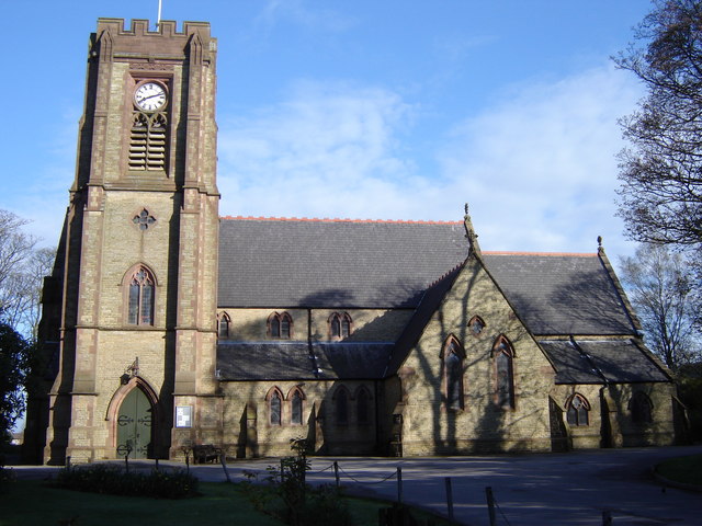


Why visit Horwich
Townapedia lists 10 museums and landmarks, 7 parks and trails, 111 places to eat, 1 place to stay and 10 attractions in and around town.
Highlights include Rivington Pike, Vue, Great House Barn and Great House Farmhouse and Cottage.
Weather in Horwich
Forecast from MET Norway (CC BY 4.0). Full forecast
About Horwich
Horwich is a town and civil parish in the Metropolitan Borough of Bolton, Greater Manchester, England, within the historic county boundaries of Lancashire. It is 5.8 miles (9.3 km) northwest of Bolton Town Centre, 5.3 miles (8.5 km) southeast of Chorley and 15 miles (24 km) northwest of Manchester. It lies at the southern edge of the West Pennine Moors with the M61 motorway passing close to the south and west. At the 2011 Census, Horwich had a population of 20,067.
From the Wikipedia article Horwich (this version), under CC BY-SA 4.0.
Travel tips from other travellers: Horwich on Wikivoyage (CC BY-SA 4.0).
Photos of Horwich

Things to do10



Museums and landmarks10

Gidlow Hall moated site
Monument and historic site · 3.0 mi
Archaeological site in Wigan, Greater Manchester, England, UK

Parks, trails and playgrounds7



Restaurants and cafes111
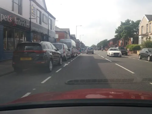
Clove Indian Takeaway
Restaurant · Indian · 0.7 mi
Indian Takeaway, Deliver £1 Free delivery over £12 within 3 miles (£1 charge per mile over 3 miles)
335 Chorley New Road, Bolton
Mo 16:15-23:00; We-Fr,Su 17:00-23:00; Sa 16:25-23:00
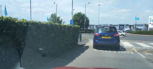
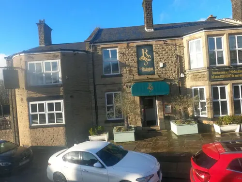


Bella Italia
Restaurant · Italian · 1.4 mi
23 The Linkway, Bolton
Mo-Th 11:30-21:30; Fr-Sa 11:30-22:00; Su 11:00-21:00
Chiquito
Restaurant · Tex-Mex · 1.4 mi
19-21 The Linkway, Bolton
Mo-Th 11:30-22:00; Fr-Sa 11:30-23:00; Su 11:30-21:00

Lattitude bar
Bar and pub
92 Winter Hey Lane, Bolton
Fr 17:00-22:00; Sa 18:00-22:00
99 more on the map.
History
The name Horwich derives from the Old English har and wice, meaning the place at the grey wych-elm and in 1221 was recorded as Horewic. The name was recorded as Harewych in 1277 and Horewyche in 1327.
Read more of the history
Ancient records are of Horwich Forest being overrun with wolves in the time of Ecgfrid, ruler of Northumbria until 685, 'Smithills walled round to keep them at bay'. Around this time early Saxon Kings used the forest for the chase, while staying at the ancient Smithells Hall, records exist of Ælla of Northumbria making use of the forests for hunting. Ecgberht (Egbert) is a notably visitor associated with the area in this early period. Horwich developed from a 'bridge point settlement' on the River Douglas at what is now Scholes Bank. By the Middle Ages Horwich was a hunting chase, after the Norman Conquest held by Albert de Gresle between 1086 and 1100. In 1277 Robert Gresle, Baron of Manchester prosecuted Martin de Rumworth for carrying off deer in Horwich Chase which was described in 1322 as being within "a circuit of sixteen leagues with a yearly value in pannage, aeries of eagles, herons and goshawks, in honey, millstones, and iron mines, in charcoal-burning, and the like issues, 60 shillings; of which the vesture in oaks, elms and wholly covered with such, 160 marks." In 1294 Thomas Gresle, sixth Baron of Manchester obtained free warren over "Horewich". The local enforcement of Forest Law was through a Bailiff who served the Lord of the Manor and it was he who decided punishments. Trespassers in the forest were brought before the Manorial Court Leet. The decline of Horwich forest is connected to the dissolution when Henry VIII seized all the church lands and then sold them.
By the 16th century, subsequent to the reformation land ownership had shifted from Church to the crown and was then sold to new owners, who transformed the town into an agricultural economy, and forests were cleared. Many of the farms from the period still existed until the housing boom of the 19th and 20th centuries, like many Lancashire towns the cotton industry was prominent as at least a secondary occupation in many households, weaving became a widespread occupation, and industries like bleaching, dying and paper making grew from the use of water power with the towns preindustrial plentiful access to flowing water. The town continued this path until the arrival of the railway workshops in the 19th century.
In 1598 a number of men were presented at the court leet for tithing and in 1621 the court leet recorded "paid for hue and crye that came from Horwich after the man who made an escape forth of ye stocks for stealing certain lynen cloth 8d". The earliest map of Horwich is dated 1620 and is known as 'The Platt of Horwich', naming the landowner as Sir Thomas Barton, of the Barton family of Holme Hall in the manor of Holme Newark and Smithills Hall, Bolton. A plague pit is noted on the map, with victims of a 1623 outbreak, interred in a mass grave under what is now Lever Park Avenue. The existence of the pit is likely a local myth coming about by modern additions to a copy of an older map. By the 17th century, the amount of woodland in the Horwich forest was reduced by house building and for fuel. Horwich Moor was enclosed between 1815 and 1818. Race meetings were held between 1837 and 1847 at the 'Old Lords estate', an area next to the Rivington border, named after 11th Baron Willoughby. Four Barons Willoughby of Parham are interred at Horwich Parish Church.
The manor became the property of the Andertons of Lostock Hall, Lostock, who purchased it in 1599 from Nicholas and Elizabeth Mosley. These lands were confiscated by The Crown in 1715 after the Battle of Preston. They were leased to the Blundells whose coat of arms is displayed above the door at the Blundell Arms on Chorley Old Road.
The Pilkington family were notable in the town's history, prior to the Ridgways. The town coat of arms incorporates the Pilkington Cross, in recognition of the founder of the Rivington and Blackrod High School, James Pilkington, Bishop of Durham and the prominent role in the local history of the family. Richard Pilkington, a leading non-conformist and owner of Horwich Manor, and his family feature in the town's history from the post Protectorate to the industrial revolution being benefactors and founders of a number of places of worship. Another William Pilkington (1765–1831) became a physician and apothecary in St Helens. It is this branch that links Horwich to the founders of Pilkington Glass, his sons being Richard (1795–1869) and William (1800–1872).
In the 1770s brothers, John and Joseph Ridgway, land agents to the Blundells, moved their bleach works from Bolton to Wallsuches. Their works was the oldest and one of the few stone-built mills in the Bolton borough. The firm was one of the earliest users of chemical bleaching using chlorine.
Horwich Vale Printworks, founded in 1799 by the River Douglas, printed cloth using machines and handblocks. On the slopes of Winter Hill, stone was quarried and there were several small collieries and a firebrick and tile works. In 1896 the Montcliffe Colliery was owned by Adam Mason and Son and managed by Joseph Crankshaw and Joseph Kenwright. It employed 26 men underground and seven surface workers getting coal and fireclay from the Mountain coal seam. Crankshaws pipeworks used the fireclay and had had several beehive kilns at their works at Tiger's Clough. In the mid-19th century, cotton mills were built by W. & W. Bennett and Peter Gaskell.
Ridgways provided land for the early 19th century Club Houses, a grid pattern development of streets of stone built cottages south of Church Street. Some had basements for hand loom weaving. In 1851 the occupants were crofters, stovers and bleachers.
From the History section of Horwich on Wikipedia, under CC BY-SA 4.0.
More about Horwich
Geography
Suburban localities in Horwich include Wallsuches and Middlebrook.
Horwich extends to 3,230 acres (13.1 km2) and measures 3 miles (4.8 km) from north to south and 2 miles (3.2 km) west to east. The River Douglas flowing in a south westerly direction forms part of its northern boundary. The landscape to the north is dominated by Winter Hill, Rivington Pike and the West Pennine Moors. The highest point is 1,475 feet (450 m) on the moors in the north from where the ground slopes down towards the south and west, where the lowest land is about 350 feet (110 m). On Wilders and Horwich Moors the underlying rock is Millstone Grit, and in the intermediate slopes are found the Lower Coal Measures of the Lancashire Coalfield. The Middle Coal Measures are found in the southwest of the township.
Red Moss, 1.5 km south of the town centre, is a 47.2 hectares (117 acres) Site of Special Scientific Interest (SSSIs) which was designated in 1995 because of its biological interest. Red Moss is the best example of lowland raised mire in Greater Manchester and is one of 21 SSSIs in the area. The site is managed by the Wildlife Trust for Lancashire, Manchester and North Merseyside.
Economy
Many of Horwich's traditional industries, Horwich Works and W.T. Taylor's cotton mill closed in the late 20th century. Regeneration was led by the construction of the Toughsheet Community Stadium for Bolton Wanderers at Middebrook in 1995. The development which stretches into neighbouring Lostock, attracted industrial and commercial users including Hitachi, generating jobs to replace those lost in the old industries and the area is now dominated by small and medium enterprises. E.ON and RBS have set up offices close to the Toughsheet Community Stadium. Watson Steel Structures founded in 1933 and BAe's successor company, Matra BAe Dynamics operates from the Middlebrook area. Georgia Pacific owned a paper manufacturing plant close to the Toughsheet Community Stadium, which in 2012 was bought by SCA and later Sofidel Group, who decided to close it in 2017. Halbro, manufacturers of sportswear and equipment for both codes of rugby, is based on Chorley New Road.
There are Tesco and Asda stores on the outskirts of town and Aldi and Iceland stores closer to the town centre. The Horwich indoor market building was closed and demolished in 2009, but the traditional town centre has many small, specialist shops and businesses, including a greengrocers, butchers, florist and gift shops. Free parking is available across the town and there is a post office and library in the town centre.
Education
The Lancashire and Yorkshire Railway Company built the Railway Mechanics Institute in 1888. It became the Technical College but has been demolished.
Horwich secondary school students years attend either Rivington and Blackrod High School, a Specialist Technology College which was originally the Rivington & Blackrod Grammar School on a site in Rivington close to the boundary with Horwich, or St Joseph's RC High School on Chorley New Road. The oldest school building is the old Horwich Parish School which was built as a National, Infant and Sunday School in 1793 and now used as a parish hall and is a Listed building. Horwich Parish Church of England Primary School occupies the listed premises built in 1832.
Our Lady's school was built in 1886 on Chorley New Road and Holy Family Primary School on Victoria Road in 1894. Holy Family was the first Lancashire County Council school to be granted aided status under the Education Act 1944. The schools merged on the Victoria Road site as St. Mary's RC Primary School.
From the Wikipedia article Horwich, under CC BY-SA 4.0.
Notable people from Horwich
- Gordon AstallEnglish footballer (born 1927)
- Jim CoopEnglish association football player (1927-1996)
- Joan FlemingBritish crime fiction writer (1908–1980)
- Sam HartEnglish association football player (born 1996)
- Ray Aspdenassociation football player (1938-2021)
- John BrocklehurstFootballer (1927-2005)
- Gordon AthertonEnglish footballer (born 1934)
- Tom BamfordEnglish footballer (1887-1944)
- John WaltonEnglish footballer (1928-1979)
- Joanna HigsonEnglish actress
- David Whitecricket player from England, born 1967
- Fred ScotchbrookProfessional footballer, football manager (1886-1959)
Born in Horwich, according to Wikidata (CC0). Each name links to its Wikipedia article.
Where to stay1
Churches and places of worship18
Ahmadiyya Muslim Community Centre
Place of worship · Ahmadiyya
Jones Street, Bolton
Shopping22
Gas and EV charging3
Schools, colleges and libraries13
Healthcare4
Map of Horwich
199 places. The map loads OpenStreetMap tiles when you open it.
Getting there and nearby towns
Warton Aerodrome (WRT) is the nearest airport with scheduled flights listed in OpenStreetMap, 17 miles away.
- Westhoughton 4 mi south, about 6 min by car
- Bolton 5 mi east, about 8 min by car
- Wigan 5 mi southwest, about 9 min by car
- Ince-in-Makerfield 5 mi southwest, about 9 min by car
- Little Hulton 7 mi southeast, about 12 min by car
- Little Lever 8 mi east, about 12 min by car
- Kearsley 8 mi southeast, about 13 min by car
- Ramsbottom 10 mi east, about 16 min by car
- Blackburn 11 mi north, about 17 min by car
- Newton-le-Willows 11 mi south, about 17 min by car
Drive times are estimates from straight-line distance, not routes.
Towns near Horwich


Keep exploring
Local news
Headlines from INDB.
Reviews, tips and questions
Loading what members have shared...
Sources and licences
- GeoNames (CC BY 4.0): population, coordinates, regions and time zone
- Mapillary (see each image): photos
- OpenStreetMap contributors (ODbL 1.0): places, airports, map data
- Wikidata (CC0 1.0): elevation, founding date, time zone, website, landmarks and historic places
- Wikimedia Commons (see each image): photos
- Wikipedia (CC BY-SA 4.0): overview and history text
Photo credits
- Christ Church, Adlington, Plucas58, CC BY-SA 4.0
- Rivington Church, J3Mrs ( talk ), CC BY-SA 3.0
- Unitarian Chapel, Rivington, J3Mrs ( talk ), CC BY-SA 3.0
- St Paul's CE Church, Adlington, Christine Crompton, CC BY-SA 2.0
- Church of St Catherine, Peter Broster, CC BY 4.0
- Horwich Parish Church, Ickleweb, Public domain
- Reebokstadium inside, Mark Hammond from London, England, CC BY 2.0
- St Katharine's Church, Paul Bennett, CC BY-SA 2.0
- Rivington Pike Winter 1, Francis Franklin, CC BY-SA 4.0
- Rivington & Blackrod High School, Margaret Clough, CC BY-SA 2.0
- Bolton macron wanderers stadium, Arne Müseler, CC BY-SA 3.0 de
- Street-level photo, tonys999, CC BY-SA 4.0
- Street-level photo, tonys999, CC BY-SA 4.0
- Street-level photo, tonys999, CC BY-SA 4.0
- Street-level photo, tonys999, CC BY-SA 4.0
- Street-level photo, tonys999, CC BY-SA 4.0
- Street-level photo, tonys999, CC BY-SA 4.0
- Street-level photo, tonys999, CC BY-SA 4.0
- Street-level photo, tonys999, CC BY-SA 4.0
- Street-level photo, tonys999, CC BY-SA 4.0
- Street-level photo, tonys999, CC BY-SA 4.0
- Street-level photo, tonys999, CC BY-SA 4.0
- Street-level photo, tonys999, CC BY-SA 4.0
- Street-level photo, tonys999, CC BY-SA 4.0
- Street-level photo, tonys999, CC BY-SA 4.0
- Street-level photo, aidan573, CC BY-SA 4.0
- Street-level photo, tonys999, CC BY-SA 4.0
- Street-level photo, tonys999, CC BY-SA 4.0
- Street-level photo, tonys999, CC BY-SA 4.0
- Street-level photo, tonys999, CC BY-SA 4.0
- Street-level photo, tonys999, CC BY-SA 4.0
- Street-level photo, tonys999, CC BY-SA 4.0
- Street-level photo, victuallers, CC BY-SA 4.0


Page built November 10, 2026. Spotted a mistake? Tell us or suggest a place.