

Why visit Huntley
Townapedia lists 1 museum or landmark, 2 parks and trails, 4 places to eat, 1 place to stay and 3 attractions in and around town.
Highlights include Huntley Manor, International Centre for Birds of Prey and Highnam Woods.
Weather in Huntley
Forecast from MET Norway (CC BY 4.0). Full forecast
About Huntley
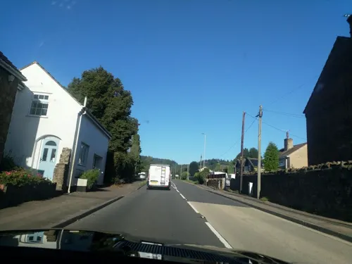
Huntley, Gloucestershire, is a village on the A40 located seven miles (11 km) west of Gloucester. It is in the north of the Forest of Dean.
From the Wikipedia article Huntley, Gloucestershire (this version), under CC BY-SA 4.0.
Things to do3

Museums and landmarks1

Parks, trails and playgrounds2

International Centre for Birds of Prey
Park · 3.1 mi
Conservation centre in UK

Restaurants and cafes4


History
Huntley (meaning Huntsman's clearing) is mentioned in the Domesday Book as Huntelei.
The village was the scene of fighting during the English Civil War. In 1643 the Royalists
took the parliamentary garrison, but they were betrayed and in 1644 the parliamentarians regained
The roads to Mitcheldean (now the A4136) and Ross-on-Wye were turnpiked in 1726 and the Toll house, which was built c1830 stood at their junction. This Toll house, that operated where the Longhope Road joins the
Ross Road, was of sufficient importance to be replaced by a new one in 1881 and the house still
William Cobbett wrote that, during one of his Rural Rides through England in September 1826, he wanted to
spend the night in Gloucester, but arrived there at the time of the Three Choirs Festival. As rooms were
so expensive, he had to continue to the coaching inn at Huntley.
The common, part of which is now the recreation ground and allotments, was enclosed in 1857 and in 1872 most of the remaining common land on Huntley Hill was also enclosed.
The village stocks were originally situated on the main road. They were re-sited on the recreation ground in
the early 1970s. They are believed to be the only remaining set in the Forest of Dean.
The village was the home of the Forest of Dean chronicler Winifred Foley and her husband Sydney until the mid-1970s.
Read more of the history
Two miles north-west lie the earthwork remains of Taynton Castle, a ring motte of C11-C12 date.
From the History section of Huntley, Gloucestershire on Wikipedia, under CC BY-SA 4.0.
More about Huntley
Economy
Over time, the focus of the village has moved from the Church and School, on the slopes of Brights Hill, down towards the Toll House and the pub. Between 1951 and 1980 a large number of new houses and roads were built around the centre.
Many residents commute to Gloucester to work, but some do work locally. Fruit production has declined in recent years, but much land is still devoted to agriculture, horticulture and woodland. There has been a growth in the leisure and recreation sector, such as a golf course, a garden centre and a School of Equitation. The golf course and school of equitation had both permanently closed by 2016. The village had its own Post Office until 2010 when it closed. The nearest Post Office is located in Longhope. There is also a pub, "The Red Lion", a traditional butcher's shop and other businesses.
A range of community groups use the Village hall, including the football club, which plays in the Northern
Senior League of Gloucestershire County League of the FA. The cricket club, founded
in 1874, has its own ground to the south of the main road and used to run a Beer Festival in the summer.
From the Wikipedia article Huntley, Gloucestershire, under CC BY-SA 4.0.
Where to stay1
Churches and places of worship2
Gas and EV charging2
Schools, colleges and libraries1
Map of Huntley
16 places. The map loads OpenStreetMap tiles when you open it.
Getting there and nearby towns
Gloucestershire Airport (GLO) is the nearest airport with scheduled flights listed in OpenStreetMap, 10 miles away.
- Longhope 2 mi west, about 3 min by car
- Cinderford 5 mi southwest, about 9 min by car
- Gloucester 7 mi east, about 11 min by car
- Ross on Wye 8 mi northwest, about 12 min by car
- Lydbrook 8 mi west, about 13 min by car
- Churchdown 10 mi east, about 16 min by car
- Painswick 11 mi southeast, about 17 min by car
- Stroud 12 mi southeast, about 19 min by car
- Tewkesbury 13 mi northeast, about 21 min by car
- Cheltenham 14 mi east, about 22 min by car
Drive times are estimates from straight-line distance, not routes.
Towns near Huntley


Keep exploring
Local news
Headlines from INDB.
Reviews, tips and questions
Loading what members have shared...
Sources and licences
- GeoNames (CC BY 4.0): population, coordinates, regions and time zone
- Mapillary (see each image): photos
- OpenStreetMap contributors (ODbL 1.0): places, airports, map data
- Wikidata (CC0 1.0): elevation, founding date, time zone, website, landmarks and historic places
- Wikimedia Commons (see each image): photos
- Wikipedia (CC BY-SA 4.0): overview and history text
Photo credits
- Jemima Parry-Jones with tawny eagle, AmosWolfe, CC BY-SA 3.0
- Street-level photo, laye, CC BY-SA 4.0
- Street-level photo, adam2, CC BY-SA 4.0
- Street-level photo, southglos, CC BY-SA 4.0
- Street-level photo, southglos, CC BY-SA 4.0
Page built November 10, 2026. Spotted a mistake? Tell us or suggest a place.