


Snodland, United Kingdom
Snodland is a town of 10,211 people in England, United Kingdom.
Why visit Snodland
Townapedia lists 10 museums and landmarks, 14 parks and trails and 27 places to eat in and around town.
Highlights include Coffin Stone, Coldrum Long Barrow, Burham Down and Burham Marsh.
Weather in Snodland
Forecast from MET Norway (CC BY 4.0). Full forecast
About Snodland
Snodland is a town in the borough of Tonbridge and Malling in Kent, England. It lies on the River Medway, between Rochester and Maidstone, and 34 miles (55 km) from central London. At the 2011 Census, it had a population of 10,211.
From the Wikipedia article Snodland (this version), under CC BY-SA 4.0.
Museums and landmarks10

Coffin Stone
Monument and historic site · 2.4 mi
Archaeological artifact in Kent, England

Coldrum Long Barrow
Museum · 3.1 mi
Neolithic chambered long barrow near Trottiscliffe, Kent, England, UK

Medway megaliths
Museum · 2.6 mi
Group of long barrows in Kent, England

Smythe's Megalith
Monument and historic site · 3.3 mi
Neolithic monument in Kent, England

White Horse Stone
Monument and historic site · 3.3 mi
Two megaliths near Aylesford, Kent, England

Eccles Roman Villa
Monument and historic site · 1.4 mi
Roman villa in the UK
Parks, trails and playgrounds14





2 more on the map.
Restaurants and cafes27
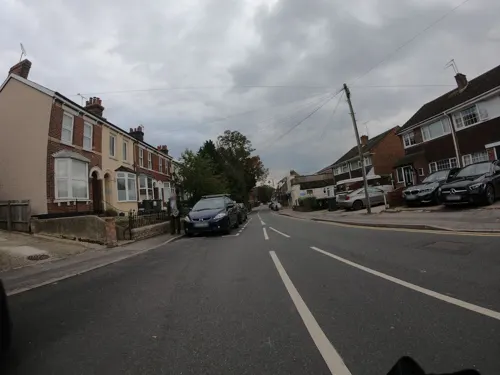
Costa
Cafe · Coffee Shop · 0.8 mi
Holborough Road, Snodland
Mo-Fr 07:00-19:00; Sa 07:00-19:00; Su 08:00-17:00
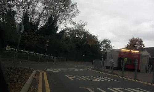
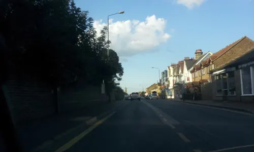



15 more on the map.
Churches and places of worship8

All Saints Church, Snodland
Church
Church in Snodland, Kent, England, UK
St Mary's Church, Burham
Church · 0.9 mi
Grade I listed church in Burham, Tonbridge and Malling, Kent, England, UK

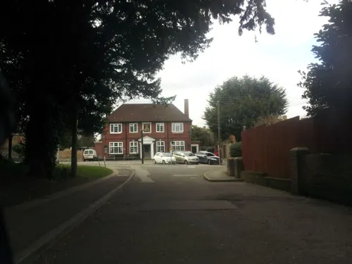

St Benedict's Church, Paddlesworth
Church · 1.2 mi
Church in Paddlesworth, Tonbridge and Malling District, Kent, England, UK
History
"Snoddingland" is first mentioned in a charter of 838 in which King Egbert of Wessex gave "four ploughlands in the place called Snoddingland and Holanbeorge" (Holborough) to Beornmod, the Bishop of Rochester. Since -ingland names are mostly derived from personal names, the name appears to refer to 'cultivated land connected with Snodd' or Snodda. The Domesday Book of 1086 refers to it as "Esnoiland".
The first Roman advance in the conquest of Britain may have crossed the River Medway near Snodland, although there are other possible locations. The supposed crossing place is marked by a memorial on the opposite side of the river from Snodland, close to Burham. Near this spot, a ferry later carried pilgrims bound for Canterbury along the Pilgrims' Way.
Bishop Gundulph, at the end of the 11th century, built a palace at Halling, which was used by his successors until the 16th century.
Lime working had been carried out at Snodland for centuries, but expanded dramatically in the 19th century, as building boomed. The firm of Poynder and Medlicott began quarrying on the Snodland-Halling border in the early 19th century and the company was taken over by William Lee in 1846. Others followed and the last one was built in 1923 by W. L. H. Roberts at Holborough. Lime for building Waterloo and other London bridges came from the area.
Read more of the history
The paper-making industry came to Snodland around 1740, when the May family built a mill which the Hook family took over in 1854. New manufacturing techniques and the coming of the railway in the 1850s improved paper production from five to 70 tons a week. Snodland's population doubled between 1840 and 1857. After the Medway Valley railway was opened on 18 June 1856, the village trebled in size between 1861 and 1881. As a result, the parish boundary was re-aligned in 1898 and again in 1988, both changes absorbing areas of Birling parish, known locally as "Lower Birling".
Snodland is now under a 10-year development plan by Tonbridge and Malling Borough Council to redevelop and expand the Holborough part of Snodland. In 2005, Berkeley Homes began the construction of around 1,200 houses on the former Holborough Quarry.
From the History section of Snodland on Wikipedia, under CC BY-SA 4.0.
More about Snodland
Geography
The town is situated between the North Downs to the west and the river Medway to the east. Leybourne Lakes Country Park was created from disused gravel pits to the south that have been flooded and landscaped to make fishing and wildlife lakes; across the river is the Burham Marsh nature reserve, a tidal reed bed.
Economy
From 1903, Snodland was the home of the Mid Kent Water Company. After privatisation of the water companies, the owners of Mid Kent Water in October 2006 bought South East Water, although regulatory issues dragged on until 2007. The two companies were then merged under the name South East Water, whilst retaining the headquarters facilities in Rocfort Road. The company supplies 2.1 million customers in Kent, Sussex, Surrey, Hampshire and Berkshire.
Arts and culture
Since 1986, Snodland has been twinned with Moyeuvre-Grande, a town of similar size, located near Metz in North East France. The towns planned to celebrate the thirtieth anniversary of the partnership in May 2016.
Snodland has two public houses, The Freemasons Arms and The Monks Head, and two working men's clubs, Snodland WMC and Ham Hill WMC.
Education
The Holmesdale School is a Foundation school formerly known as Holmesdale Technology College. It still specialises in technology and is linked to The Malling School in The Malling Holmesdale Federation Trust. There are two primary schools in the village, St Katherine's Primary School and Snodland Church of England Primary School.
From the Wikipedia article Snodland, under CC BY-SA 4.0.
Notable people from Snodland
- Stephen Caponcricketer (1927-2017)
Born in Snodland, according to Wikidata (CC0). Each name links to its Wikipedia article.
Shopping4
Gas and EV charging4
Schools, colleges and libraries6
Wouldham All Saints Church of England Voluntary Controlled Primary School
School · Anglican · 1.2 mi
1 Worrall Drive, Rochester
Map of Snodland
73 places. The map loads OpenStreetMap tiles when you open it.
Getting there and nearby towns
Rochester Airport (RCS) is the nearest airport with scheduled flights listed in OpenStreetMap, 3 miles away.
- Maidstone 5 mi southeast, about 9 min by car
- Gillingham 6 mi northeast, about 10 min by car
- Swanscombe 10 mi northwest, about 16 min by car
- Tilbury 10 mi north, about 16 min by car
- Swanley 13 mi west, about 20 min by car
- Stanford-le-Hope 13 mi north, about 21 min by car
- South Ockendon 14 mi northwest, about 23 min by car
- Bexley 15 mi northwest, about 24 min by car
- Basildon 17 mi north, about 27 min by car
- Southend-on-Sea 19 mi northeast, about 30 min by car
Drive times are estimates from straight-line distance, not routes.
Towns near Snodland


Keep exploring
Local news
Headlines from INDB.
Reviews, tips and questions
Loading what members have shared...
Sources and licences
- GeoNames (CC BY 4.0): population, coordinates, regions and time zone
- Mapillary (see each image): photos
- OpenStreetMap contributors (ODbL 1.0): places, airports, map data
- Wikidata (CC0 1.0): elevation, founding date, time zone, website, landmarks and historic places
- Wikimedia Commons (see each image): photos
- Wikipedia (CC BY-SA 4.0): overview and history text
Photo credits
- BlueBellHill0005, Clem Rutter, Rochester Kent, CC BY-SA 3.0
- Snodland library (24762464781), JuliaC2006 from Rochester, UK, CC BY 2.0
- In Snodland library (45519096692), JuliaC2006 from Rochester, UK, CC BY 2.0
- In Snodland library (45519096412), JuliaC2006 from Rochester, UK, CC BY 2.0
- In Snodland library (44655538705), JuliaC2006 from Rochester, UK, CC BY 2.0
- Coffin Stone, Blue Bell Hill, Kent 01, Simon Burchell, CC BY-SA 4.0
- Three Medway Megaliths, Midnightblueowl at English Wikipedia, CC BY-SA 3.0
- Smythe's Megalith field, Ethan Doyle White, CC BY-SA 3.0
- Upper White Horse Stone, Roger Smith, CC BY-SA 2.0
- Burham Down 3, Dudley Miles, CC BY-SA 4.0
- Burham Marsh 4, Dudley Miles, CC BY-SA 4.0
- Nashenden Down 3, Dudley Miles, CC BY-SA 4.0
- Church of All Saints, Snodland, Tonbridge & Malling, Kent, Christopher Nicol, CC BY-SA 3.0
- Christ Church, Snodland, The Voice of Hassocks, CC0
- Coldrum Long Barrow overlooking landscape, Ethan Doyle White, CC BY-SA 3.0
- Street-level photo, paulbiv, CC BY-SA 4.0
- Street-level photo, paulbiv, CC BY-SA 4.0
- Street-level photo, paulbiv, CC BY-SA 4.0
- Street-level photo, paulbiv, CC BY-SA 4.0
- Street-level photo, paulbiv, CC BY-SA 4.0
- Street-level photo, paulbiv, CC BY-SA 4.0
- Street-level photo, paulbiv, CC BY-SA 4.0
- Street-level photo, paulbiv, CC BY-SA 4.0
- Street-level photo, paulbiv, CC BY-SA 4.0
- Street-level photo, paulbiv, CC BY-SA 4.0
- Street-level photo, paulbiv, CC BY-SA 4.0
- Street-level photo, paulbiv, CC BY-SA 4.0
- Street-level photo, paulbiv, CC BY-SA 4.0
- Street-level photo, paulbiv, CC BY-SA 4.0
- Street-level photo, paulbiv, CC BY-SA 4.0
- Street-level photo, paulbiv, CC BY-SA 4.0
- Street-level photo, paulbiv, CC BY-SA 4.0
- Street-level photo, paulbiv, CC BY-SA 4.0
- Street-level photo, paulbiv, CC BY-SA 4.0
- Street-level photo, paulbiv, CC BY-SA 4.0
- Street-level photo, paulbiv, CC BY-SA 4.0
- Street-level photo, paulbiv, CC BY-SA 4.0
- Street-level photo, paulbiv, CC BY-SA 4.0
- Street-level photo, paulbiv, CC BY-SA 4.0
- Street-level photo, paulbiv, CC BY-SA 4.0
Page built November 10, 2026. Spotted a mistake? Tell us or suggest a place.