


Why visit Ixworth
Townapedia lists 2 museums and landmarks, 2 parks and trails, 7 places to eat and 1 place to stay in and around town.
Highlights include Bardwell Manor, Pakenham Water Mill, Black Bourn Valley and Mickle Mere.
Weather in Ixworth
Forecast from MET Norway (CC BY 4.0). Full forecast
About Ixworth
Ixworth is a village and civil parish in the West Suffolk district of Suffolk, England, 6 miles (9.7 km) north-east of Bury St Edmunds on the A143 road to Diss and 9 miles (14 km) south-east of Thetford. The parish had a population of 2,365 at the 2011 Census.
From the Wikipedia article Ixworth (this version), under CC BY-SA 4.0.
Museums and landmarks2

Parks, trails and playgrounds2

Black Bourn Valley
Park · 3.4 mi
Suffolk Wildlife Trust nature reserve

Restaurants and cafes7
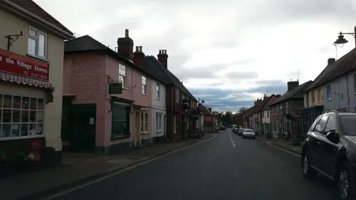
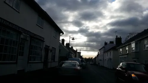
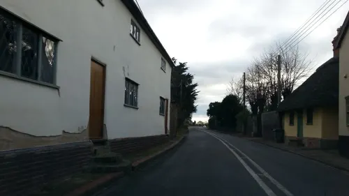
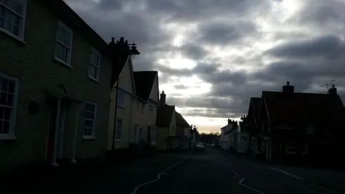

Rambling Rose Coffee House and Bistro
Cafe
17 High Street, Ixworth
Mo-We 09:00-17:00; Th 09:00-16:30; Fr-Sa 09:00-17:00; Su 09:00-16:00

Where to stay1

Bardwell Manor Equestrian Centre Camping
Campground · 1.1 mi
Ixworth Road, Bury St Edmunds
History
Ixworth was settled by the Romans and was the site of a 1st-century fort. The fort is believed to have been built as a response to Boudicca's revolt and appears to have been in use only until the end of the 1st century. The site measures 193 metres (633 ft) by 205 metres (673 ft) and was surrounded by three ditches.
After the fort went out of use a civilian settlement was established at the site, possibly with a pottery industry. Ixworth became an important junction in the Roman road system of East Anglia and the Peddars Way ran 48 miles (77 km) from Ixworth to Holme next the Sea on the north coast of Norfolk. The foundations of a Roman building with hypocaust were discovered in 1834 and are believed to be a villa and bath house complex.
An early pagan cemetery with Anglo-Saxon burial urns was discovered south-west of the church some time before 1849, and a number of other post-Roman archaeological finds have been discovered in the area. In 1856, the Ixworth Cross, a gold pectoral cross covered in garnets dating from the 7th century, was discovered in what is believed to be another Anglo-Saxon cemetery. The cross is decorated using cloisonné work and was donated to the Ashmolean Museum in Oxford in 1909. It was discovered in a rare bed burial.
Read more of the history
The first recorded name for Ixworth is from 1025 as Gyxeweorde meaning "Enclosure of a man called Gisca". It was mentioned again as Gyxeweor∂e in the S1225 charter of 1040 where Thurketel grants the lands to Bury St Edmunds Abbey. The settlement was recorded in the Domesday Book of 1086 as "Icsewrda" or "Giswortha". The village, which was in the Hundred of Blackbourn, was relatively very large at this time with 51 households. It was held by Robert Blunt or Blount in 1086, having formed part of the lands controlled by the Abbey of Bury St Edmunds in 1066.
Ixworth Priory was founded as an Augustinian priory in about 1170 and dissolved in 1537. Remains of the priory include the almost complete east range whilst some of the west range can be found incorporated into a house, known as Ixworth Abbey. These remains are a Grade I listed building and include elements from the early 13th century.
Ixworth is the site the earliest rural council housing built in England. Four pairs of houses were built in 1893–94 for Thingoe Rural District Council, encouraged by the Ixworth Labourers' Association. These were built under the Housing of the Working Classes Act 1890, the first to allow rural councils to build their own housing. The act was only adopted by eight councils. The houses exist today in a largely unaltered condition. Two of them, on Stow Road, are Grade II listed buildings.
A Q Type bombing decoy was operated in the north-east of the parish to deflect enemy bombing from RAF Honington.
A former pumping station at Bailypool Lane off Stow Lane was given planning permission in 2012 for conversion to a residential dwelling.
From the History section of Ixworth on Wikipedia, under CC BY-SA 4.0.
More about Ixworth
Education
Ixworth Church of England Voluntary Controlled Primary School [1], run by the Tilian Partnership,[2] educates children aged 5 to 11 and its maintained nursery school/class offers places to three to five year olds. At the end of year 6, children can transfer to Ixworth High School [3] run by Sapientia Education Trust, [4] which educates students aged 11 to 16, or Thurston Community College, which educates students aged 11 to 18.
From the Wikipedia article Ixworth, under CC BY-SA 4.0.
Notable people from Ixworth
 Guy SimondsCanadian general (1903–1974)Photo: Canadian government employee, Public domain
- Joy MarshallEnglish-born New Zealand Anglican clergyman and school teacher (1867-1903)
Born in Ixworth, according to Wikidata (CC0). Each name links to its Wikipedia article.
Churches and places of worship4
Schools, colleges and libraries3
Healthcare1
Map of Ixworth
20 places. The map loads OpenStreetMap tiles when you open it.
Getting there and nearby towns
RAF Honington (BEQ) is the nearest airport with scheduled flights listed in OpenStreetMap, 4 miles away.
- Great Barton 3 mi southwest, about 5 min by car
- Bury St Edmunds 6 mi southwest, about 10 min by car
- Woolpit 6 mi southeast, about 9 min by car
- Rickinghall 7 mi east, about 12 min by car
- Botesdale 8 mi northeast, about 13 min by car
- Haughley 8 mi southeast, about 13 min by car
- Thetford 9 mi northwest, about 14 min by car
- Stowmarket 10 mi southeast, about 17 min by car
- Diss 13 mi northeast, about 21 min by car
- Mildenhall 14 mi west, about 23 min by car
Drive times are estimates from straight-line distance, not routes.
Towns near Ixworth


Keep exploring
Local news
Headlines from INDB.
Reviews, tips and questions
Loading what members have shared...
Sources and licences
- GeoNames (CC BY 4.0): population, coordinates, regions and time zone
- Mapillary (see each image): photos
- OpenStreetMap contributors (ODbL 1.0): places, airports, map data
- Wikidata (CC0 1.0): elevation, founding date, time zone, website, landmarks and historic places
- Wikimedia Commons (see each image): photos
- Wikipedia (CC BY-SA 4.0): overview and history text
Photo credits
- Black Bourn Valley 6, Dudley Miles, CC BY-SA 4.0
- St Andrew's church Sapiston Suffolk (514383264), David from Colorado Springs, United States, CC BY 2.0
- Ixworth - Church of St Mary, Robert Edwards, CC BY-SA 2.0
- Street-level photo, adam2, CC BY-SA 4.0
- Street-level photo, adam2, CC BY-SA 4.0
- Street-level photo, adam2, CC BY-SA 4.0
- Street-level photo, adam2, CC BY-SA 4.0
- Street-level photo, adam2, CC BY-SA 4.0
- Street-level photo, adam2, CC BY-SA 4.0
Page built November 10, 2026. Spotted a mistake? Tell us or suggest a place.