


Why visit Haughley
Townapedia lists 3 museums and landmarks, 4 parks and trails, 4 places to eat and 2 places to stay in and around town.
Highlights include Food Museum, Haughley Castle and Church Meadow.
Weather in Haughley
Forecast from MET Norway (CC BY 4.0). Full forecast
About Haughley
Haughley is a village and civil parish in the Mid Suffolk district of Suffolk, England. The village is located 2 miles (3.2 km) northwest of the town of Stowmarket, overlooking the Gipping valley, next to the A14 corridor. The population recorded in 2011 was 1,638. Mentioned in the Domesday Book, it was the site of a castle, a church on the pilgrim's route to Bury St Edmunds Abbey, and a market.
From the Wikipedia article Haughley (this version), under CC BY-SA 4.0.
Museums and landmarks3

Food Museum
Museum · 2.5 mi
Museum in Stowmarket, Suffolk, United Kingdom


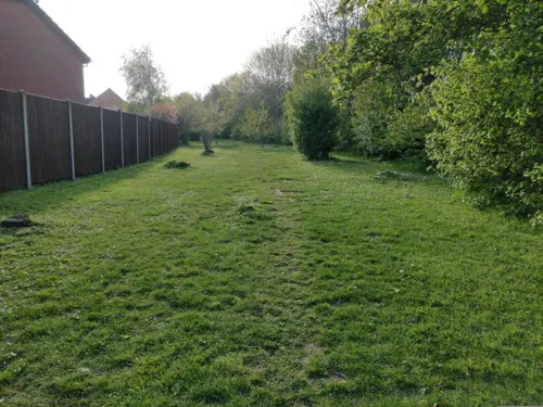
Parks, trails and playgrounds4

Restaurants and cafes4
Where to stay2


History
The village has evidence of Neolithic, pagan, Iron Age, Roman and Saxon settlements and was first mentioned (as Hag'e'le) in the will of Leofgifu, a Saxon noblewoman, in 1040. Leofgifu bequeathed Haughley to her only daughter who may eventually have become the wife of Guthmund, the holder of Haughley in 1066 (Guthmund was the brother of Wulfric, 'a kinsman' of Edward the Confessor, appointed Bishop of Ely c. 1052-63). Haughley is mentioned in the Domesday Survey of 1086 as Hagala being held by Hugh de Montfort, having formerly been held by the Saxon lord Guthmund for Edward.
A medieval market town and site of a royal fortress, Haughley prospered till the Tudor period then went into decline further compounded by a fire started on 11 April 1709 at which it is said “like a phoenix Stowmarket rose from its ashes”.
The parish anciently divided into the four divisions of Haughley Green, Old Street, New Street and Tothill. The original 120 acres (49 ha) of Haughley Green, north of the main village, were enclosed in 1854, after being bisected by the railway from Ipswich to Bury St Edmunds which opened in 1846.
Read more of the history
Through the Victorian period to the present day the village has grown and was connected to water and sewerage with the addition of local authority housing at the instigation of the infamous and controversial Rev Walter Grainge White in the 1920s following the description of Haughley and its open sewers by the Daily Mail in 1928 as “the fever pit of the kingdom”.
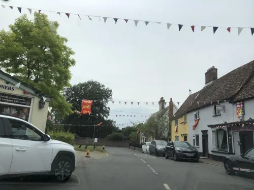
In 2022, to commemorate Platinum Jubilee of Elizabeth II, a beacon was erected on the former Market Place and Village Green, attended by over one thousand people.
From the History section of Haughley on Wikipedia, under CC BY-SA 4.0.
Notable people from Haughley
 Kerry EllisBritish stage actress and singerPhoto: Steve Lawton Photography, CC BY-SA 4.0
Born in Haughley, according to Wikidata (CC0). Each name links to its Wikipedia article.
Churches and places of worship7
Gas and EV charging1
Schools, colleges and libraries2
Map of Haughley
23 places. The map loads OpenStreetMap tiles when you open it.
Getting there and nearby towns
RAF Honington (BEQ) is the nearest airport with scheduled flights listed in OpenStreetMap, 12 miles away.
- Stowmarket 2 mi southeast, about 4 min by car
- Woolpit 3 mi west, about 5 min by car
- Bildeston 8 mi south, about 13 min by car
- Bury St Edmunds 11 mi west, about 18 min by car
- Lavenham 11 mi southwest, about 17 min by car
- Diss 12 mi northeast, about 20 min by car
- Scole 13 mi northeast, about 21 min by car
- Ipswich 14 mi southeast, about 22 min by car
- Sudbury 16 mi southwest, about 26 min by car
- Thetford 16 mi northwest, about 27 min by car
Drive times are estimates from straight-line distance, not routes.
Towns near Haughley


Keep exploring
Local news
Headlines from INDB.
Reviews, tips and questions
Loading what members have shared...
Sources and licences
- GeoNames (CC BY 4.0): population, coordinates, regions and time zone
- Mapillary (see each image): photos
- OpenStreetMap contributors (ODbL 1.0): places, airports, map data
- Wikidata (CC0 1.0): elevation, founding date, time zone, website, landmarks and historic places
- Wikimedia Commons (see each image): photos
- Wikipedia (CC BY-SA 4.0): overview and history text
Photo credits
- Abbot's Hall, Stowmarket, Martinevans123, CC BY-SA 4.0
- St Peter and St Mary's church, Stowmarket - from south, Martinevans123, CC BY-SA 4.0
- Harleston - Church of St Augustine, Andrew Hill, CC BY-SA 2.0
- Wetherden1, DJIPhantom, CC BY-SA 3.0
- Haugley - Church of St Mary, Joan Vaughan, CC BY-SA 2.0
- Street-level photo, laye, CC BY-SA 4.0
- Street-level photo, IpswichEdits, CC BY-SA 4.0
- Street-level photo, laye, CC BY-SA 4.0
- Street-level photo, AR_Mapper, CC BY-SA 4.0
- Street-level photo, laye, CC BY-SA 4.0
- Street-level photo, laye, CC BY-SA 4.0
- Street-level photo, IpswichEdits, CC BY-SA 4.0
- Street-level photo, AR_Mapper, CC BY-SA 4.0
Page built November 10, 2026. Spotted a mistake? Tell us or suggest a place.