


Jedburgh, United Kingdom
Jedburgh is a town of 3,860 people in Scotland, United Kingdom.
Why visit Jedburgh
Townapedia lists 35 museums and landmarks, 4 parks and trails, 25 places to eat, 6 places to stay and 1 attraction in and around town.
Highlights include Canongate Bridge, Allerley Well Park Gatepiers, Jedburgh Castle and Jedburgh Golf Course.
Weather in Jedburgh
Forecast from MET Norway (CC BY 4.0). Full forecast
About Jedburgh
Jedburgh ( JED-bər-ə; Scottish Gaelic: Deadard; Scots: Jeddart or Jethart) is a market town and former royal burgh in the Scottish Borders, Scotland. It was the traditional county town of the historic county of Roxburghshire, and is approximately 41 miles (66 km) south west of Edinburgh, 74 miles (119 km) southeast of Glasgow, and 76 miles (122 km) southeast of Falkirk. It had a population of 4,129 in 2022.
From the Wikipedia article Jedburgh (this version), under CC BY-SA 4.0.
Travel tips from other travellers: Jedburgh on Wikivoyage (CC BY-SA 4.0).
Photos of Jedburgh


Things to do1

Museums and landmarks35
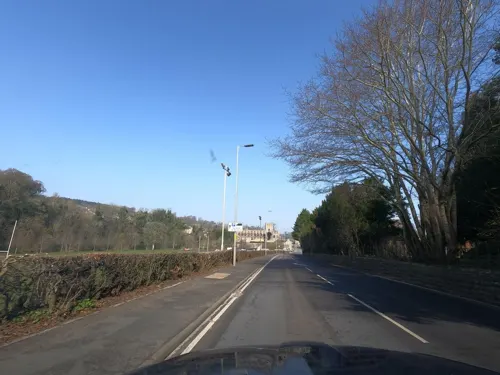
Allerley Well Park Gatepiers
Monument and historic site · 0.5 mi
Newcastle Road, Jedburgh

Jedburgh Castle
Museum · 0.5 mi
Castle, later rebuilt as a jail, in Jedburgh, Scottish Borders, Scotland, UK



Mary Queen Of Scots' Visitors Centre
Museum
Queen Street, Jedburgh
April - October Monday - Saturday 10:00-16:00 Sunday 10:00-15:00 ...

Penielheugh Monument
Monument and historic site · 3.4 mi
Waterloo monument in Scottish Borders, Scotland, UK
23 more on the map.
Parks, trails and playgrounds4



Restaurants and cafes25
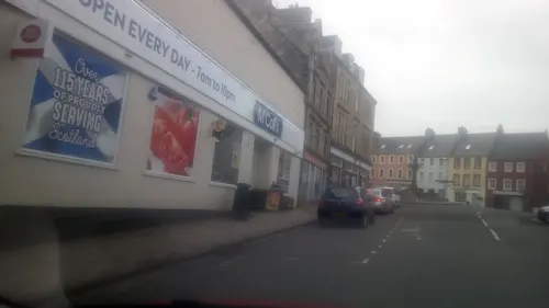
Bella Sicily
Restaurant · Italian
12 Canongate, Jedburgh
Tu-Th 17:00-20:30; Fr,Sa 12:00-22:00; Su 12:00-21:00
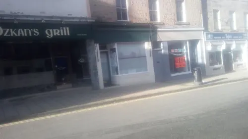
Simply Scottish
Restaurant · Regional, Sandwich, British
6-8 High Street
09:00-17:00
Michelle's Little Cake Shop and Cafe
Cafe · Cafe, Cake
1 High Street, Jedburgh
Mo-Fr 09:00-16:30; Sa 09:00-16:00
Railway Tavern
Bar and pub
50 High Street
Mo-Th 16:00-24:00; Fr-Sa 11:00-24:00; Su 12:30-24:00
The Carters Rest
Bar and pub
Abbey Place
Mo-Tu,Fr-Su 12:00-19:00; We 12:00-14:00; Th off
The Edinburgh Woollen Mill Coffee Shop
Cafe · Coffee Shop · 0.6 mi
Mo-Sa 10:00-17:30; Su 10:00-17:00


Border Meringues
Cafe · Cake, Coffee Shop, Bakery · 0.5 mi
Meringues, Cakes, Pastries, Cheesecakes, Soup, Coffee and much much more in a coffee shop based in Jedburgh.
Unit 1 Old Station Yard, Jedburgh
Mo,Su off; Tu-Sa 10:00-16:00
Abbey Bridge Coffee House
Cafe · Pizza, Regional
Newcastle Road, Jedburgh
13 more on the map.
History
Jedburgh began as Jedworð, the "worth" or enclosed settlement on the Jed. Later the more familiar word "burgh" was substituted for this, though the original name survives as Jeddart/Jethart.
Bishop Ecgred of Lindisfarne founded a church at Jedburgh in the 9th century, and King David I of Scotland made it a priory between 1118 and 1138, housing Augustinian monks from Beauvais in France. The abbey was founded in 1147, but border wars with England in the 16th century left it a ruin.
The deeply religious Scottish king Malcolm IV died at Jedburgh in 1165, aged 24. His death is thought to have been caused by Paget's disease of bone.
David I built a castle at Jedburgh, and in 1174 it was one of five fortresses ceded to England. It was an occasional royal residence for the Scots. It was demolished in 1409.
In 1258, Jedburgh was a focus of royal attention, with negotiations between Scotland's Alexander III and England's Henry III over the succession to the Scottish throne, leaving the Comyn faction dominant. Alexander III was married to Yolande in the abbey in 1285.
In 1307, James Douglas, fighting for King Robert Bruce, took Jedburgh from the English with little effort.
Read more of the history
Its proximity to England made it subject to raids and skirmishes by both Scottish and English forces but its strategic position also brought the town valuable trade. At various times and at various locations the town supported a horse market, a cattle market, a corn market and a butcher market. Farm workers and servants also attended hiring fairs seeking employment.
Jedburgh was burnt in September 1523 by an English force commanded by William Bulmer and Thomas Tempest. The Earl of Surrey reported the town had more houses than Berwick-upon-Tweed and six good towers. The horses stampeded from the English camp, some into the burning town. Such was the panic, Lord Dacre's men said that the Devil was seen amongst them. During the war with England now known as the "Rough Wooing", the Scots and their French allies made plans to fortify Jedburgh in 1549, with the advice of Camillo Marini, an Italian military engineer.
Mary, Queen of Scots, stayed at a certain house in the town in 1566 and that house is now a museum – Mary Queen of Scots House. Mary fell ill, and on 25 October 1566, the Privy council issued a "Proclamation to keep good rule at Jedburgh" during the time of her recuperation. No one should pursue their private quarrel and arm themselves, on pain of death for treason.
The title "Lord of Jedburgh Forest" was granted to George Douglas, 1st Earl of Angus on his marriage to the Princess Mary, daughter of Robert III in 1397. The titles of Archibald Douglas, 1st Duke of Douglas included "Viscount Jedburgh Forest", but he died without an heir in 1761.
On 6 November 1745, the Jacobite army led by Prince Charles Edward Stuart passed through the town on its way to England. The Castle Prison opened in 1823.
In 1787, the geologist James Hutton noted what is now known as the Hutton Unconformity at Inchbonny, near Jedburgh. Layers of sedimentary rock which are tilted almost vertically are covered by newer horizontal layers of red sandstone. This was one of the findings that led him to develop his concept of an immensely long geologic time scale with "no vestige of a beginning, no prospect of an end."
The Scots name for the town is part of the expression "Jeddart justice" or "Jethart Justice", in which a man was hanged first, and tried afterwards.
Jedburgh became the county town of Roxburghshire after the original county town of Roxburgh was abandoned following the destruction of Roxburgh Castle in 1460 during the Anglo-Scottish Wars. In 1812, County Buildings was built at the junction of Market Place and Castlegate in Jedburgh, serving as both a sheriff court and meeting place for the Commissioners of Supply. Roxburghshire County Council was created in 1890 and continued to meet at the County Buildings until 1930 when it moved its meetings to County Offices at Newtown St Boswells.
The town's name was used for Operation Jedburgh, a clandestine operation by allied soldiers in occupied Europe during the Second World War.
From the History section of Jedburgh on Wikipedia, under CC BY-SA 4.0.
More about Jedburgh
Geography
Jedburgh lies on the Jed Water, a tributary of the River Teviot. It is 10 miles (16 km) from the border with England, and is dominated by the substantial ruins of Jedburgh Abbey. Other notable buildings in the town include Queen Mary's House, Jedburgh Castle Jail, now a museum, and the Jedburgh Library.
Other places nearby are Ancrum, Bairnkine, Bonjedward, Camptown, Crailing, Edgerston, Ferniehirst Castle, Nisbet and Oxnam.
From the Wikipedia article Jedburgh, under CC BY-SA 4.0.
Notable people from Jedburgh
 Mary SomervilleScottish scientist, writer and polymath (1780–1872)Photo: Thomas Phillips, Public domain
 David George RitchieBritish philosopher (1853-1903)Photo: Unknown author Unknown author, Public domain
 John FerriarBritish writer and physicianPhoto: Engraved by G. Bartolozzi, from an..., Public domain
 Douglas JacksonBritish writerPhoto: Victuallers, CC BY-SA 4.0
 Robert Livingston the ElderNew York colonial official, fur trader, and businessman (1654–1728)Photo: This file is lacking author information., Public domain
 Clare FitzRoy, Countess of EustonBritish official (born 1951)Photo: U.S. Air Force photo by Airman 1st..., Public domain
- David BrewsterScottish astronomer and mathematician (1781–1868)
- Alexander, Prince of ScotlandSon of Alexander III of Scotland and his Queen Consort Margaret of England, and heir to the throne of Scotland
- William FlemingAmerican politician and physician (1729-1795)
- Ned HaigInventor of rugby sevens (1858–1939)
- Lennox CowieBritish astronomer
- Ian DavidsonBritish politician (born 1950)
Born in Jedburgh, according to Wikidata (CC0). Each name links to its Wikipedia article.
Where to stay6
Churches and places of worship6
Shopping13
Gas and EV charging1
Schools, colleges and libraries2
Healthcare2
Map of Jedburgh
95 places. The map loads OpenStreetMap tiles when you open it.
Getting there and nearby towns
Carlisle Lake District Airport (CAX) is the nearest airport with scheduled flights listed in OpenStreetMap, 39 miles away.
- Saint Boswells 7 mi northwest, about 12 min by car
- Newtown St Boswells 8 mi northwest, about 13 min by car
- Kelso 9 mi northeast, about 15 min by car
- Hawick 10 mi southwest, about 16 min by car
- Melrose 11 mi northwest, about 17 min by car
- Selkirk 12 mi northwest, about 20 min by car
- Galashiels 14 mi northwest, about 22 min by car
- Wooler 22 mi east, about 35 min by car
- Allanton 25 mi northeast, about 40 min by car
- Peebles 28 mi northwest, about 44 min by car
Drive times are estimates from straight-line distance, not routes.
Towns near Jedburgh


Keep exploring
Local news
Headlines from INDB.
Reviews, tips and questions
Loading what members have shared...
Sources and licences
- GeoNames (CC BY 4.0): population, coordinates, regions and time zone
- Mapillary (see each image): photos
- OpenStreetMap contributors (ODbL 1.0): places, airports, map data
- Wikidata (CC0 1.0): elevation, founding date, time zone, website, landmarks and historic places
- Wikimedia Commons (see each image): photos
- Wikipedia (CC BY-SA 4.0): overview and history text
Photo credits
- 19 Queen St Jedburgh listed building in 2018, Victuallers, CC BY-SA 4.0
- 2024 Tour of Britain Jedburgh races, Victuallers, CC BY-SA 4.0
- 2024 Tour of Britain Stage One Kelso to Kelso comes through High street Jedburgh, Victuallers, CC BY-SA 4.0
- 2024 Tour of Britain Stage One Kelso to Kelso yellow through Jedburgh, Victuallers, CC BY-SA 4.0
- 2024 Tour of Britain Stage One Kelso to Kelso through Jedburgh, Victuallers, CC BY-SA 4.0
- 2 Bridge Street, Jedburgh, Victuallers, CC BY-SA 3.0
- 2024 Tour of Britain Stage One Kelso to Kelso comes through Jedburgh, Victuallers, CC BY-SA 4.0
- Grammar school gates Jedburgh listed building, Victuallers, CC BY-SA 4.0
- Grammar school gates Jedburgh listed building Sept 2018 (2), Victuallers, CC BY-SA 4.0
- 2024 Tour of Britain Jedburgh welcome pictures, Victuallers, CC BY-SA 4.0
- 5 Bridge Jedburgh listed building in 2018, Victuallers, CC BY-SA 4.0
- 03276 Jedburgh Baptist Church, Jedburgh 001, WeeHolly, CC BY-SA 4.0
- Townsfoot bridge in Jedburgh, Victuallers, CC BY-SA 4.0
- Jedburgh, High Street, Grammar School And Primary School, Victuallers, CC BY-SA 4.0
- 07414 Former Trinity Church of Scotland, Jedburgh 002, WeeHolly, CC BY-SA 4.0
- 07414 Former Trinity Church of Scotland, Jedburgh 003, WeeHolly, CC BY-SA 4.0
- 07414 Former Trinity Church of Scotland, Jedburgh 004, WeeHolly, CC BY-SA 4.0
- 07414 Former Trinity Church of Scotland, Jedburgh 001, WeeHolly, CC BY-SA 4.0
- Queen's buildings Queen st Jedburgh, Victuallers, CC BY-SA 4.0
- Boston Church and Offices, High Street, Jedburgh 2025, Victuallers, CC BY-SA 4.0
- 8 Queen Street, Jedburgh, Victuallers, CC BY-SA 4.0
- British Legion in Jedburgh was the Boston Church Front, Victuallers, CC BY-SA 4.0
- Canongate Bridge 2025 rideout, Victuallers, CC BY-SA 4.0
- Jedburgh and Oxnam Parish Church Jedburgh, Victuallers, CC BY 3.0
- Scottish church in Jedburgh, Victuallers, CC BY-SA 4.0
- Jedburgh-wyrdlight-760337, Antony McCallum, CC BY-SA 4.0
- Jed grammar 1880, Victuallers, CC BY-SA 4.0
- Timpendean Tower, Walter Baxter, CC BY-SA 2.0
- Jedburgh war memorial at start of ramparts, Victuallers, CC BY-SA 4.0
- Jedburgh Library in 2018, Victuallers, CC BY-SA 3.0
- Spread Eagle Hotel at xmas, Victuallers, CC BY-SA 4.0
- Jubilee fountain by night in Jedburgh, Victuallers, CC BY-SA 4.0
- St Mary's Roman Catholic Church And Presbytery, Victuallers, CC BY-SA 4.0
- IRoyal Hotel Jedburgh, Victuallers, CC BY-SA 4.0
- Glenfriars Hotel Jedburgh listed building in 2018, Victuallers, CC BY-SA 4.0
- Friary in middle of Jedburgh, Victuallers, CC BY-SA 3.0
- Allerton House, Victuallers, CC BY-SA 4.0
- Capon Oak Tree, Chris Booth, CC BY-SA 2.0
- 2024 Tour of Britain welcome pictures, Victuallers, CC BY-SA 4.0
- Railway tavern, Victuallers, CC BY-SA 3.0
- Jedburgh Castle inside, Temppwdonly, CC BY-SA 3.0
- Queen Mary's House in Autumn, Victuallers, CC BY-SA 4.0
- Street-level photo, victuallers, CC BY-SA 4.0
- Street-level photo, victuallers, CC BY-SA 4.0
- Street-level photo, victuallers, CC BY-SA 4.0
- Street-level photo, floatingboater, CC BY-SA 4.0
- Street-level photo, victuallers, CC BY-SA 4.0
- Street-level photo, victuallers, CC BY-SA 4.0
- Street-level photo, victuallers, CC BY-SA 4.0
- Street-level photo, victuallers, CC BY-SA 4.0
- Street-level photo, victuallers, CC BY-SA 4.0
- Street-level photo, toho, CC BY-SA 4.0
- Street-level photo, victuallers, CC BY-SA 4.0
- Street-level photo, victuallers, CC BY-SA 4.0
- Street-level photo, victuallers, CC BY-SA 4.0
- Street-level photo, victuallers, CC BY-SA 4.0
- Street-level photo, victuallers, CC BY-SA 4.0
- Street-level photo, victuallers, CC BY-SA 4.0
- Street-level photo, victuallers, CC BY-SA 4.0
- Street-level photo, victuallers, CC BY-SA 4.0
- Street-level photo, victuallers, CC BY-SA 4.0
- Street-level photo, toho, CC BY-SA 4.0
- Street-level photo, victuallers, CC BY-SA 4.0
- Street-level photo, victuallers, CC BY-SA 4.0
- Street-level photo, southglos, CC BY-SA 4.0
- Street-level photo, victuallers, CC BY-SA 4.0
- Street-level photo, victuallers, CC BY-SA 4.0
- Street-level photo, victuallers, CC BY-SA 4.0
- Street-level photo, victuallers, CC BY-SA 4.0
- Street-level photo, victuallers, CC BY-SA 4.0
- Street-level photo, victuallers, CC BY-SA 4.0


Page built November 10, 2026. Spotted a mistake? Tell us or suggest a place.