


Wallingford, United Kingdom
Wallingford is a town of 11,600 people in England, United Kingdom.
Why visit Wallingford
Townapedia lists 10 museums and landmarks, 15 parks and trails, 38 places to eat, 6 places to stay and 9 attractions in and around town.
Highlights include Benson Lock, Day's Lock, Wallingford Museum and Wallingford Castle.
Weather in Wallingford
Forecast from MET Norway (CC BY 4.0). Full forecast
About Wallingford
Wallingford () is a market town and civil parish on the River Thames in South Oxfordshire, England, 12 miles (19 km) north of Reading, 13 miles (21 km) south of Oxford and 11 miles (18 km) north west of Henley-on-Thames. Although belonging to the historic county of Berkshire, it is within the ceremonial county of Oxfordshire for administrative purposes (since 1974) as a result of the Local Government Act 1972. The population was 11,600 at the 2011 census.
From the Wikipedia article Wallingford, Oxfordshire (this version), under CC BY-SA 4.0.
Travel tips from other travellers: Wallingford on Wikivoyage (CC BY-SA 4.0).
Photos of Wallingford


Things to do9

Benson Lock
Bridge · 1.2 mi
Lock on the River Thames in Oxfordshire, England

Day's Lock
Bridge · 3.5 mi
Lock in Oxfordshire, South East England, England, UK

Moulsford Railway Bridge
Bridge · 3.0 mi
Railway bridge in Oxfordshire, England, UK

Shillingford Bridge
Bridge · 1.8 mi
Bridge in Warborough, South Oxfordshire, England, UK



Corn Exchange Theatre
Cinema and theater
Meeting hall, concert hall and theatre in Wallingford, Oxfordshire, England, UK
Museums and landmarks10

Wallingford Museum
Museum
Local museum in Wallingford, England, United Kingdom
52 High Street, Wallingford
Mar 01-Nov 30 Tu-Fr 14:00-17:00; Mar 01-Nov 30 Sa 10:30-17:00;...

Wallingford Castle
Monument and historic site
Castle in Wallingford, Oxfordshire, England, UK
Dorchester Abbey Museum
Museum · 3.5 mi
Local museum in Dorchester, England, United Kingdom





Parks, trails and playgrounds15


Cholsey Marsh
Park · 2.4 mi
Nature reserve near Cholsey, Oxfordshire, England



3 more on the map.
Restaurants and cafes38
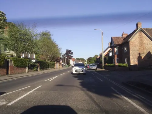
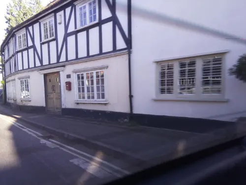

The Red Lion
Bar and pub · 1.8 mi
Mo-Fr 12:00-15:00,18:00-23:00; Sa 12:00-24:00, Su 12:00-22:30
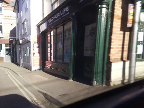


The Old Post Office
Cafe
St Martin's Street, Wallingford
Mo-Th 08:00-24:00; Fr-Sa 08:00-01:00; Su 08:00-23:00
26 more on the map.
History
Wallingford developed around an important crossing point of the River Thames. There is evidence of Roman activity in the area who have left traces of occupation, burials, roads, coins and pottery. The Anglo-Saxons built the first settlement. Wallingford has been fortified since the Anglo-Saxon period when it was an important fortified borough of Wessex with the right to mint royal coinage. It was enclosed with substantial earthworks by King Alfred the Great in the ninth century as part of a network of fortified towns known as burhs, or burghs, to protect Wessex against the Vikings. These defences can still be clearly discerned as a group of four roughly square areas around the centre of the town and are well-preserved. Wallingford became the chief town of Berkshire and the seat of the county's Ealdorman.
Read more of the history
During the Norman Conquest in 1066, the Anglo-Saxon lord Wigod allowed William the Conqueror's invading armies into Wallingford to rest and to cross the Thames unopposed. It was in Wallingford that Stigand the Archbishopric of Canterbury surrendered and submitted to William, thereby all but ending opposition to William's ascent to the throne. From Wallingford, William with Stigand and his armies rode east to Berkhamsted, where he received the final surrender from Edgar and the rest of the English leadership before marching on London for his coronation on Christmas Day. At that time, the river at Wallingford was the lowest point at which the river could be forded. The town subsequently stood in high favour with the Normans as Wallingford Castle was built soon afterward on the orders of William, and became a key strategic centre controlling the Thames crossing and surrounding area. The Domesday Book of 1086 lists Wallingford as one of only 18 towns in the kingdom with a population of over 2,000 people.
Wallingford Priory, also known as Holy Trinity Priory, is believed to have stood on the site of the Bull Croft recreation ground off the High Street. This Benedictine priory was established on land granted to St Albans Abbey in 1097 by Henry I, and Geoffrey the Chamberlain gave the priory to St Albans Paul, 14th Abbot of St Albans, who sent some of his monks to establish a cell there. Wallingford Priory produced the mathematician Richard of Wallingford and the chronicler John of Wallingford.
Wallingford provided refuge for the Empress Matilda's party during the civil war that began after her father Henry I's death. After the fall of Oxford Castle to Stephen in 1141, Matilda fled to Wallingford, according to some historic accounts in the snow under a moonlit sky. Wallingford Castle was besieged unsuccessfully a number of times, with the Treaty of Wallingford ending the conflict there in November 1153.
The town was granted a Royal Charter in 1155 by the new king, Henry II, being the second town in England to receive one.
During Prince John's unsuccessful revolt against his brother King Richard I whilst Richard was involved with the Third Crusade, John seized Wallingford Castle in 1189. The rebellion failed, and John was forced to return the castle to the king's administrators. King John reclaimed the castle after his inheriting the crown in 1199. John modernised, fortified and greatly enlarged the Castle and used it extensively during the First Barons' War.
The town declined in importance from the mid-13th century, when its size and population reduced. The town received a further blow when plague arrived in 1343. It severely damaged the town and its population; the number of churches declined from eleven (during the reign of King Henry II) to only four by the 15th century. The castle declined subsequently, much stone being removed to renovate Windsor Castle.
The road from London to Gloucestershire passed through Wallingford, and the town flourished as a trading centre throughout most of the Middle Ages. The road was diverted, and a bridge was constructed at Abingdon. The opening of Abingdon Bridge and loss of traffic that the road had brought caused the town to enter a steep economic decline.
In 1422 Wallingford and its castle was granted to Catherine of Valois, widowed Queen of Henry V. Catherine lived at Wallingford with her son Henry VI, who was tutored there. While she lived at Wallingford, Catherine met Owen Tudor, whom she later married in secret. Catherine and Owen's eldest son Edmund Tudor fathered Henry VII who defeated Richard III at Bosworth Field and founded the Tudor Dynasty.
One of the last documented uses of Wallingford as a royal residence was during 1518. Letters between Cardinal Wolsey and his secretary Richard Pace discuss King Henry VIII's dissatisfaction with Wallingford and his desire to move on. The priory was dissolved in 1525 by Cardinal Wolsey, partly in order to fund the building of the Cardinal College in Oxford. Henry VIII separated the Honour of Wallingford, which included rights of control over the town and its castle, from the Duchy of Cornwall in 1540.
He combined it with the Honour of Ewelme, which included the rights over his existing residence and lands at Ewelme. Ewelme is two miles from Wallingford, so this was done to consolidate control in the area. In return Henry transferred as compensation several areas of Cornish property into the Duchy of Cornwall for Prince Edward. After taking control of Wallingford in 1540, Henry VIII did not favour choosing Wallingford Castle as an official residence. Instead, he opted to transfer materials from it to Windsor to enlarge & improve his own castle there. This practice of dismantling Wallingford Castle to improve Windsor Castle was continued in the reigns of Edward VI, Mary I, and Elizabeth I.
From the History section of Wallingford, Oxfordshire on Wikipedia, under CC BY-SA 4.0.
More about Wallingford
Geography
As with the rest of the British Isles and Oxfordshire, Wallingford experiences a maritime climate with cool summers and mild winters. There has been a weather station at the nearby Centre for Ecology & Hydrology collecting data on the local climate since 1961. Temperature extremes at Wallingford vary from −21.0 °C (−5.8 °F) recorded in January 1982 to 35.2 °C (95.4 °F) recorded in July 2006. Recent low temperatures include −17.6 °C (0.3 °F) during January 2010 and −17.5 °C (0.5 °F) during December 2010.
Economy
Historically, Wallingford was a centre for local trading in livestock and corn as well as the general trade of other goods. This decreased after the construction of the bridge at Abingdon. The town developed as a centre for the production of iron and machinery in the 18th century; this continued until the 1980s. The brewing industry was important with two breweries and 17 maltings in the town. This link was ended with the demolition of Paul's Malt in 2001. The Lamb arcade was originally known as the Lamb Coaching Inn and in 1980 after being derelict for some years was converted into an Antiques Arcade. Champions hardware store has been serving the residents of the town since 1869.
Education
St John's (a primary school), Fir Tree, (a junior school), and St Nicholas (an infants' school) are all located within the town itself, with additional primary schools at Brightwell-cum-Sotwell, Cholsey and Crowmarsh Gifford serving the surrounding areas.
Wallingford School is the successor to Wallingford Grammar School, founded in 1659 when Walter Bigg left money for a school in his will. Located to the north of the town, it is an academy school and part of the Merchant Taylors’ Oxfordshire Academy Trust. The school provides education for the Wallingford area for boys and girls between the ages of 11 and 18. The majority of pupils from both Fir Tree and St John's continue on to Wallingford School. Wallingford School also draws pupils from Crowmarsh, Brightwell-cum-Sotwell, Cholsey and Warborough primary schools and occasionally Didcot primary schools.
From the Wikipedia article Wallingford, Oxfordshire, under CC BY-SA 4.0.
Notable people from Wallingford
 Jonathan BaileyEnglish actor (born 1988)Photo: LucaFazPhoto, CC BY-SA 4.0
 Richard of WallingfordEnglish mathematicianPhoto: Unknown author, Public domain
 Edith HayllarBritish painter (1860–1948)Photo: Edith Hayllar (1860-1948), Public domain
 Matt RoddaBritish politician, Member of Parliament for Reading Central, UK (born 1966)Photo: ©House of Commons / Jessica Taylor, CC BY 3.0
 Jonathan S. Stamlerenglish-American physician and biochemistPhoto: Keith Berr, [email protected], CC BY-SA 4.0
- John BrunnerBritish author (1934–1995)
- Geoffrey KeenEnglish actor (1916–2005)
- Richard LesterBritish rower
- Rob WilsonBritish politician (born 1965)
- Edgar FieldEnglish footballer (1854-1934)
- Gary ElkinsEnglish footballer (born 1966)
- Katty KayBritish journalist
Born in Wallingford, according to Wikidata (CC0). Each name links to its Wikipedia article.
Where to stay6
Newnham Manor Caravan Park
Campground · 0.8 mi
138 The Street, Crowmarsh Wallingford
Churches and places of worship19
Shopping13
Gas and EV charging2
Schools, colleges and libraries9
St Nicholas Church of England Infants' School
School · Anglican · 0.5 mi
St Nicholas Road, Wallingford
Brightwell-cum-Sotwell Church of England Primary School
School · Anglican · 1.8 mi
Healthcare4
Map of Wallingford
125 places. The map loads OpenStreetMap tiles when you open it.
Getting there and nearby towns
RAF Benson (BEX) is the nearest airport with scheduled flights listed in OpenStreetMap, 2 miles away.
- Reading 12 mi southeast, about 19 min by car
- Oxford 12 mi northwest, about 19 min by car
- Wantage 13 mi west, about 21 min by car
- High Wycombe 16 mi east, about 26 min by car
- Witney 20 mi northwest, about 32 min by car
- Basingstoke 23 mi south, about 38 min by car
- Slough 24 mi east, about 38 min by car
- Windsor 24 mi east, about 39 min by car
- Swindon 28 mi west, about 46 min by car
- Woking 31 mi southeast, about 50 min by car
Drive times are estimates from straight-line distance, not routes.
Towns near Wallingford


Keep exploring
Local news
Headlines from INDB.
Reviews, tips and questions
Loading what members have shared...
Sources and licences
- GeoNames (CC BY 4.0): population, coordinates, regions and time zone
- Mapillary (see each image): photos
- OpenStreetMap contributors (ODbL 1.0): places, airports, map data
- Wikidata (CC0 1.0): elevation, founding date, time zone, website, landmarks and historic places
- Wikimedia Commons (see each image): photos
- Wikipedia (CC BY-SA 4.0): overview and history text
Photo credits
- Wallingford Bunkfest 2022-09-03 14.07.53, Chris j wood, CC BY-SA 4.0
- Wallingford Bunkfest 2022-09-03 14.08.20, Chris j wood, CC BY-SA 4.0
- Moulsford Viaduct 09, Simon Burchell, CC BY-SA 4.0
- Shillingford Bridge, Nancy, CC BY-SA 3.0
- UK-Wallingford Bridge, Sciencebloke at English Wikipedia, Public domain
- ByPass Bridge, Sciencebloke at English Wikipedia, Public domain
- UK-Wallingford Museum, Photograph by David Hemming, Public domain
- Wallingford castle ruins, Pitou250, Public domain
- DorchesterAbbey, JohnArmagh, Public domain
- Wallingford, Sciencebloke at English Wikipedia, Public domain
- St Mary Magdalene Church, Crowmarsh Gifford, UKgeofan, CC BY-SA 3.0
- St Nicholas Wallingford Castle, Sciencebloke ( talk ), CC BY-SA 3.0
- St Leonards Church Wallingford, Rob Stallard, CC BY-SA 3.0
- Thatch End The Red Lion Public House Brightwell cum Sotwell(1), Mywikicompetition, CC BY-SA 4.0
- Wallingford St Peters Bridge, Sciencebloke at English Wikipedia, CC BY-SA 3.0
- Benson church, Brendan and Ruth McCartney, CC BY-SA 2.0
- Close-up of the inscription (OpenBenches 4766), edent, CC BY-SA 4.0
- Long shot of the bench (OpenBenches 4766-1), edent, CC BY-SA 4.0
- Long shot of the bench (OpenBenches 4765-1), edent, CC BY-SA 4.0
- Close-up of the inscription (OpenBenches 4765), edent, CC BY-SA 4.0
- Little Wittenham Bridge, Day's Lock, Motmit, CC BY-SA 3.0
- Benson Lock, Dennis Jackson, CC BY-SA 2.0
- Benson war memorial, Stephen McKay, CC BY-SA 2.0
- Jethro Tull blue plaque at Crowmarsh Gifford, Oxfordshire, Bill Nicholls, CC BY-SA 2.0
- Street-level photo, southglos, CC BY-SA 4.0
- Street-level photo, southglos, CC BY-SA 4.0
- Street-level photo, southglos, CC BY-SA 4.0
- Street-level photo, southglos, CC BY-SA 4.0
- Street-level photo, southglos, CC BY-SA 4.0
- Street-level photo, southglos, CC BY-SA 4.0
- Street-level photo, southglos, CC BY-SA 4.0
- Street-level photo, southglos, CC BY-SA 4.0
- Street-level photo, southglos, CC BY-SA 4.0
- Street-level photo, southglos, CC BY-SA 4.0
- Street-level photo, southglos, CC BY-SA 4.0
- Street-level photo, southglos, CC BY-SA 4.0
- Street-level photo, southglos, CC BY-SA 4.0


Page built November 10, 2026. Spotted a mistake? Tell us or suggest a place.