


Why visit Lamlash
Townapedia lists 9 museums and landmarks, 1 park or trail, 3 places to eat, 7 places to stay and 2 attractions in and around town.
Highlights include Eas Geal and Meallach's Grave.
Weather in Lamlash
Forecast from MET Norway (CC BY 4.0). Full forecast
About Lamlash
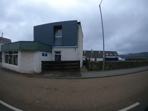
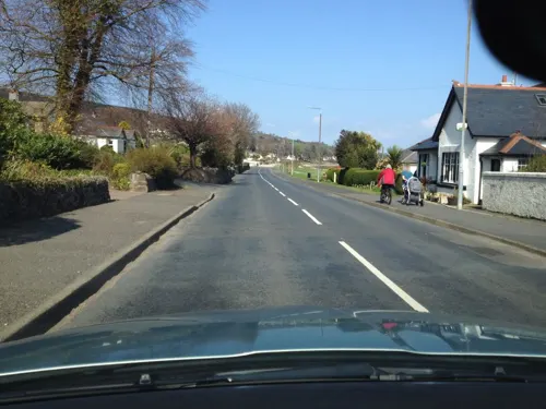
Lamlash (Scottish Gaelic: An t-Eilean Àrd) is a town on the Isle of Arran, in the Firth of Clyde, Scotland. It lies three miles (five kilometres) south of the island's main settlement and ferry port Brodick, in a sheltered bay on the island's east coast, facing the Holy Isle. Lamlash is the seat of Arran's local government offices, and is also the location of the island's police station, secondary school and hospital. In common with the rest of the island, the town's main industry is tourism and the public sector is also an important employer.
From the Wikipedia article Lamlash (this version), under CC BY-SA 4.0.
Photos of Lamlash


Things to do2

Eas Geal
Waterfall · 2.2 mi
Waterfall in North Ayrshire, Scotland, UK

Museums and landmarks9

Parks, trails and playgrounds1

Restaurants and cafes3
History
A prehistoric ring of stones indicates that an ancient settlement has existed near Lamlash since antiquity. The name Lamlash dates back to the 6th Century hermitage of Saint Molaise, a Celtic monk born in Ireland but raised in Scotland, who, circa 590, spent some time in a cave on the neighbouring Holy Isle. Commonly known as MoLaise the Gaelic name of Holy Isle was, as a result, Eilean MoLaise. This gradually evolved through Elmolaise and Lemolash to Lamlash, which is what Holy Isle was called until early in the 19th century. After that time the name was more normally attached to the village that grew up facing it.
Lamlash was peripherally involved in the 13th century Battle of Largs. It was the birthplace of artist James Kay.
When Mary, Queen of Scots was at Dumbarton Castle in February 1548 during the war of the Rough Wooing, the English commander Grey of Wilton proposed basing some warships at "Lammelashe" to watch for French ships. Mary was taken to France. Her ship was at first forced by adverse winds to return towards the Firth of Clyde, and anchored at the "roadstead of the isle of Lamlash" or "Lamelesche" on August 6.
The town was the training place for No. 11 (Scottish) Commando during the early years of the Second World War.
From the History section of Lamlash on Wikipedia, under CC BY-SA 4.0.
More about Lamlash
Geography
Lamlash is located in the southern half of the island, some 3 miles (5 km) to the south of Brodick and 5 miles (8 km) to the north of Whiting Bay. It is on the eastern side and sits on a bay facing the Holy Isle and the Firth of Clyde.
Economy
In common with the rest of the island the town's main industry is tourism. In Lamlash the public sector is also an important employer. Fisheries is no longer important; although the Clyde was once the finest fishery in Europe it is now all but gone. There are strictly speaking no fish left in the Clyde for commercial capture and the few fishermen left are reduced to scraping the seabed for scallops and prawns.
According to Glasgow's Department of Naval Architecture and Marine Engineering, Lamlash Bay is a good natural harbour offering very good shelter. It has accommodated the Royal Navy Home Fleet and Atlantic Fleet.
Lamlash has an RNLI Lifeboat station with a B class Atlantic 75 lifeboat, covering the inshore waters around the coast of Arran.
In summer, there is a regular ferry service from Lamlash harbour to Holy Isle.
From the Wikipedia article Lamlash, under CC BY-SA 4.0.
Notable people from Lamlash
- James KayBritish (Scottish) painter (1858-1942)
- David McNicolCanadian politician
Born in Lamlash, according to Wikidata (CC0). Each name links to its Wikipedia article.
Where to stay7
Churches and places of worship1
Shopping5
Schools, colleges and libraries3
Healthcare2
Map of Lamlash
33 places. The map loads OpenStreetMap tiles when you open it.
Getting there and nearby towns
Glasgow Prestwick Airport (PIK) is the nearest airport with scheduled flights listed in OpenStreetMap, 21 miles away.
- Ardrossan 15 mi northeast, about 24 min by car
- Saltcoats 15 mi northeast, about 24 min by car
- Millport 17 mi northeast, about 28 min by car
- Troon 18 mi east, about 29 min by car
- Kilwinning 18 mi northeast, about 30 min by car
- Irvine 19 mi east, about 31 min by car
- Ayr 20 mi east, about 32 min by car
- Prestwick 20 mi east, about 33 min by car
- Largs 21 mi northeast, about 34 min by car
- Kilmarnock 25 mi east, about 41 min by car
Drive times are estimates from straight-line distance, not routes.
Towns near Lamlash


Keep exploring
Local news
Headlines from INDB.
Reviews, tips and questions
Loading what members have shared...
Sources and licences
- GeoNames (CC BY 4.0): population, coordinates, regions and time zone
- Mapillary (see each image): photos
- OpenStreetMap contributors (ODbL 1.0): places, airports, map data
- Wikidata (CC0 1.0): elevation, founding date, time zone, website, landmarks and historic places
- Wikimedia Commons (see each image): photos
- Wikipedia (CC BY-SA 4.0): overview and history text
Photo credits
- Scotland, Isle of Arran, Lamlash, Hamilton Terrace, Vincent van Zeijst, CC BY-SA 3.0
- 05066 Parish Church, Lamlash, Arran 013, WeeHolly, CC BY-SA 4.0
- 05066 Parish Church, Lamlash, Arran 005, WeeHolly, CC BY-SA 4.0
- 05066 Parish Church, Lamlash, Arran 011, WeeHolly, CC BY-SA 4.0
- 05066 Parish Church, Lamlash, Arran 009, WeeHolly, CC BY-SA 4.0
- 05066 Parish Church, Lamlash, Arran 007, WeeHolly, CC BY-SA 4.0
- 05066 Parish Church, Lamlash, Arran 014, WeeHolly, CC BY-SA 4.0
- 05066 Parish Church, Lamlash, Arran 012, WeeHolly, CC BY-SA 4.0
- Street-level photo, hobgoblin, CC BY-SA 4.0
- Street-level photo, iain_mcnicol, CC BY-SA 4.0
- Street-level photo, iain_mcnicol, CC BY-SA 4.0
- Street-level photo, iain_mcnicol, CC BY-SA 4.0
- Street-level photo, hobgoblin, CC BY-SA 4.0
- Street-level photo, hobgoblin, CC BY-SA 4.0
- Street-level photo, hobgoblin, CC BY-SA 4.0
- Street-level photo, iain_mcnicol, CC BY-SA 4.0
- Street-level photo, hobgoblin, CC BY-SA 4.0
- Street-level photo, hobgoblin, CC BY-SA 4.0
- Street-level photo, hobgoblin, CC BY-SA 4.0
- Street-level photo, hobgoblin, CC BY-SA 4.0
- Street-level photo, hobgoblin, CC BY-SA 4.0
Page built November 10, 2026. Spotted a mistake? Tell us or suggest a place.