


Ayr, United Kingdom
Ayr is a town of 46,260 people in Scotland, United Kingdom, founded in 1205.
Why visit Ayr
Townapedia lists 38 museums and landmarks, 17 parks and trails, 185 places to eat, 27 places to stay and 7 attractions in and around town.
Highlights include Gaiety Theatre, Brig o' Doon, Burns Cottage and Burns Monument.
Weather in Ayr
Forecast from MET Norway (CC BY 4.0). Full forecast
About Ayr
Ayr ( AIR; Scots: Ayr; Scottish Gaelic: Inbhir Àir meaning "confluence of the River Àir") is a town situated on the southwest coast of Scotland. A former royal burgh, today it is the administrative centre of South Ayrshire Council, and the historic county town of Ayrshire. With a population of 46,182 in 2022, Ayr is the 15th largest settlement in Scotland and second largest town in Ayrshire by population. The town is contiguous with the smaller town of Prestwick to the north.
From the Wikipedia article Ayr (this version), under CC BY-SA 4.0.
Travel tips from other travellers: Ayr on Wikivoyage (CC BY-SA 4.0).
Photos of Ayr

Things to do7

Brig o' Doon
Bridge · 2.5 mi
Medieval bridge in South Ayrshire, Scotland

The Pavilion
Cinema and theater
Former music venue in Ayr, Scotland, now used as a family entertainment centre



Museums and landmarks38


Shaw Monument
Monument and historic site · 3.3 mi
Monumental tower in South Ayrshire, Scotland, UK



Robert Burns Birthplace Museum
Museum · 2.4 mi
Museum in Scotland
Murdoch's Lone, Alloway
Jan 03-Mar 31 10:00-16:30; Apr 01-Oct 31 10:00-17:00; Dec 25-26...

Macrae's Monument
Monument and historic site · 4.3 mi
Monument in South Ayrshire, Scotland, UK
26 more on the map.
Parks, trails and playgrounds17


Belleisle & Seafield Golf Courses
Golf course · 1.5 mi
18 hole Par 71 Belleisle Course + 18 hole Par 67 Seafield Course
Doonfoot Road, Ayr

The Oval
Park · 2.3 mi
Public park in Prestwick, South Ayrshire, Scotland, UK

5 more on the map.
Restaurants and cafes185
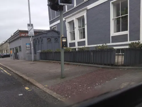



The Smoking Goat
Bar and pub
2a Academy Street, Ayr
Mo-Th 12:00-00:30; Fr-Sa 12:00-01:00; Sa 12:00-00:30

Lychees Ayr
Restaurant · Chinese
42 South Harbour Street, Ayr
We,Th 12:00-14:00,17:00-22:00; Fr,Sa 12:00-22:00; Su 14:30-22:00
173 more on the map.
History
The areas surrounding modern day Ayr were known to have been occupied by Mesolithic hunter-gatherers more than 5,000 years ago. There is also a Neolithic standing stone at the end of Stonefield Park in Doonfoot, which is believed to have been upended as a place of sun worship by Stone Age people. In 1197, King William the Lion ordered that a new castle be built between the River Ayr and the River Doon. It is believed that the castle was a wooden structure built around Montgomerie Terrace. Ayr was later established as a royal burgh and market town on 21 May 1205 by King William the Lion. At its establishment, the burgh encompassed a single street (The Sandgate) and the Church of St John. By 1225 the town reached as far as Carrick Street and Mill Street along the south side of the River Ayr. The town grew quickly to become the main seaport, marketplace and administrative centre for Ayrshire.
Read more of the history
The King gifted fishing rights to the burgh for the River Ayr and the River Doon in 1236. In the following year, a timber bridge was built across the River Ayr, linking the town to the north side of the river. Since 1261, annual fairs were held in the town. At this time the town had a recorded population of 1,500 and served as a major port on the west coast. The town was unsuccessfully attacked by Norwegian forces in 1263 and invaded and occupied by English forces from 1296 until 1312 as part of the Scottish Wars of Independence. In 1298 the original castle at Ayr was destroyed by Robert The Bruce's forces. On 26 April 1315, a Parliament of Scotland was held in Ayr by Robert The Bruce at St. John's Tower by the sea. As a Royal Burgh, Ayr was afforded various privileges relating to trade, tolls and fishing rights, which allowed the town to out-compete the neighbouring free burgh of Newton-on-Ayr which was established in the 14th century and situated on the north side of the River Ayr.
Ayr was frequently hit by plagues between 1545 and 1647, resulting in the town's port being quarantined and plague victims being removed from the town on pain of death. Mary, Queen of Scots visited the town in 1552 and 1563. Ayr remained a significant port throughout the 16th century, exporting goods such as fish, hide and wool and importing salt and wine.
Ayr played a pivotal role in the Plantation of Ulster throughout the 17th century, in which a significant number of British people settled in present-day Northern Ireland. The town provided the largest share of colonists from Great Britain, with many colonists from Ayr joining the Earl of Eglinton, Hugh Montgomery's, plant in the Ards Peninsula (particularly around Newtownards), and others going on to settle around Belfast. In 1652, the town was used as a base and fortress for some of Oliver Cromwell's men. They established a large fortress along the mouth of the River Ayr and erected walls around the area just south of the river's mouth – most of these walls remain present to this day. St John's Tower, which sat around the centre of the fortress, was originally part of a large church yet this was knocked down during the construction of the fort with the tower being used for military practice; it is now protected by "Friends of Saint Johns Tower" (FROST) residents in the "Ayr Fort Area" which sits atop the former site of the citadel. In 1654, a replacement church for St John's, the Auld Kirk of Ayr was completed.
The lands occupied by the fort were granted to the Earl of Eglinton, Alexander Montgomerie, in 1663, who established the separate Burgh of Regality named Montgomerieston around the fort, which was eventually absorbed into the Burgh of Ayr. The separate village of Alloway to the south-east of Ayr was also annexed by the town in 1691, despite numerous petitions against this to Edinburgh from residents of the village. Although the importation of French wine continued to be Ayr's most important trade during the 17th century, the port was one of the first in Scotland to establish regular trade links with the English colonies in the Americas. This commenced during the 1640s when the English Civil War disrupted established colonial trading arrangements, and during the Cromwellian occupation there was free trade between Scotland and the English colonies. Following the 1660 Restoration of the monarchy, the Navigation Acts excluded Scottish ships from this trade apart from a few exceptional cases. Several English merchants had settled in Ayr during the Cromwellian occupation, and they collaborated with local merchants in circumventing the Navigation Acts by disguising Ayr ships as English vessels. Tobacco, sugar and indigo were imported, and salted fish, meat, clothing and indentured servants were exported.
From the History section of Ayr on Wikipedia, under CC BY-SA 4.0.
More about Ayr
Geography
Ayr is a coastal town which lies on the mouth of the River Ayr which flows into the larger Firth of Clyde estuary. From the coast, the Isle of Arran can be seen, and on a very clear day, the northern tip of Northern Ireland is also visible. Ayr is located within the region of Strathclyde, and forms part of the historic county of Ayrshire. Today, it is the largest town and administrative centre of South Ayrshire. Much of the land in and around Ayr is flat and low lying surface, used for rearing dairy cattle. Towards the south of Ayr, however, the land is higher than most areas in the county of Ayrshire, an example of this being the Brown Carrick Hill which is situated due south of Doonfoot. Ayr lies approximately 35 miles (55 km) southwest of Glasgow.
The urban area which encompasses Ayr is defined by the General Register Office for Scotland as the adjoining localities of Ayr and Prestwick − this is the 12th largest urban area in Scotland.
The nearest official Met Office weather station to Ayr is Auchincruive, about 3 miles (5 km) to the north-east of Ayr town centre. The area experiences very cool summers and somewhat mild winters. The air is cooler during the summer due to its proximity to the sea as water has a major cooling effect on summer temperatures.
Arts and culture
Ayr Racecourse is a well-known racecourse in Scotland and hosts both National Hunt and flat racing. It has the largest capacity in Scotland for horse racing. Notable events include the Scottish Grand National (April) and Ayr Gold Cup (September) as well as several night meetings. It was recently put up for sale by the owners and included the Western House Hotel as part of the potential sale.
Ayr has two senior football clubs. Ayr United play at Somerset Park in the Scottish Championship. They reached the final of the 2001–02 Scottish League Cup competition. The club was formed in 1910 with the merger of Ayr F.C. (who were formed in 1879 by the merger of Ayr Thistle and Ayr Academical football clubs) and Ayr Parkhouse F.C. Whitletts Victoria are based in the Whitletts area of Ayr and compete in the West of Scotland Football League.
From the Wikipedia article Ayr, under CC BY-SA 4.0.
Notable people from Ayr
 Drew McIntyreScottish professional wrestlerPhoto: Diego Serrano, CC BY 2.0
 Alan McInallyScottish footballerPhoto: Jonesy702, CC BY 4.0
 Stuart MartinBritish film actor, television actor and dub actorPhoto: Gabriel Hutchinson, CC BY-SA 4.0
 James FergussonScottish architectural historian (1808–1886)Photo: Not determined, Public domain
 Mary MacarthurBritish labour organizer, editorPhoto: LSE Library, No restrictions
 William BrackenridgeScottish-U.S. botanist (1810–1893)Photo: Unknown author Unknown author, Public domain
 Andrew Michael RamsayScottish-born writer and freemasonPhoto: Pier Leone Ghezzi, Public domain
 Stuart MurdochBritish musicianPhoto: Andy Witchger, CC BY 2.0
 Sir Hew Dalrymple, 1st Baronet, of High MarkBritish Army general (1750-1830)Photo: Charles Turner, Public domain
- John Loudon McAdamScottish engineer and road-builder (1756–1836)
- Abdalqadir as-SufiIslamic Scholar, Shaykh of Instruction (1930–2021)
- Craig BurleyScottish association football player
Born in Ayr, according to Wikidata (CC0). Each name links to its Wikipedia article.
Where to stay27
Churches and places of worship30
Shopping49
Gas and EV charging4
Schools, colleges and libraries25
Healthcare17
Map of Ayr
250 places. The map loads OpenStreetMap tiles when you open it.
Getting there and nearby towns
Glasgow Prestwick Airport (PIK) is the nearest airport with scheduled flights listed in OpenStreetMap, 3 miles away.
- Prestwick 2 mi northeast, about 3 min by car
- Troon 6 mi north, about 9 min by car
- Irvine 11 mi north, about 17 min by car
- Kilmarnock 12 mi northeast, about 19 min by car
- Kilwinning 13 mi north, about 22 min by car
- Saltcoats 13 mi northwest, about 22 min by car
- Newton Mearns 24 mi northeast, about 39 min by car
- Barrhead 25 mi north, about 40 min by car
- Paisley 27 mi north, about 43 min by car
- East Kilbride 27 mi northeast, about 44 min by car
Drive times are estimates from straight-line distance, not routes.
Towns near Ayr


Keep exploring
Local news
Headlines from INDB.
Reviews, tips and questions
Loading what members have shared...
Sources and licences
- GeoNames (CC BY 4.0): population, coordinates, regions and time zone
- Mapillary (see each image): photos
- OpenStreetMap contributors (ODbL 1.0): places, airports, map data
- Wikidata (CC0 1.0): elevation, founding date, time zone, website, landmarks and historic places
- Wikimedia Commons (see each image): photos
- Wikipedia (CC BY-SA 4.0): overview and history text
Photo credits
- 05188 Ex Ayr & Wallacetown Free-UF-Sandgate Parish Church, Ayr 018, WeeHolly, CC BY-SA 4.0
- 05188 Ex Ayr & Wallacetown Free-UF-Sandgate Parish Church, Ayr 027, WeeHolly, CC BY-SA 4.0
- 05188 Ex Ayr & Wallacetown Free-UF-Sandgate Parish Church, Ayr 009, WeeHolly, CC BY-SA 4.0
- 05188 Ex Ayr & Wallacetown Free-UF-Sandgate Parish Church, Ayr 011, WeeHolly, CC BY-SA 4.0
- 05188 Ex Ayr & Wallacetown Free-UF-Sandgate Parish Church, Ayr 024, WeeHolly, CC BY-SA 4.0
- 05188 Ex Ayr & Wallacetown Free-UF-Sandgate Parish Church, Ayr 030, WeeHolly, CC BY-SA 4.0
- 05188 Ex Ayr & Wallacetown Free-UF-Sandgate Parish Church, Ayr 012, WeeHolly, CC BY-SA 4.0
- 05188 Ex Ayr & Wallacetown Free-UF-Sandgate Parish Church, Ayr 008, WeeHolly, CC BY-SA 4.0
- 05188 Ex Ayr & Wallacetown Free-UF-Sandgate Parish Church, Ayr 017, WeeHolly, CC BY-SA 4.0
- 05188 Ex Ayr & Wallacetown Free-UF-Sandgate Parish Church, Ayr 001, WeeHolly, CC BY-SA 4.0
- 05188 Ex Ayr & Wallacetown Free-UF-Sandgate Parish Church, Ayr 014, WeeHolly, CC BY-SA 4.0
- 05188 Ex Ayr & Wallacetown Free-UF-Sandgate Parish Church, Ayr 003, WeeHolly, CC BY-SA 4.0
- 05188 Ex Ayr & Wallacetown Free-UF-Sandgate Parish Church, Ayr 025, WeeHolly, CC BY-SA 4.0
- 05188 Ex Ayr & Wallacetown Free-UF-Sandgate Parish Church, Ayr 031, WeeHolly, CC BY-SA 4.0
- 05188 Ex Ayr & Wallacetown Free-UF-Sandgate Parish Church, Ayr 016, WeeHolly, CC BY-SA 4.0
- 05188 Ex Ayr & Wallacetown Free-UF-Sandgate Parish Church, Ayr 019, WeeHolly, CC BY-SA 4.0
- 05188 Ex Ayr & Wallacetown Free-UF-Sandgate Parish Church, Ayr 020, WeeHolly, CC BY-SA 4.0
- 05188 Ex Ayr & Wallacetown Free-UF-Sandgate Parish Church, Ayr 005, WeeHolly, CC BY-SA 4.0
- 05188 Ex Ayr & Wallacetown Free-UF-Sandgate Parish Church, Ayr 010, WeeHolly, CC BY-SA 4.0
- 05188 Ex Ayr & Wallacetown Free-UF-Sandgate Parish Church, Ayr 013, WeeHolly, CC BY-SA 4.0
- 05188 Ex Ayr & Wallacetown Free-UF-Sandgate Parish Church, Ayr 029, WeeHolly, CC BY-SA 4.0
- 05188 Ex Ayr & Wallacetown Free-UF-Sandgate Parish Church, Ayr 032, WeeHolly, CC BY-SA 4.0
- 05188 Ex Ayr & Wallacetown Free-UF-Sandgate Parish Church, Ayr 026, WeeHolly, CC BY-SA 4.0
- 05188 Ex Ayr & Wallacetown Free-UF-Sandgate Parish Church, Ayr 015, WeeHolly, CC BY-SA 4.0
- 05188 Ex Ayr & Wallacetown Free-UF-Sandgate Parish Church, Ayr 021, WeeHolly, CC BY-SA 4.0
- 05188 Ex Ayr & Wallacetown Free-UF-Sandgate Parish Church, Ayr 007, WeeHolly, CC BY-SA 4.0
- 05188 Ex Ayr & Wallacetown Free-UF-Sandgate Parish Church, Ayr 022, WeeHolly, CC BY-SA 4.0
- 05188 Ex Ayr & Wallacetown Free-UF-Sandgate Parish Church, Ayr 006, WeeHolly, CC BY-SA 4.0
- 05188 Ex Ayr & Wallacetown Free-UF-Sandgate Parish Church, Ayr 028, WeeHolly, CC BY-SA 4.0
- 05188 Ex Ayr & Wallacetown Free-UF-Sandgate Parish Church, Ayr 002, WeeHolly, CC BY-SA 4.0
- 05188 Ex Ayr & Wallacetown Free-UF-Sandgate Parish Church, Ayr 004, WeeHolly, CC BY-SA 4.0
- 05188 Ex Ayr & Wallacetown Free-UF-Sandgate Parish Church, Ayr 033, WeeHolly, CC BY-SA 4.0
- 05188 Ex Ayr & Wallacetown Free-UF-Sandgate Parish Church, Ayr 023, WeeHolly, CC BY-SA 4.0
- Brig o' Doon, Alloway 2017-05-17, August Schwerdfeger, CC BY 4.0
- Ayr Pavilion from east, Iroberts696, CC BY-SA 4.0
- Shaw Monument - North Facing side, Rosser1954 Roger Griffith, CC BY-SA 3.0
- Auld Kirk Of Ayr - gable, Iroberts696, CC BY-SA 4.0
- AyrRCCathedral, JohnArmagh, Public domain
- Burns Cottage - Alloway, DeFacto, CC BY-SA 4.0
- SomersetPark, Martin Le Roy, CC BY 2.5
- New Ayr Academy, 2017, Mary and Angus Hogg, CC BY-SA 2.0
- Kyle Academy campus, 2017, Goodreg3, CC BY-SA 4.0
- Burns Monument By VegasGav77777, VegasGav7777, CC BY-SA 4.0
- The new Queen Margaret Academy building, Mary and Angus Hogg, CC BY-SA 2.0
- University Hospital, Ayr, Billy McCrorie, CC BY-SA 2.0
- Alloway Auld Kirk - panoramio, Scotia, CC BY 3.0
- Greenan castle with some coloring - panoramio, tormentor4555, CC BY-SA 3.0
- Street-level photo, plan_c, CC BY-SA 4.0
- Street-level photo, noid, CC BY-SA 4.0
- Street-level photo, xdTAGCLAN, CC BY-SA 4.0
- Street-level photo, noid, CC BY-SA 4.0
- Street-level photo, hobgoblin, CC BY-SA 4.0
- Street-level photo, southglos, CC BY-SA 4.0
- Street-level photo, southglos, CC BY-SA 4.0
- Street-level photo, southglos, CC BY-SA 4.0
- Street-level photo, rudolfmayer, CC BY-SA 4.0
- Street-level photo, southglos, CC BY-SA 4.0
- Street-level photo, southglos, CC BY-SA 4.0
- Street-level photo, rudolfmayer, CC BY-SA 4.0
- Street-level photo, plan_c, CC BY-SA 4.0
- Street-level photo, rudolfmayer, CC BY-SA 4.0
- Street-level photo, plan_c, CC BY-SA 4.0


Page built November 10, 2026. Spotted a mistake? Tell us or suggest a place.