


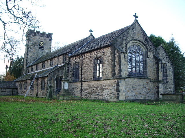


Why visit Langho
Townapedia lists 1 museum or landmark, 3 parks and trails, 6 places to eat, 4 places to stay and 3 attractions in and around town.
Highlights include Ribchester Bridge and Ribchester Roman Museum.
Weather in Langho
Forecast from MET Norway (CC BY 4.0). Full forecast
About Langho
Langho is a small rural village 5 miles (8 km) north of Blackburn in the Ribble Valley, Lancashire, England. It is part of the parish of Billington and Langho. The village is linked with Blackburn and Clitheroe by the A666 road and is served by Langho railway station on the Ribble Valley Line. The population at the 2011 census was 2,015.
From the Wikipedia article Langho (this version), under CC BY-SA 4.0.
Photos of Langho

Things to do3

Ribchester Bridge
Bridge · 2.8 mi
Road bridge in Dutton, Ribble Valley, Lancashire, England, UK

Museums and landmarks1

Ribchester Roman Museum
Museum · 3.4 mi
Museum in Ribchester, England
Parks, trails and playgrounds3


Restaurants and cafes6



The Little Croft
Fast food · Sandwich
98 Whalley Road, Blackburn
Tu-Sa 08:00-14:00
Where to stay4
Churches and places of worship12
Gas and EV charging1
Schools, colleges and libraries3
Langho and Billington St Leonards Church of England Primary School
School · Anglican · 0.8 mi
Whalley Road, Blackburn
Healthcare1
Map of Langho
34 places. The map loads OpenStreetMap tiles when you open it.
Getting there and nearby towns
Warton Aerodrome (WRT) is the nearest airport with scheduled flights listed in OpenStreetMap, 18 miles away.
- Billington 1 mi northeast, about 2 min by car
- Great Harwood 2 mi southeast, about 3 min by car
- Blackburn 4 mi south, about 6 min by car
- Accrington 5 mi southeast, about 8 min by car
- Clitheroe 5 mi northeast, about 8 min by car
- Sabden 5 mi northeast, about 8 min by car
- Padiham 6 mi east, about 9 min by car
- Waddington 6 mi north, about 10 min by car
- Darwen 7 mi south, about 12 min by car
- Burnley 9 mi east, about 14 min by car
Drive times are estimates from straight-line distance, not routes.
Towns near Langho


Keep exploring
Local news
Headlines from INDB.
Reviews, tips and questions
Loading what members have shared...
Sources and licences
- GeoNames (CC BY 4.0): population, coordinates, regions and time zone
- Mapillary (see each image): photos
- OpenStreetMap contributors (ODbL 1.0): places, airports, map data
- Wikidata (CC0 1.0): elevation, founding date, time zone, website, landmarks and historic places
- Wikimedia Commons (see each image): photos
- Wikipedia (CC BY-SA 4.0): overview and history text
Photo credits
- Langho railway station in 2007, Ian Threlfall, CC BY-SA 2.0
- Ribchester Roman Museum, DIaNyf8q, CC0
- St Bartholomew's Church, Great Harwood, Alexander P Kapp, CC BY-SA 2.0
- Baptistery windows of Velarde's church St Gabriel's, Blackburn by Brian Clarke, Brian Clarke, CC BY-SA 4.0
- St John's Church, Great Harwood, Alexander P Kapp, CC BY-SA 2.0
- St. Saviours, Stydd from south-west, Poliphilo, CC0
- Northcote Hotel, CillaLowe, CC BY-SA 4.0
- St. Augustine's Roman Catholic High School, Lancashire County Council, CC BY-SA 2.5
- 006-NC-Drone (160915), CillaLoweSwe, CC0
- Ribchester Bridge, David Dixon, CC BY-SA 2.0
- Street-level photo, endszbrxns, CC BY-SA 4.0
- Street-level photo, endszbrxns, CC BY-SA 4.0
- Street-level photo, endszbrxns, CC BY-SA 4.0


Page built November 10, 2026. Spotted a mistake? Tell us or suggest a place.