


Langholm, United Kingdom
Langholm is a town of 2,250 people in Scotland, United Kingdom.
Why visit Langholm
Townapedia lists 9 museums and landmarks, 2 parks and trails, 5 places to eat, 4 places to stay and 9 attractions in and around town.
Highlights include Duchess Bridge and The Buccleuch Centre.
Weather in Langholm
Forecast from MET Norway (CC BY 4.0). Full forecast
About Langholm
Langholm , also known colloquially as the "Muckle Toon", is a burgh in Dumfries and Galloway, southern Scotland. Langholm lies between four hills in the valley of the River Esk in the Southern Uplands.
From the Wikipedia article Langholm (this version), under CC BY-SA 4.0.
Photos of Langholm


Things to do9
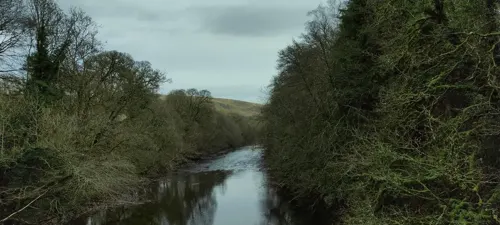
Duchess Bridge
Bridge · 0.7 mi
Cast-iron footbridge in Langholm, Dumfries and Galloway, Scotland


Museums and landmarks9
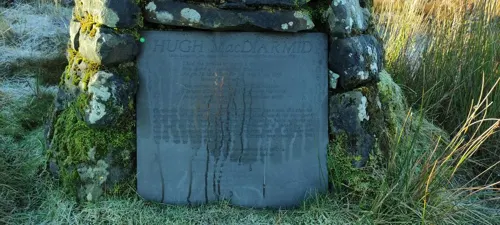
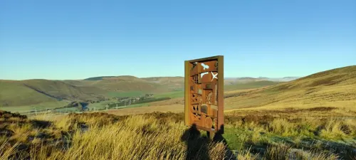
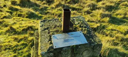
Langholm Common Riding 250th Anniversary Cairn
Monument and historic site · 0.5 mi
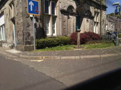

Parks, trails and playgrounds2

Restaurants and cafes5

History
A fort at nearby Langholm Castle was occupied by English soldiers during the war known as the Rough Wooing. Thomas Wharton reported that at the end of April 1543 the soldiers burnt farms at Whitslade in Teviotdale. There were plans to modify the tower by reducing its height to place artillery on it. The garrison was able to influence the region and compel Scots to "assure" with England. Regent Arran successfully besieged the fort on 17 July 1547 and then travelled to the siege of St Andrews Castle to meet a French force. Mary of Guise had the fort rebuilt in 1556.
Langholm is the traditional seat of Clan Armstrong, which is currently represented globally by the official Clan Armstrong Trust. Home of the Clan Armstrong line is Gilnockie Tower 4.5 miles (7 kilometres) south of Langholm and 1.4 miles (2 kilometres) north of Canonbie. The Episcopalian church on Castle Holm fell into disuse before conversion into the Clan Armstrong museum, later moved to Gilnockie Tower.
The town was an important centre for the Border Reivers. In 1759 it won its case in a legal dispute with the Duke of Buccleuch, winning the right of common over the Kilngreen and Common Moss, a success that led to the establishment of the Langholm Common Riding. The town later grew around the textile industry. Langholm Town Hall was completed in 1813.
Read more of the history
In 2020 the local community purchased 5,000 acres (2,000 hectares) of Langholm Moor for £3.8m from Buccleuch Estates.
From the History section of Langholm on Wikipedia, under CC BY-SA 4.0.
More about Langholm
Economy
Edinburgh Woollen Mill was founded in Langholm in 1946 by Drew Stevenson but they moved their headquarters from Langholm to Carlisle in 2019.
Buccleuch Estates have an office in Langholm and own much of the surrounding land.
Education
Langholm Academy and Langholm Primary were established in the 1800s (the original building of which still stands).
The schools run sessions in the community with various groups such as Wild Eskdale and Outpost Arts to expand and improve pupils' skills and community interests.
From the Wikipedia article Langholm, under CC BY-SA 4.0.
Notable people from Langholm
 Hugh MacDiarmidScottish poet, pen name of Christopher Murray Grieve (1892–1978)Photo: Unknown author Unknown author, Public domain
 Sir Thomas Pasley, 1st BaronetBritish Royal Navy admiral (1734-1808)Photo: Lemuel Francis Abbott, Public domain
 Helen HyslopHad a daughter by Robert BurnsPhoto: Rosser1954, CC BY-SA 3.0
- William Julius MickleScottish poet (1734–1788)
- Hector Monro, Baron Monro of LangholmBritish politician (1922-2006)
- Pulteney MalcolmBritish admiral (1768-1838)
- David IrvingScottish librarian and biographer
- Alex DavidsonScottish footballer (1920-2005)
- Donald ScottScottish rugby union footballer
- Tom ScottScottish rugby union player (1875–1947)
- Ross Mabonrugby union referee
Born in Langholm, according to Wikidata (CC0). Each name links to its Wikipedia article.
Where to stay4
Churches and places of worship2
Shopping1
Gas and EV charging1
Schools, colleges and libraries3
Healthcare2
Map of Langholm
38 places. The map loads OpenStreetMap tiles when you open it.
Getting there and nearby towns
Carlisle Lake District Airport (CAX) is the nearest airport with scheduled flights listed in OpenStreetMap, 17 miles away.
- Longtown 10 mi south, about 16 min by car
- Lockerbie 14 mi west, about 23 min by car
- Burgh by Sands 16 mi south, about 26 min by car
- Brampton 17 mi southeast, about 28 min by car
- Carlisle 18 mi south, about 29 min by car
- Lochmaben 18 mi west, about 28 min by car
- Scotby 19 mi south, about 30 min by car
- Great Corby 20 mi south, about 32 min by car
- Wetheral 20 mi south, about 32 min by car
- Hawick 21 mi northeast, about 33 min by car
Drive times are estimates from straight-line distance, not routes.
Towns near Langholm


Keep exploring
Local news
Headlines from INDB.
Reviews, tips and questions
Loading what members have shared...
Sources and licences
- GeoNames (CC BY 4.0): population, coordinates, regions and time zone
- Mapillary (see each image): photos
- OpenStreetMap contributors (ODbL 1.0): places, airports, map data
- Wikidata (CC0 1.0): elevation, founding date, time zone, website, landmarks and historic places
- Wikimedia Commons (see each image): photos
- Wikipedia (CC BY-SA 4.0): overview and history text
Photo credits
- Langholm, Robma at English Wikipedia, CC BY-SA 3.0
- Langholm, Townhead, Erskine Church and scaffolding, Victuallers, CC BY-SA 4.0
- Post Office - panoramio (4), flipflopnick, CC BY-SA 3.0
- Thomas Hope Hospital - panoramio, flipflopnick, CC BY-SA 3.0
- Town Hall - panoramio (3), flipflopnick, CC BY-SA 3.0
- Beattie Plaque2 - panoramio, flipflopnick, CC BY-SA 3.0
- Lamp above Town Hall Entrance - panoramio, flipflopnick, CC BY-SA 3.0
- Congregational Church - panoramio, flipflopnick, CC BY-SA 3.0
- Telford Arch and Pulteney Statue - panoramio, flipflopnick, CC BY-SA 3.0
- Library - panoramio (9), flipflopnick, CC BY-SA 3.0
- Royal Bank Scotland - panoramio, flipflopnick, CC BY-SA 3.0
- Buccleuch Centre - panoramio, flipflopnick, CC BY-SA 3.0
- Street-level photo, jethro10, CC BY-SA 4.0
- Street-level photo, jethro10, CC BY-SA 4.0
- Street-level photo, victuallers, CC BY-SA 4.0
- Street-level photo, victuallers, CC BY-SA 4.0
- Street-level photo, southglos, CC BY-SA 4.0
- Street-level photo, southglos, CC BY-SA 4.0
- Street-level photo, southglos, CC BY-SA 4.0
- Street-level photo, southglos, CC BY-SA 4.0
- Street-level photo, southglos, CC BY-SA 4.0
- Street-level photo, southglos, CC BY-SA 4.0
- Street-level photo, southglos, CC BY-SA 4.0
- Street-level photo, southglos, CC BY-SA 4.0
- Street-level photo, jethro10, CC BY-SA 4.0
- Street-level photo, jethro10, CC BY-SA 4.0
- Street-level photo, jethro10, CC BY-SA 4.0
- Street-level photo, jethro10, CC BY-SA 4.0
- Street-level photo, jethro10, CC BY-SA 4.0
- Street-level photo, jethro10, CC BY-SA 4.0


Page built November 10, 2026. Spotted a mistake? Tell us or suggest a place.