


Why visit Brampton
Townapedia lists 7 museums and landmarks, 1 park or trail, 11 places to eat and 4 places to stay in and around town.
Highlights include Camboglanna and Mile Castle 55.
Weather in Brampton
Forecast from MET Norway (CC BY 4.0). Full forecast
About Brampton
Brampton is a market town and civil parish in the Cumberland unitary authority area of Cumbria, England. It is 9 miles (14 km) east of Carlisle and 2 miles (3.2 km) south of Hadrian's Wall. Historically part of Cumberland, it is situated off the A69 road which bypasses it. In 2021 the parish had a population of 4,545.
From the Wikipedia article Brampton, Cumberland (this version), under CC BY-SA 4.0.
Travel tips from other travellers: Brampton on Wikivoyage (CC BY-SA 4.0).
Museums and landmarks7

Camboglanna
Monument and historic site · 1.5 mi
Roman auxiliary troop fort in near Castlesteads, United-Kingdom
Parks, trails and playgrounds1
Restaurants and cafes11
Brampton Tandoori
Restaurant · Indian · 0.6 mi
36 Front Street, Brampton
Mo 18:00-23:00, We-Fr 18:00-23:00, Sa 16:00-23:00, Su 15:00-23:00



Where to stay4

Irthing Vale Caravan Park
Campground · 0.7 mi
Old Church Lane, Brampton

History
The town is thought to have been founded in the 7th century as an Anglian settlement.
The place-name 'Brampton' is first attested in Charter Rolls of 1252, where it appears as Braunton. In the Taxatio Ecclesiastica of 1291 it appears as Brampton. The name derives from the Old English 'Brōm-tūn', meaning "town or settlement where broom grew".
Its original church survives a couple of miles away to the west as Brampton Old Church, on the site of a Stanegate Roman fort.
The town is overlooked by the large medieval motte known as The Mote, which is surmounted by a statue of George Howard, 7th Earl of Carlisle.
Brampton was granted a Market Charter in 1252 by King Henry III, and became a market town as a result.
During the Jacobite rising of 1745, Charles Edward Stuart ('Bonnie Prince Charlie') stayed in the town for one night, marked by a plaque on the wall of the building (an antique shop) currently occupying the location; here he received the Mayor of Carlisle who had been summoned to Brampton to surrender the city to the Young Pretender. The Capon Tree Monument, to the south of the town centre, commemorates the 1746 hanging of six Jacobites from the branches of the Capon Tree, Brampton's hitherto traditional trysting place.
Read more of the history
The octagonal Moot Hall, which is in the centre of Brampton and houses the tourist information office, was commissioned by Frederick Howard, 5th Earl of Carlisle in 1817. It replaced a 1648 building which was once used by Oliver Cromwell to house prisoners. To the right of its door can be seen the old town iron stocks affixed to the pavement.
Brampton was granted Fairtrade status on 6 January 2005, becoming one of the first hundred towns in the UK to be recognised in this way.
In 2011, Brampton became the 66th town in the United Kingdom and the second in Cumbria to gain Walkers are Welcome status.
From the History section of Brampton, Cumberland on Wikipedia, under CC BY-SA 4.0.
More about Brampton
Arts and culture
William Howard School was host to 'Brampton Live' every summer, an ever-growing music festival that, after its first appearance in 1995, became the largest folk/roots/world music festival in the North of England. Major artists included the Levellers, the Waterboys, Egudo Embako, Richard Thompson, Suzanne Vega, Loudon Wainwright III, Altan, Tommy Emmanuel, Seth Lakeman and many others. The last 'Brampton Live' took place in 2009 and has been, to a certain extent, replaced in 2012 by the 'Stepping Stones Festival' organised by Maddy Prior (of Steeleye Span) held in early May at the Brampton Community Centre.
Education
Brampton's secondary school is the William Howard School, known as Irthing Valley School until 1980 when it was amalgamated with Brampton's White House School and took on a larger catchment area, with pupils from as far away as Alston and Penrith.
From the Wikipedia article Brampton, Cumberland, under CC BY-SA 4.0.
Notable people from Brampton
 Darwin ShawBritish actorPhoto: SilentKisses1, CC0
 Geoff TwentymanEnglish footballer (1930–2004)Photo: RonalLee, CC0
- George RoutledgeBritish publisher
- Keith EdwardsEnglish cricketer (born 1951)
- Syd Scottprofessional golfer
- Tommy Hoggassociation football player (1908-1965)
Born in Brampton, according to Wikidata (CC0). Each name links to its Wikipedia article.
Churches and places of worship5
Shopping4
Gas and EV charging1
Schools, colleges and libraries4
Healthcare2
Map of Brampton
39 places. The map loads OpenStreetMap tiles when you open it.
Getting there and nearby towns
Carlisle Lake District Airport (CAX) is the nearest airport with scheduled flights listed in OpenStreetMap, 3 miles away.
- Great Corby 6 mi southwest, about 10 min by car
- Wetheral 6 mi southwest, about 10 min by car
- Scotby 7 mi southwest, about 11 min by car
- Carlisle 9 mi southwest, about 14 min by car
- Longtown 10 mi northwest, about 16 min by car
- Haltwhistle 11 mi east, about 18 min by car
- Dalston 12 mi southwest, about 20 min by car
- Burgh by Sands 13 mi west, about 21 min by car
- Alston 15 mi southeast, about 24 min by car
- Penrith 20 mi south, about 32 min by car
Drive times are estimates from straight-line distance, not routes.
Towns near Brampton


Keep exploring
Local news
Headlines from INDB.
Reviews, tips and questions
Loading what members have shared...
Sources and licences
- GeoNames (CC BY 4.0): population, coordinates, regions and time zone
- Mapillary (see each image): photos
- OpenStreetMap contributors (ODbL 1.0): places, airports, map data
- Wikidata (CC0 1.0): elevation, founding date, time zone, website, landmarks and historic places
- Wikimedia Commons (see each image): photos
- Wikipedia (CC BY-SA 4.0): overview and history text
Photo credits
- Brampton Old church, Humphry Bolton, CC BY-SA 2.0
- Howard Arms Hotel, Victuallers, CC BY-SA 4.0
- The Nag's Head Public House, Victuallers, CC BY-SA 4.0
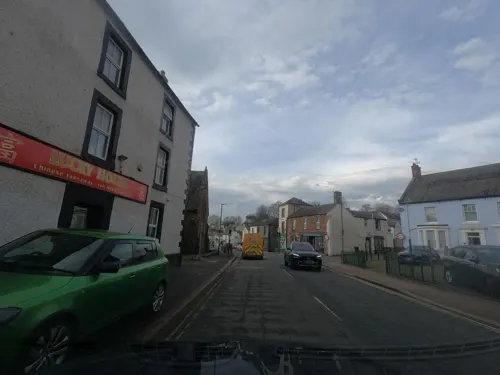
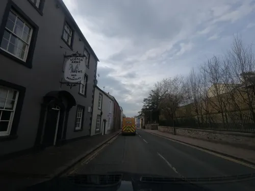
- Street-level photo, floatingboater, CC BY-SA 4.0
- Street-level photo, floatingboater, CC BY-SA 4.0
- Street-level photo, floatingboater, CC BY-SA 4.0
- Street-level photo, floatingboater, CC BY-SA 4.0
- Street-level photo, floatingboater, CC BY-SA 4.0
- Street-level photo, floatingboater, CC BY-SA 4.0
- Street-level photo, floatingboater, CC BY-SA 4.0
- Street-level photo, floatingboater, CC BY-SA 4.0
- Street-level photo, mapz4lolz, CC BY-SA 4.0
- Street-level photo, floatingboater, CC BY-SA 4.0
Page built November 10, 2026. Spotted a mistake? Tell us or suggest a place.