


Larne, United Kingdom
Larne is a town of 18,421 people in Northern Ireland, United Kingdom.
Why visit Larne
Townapedia lists 8 museums and landmarks, 12 parks and trails, 48 places to eat, 6 places to stay and 3 attractions in and around town.
Highlights include Omniplex Larne, Chaine Tower Lighthouse, Olderfleet Castle and Chaine Memorial.
Weather in Larne
Forecast from MET Norway (CC BY 4.0). Full forecast
About Larne
Larne (from Irish Latharna, pronounced [ˈl̪ˠahəɾˠn̪ˠə], the name of a Gaelic territory) is a town on the east coast of County Antrim, Northern Ireland, with a population of 18,853 at the 2021 census. It is a major passenger and freight roll-on roll-off port. Larne is within the Mid and East Antrim Borough Council area. Together with parts of the neighbouring districts of Antrim and Newtownabbey and Causeway Coast and Glens, it forms the East Antrim constituency for elections to the Westminster Parliament and Northern Ireland Assembly.
From the Wikipedia article Larne (this version), under CC BY-SA 4.0.
Travel tips from other travellers: Larne on Wikivoyage (CC BY-SA 4.0).
Things to do3


Museums and landmarks8


Chaine Memorial
Monument and historic site · 0.8 mi
Lighthouse in Larne, County Antrim, Northern Ireland

Larne Museum and Arts Centre
Museum
Museum in Larne, County Antrim, Northern Ireland, UK
Parks, trails and playgrounds12



Restaurants and cafes48
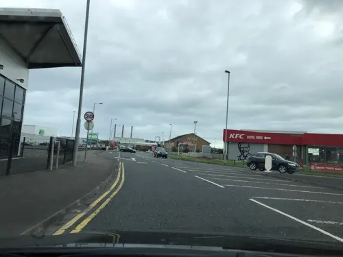


Cafe Riva
Restaurant · Italian
Mo-Th 09:00-21:00; Fr-Sa 09:00-22:00; Su 11:00-20:00



36 more on the map.
History
The coastal area around Larne has been inhabited for millennia and may be one of earliest inhabited areas of Ireland. Knockdhu, north of Larne, was the site of a Bronze Age promontory fort and settlement. Archaeological digs in the area have found flintwork and other artefacts which have been assigned dates from 6000 BCE onwards. The term Larnian has been coined by archaeologists to describe flintworks and similar artefacts of the Mesolithic era and to describe Mesolithic culture in Ireland as a whole. Larnian is also currently used to refer to people from Larne.
From the History section of Larne on Wikipedia, under CC BY-SA 4.0.
More about Larne
Geography
Larne sits within the traditional Glens of Antrim (in an area known historically as the Lower Glynns ). The town occupies the western side of a narrow inlet that links Larne Lough to the sea. On the eastern side of the inlet is a peninsula called Islandmagee. To the west of Larne is the ancient volcanic formation, the Antrim Plateau, which is composed of glaciated valleys or glens. Larne is 25 miles from the Scottish mainland, with views across the North Channel towards the Mull of Kintyre, Rhins of Galloway, Islay and Paps of Jura. This proximity to Scotland has had a defining influence on Larne's history and culture.
The town is within the small parish of the same name. Like the rest of Ireland, this parish is divided into townlands. The following is a list of townlands within Larne's urban area, along with their likely etymologies:
Antiville: one theory in the is that this name comes from An Tigh Bhile meaning the house of the old tree, but other townlands had ville/villa as a direct Norman translation of Bally, e.g. Ballyhacket was Ville Hacket. Ante ville may signify 'in front of the settlement.'
Ballyboley (from Baile Buaile meaning 'townland of the booley/dairy place')
Ballycraigy (from Baile Creige meaning 'townland of the rocky outcrop')
Curran and Drumalis (from Córran meaning 'crescent' and Druim a' Lios meaning 'ridge of the ringfort')
Education
Secondary schools located in Larne are Larne Grammar School and Larne High School. Northern Regional College (formerly Larne Technical College) closed down in 2010 and was replaced by AEL (Access Employment Limited), a training and employment provider for people with disadvantages. Other schools are Roddensvale School, Moyle Primary School, St. MacNissis' Primary School, St. Anthony's Primary School, Linn Primary School, Corran Integrated School, Olderfleet Primary School and Larne & Inver Primary School.
From the Wikipedia article Larne, under CC BY-SA 4.0.
Notable people from Larne
 Gareth McAuleyNorthern Irish association football player (born 1979)Photo: Warwick Gastinger, CC BY-SA 2.0
 Valerie HobsonBritish actress (1917–1998)Photo: Unknown author Unknown author, Public domain
 Arthur McCashinAmerican equestrianPhoto: United Press, Public domain
 Paddy McLaughlinNorthern Irish footballer (born 1991)Photo: DSimmonite, CC BY-SA 4.0
 Sir Daniel Dixon, 1st BaronetBritish politician (1844-1907)Photo: Henrietta Rae, Public domain
- Keith GillespieNorthern Irish footballer (born 1975)
- Michael HughesNorthern Ireland footballer
- Julie NelsonNorthern Irish association football player
- Jeff Hughesfootballer
- Michael Gregory CampbellCatholic bishop
- Jonny SteeleNorthern Irish footballer
- James Augustine McFaulBishop of the Roman Catholic Diocese of Trenton (1850–1917)
Born in Larne, according to Wikidata (CC0). Each name links to its Wikipedia article.
Where to stay6
Churches and places of worship17
Kingdom Hall of Jehovah's Witnesses
Church · Jehovahs Witness · 1.1 mi
1 Seacliff Road, Larne
Shopping11
Gas and EV charging7
Schools, colleges and libraries12
Healthcare3
Map of Larne
127 places. The map loads OpenStreetMap tiles when you open it.
Getting there and nearby towns
George Best Belfast City Airport (BHD) is the nearest airport with scheduled flights listed in OpenStreetMap, 16 miles away.
- Whitehead 8 mi southeast, about 13 min by car
- Carrickfergus 9 mi south, about 15 min by car
- Ballyclare 10 mi southwest, about 16 min by car
- Newtownabbey 14 mi south, about 22 min by car
- Belfast 18 mi south, about 29 min by car
- Newtownards 18 mi south, about 30 min by car
- Lisburn 24 mi south, about 39 min by car
- Portadown 39 mi southwest, about 1 h by car
- Limavady 47 mi west, about 1 h 15 min by car
- Newry 51 mi southwest, about 1 h 15 min by car
Drive times are estimates from straight-line distance, not routes.
Towns near Larne


Keep exploring
Local news
Headlines from INDB.
Reviews, tips and questions
Loading what members have shared...
Sources and licences
- GeoNames (CC BY 4.0): population, coordinates, regions and time zone
- Mapillary (see each image): photos
- OpenStreetMap contributors (ODbL 1.0): places, airports, map data
- Wikidata (CC0 1.0): elevation, founding date, time zone, website, landmarks and historic places
- Wikimedia Commons (see each image): photos
- Wikipedia (CC BY-SA 4.0): overview and history text
Photo credits
- 11.08.25 Larne Town 4009, Phil Richards, CC BY-SA 4.0
- Ruins of Olderfleet Castle, Larne, National Library of Ireland on The Commons, No restrictions
- Street-level photo, laye, CC BY-SA 4.0
- Street-level photo, laye, CC BY-SA 4.0
- Street-level photo, laye, CC BY-SA 4.0
- Street-level photo, laye, CC BY-SA 4.0
- Street-level photo, mackerski, CC BY-SA 4.0
- Street-level photo, laye, CC BY-SA 4.0
Page built November 10, 2026. Spotted a mistake? Tell us or suggest a place.