


Why visit Lees
Townapedia lists 13 museums and landmarks, 14 parks and trails, 134 places to eat and 3 attractions in and around town.
Highlights include Hartshead Pike, Oldham Theatre Workshop, Gallery Oldham and Buckton Castle.
Weather in Lees
Forecast from MET Norway (CC BY 4.0). Full forecast
About Lees
Lees is a town in the Metropolitan Borough of Oldham, Greater Manchester, England, amongst the Pennines east of the River Medlock, 1.8 miles (2.9 km) east of Oldham, and 8.2 miles (13.2 km) northeast of Manchester.
From the Wikipedia article Lees, Greater Manchester (this version), under CC BY-SA 4.0.
Photos of Lees


Things to do3


Oldham Theatre Workshop
Cinema and theater · 1.6 mi
Youth theatre group based in the north west of England
Greaves Street, Oldham
Oldham Coliseum Theatre
Cinema and theater · 1.5 mi
Theatre and former cinema in Oldham, Greater Manchester, England
Museums and landmarks13

Gallery Oldham
Museum · 1.5 mi
Art gallery in Greater Manchester, England, United Kingdom
35 Greaves Street, Oldham
Tu-Sa 10:00-17:00; PH off

Buckton Castle
Monument and historic site · 2.9 mi
12th-century castle in Mossley, Greater Manchester, England, UK

Crompton War Memorial
Monument and historic site · 2.7 mi
War memorial in Shaw and Crompton, Oldham, Greater Manchester, England, UK

Oldham War Memorial
Monument and historic site · 1.6 mi
War memorial in Oldham, Greater Manchester, England, UK
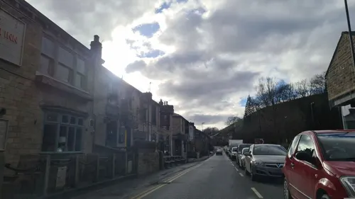
Saddleworth Museum and Gallery
Museum · 2.8 mi
Museum in Uppermill, Oldham, Greater Manchester, England, United Kingdom
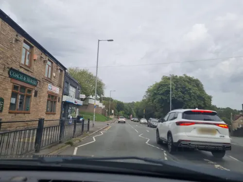


1 more on the map.
Parks, trails and playgrounds14

Alexandra Park
Park · 1.3 mi
Park in Oldham, Greater Manchester, England, UK



Werneth Park, Oldham
Park · 2.4 mi
Public park in Oldham, Greater Manchester, United Kingdom


2 more on the map.
Restaurants and cafes134
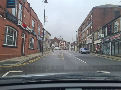
Lees Spice Lounge
Restaurant · Indian
73 High Street, Oldham
Mo-Th 17:00-23:00; Fr-Sa 17:00-00:00; Su 15:00-22:00
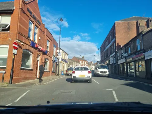
Cha Cha Chai
Cafe · 1.5 mi
34-36 Yorkshire Street, Oldham
Mo-Fr 11:00-23:00




122 more on the map.
History
The settlement dates back to the 14th century and is thought to have been named after former retainer of the manor, John de Leghes.
Lees was one of the localities which, on 16 August 1819, sent a contingent of parishioners to the mass public demonstration at Manchester, now known as the Peterloo massacre. In the week before Peterloo (an assembly demanding the reform of parliamentary representation), weavers in Lees had paraded through the village with a large black flag adorned with the slogans "no Borough Mongering, Taxation Without Representation is Unject and Tyrannical," and "Unite and be Free, Equal Representation or Death". The growing unrest in the village prompted one alarmed inhabitant to write to the Home Office.
Read more of the history
In the late 18th century, a natural chalybeate spring was discovered in the locality, and by the early 19th century the village gained a reputation for these "fashionable" mineral springs. In the early 19th century, water from Lees Spa, had become fashionable to drink, so much so, that it was bottled and sold around the country. In the month of August 1821, 60,000 people visited Lees Spa. Ambitions to develop Lees into a spa town – "Lancashire's very own Harrogate" – were thwarted by an unplanned process of urbanisation caused by introduction and profitability of textile manufacture during the Industrial Revolution. The Industrial Revolution brought cotton spinning to Lees in the form of eleven mills, which by the late 19th century, had changed the character of the village completely.
Springhead-born Annie Kenney, one of the first suffragettes to be imprisoned worked at Lees's Leesbrook Mill. Annie's younger, Lees-born sister Jessie Kenney was also a campaigner for women's suffrage in the United Kingdom. By the age of 21 Jessie was the Women's Social and Political Union's youngest organiser.
Lees has grown in size in terms of both amenities and residential population, in its role as a commuter village for people working in Oldham and West Yorkshire. It is home to commercial and distribution companies. The main street is notable for the number of public houses in close proximity.
From the History section of Lees, Greater Manchester on Wikipedia, under CC BY-SA 4.0.
More about Lees
Geography
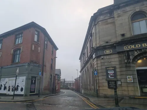
The village consists of a small cluster of shops and businesses on either side of the A669 Lees High Street, surrounded by some terraced houses, cottages and some small estates. Lees is separated from the main conurbation of Oldham by a small amount of green belt land in the valley of Leesbrook, on either bank of the River Medlock.
A part of Lees is known locally as County End; Springhead in Saddleworth forms a contiguous urban area with Lees, though the border between the two forms part of the ancient county boundary between Lancashire and the West Riding of Yorkshire. Crossbank is an area of Lees.
From the Wikipedia article Lees, Greater Manchester, under CC BY-SA 4.0.
Notable people from Lees
 Jenny KenneyBritish suffragette and Montessori teacherPhoto: Colonel Linley Blathwayt, Public domain
- Jessie KenneyUK suffragette
- Laurence ChadertonEnglish bible translator (1536-1640)
- Nell KenneySuffragette (1876-1953)
- Helen BradleyBritish artist (1900-1979)
- Arthur LeesEnglish rugby union and rugby league footballer
Born in Lees, according to Wikidata (CC0). Each name links to its Wikipedia article.
Churches and places of worship46
Shopping14
Gas and EV charging6
Schools, colleges and libraries34
Healthcare15
Glodwick Primary Care Centre
Clinic and pharmacy · 0.9 mi
137 Glodwick Road, Oldham
Springfield House Medical Centre
Clinic and pharmacy · 0.9 mi
275 Huddersfield Road, Oldham
Map of Lees
250 places. The map loads OpenStreetMap tiles when you open it.
Getting there and nearby towns
Manchester Airport (MAN) is the nearest airport with scheduled flights listed in OpenStreetMap, 16 miles away.
- Oldham 2 mi west, about 3 min by car
- Royton 3 mi northwest, about 4 min by car
- Saddleworth 3 mi east, about 5 min by car
- Stalybridge 4 mi south, about 6 min by car
- Littleborough 7 mi north, about 12 min by car
- Manchester 8 mi southwest, about 13 min by car
- Prestwich 9 mi west, about 14 min by car
- Whitefield 9 mi west, about 15 min by car
- Stockport 10 mi south, about 15 min by car
- Salford 10 mi west, about 15 min by car
Drive times are estimates from straight-line distance, not routes.
Towns near Lees


Keep exploring
Local news
Headlines from INDB.
Reviews, tips and questions
Loading what members have shared...
Sources and licences
- GeoNames (CC BY 4.0): population, coordinates, regions and time zone
- Mapillary (see each image): photos
- OpenStreetMap contributors (ODbL 1.0): places, airports, map data
- Wikidata (CC0 1.0): elevation, founding date, time zone, website, landmarks and historic places
- Wikimedia Commons (see each image): photos
- Wikipedia (CC BY-SA 4.0): overview and history text
Photo credits
- Lees, Greater Manchester, Martin Clark, CC BY-SA 2.0
- Bus stop Lees, Joeymarsbar, CC BY-SA 4.0
- POPPY IN LEES, JoeyFishBoy, CC BY-SA 4.0
- Poppy in lees2, JoeyFishBoy, CC BY-SA 4.0
- Leeschristmastree, JoeyFishBoy, CC BY-SA 4.0
- High Street shops Lees, Joeymarsbar, CC BY-SA 4.0
- Christmas tree in lees square with a purple sky and a tree, JoeyFishBoy, CC BY-SA 4.0
- The Square in Lees, Joeymarsbar, CC BY-SA 4.0
- Angel Inn Lees, Joeymarsbar, CC BY-SA 4.0
- Lees Centre, JoeyFishBoy, CC BY-SA 4.0
- High Street Lees towards Stamford Street, Joeymarsbar, CC BY-SA 4.0
- Stamford Street Lees, Joeymarsbar, CC BY-SA 4.0
- The Square Lees, Joeymarsbar, CC BY-SA 4.0
- View of Lees in the rain, Joeymarsbar, CC BY-SA 4.0
- Lees high street facing towards the legends pub, JoeyFishBoy, CC BY-SA 4.0
- High Street Lees may, Joeymarsbar, CC BY-SA 4.0
- Lees Library May, Joeymarsbar, CC BY-SA 4.0
- Gallery Oldham, SMJ, CC BY-SA 2.0
- Buckton Castle (5) (28563211972), Richard Nevell from London, United Kingdom, CC BY-SA 2.0
- Crompton War Memorial (1), Rept0n1x, CC BY-SA 2.0
- Oldham War Memorial, Narniauk at English Wikipedia, Public domain
- Alexandra Park, Peter Hyde, CC BY-SA 2.0
- Stamford Park, Tameside (5), Rept0n1x, CC BY-SA 3.0
- Oldham Parish Church of St. Mary with St. Peter (1), Rept0n1x, CC BY-SA 3.0
- Friarmere St. Thomas, Michael Ely, CC BY-SA 2.0
- St Thomas, Lees, David Dixon, CC BY-SA 2.0
- St James Church, Oldham, David Dixon, CC BY-SA 2.0
- Hartshead Pike (1), RandomDan at English Wikipedia, Public domain
- High Street barber Pole, Joeymarsbar, CC BY-SA 4.0
- High Street facing Stamford Street, Joeymarsbar, CC BY-SA 4.0
- The Swan on the High Street, Joeymarsbar, CC BY-SA 4.0
- High Street opposite The Swan, Joeymarsbar, CC BY-SA 4.0
- High Street Countys End, Joeymarsbar, CC BY-SA 4.0
- Stannybrook road on daisy nook, Marc A Gibbs, CC BY-SA 4.0
- Street-level photo, mappo2, CC BY-SA 4.0
- Street-level photo, mappo2, CC BY-SA 4.0
- Street-level photo, mappo2, CC BY-SA 4.0
- Street-level photo, mappo2, CC BY-SA 4.0
- Street-level photo, mappo2, CC BY-SA 4.0
- Street-level photo, mappo2, CC BY-SA 4.0
- Street-level photo, mappo2, CC BY-SA 4.0
- Street-level photo, mappo2, CC BY-SA 4.0
- Street-level photo, mappo2, CC BY-SA 4.0
- Street-level photo, mappo2, CC BY-SA 4.0
- Street-level photo, mappo2, CC BY-SA 4.0
- Street-level photo, mappo2, CC BY-SA 4.0
- Street-level photo, mappo2, CC BY-SA 4.0
- Street-level photo, mappo2, CC BY-SA 4.0
- Street-level photo, mappo2, CC BY-SA 4.0
- Street-level photo, mappo2, CC BY-SA 4.0
- Street-level photo, mappo2, CC BY-SA 4.0
- Street-level photo, mappo2, CC BY-SA 4.0
- Street-level photo, mappo2, CC BY-SA 4.0
- Street-level photo, mappo2, CC BY-SA 4.0
- Street-level photo, mappo2, CC BY-SA 4.0
- Street-level photo, mappo2, CC BY-SA 4.0
- Street-level photo, mappo2, CC BY-SA 4.0
- Street-level photo, mappo2, CC BY-SA 4.0
- Street-level photo, mappo2, CC BY-SA 4.0


Page built November 10, 2026. Spotted a mistake? Tell us or suggest a place.