


Stalybridge, United Kingdom
Stalybridge is a town of 26,830 people in England, United Kingdom.
Why visit Stalybridge
Townapedia lists 10 museums and landmarks, 14 parks and trails, 78 places to eat, 1 place to stay and 3 attractions in and around town.
Highlights include Tameside Hippodrome, Theatre Royal, Stalybridge War Memorial and Ashton Under Lyne War Memorial.
Weather in Stalybridge
Forecast from MET Norway (CC BY 4.0). Full forecast
About Stalybridge
Stalybridge () is a town in Tameside, Greater Manchester, England. At the 2021 census, it had a population of 26,830.
From the Wikipedia article Stalybridge (this version), under CC BY-SA 4.0.
Things to do3
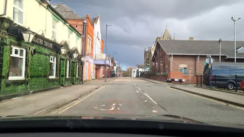
Tameside Hippodrome
Cinema and theater · 1.6 mi
Theatre and former cinema in Ashton-under-Lyne, Greater Manchester, England, UK

Theatre Royal
Cinema and theater · 2.5 mi
Former theatre and cinema in Hyde, Greater Manchester, England, UK

Museums and landmarks10

Stalybridge War Memorial
Monument and historic site
War memorial in Stalybridge, Greater Manchester, England, UK

Ashton Under Lyne War Memorial
Monument and historic site · 1.2 mi
War memorial in Tameside, Greater Manchester, England, UK

Buckton Castle
Monument and historic site · 2.5 mi
12th-century castle in Mossley, Greater Manchester, England, UK


Replica of the old cross
Monument and historic site · 1.3 mi
The first reference to Ashton market cross comes from local marriage registers of 1854. The ancient cross was replaced in 1763 or 1764...
Parks, trails and playgrounds14


Bower Fold
Sports field and stadium · 0.9 mi
Mottram Road, Stalybridge


2 more on the map.
Restaurants and cafes78
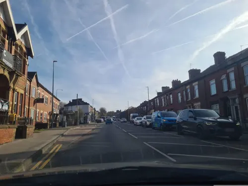
Candolim
Restaurant · Indian · 0.4 mi
71 Mottram Road, Stalybridge
Mo-Th 17:00-23:00; Fr,Sa 17:00-24:00; Su 16:30-23:00
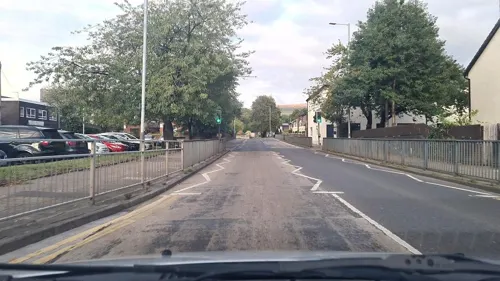
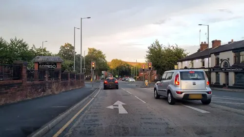


Pizza Hut
Restaurant · Pizza · 1.4 mi
4-8 Henrietta Street, Ashton-under-Lyne
Mo-Su 11:00-23:00
The Railway
Bar and pub · 1.5 mi
52-54 Wellington Road, Ashton-under-Lyne
Mo-Su 12:00-22:00
Bridge Beers
Bar and pub
55 Melbourne Street, Stalybridge
Open at least on Thursday in Summer
66 more on the map.
History
The earliest evidence of human activity in Stalybridge is a flint scraper from the late Neolithic/early Bronze Age. Also bearing testament to the presence of man in prehistory are the Stalybridge cairns. The two monuments are on the summit of Hollingworthall Moor, 153 yards (140 m) apart. One of the round cairns is the best-preserved Bronze Age monument in Tameside and is protected as a scheduled monument. A branch of the Roman road between the forts at Manchester (Mamucium) and Melandra Castle (Ardotalia) is thought to run through Stalybridge to the fort of Castleshaw.
The settlement was originally called Stavelegh, which derives from the Old English stæf leah, meaning "wood where the staves are got". The medieval lords of the manor took de Stavelegh as their name, later becoming Stayley or Staley. The lordship of Longdendale was one of the ancient feudal estates of Cheshire and included the area of Stalybridge. Buckton Castle, near Stalybridge, was probably built by one of the earls of Chester in the 12th century. William de Neville was the first lord of Longdendale, appointed by the Earl of Chester between 1162 and 1186. The lordship of Longdendale included the manors of Staley, Godley, Hattersley, Hollingworth, Matley, Mottram, Newton, Tintwistle and Werneth; the manor of Staley was first mentioned between 1211 and 1225.
Read more of the history
The first records of the de Stavelegh family as lords of the manor of Staley date from the early 13th century. Staley Hall was their residence. The present hall was built in the late 16th century, on the same site as an earlier hall of the Stayley family which dated from before 1343.
Sir Ralph Staley (descendant of the de Stavelegh family) had no male heirs but an only daughter, Elizabeth Staley, who married Sir Thomas Assheton and united the manors of Ashton and Staley. Elizabeth and Thomas had two daughters and no sons. Margaret, the eldest of their two daughters, married Sir William Booth of Dunham Massey. The younger daughter Elizabeth was widowed and without children, and continued to live at Staley Hall until her death in 1553. In her will, her share of the lordships of Staley and Ashton were left to the Booths.
The manor of Staley remained in the possession of the Booth family until the death of George Booth, 2nd Earl of Warrington on 2 August 1758. Upon his death, the Earldom of Warrington became extinct. His only daughter, Lady Mary Booth, the wife of Harry Grey, 4th Earl of Stamford, inherited all the Booth estates. The manor of Staley was owned by the Grey family until the extinction of the Earldom of Stampford on the death of Roger Grey, 10th Earl of Stamford in 1976. At this point, the family estates were dispersed. Stamford Street, Grey Street, Groby Street, Stamford Park, Stamford Golf Club and the two Stamford Arms public houses in Stalybridge are all named after the Grey family.
As Stayley expanded in the 18th century, it reached the banks of the river Tame. After the construction of a bridge in 1707, the settlement was commonly referred to as Stalybridge, meaning the bridge at Stayley. By the mid-18th century, Stalybridge had a population of just 140; farming and woolen spinning were the main means of subsistence at this time.
In 1776, the town's first water-powered mill for carding and spinning cotton was built at Rassbottom. In 1789, the town's first spinning mill using the principle of Arkwright's water frame was built. By 1793, steam power had been introduced to the Stalybridge cotton industry; in 1803, there were eight cotton mills in the growing town containing 76,000 spindles. The Huddersfield Narrow Canal was completed in 1811 and still runs through the town.
The rapid growth of industry in Stalybridge was due to the introduction of machinery. This was, however, met with violent opposition. After the arrival of the Luddites in the area the doors of mills were kept locked day and night. Military aid was requested by the mill owners and a Scottish regiment under the Duke of Montrose was sent to the town. It was led by Captain Raines who made his headquarters at the Roe Cross Inn. Gangs of armed men destroyed power looms and fired mills. The disturbances in Stalybridge culminated with a night of violent rioting on 20 April 1812.
The social unrest did not curb the growth of Stalybridge. By 1814, there were twelve factories and, by 1818, the number had increased to 16. The Industrial Revolution led to a rapid increase in the town's population in the early part of the 19th century. The population of the town by 1823 was 5,500; in the following two years, partly because of an influx of Irish families seeking better wages, it rose to 9,000. Stalybridge was among the first wave of towns to establish a Mechanics' Institute with a view to educating the growing number of workers. Only a year after the establishment of Manchester Mechanics' Institute, Stalybridge founded an institute of its own. Its doors opened on 7 September 1825 on Shepley Street with a reading room on Queen Street.
On 9 May 1828, the Stalybridge Police and Market Act received royal assent, establishing Stalybridge as an independent town with a board of 21 commissioners. Every male over the age of 21 who was the occupier of a rateable property under the act was entitled to vote at the election of the commissioners. On 30 December 1831, Stalybridge Town Hall was officially opened. In 1833, the commissioners set up the Stalybridge Police Force, the first of its kind in the country. By this year, the population of the town had reached 14,216 with 2.357 inhabited houses.
In 1834, a second bridge was built over the Tame. It was downstream of Staley Bridge and constructed of iron.
From the History section of Stalybridge on Wikipedia, under CC BY-SA 4.0.
More about Stalybridge
Geography
Stalybridge lies in the foothills of the Pennines, straddling the river Tame, which forms part of the ancient boundary between Lancashire and Cheshire, on the boundary of the Peak District national park. The highest point in the town is the summit of Wild Bank, at 1,309 feet (399 m). Harridge Pike is the second highest peak at 1,296 ft (395 m). Buckton Hill, the site of the mediaeval Buckton Castle, is another prominent landmark.
The town centre itself is situated along the banks of the river between Ridge Hill to the north and Hough Hill 801 ft (244 m) to the south. Stalybridge weather station is staffed by volunteers and has been providing statistics since 1999. The local bedrock is millstone grit, covered by a thin layer of soil over clay, with surface rock outcrops.
Over the course of the 20th century, the population of the town declined, particularly after the demolition of the mid-19th century high-density housing. At the 2001 census, Stalybridge had a population of 22,568. The town includes the localities of Heyheads, Buckton Vale, Carrbrook, Millbrook, Brushes Estate, Copley, Mottram Rise, Woodlands, Matley, Hough Hill, Castle Hall, Hollins Street, Hydes, Rassbottom, Waterloo, Cocker Hill, the Hague, Springs, Ridge Hill and Heyrod.
Arts and culture
The song It's a Long Way to Tipperary was created in the Newmarket Tavern, by the composer Jack Judge in 1912, after being challenged to write, compose and produce a song in just one night. It was first sung in public by him in the Grand Theatre on Corporation Street on 31 January 1912. On 31 January 1953, a memorial tablet was unveiled by Jack Hylton on the wall of the old Newmarket Tavern, where the song was composed. To coincide with the ceremony a wreath was laid on Jack Judge's grave, by the mayor of Oldbury. Jack Judge is now also commemorated by a statue in Lord Pendry Square outside the Old Victoria Market Hall.
Stalybridge Old Band was formed in 1809, perhaps the first civilian brass band in the world. The band currently contests in the second section. Carrbrook Brass currently contests in the fourth section and represent the town annually at the Armentières festival. An annual brass band contest has been held in the town on Whit Friday, since at least 1870. Other contests have been held on the same day in the surrounding villages of Millbrook, Carrbrook and Heyrod. There is now an established tradition of holding brass band contests on this day around Stalybridge, Mossley and Saddleworth. Bands travel by coach from all over the United Kingdom, and sometimes from other countries, to contest in as many different locations as possible on the day.
Education
Before 1910, primary education was provided by the church schools. In 1910, the borough opened its own school on Waterloo Road. In 1927, West Hill School, a central school for boys was opened; the central school for girls opened in 1930. Until 1980, secondary modern education was provided by schools in the town itself; with selective education by Hyde Grammar School. For Roman Catholic pupils, grammar school education was provided by Harrytown, in Bredbury, and Xaverian, in Rusholme. Catholic secondary modern education was available from 1963 at St Peter and St Paul, Dukinfield.
In 1977, the local education authority appealed to keep its grammar schools rather than be forced by the government to adopt a comprehensive system. The Lord of Appeal, Lord Lane, was personally critical of Fred Mulley, the Secretary of State for Education and Science for being "far from frank" about his reason for intervening in Tameside and joined in the judgement which found for Tameside and brought a halt to comprehensivisation. However, following the election of a Labour council in 1980, the local grammar schools were abolished and all the secondary modern and grammar schools in Stalybridge, Hyde and Dukinfield became comprehensives.
St Peter's RC Primary School and Nursery Voluntary Aided by the Diocese of Shrewsbury
St Paul's C of E Primary School Voluntary Aided by the Diocese of Chester
From the Wikipedia article Stalybridge, under CC BY-SA 4.0.
Notable people from Stalybridge
 Rob HoldingEnglish association football playerPhoto: Bryan Berlin, CC BY-SA 4.0
 Tim WillocksBritish writerPhoto: Kontrola, CC BY-SA 4.0
 Peter KenyonBritish businessmanPhoto: Рыбакова Елена, CC BY-SA 3.0
 John AshtonAmerican architectPhoto: Daderot, CC0
 Hugh MasonEnglish mill owner, social reformer and Liberal politician (1817-1886)Photo: Unknown author Unknown author, Public domain
 George ShawBritish academic dress scholar (1928–2006)Photo: Nicholas Jackson, CC BY-SA 3.0
 Mera Royleharpist, violinist and composerPhoto: Culture Vannin, CC BY 3.0
- Mark WilliamsNorthern Irish footballer (born 1970)
- Jimmy BroadEnglish footballer (1891-1963)
- Tommy BroadEnglish footballer (1887-1966)
- William J. PorterAmerican diplomat (1914-1988)
- Patrick AuldSouth Australian vigneron and wine merchant (1840-1912)
Born in Stalybridge, according to Wikidata (CC0). Each name links to its Wikipedia article.
Where to stay1
Churches and places of worship35
St Michael and All Angels' Church, Ashton-under-Lyne
Church · 1.3 mi
Shopping15
Gas and EV charging10
Schools, colleges and libraries38
Parochial Church of England Primary and Nursery School
School · Anglican · 1.1 mi
Keppel Street, Ashton-under-Lyne
St James' Church of England Primary School
School · Anglican · 1.3 mi
Romney Street, Ashton-under-Lyne
Hurst Knoll St James' Church of England Primary School
School · Anglican · 1.4 mi
Ladbrooke Road, Ashton-under-Lyne
Our Lady of Mount Carmel RC Primary School
School · Roman Catholic · 1.2 mi
Holden Street, Ashton-under-Lyne
St Christopher's RC Primary School
School · Roman Catholic · 1.5 mi
St Christopher's Road, Ashton-under-Lyne
Healthcare9
Map of Stalybridge
213 places. The map loads OpenStreetMap tiles when you open it.
Getting there and nearby towns
Manchester Airport (MAN) is the nearest airport with scheduled flights listed in OpenStreetMap, 13 miles away.
- Oldham 5 mi northwest, about 7 min by car
- Stockport 7 mi southwest, about 11 min by car
- Manchester 7 mi west, about 12 min by car
- Salford 10 mi west, about 15 min by car
- Whitefield 11 mi northwest, about 18 min by car
- Swinton 12 mi west, about 19 min by car
- Wilmslow 13 mi southwest, about 21 min by car
- Timperley 13 mi southwest, about 20 min by car
- Huddersfield 16 mi northeast, about 26 min by car
- Bolton 17 mi northwest, about 27 min by car
Drive times are estimates from straight-line distance, not routes.
Towns near Stalybridge


Keep exploring
Local news
Headlines from INDB.
Reviews, tips and questions
Loading what members have shared...
Sources and licences
- GeoNames (CC BY 4.0): population, coordinates, regions and time zone
- Mapillary (see each image): photos
- OpenStreetMap contributors (ODbL 1.0): places, airports, map data
- Wikidata (CC0 1.0): elevation, founding date, time zone, website, landmarks and historic places
- Wikimedia Commons (see each image): photos
- Wikipedia (CC BY-SA 4.0): overview and history text
Photo credits
- Stalybridge, Andrewlee1967, CC BY-SA 3.0
- Theatre Royal, Hyde, Izzak, CC BY-SA 3.0
- Stalybridge war memorial (6), Rept0n1x, CC BY-SA 3.0
- Ashton-under-Lyne War Memorial (1), Rept0n1x, CC BY-SA 3.0
- Buckton Castle (5) (28563211972), Richard Nevell from London, United Kingdom, CC BY-SA 2.0
- Albion United Reformed Church, Ashton under Lyne, A. Carty ( talk ), CC BY-SA 3.0
- St John's Church, Dukinfield, Gerald England, CC BY-SA 2.0
- St Lawrence's Church, Denton 2005, Roger May, CC BY-SA 2.0
- Mottram Church 01, A. Carty at English Wikipedia, Public domain
- St Michaels and All Saints Church, Ashton-under-Lyne 2008, Gerald England, CC BY-SA 2.0
- Stamford Park, Tameside (5), Rept0n1x, CC BY-SA 3.0
- St John's Church, Hurst, David Dixon, CC BY-SA 2.0
- Bower Fold 2018, Ytfc23, CC BY-SA 4.0
- Stannybrook road on daisy nook, Marc A Gibbs, CC BY-SA 4.0
- Swallows Wood 013, Clem Rutter, Rochester, Kent., CC BY-SA 3.0
- Street-level photo, mappo2, CC BY-SA 4.0
- Street-level photo, mappo2, CC BY-SA 4.0
- Street-level photo, mappo2, CC BY-SA 4.0
- Street-level photo, mappo2, CC BY-SA 4.0
- Street-level photo, mappo2, CC BY-SA 4.0
- Street-level photo, adam2, CC BY-SA 4.0
- Street-level photo, mappo2, CC BY-SA 4.0
- Street-level photo, mappo2, CC BY-SA 4.0
- Street-level photo, mappo2, CC BY-SA 4.0
- Street-level photo, mappo2, CC BY-SA 4.0
- Street-level photo, mappo2, CC BY-SA 4.0
- Street-level photo, mappo2, CC BY-SA 4.0
- Street-level photo, mappo2, CC BY-SA 4.0
- Street-level photo, mappo2, CC BY-SA 4.0
- Street-level photo, mappo2, CC BY-SA 4.0
- Street-level photo, mappo2, CC BY-SA 4.0


Page built November 10, 2026. Spotted a mistake? Tell us or suggest a place.