


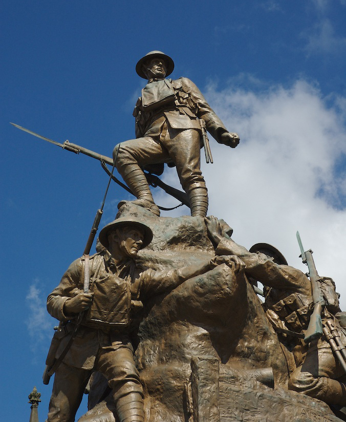

Saddleworth, United Kingdom
Saddleworth is a town of 25,441 people in England, United Kingdom.
Why visit Saddleworth
Townapedia lists 39 museums and landmarks, 41 parks and trails, 260 places to eat, 8 places to stay and 34 attractions in and around town.
Highlights include Black Chew Head, Hartshead Pike, Gallery Oldham and Buckton Castle.
Weather in Saddleworth
Forecast from MET Norway (CC BY 4.0). Full forecast
About Saddleworth
Saddleworth is a civil parish of the Metropolitan Borough of Oldham in Greater Manchester, England. It comprises several villages and hamlets as well as suburbs of Oldham on the west side of the Pennine hills.
From the Wikipedia article Saddleworth (this version), under CC BY-SA 4.0.
Photos of Saddleworth


Things to do34



Oldham Theatre Workshop
Cinema and theater · 4.4 mi
Youth theatre group based in the north west of England
Greaves Street, Oldham
Oldham Coliseum Theatre
Cinema and theater · 4.3 mi
Theatre and former cinema in Oldham, Greater Manchester, England
Tameside Hippodrome
Cinema and theater · 5.7 mi
Theatre and former cinema in Ashton-under-Lyne, Greater Manchester, England, UK


Harrops
Farm and orchard · 0.9 mi
135 Chew Valley Road, Oldham
Mo-Fr 08:00-17:00; Sa 08:00-14:00
22 more on the map.
Museums and landmarks39

Gallery Oldham
Museum · 4.3 mi
Art gallery in Greater Manchester, England, United Kingdom
35 Greaves Street, Oldham
Tu-Sa 10:00-17:00; PH off

Buckton Castle
Monument and historic site · 2.6 mi
12th-century castle in Mossley, Greater Manchester, England, UK

Crompton War Memorial
Monument and historic site · 4.2 mi
War memorial in Shaw and Crompton, Oldham, Greater Manchester, England, UK

Oldham War Memorial
Monument and historic site · 4.4 mi
War memorial in Oldham, Greater Manchester, England, UK

Ashton Under Lyne War Memorial
Monument and historic site · 5.4 mi
War memorial in Tameside, Greater Manchester, England, UK

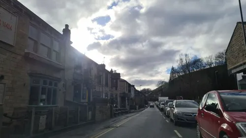
Saddleworth Museum and Gallery
Museum
Museum in Uppermill, Oldham, Greater Manchester, England, United Kingdom

Stalybridge War Memorial
Monument and historic site · 5.0 mi
War memorial in Stalybridge, Greater Manchester, England, UK

Tandle Hill
Monument and historic site · 6.0 mi
Hill and country park in Greater Manchester, England


Castleshaw Roman fort
Monument and historic site · 2.4 mi
Roman fort in Saddleworth, Greater Manchester, England, UK
Ellenroad Ring Mill Engine
Museum · 5.6 mi
Stationary steam engine and museum in Milnrow, Rochdale, Greater Manchester, England, UK
27 more on the map.
Parks, trails and playgrounds41

Alexandra Park
Park · 4.2 mi
Park in Oldham, Greater Manchester, England, UK




Werneth Park, Oldham
Park · 5.3 mi
Public park in Oldham, Greater Manchester, United Kingdom


29 more on the map.
Restaurants and cafes260
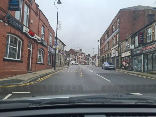
Lees Spice Lounge
Restaurant · Indian · 2.9 mi
73 High Street, Oldham
Mo-Th 17:00-23:00; Fr-Sa 17:00-00:00; Su 15:00-22:00
Pizza Love
Restaurant · Pizza · 2.5 mi
Huddersfield Road, Ashton-under-Lyne
We-Th 04:00-08:00, Fr 16:00-21:00, Sa 12:00-19:00, Su 12:00-20:00
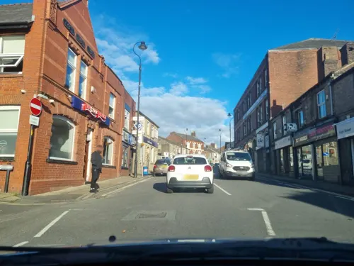



Cafe East Oldham
Restaurant · 4.4 mi
13 Yorkshire Street, Oldham
Mo-Th 12:00-23:00; Fr-Sa 12:00-00:00; Su 16:00-23:00

248 more on the map.
History
The first documentary evidence of Saddleworth appears in the Domesday Book of 1086, in which it is referred to as "Quick", spelt "Thoac"; where it is described as "Land of the King in Eurvicsire (Yorkshire), Agbrigg Wapentake."
The history of the region clearly dates further back than the Domesday Book however. Place names derived from Celtic and Anglian dialects, along with the discovery of flint arrowheads and gold Viking rings all point to a much earlier Saddleworth, possibly as old as the Stone Age. A Roman road from Chester to York passed through the area. Castleshaw Roman fort was built to defend and patrol the local section of the road. The first fort on the site was an Agricolan-period fort, built in turf and timber c. AD 79. This was refurbished soon after construction and then abandoned c. AD 95. Within the south eastern half of the fort, a fortlet was constructed, also in turf and timber, c. AD 105. This was redeveloped during its brief occupation and then abandoned again c. AD 125. In the Saddleworth area is a bowl barrow, which may be Bronze Age, located at grid reference SD98010746. Despite excavations, no grave goods or human remains have been found in the barrow.
Read more of the history
The steep slopes of the Saddleworth area and the acidic soils of the region have never been particularly conducive to intensive farming; meaning that long before the Victorian era, Saddleworth already had a long established, albeit domestic, textile tradition. Small, basic mills had been existent in Saddleworth before the industrial revolution, but these were increasingly replaced by larger more intensive establishments. By the end of Queen Victoria's reign, mechanised textile production had become a vital part of the local economy.
The boom in industry that had occurred in Saddleworth during the Industrial Revolution called for greater transport links. Construction of the Huddersfield Narrow Canal was begun in 1794, at the height of Canal Mania, connecting Huddersfield to Stalybridge via Saddleworth and completed seventeen years later in 1811; when the Standedge Canal Tunnel at Diggle was finally opened. The decline of canals and the rise of steam powered locomotives left the canal falling behind the competition, and so it was decided that a railway tunnel would be built parallel to the canal, which was completed in 1848. The rise in traffic demanded a second tunnel be built, completed in 1871. Both of these were single line tunnels and eventually superseded by the 1894 tunnel, a double line tunnel, which is the only one of the three still regularly carrying passengers.
The three brothers, Ralph Radcliffe Whitehead, James Heywood Whitehead and Francis Frederick Whitehead, were extremely philanthropic and amongst other bequests in the 1850s built Christ Church in Friezland along with the Parsonage, School and Headmaster's house. The land on which these were built was purchased in 1849 from L. & N.W. Railway Company. The Church School has been rebuilt and the Parsonage and grounds, built in the Gothic Revival style and referred to in Pevsner's Guide, has become a Grade II listed building, now in private hands. The boom in industry called for greater transport links, including the Huddersfield Narrow Canal and several railways.
Unlike the majority of the Oldham Metropolitan Borough, where the industrial architecture was generally constructed from Accrington redbrick, Saddleworth's textiles mills and supporting infrastructure was made from the local millstone grit. This is in keeping with other settlements amongst the southwest Pennines, such as Milnrow near Rochdale.
From the History section of Saddleworth on Wikipedia, under CC BY-SA 4.0.
More about Saddleworth
Geography
Saddleworth makes up around 52% 29.4 square miles (76 km2) of the Metropolitan Borough of Oldham in terms of area, and remains largely rural. Saddleworth Moor in the Dark Peak area of the Peak District National Park is a moorland plateau that straddles the boundary with West Yorkshire.
Bounded directly to the west by Oldham and the Metropolitan Borough of Rochdale in the north, Tameside in the south and Kirklees in the east. Saddleworth is 12 miles (19 km) southwest of Huddersfield.
Saddleworth contains a collection of villages and hamlets, including:
Arts and culture
Since the local government reforms of 1974, some of the people of Saddleworth have been uneasy about their primary geographic reference frame, with parts of the local community feeling aggrieved at Saddleworth forming part of Greater Manchester. Saddleworth, where the local architecture of stone cottages is of the Yorkshire type, is the only part of the Metropolitan Borough of Oldham to come from the historic county boundaries of Yorkshire, the rest being from Lancashire. It is also the only part of the metropolitan county of Greater Manchester which lay within those borders.
The Saddleworth White Rose Society organises events every Yorkshire Day (1 August) to promote its contention that Saddleworth remains part of the West Riding of Yorkshire. The Prince of Wales referred to Saddleworth's continuing Yorkshire status when he visited the area in 2001 saying "The fact that Saddleworth is still part of the historic West Riding is extremely important".
From the Wikipedia article Saddleworth, under CC BY-SA 4.0.
Notable people from Saddleworth
 Ivan HirstEngineer, British Army officer, reviver of post-World War II VolkswagenPhoto: Ivan Hirst: the story of how he..., Public domain
 Ralph Radcliffe WhiteheadEnglish benefactor of the Byrdcliffe Arts and Crafts Colony (1854-1929)Photo: J. Caswall Smith, Public domain
 Seb Lowesinger‐songwriter from United Kingdom (born 2003)Photo: Matthew04020, CC BY 4.0
- Michael BroadbentBritish wine critic (1927-2020)
- Hervey Rhodes, Baron RhodesBritish politician (1895-1987)
- Albert Rhodescricketer (1889-1970)
- David BowerAustralian politician (1819-1898)
- Joe WalshEnglish rugby league footballer
- G. B. BuckleySurgeon and cricket historian
Born in Saddleworth, according to Wikidata (CC0). Each name links to its Wikipedia article.
Where to stay8
Churches and places of worship81
Oldham Parish Church of St. Mary with St. Peter
Church · Anglican · 4.4 mi
Church Passage, Oldham
Shopping42
Gas and EV charging13
Schools, colleges and libraries65
St Joseph's RC Junior, Infant and Nursery School
School · Roman Catholic · 4.2 mi
Oldham Road, Oldham
Healthcare27
Map of Saddleworth
250 places. The map loads OpenStreetMap tiles when you open it.
Getting there and nearby towns
Manchester Airport (MAN) is the nearest airport with scheduled flights listed in OpenStreetMap, 18 miles away.
- Oldham 5 mi west, about 8 min by car
- Stalybridge 5 mi southwest, about 8 min by car
- Manchester 11 mi southwest, about 17 min by car
- Huddersfield 11 mi northeast, about 18 min by car
- Stockport 11 mi southwest, about 18 min by car
- Salford 12 mi west, about 20 min by car
- Whitefield 12 mi west, about 20 min by car
- Todmorden 12 mi north, about 19 min by car
- Swinton 15 mi west, about 23 min by car
- Bolton 18 mi west, about 29 min by car
Drive times are estimates from straight-line distance, not routes.
Towns near Saddleworth


Keep exploring
Local news
Headlines from INDB.
Reviews, tips and questions
Loading what members have shared...
Sources and licences
- GeoNames (CC BY 4.0): population, coordinates, regions and time zone
- Mapillary (see each image): photos
- OpenStreetMap contributors (ODbL 1.0): places, airports, map data
- Wikidata (CC0 1.0): elevation, founding date, time zone, website, landmarks and historic places
- Wikimedia Commons (see each image): photos
- Wikipedia (CC BY-SA 4.0): overview and history text
Photo credits
- The Obelisk on Alderman's Hill, Andy Stephenson, CC BY-SA 2.0
- Gallery Oldham, SMJ, CC BY-SA 2.0
- Buckton Castle (5) (28563211972), Richard Nevell from London, United Kingdom, CC BY-SA 2.0
- Crompton War Memorial (1), Rept0n1x, CC BY-SA 2.0
- Oldham War Memorial, Narniauk at English Wikipedia, Public domain
- Ashton-under-Lyne War Memorial (1), Rept0n1x, CC BY-SA 3.0
- Stalybridge war memorial (6), Rept0n1x, CC BY-SA 3.0
- Tandal Hill Country Park, michael ely, CC BY-SA 2.0
- Alexandra Park, Peter Hyde, CC BY-SA 2.0
- River Irk, Chadderton, Roger May, CC BY-SA 2.0
- Stamford Park, Tameside (5), Rept0n1x, CC BY-SA 3.0
- Albion United Reformed Church, Ashton under Lyne, A. Carty ( talk ), CC BY-SA 3.0
- St Thomas, Lees, David Dixon, CC BY-SA 2.0
- Hartshead Pike (1), RandomDan at English Wikipedia, Public domain
- Oldham Parish Church of St. Mary with St. Peter (1), Rept0n1x, CC BY-SA 3.0
- St John's Church, Hurst, David Dixon, CC BY-SA 2.0
- Aldermans Hill memorial, Stevekraken, CC BY-SA 4.0
- St. Mary with St. Peter (Oldham Parish Church) (14640957346), Tim Green from Bradford, CC BY 2.0
- 1-13 New Street, Julian blampied, CC BY-SA 4.0
- The Commercial, Uppermill - panoramio, Gene Hunt, CC BY 3.0
- High Street, Uppermill, Michael Fox, CC BY-SA 2.0
- 20200904 Black Chew Head summit, Alex Noble, CC0
- Looking towards Manchester from Pots and Pans Hill. Saddleworth, Benjamin Shaw, CC BY-SA 4.0
- Stannybrook road on daisy nook, Marc A Gibbs, CC BY-SA 4.0
- Street-level photo, mappo2, CC BY-SA 4.0
- Street-level photo, mappo2, CC BY-SA 4.0
- Street-level photo, mappo2, CC BY-SA 4.0
- Street-level photo, mappo2, CC BY-SA 4.0
- Street-level photo, mappo2, CC BY-SA 4.0
- Street-level photo, mappo2, CC BY-SA 4.0
- Street-level photo, mappo2, CC BY-SA 4.0
- Street-level photo, mappo2, CC BY-SA 4.0
- Street-level photo, mappo2, CC BY-SA 4.0
- Street-level photo, mappo2, CC BY-SA 4.0
- Street-level photo, mappo2, CC BY-SA 4.0
- Street-level photo, mappo2, CC BY-SA 4.0
- Street-level photo, mappo2, CC BY-SA 4.0
- Street-level photo, mappo2, CC BY-SA 4.0
- Street-level photo, mappo2, CC BY-SA 4.0
- Street-level photo, mappo2, CC BY-SA 4.0
- Street-level photo, mappo2, CC BY-SA 4.0
- Street-level photo, mappo2, CC BY-SA 4.0
- Street-level photo, mappo2, CC BY-SA 4.0
- Street-level photo, mappo2, CC BY-SA 4.0
- Street-level photo, mappo2, CC BY-SA 4.0
- Street-level photo, mappo2, CC BY-SA 4.0
- Street-level photo, mappo2, CC BY-SA 4.0
- Street-level photo, mappo2, CC BY-SA 4.0
- Street-level photo, mappo2, CC BY-SA 4.0
- Street-level photo, mappo2, CC BY-SA 4.0


Page built November 10, 2026. Spotted a mistake? Tell us or suggest a place.