


Why visit Royton
Townapedia lists 10 museums and landmarks, 18 parks and trails, 134 places to eat, 2 places to stay and 5 attractions in and around town.
Highlights include Oldham Coliseum Theatre, Oldham Theatre Workshop, Crompton War Memorial and Tandle Hill.
Weather in Royton
Forecast from MET Norway (CC BY 4.0). Full forecast
About Royton
Royton is a town in the Metropolitan Borough of Oldham, Greater Manchester, England, with a population of 21,284 in 2011. Close to the source of the River Irk, near undulating land at the foothills of the South Pennines, it is 2 miles (3.2 km) northwest of Oldham, 3 miles (4.8 km) southeast of Rochdale and 8 miles (12.9 km) northeast of Manchester.
From the Wikipedia article Royton (this version), under CC BY-SA 4.0.
Photos of Royton

Things to do5

Oldham Coliseum Theatre
Cinema and theater · 1.7 mi
Theatre and former cinema in Oldham, Greater Manchester, England
Oldham Theatre Workshop
Cinema and theater · 1.7 mi
Youth theatre group based in the north west of England


Museums and landmarks10

Crompton War Memorial
Monument and historic site · 1.3 mi
War memorial in Shaw and Crompton, Oldham, Greater Manchester, England, UK

Tandle Hill
Monument and historic site · 1.1 mi
Hill and country park in Greater Manchester, England

Gallery Oldham
Museum · 1.8 mi
Art gallery in Greater Manchester, England, United Kingdom

Oldham War Memorial
Monument and historic site · 1.6 mi
War memorial in Oldham, Greater Manchester, England, UK

Ellenroad Ring Mill Engine
Museum · 2.6 mi
Stationary steam engine and museum in Milnrow, Rochdale, Greater Manchester, England, UK

Parks, trails and playgrounds18


Alexandra Park
Park · 2.3 mi
Park in Oldham, Greater Manchester, England, UK

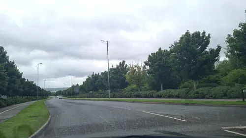

Werneth Park, Oldham
Park · 2.3 mi
Public park in Oldham, Greater Manchester, United Kingdom


6 more on the map.
Restaurants and cafes134
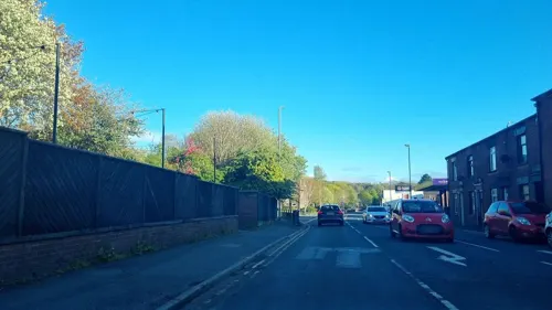
The Courtyard Brewery
Bar and pub · Coffee Shop, Burger, Italian, Chinese, Japanese, Pizza, Asian, Kebab, Sandwich, Mexican, Thai, Chicken
Brewpub and function space. rotational street food to eat in or takeaway. 10 rotating beer lines.
1 Shepherd Street, Oldham
Mo-Su 11:00-23:00
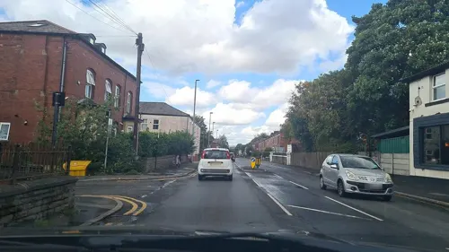
Khau Galli
Restaurant · Indian · 0.6 mi
331 Oldham Road, Oldham
Mo-Th 09:30-22:30; Fr 16:30-22:30; Sa-Su 09:30-22:30
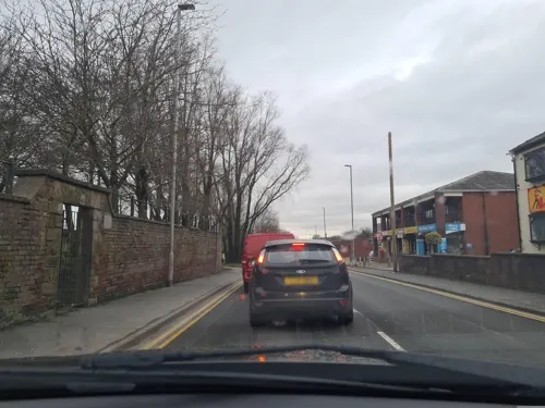
La Salsa
Restaurant · Tapas · 0.8 mi
Heyside, Oldham
Mo-Fr 16:00-22:00; Sa 12:00-22:30; Su 12:00-22:00



The Greyhound
Bar and pub · 0.5 mi
1 Elly Clough
Mo 16:00-22:00; Tu-We 16:00-23:00; Th 15:00-23:00; Fr 13:00-01:00;...
Carters Arms
Bar and pub
133 Oldham Road, Royton, Oldham
Mo-Th 15:00-23:00; Fr-Sa 12:00-00:00; Su 12:00-23:00

122 more on the map.
History
The name Royton is Anglo-Saxon in origin, and it has been suggested that the Rye crop is the root of the name; "Roy-" is derived from Rye, with the Old English suffix -ton added to imply "rye farm" or "rye settlement". The first known written record of the name Ryeton (or Ryton) was in a survey of Lancashire in 1212, although the name is believed to date from the 7th century as a result of Anglian colonisation which followed the Battle of Chester.
There is evidence of Stone Age human activity in the area, by way of a Neolithic stone axe found at Royton Park. The ancient Britons are thought to have inhabited the area, and the Romans to have traversed it; the remains of a Roman or Early Medieval bloomery was discovered in 1836. There is no physical manifestation of the Vikings/Norsemen in the locality, but toponymic evidence implies they have been present; the hamlet of Thorp is the oldest settled locality in Royton, and its name is of Old Norse origin meaning "farm, estate or village".
Read more of the history
Unmentioned in the Domesday Book of 1086, Royton does not appear in records until 1212, when it was documented to have been a thegnage estate, or manor, comprising twelve oxgangs of land, with an annual rate of 24 shillings payable by the tenant, William Fitz William, to King John. From William, who died in 1223, Royton passed to his son Thomas, who was still alive in 1254. Thomas's daughter Margery, who married Alexander Luttrell of Somerset, sold the majority of Royton and its outlying land to John de Byron in around 1260. It is from this exchange that the Byron family came to use Royton as their chief place of residence until the early part of the 17th century.
The early history of Royton is linked closely with what was then its manor house, Royton Hall, which was inhabited by the Byron family for over 350 years. During that period the Byrons' involvement in regional and national affairs added prestige to what was otherwise an obscure and rural township. John de Byron was a witness to the charter of incorporation of 1301, which elevated the township of Manchester to the status of a borough.
A descendant of John—John Byron—served as High Sheriff of Lancashire in 1572, and was knighted by Elizabeth I in 1579. John served as Deputy Lieutenant of Lancashire at the time of the Spanish Armada, and sourced infantry from Royton towards the English military. His son, also called John, fought during the English Civil War on the side of the Cavaliers. His actions led to making him John Byron, 1st Baron Byron of Rochdale by way of a peerage granted by King Charles I. Following the regicide of Charles I, and the rise of Cromwellian England, Baron Byron's possessions, including his lands in Royton, were confiscated. Royton Hall was then purchased by Thomas Percival, a wealthy linen manufacturer whose descendants continued to occupy the hall until around 1814. The hall was then inherited by the Radcliffe Baronets.
Apart from the dignitaries who lived in Royton Hall, the population of Royton during the Middle Ages comprised a small community of retainers and farmers, most of whom were involved with pasture, but supplemented their incomes by weaving woollens in the domestic system. The area was thinly populated and consisted of several hamlets, including Thorp, Heyside and Royton village itself as the nucleus. During the Early Modern period, the weavers of Royton had been using spinning wheels in makeshift weavers' cottages, but as both the demand for cotton goods increased and the technology of cotton-spinning machinery improved during the early-18th century, the need for larger structures to house bigger, better and more efficient equipment became apparent. The construction of a water powered cotton mill by Ralph Taylor at Thorp Clough in 1764, is said to be the first structure of its kind.
The construction of more mills followed, which initiated a process of urbanisation and socioeconomic transformation in the region; the population moved away from farming, adopting employment in the factory system. The introduction of the factory system led to a tenfold increase of Royton's population in less than a century; from 260 in 1714 to 2,719 in 1810. Despite its growth as a centre for cotton-cloth production, and the construction of a chapel of ease in 1754, in 1780 Royton was said to have "contained only a few straggling and mean-built cottages". The people of Royton continued to produce cotton goods (mainly cloth) and sell them at the market in Manchester.
During this period of growth, Royton's parliamentary representation was limited to two members of parliament for Lancashire, and nationally, the end of the Napoleonic Wars in 1815 had resulted in periods of famine and chronic unemployment for textile weavers. By the beginning of 1819 the pressure generated by poor economic conditions, coupled with the lack of suffrage in northern England, had enhanced the appeal of political Radicalism in the region. The Manchester Patriotic Union, a group agitating for parliamentary reform, began to organise a mass public demonstration in Manchester to demand the reform of parliamentary representation. Organised preparations took place, and a spy reported that "seven hundred men drilled at Tandle Hill as well as any army regiment would"; a few days later, on 3 August, a royal proclamation forbidding the practice of drilling was posted in Manchester.
On 16 August 1819, Royton (like its neighbours) sent a contingent of its townsfolk to Manchester to join the mass political demonstration now known as the Peterloo massacre (owing to the 15 deaths and 400–700 injuries that followed). Royton's contingent was of particular note, in that it sent a sizable female section to the demonstration.
From the History section of Royton on Wikipedia, under CC BY-SA 4.0.
More about Royton
Geography
At 53°33′57″N 2°7′16″W (53.566°, −2.121°) and 165 miles (266 km) north-northwest of London, Royton lies at the foothills of the Pennines, roughly 688 feet (210 m) above sea level. The larger towns of Rochdale and Oldham lie to the north and south respectively. For purposes of the Office for National Statistics, Royton forms part of the Greater Manchester Urban Area, with Manchester city centre itself 7.6 miles (12.2 km) southwest of Royton.
Described in Samuel Lewis's A Topographical Dictionary of England (1848) as being in "aspect rather wild", Royton lies in a shallow valley amongst undulating land. The sources of the rivers Irk and Beal are to the northeast and east respectively. The Irk meanders southwesterly into Chadderton, and then onwards to Middleton into Manchester before uniting its waters with the River Irwell in Manchester city centre. The general slope of the land decreases in height away from the Pennines, from east to west, but reaches high points of 509 feet (155 m) at Tandle Hill and 825 feet (251 m) at the summit of Oldham Edge, a ridge of elevated land which leads to Oldham. The soils of the town are broadly sand with subsoils of clay.
Economy
From the 18th century onwards, Royton's economy was closely tied with that of Britain's textile manufacture during the Industrial Revolution, particularly the cotton spinning sector. However, Royton also lies on the Oldham Coalfield, and coal mining had an economic role for the area in as early as the 17th century. Mining peaked in the 19th century with over 200 collieries in the town. Royton's pits were prone to repeated flooding, and owners began to close them. Coal production began to decline even before that of the local spinning industry, with the last pit closing in 1902.
Since deindustrialisation, Royton's economic activity has been focused around a 22-acre (8.9 ha) business park at Salmon Fields which includes distribution companies such as 3663 and Holroyd Meek, manufacturing firms including bed manufacturers Slumberland, and formerly included vehicle assembly at Seddon Atkinson. Formerly an area of "green fields", the Salmon Fields Business Village was proposed in 1983, and developed into a business park later that decade despite objections that the estate would ruin a "beautiful area", and cause noise pollution. There are additional retail parks in the locality, including the centre (formerly Elk Mill Retail Park), which lies at the start of the A627(M) motorway.
Education
The Village School of Royton was founded in 1785, and continued to provide education until 1833, when a new school linked with Royton's parish church of St Paul, was opened. The village school became the local Sunday School, but split from St Paul's in 1838, reopening as a day school. The village school closed in 1907 and was demolished in 1969.
Almost every suburb of Royton is served by a school of some kind, including some with religious affiliations. All the schools in the town perform either at or above the national average for test results.
Royton has eight primary schools and two secondary schools, E-Act Royton and Crompton Academy and Our Lady's RC High School. E-Act Royton and Crompton Academy is a coeducational, secondary comprehensive school for 11- to 16-year-olds. It has Science College status and was constructed in 1968. Our Lady's RC High School is a coeducational Roman Catholic high school and sixth form college for 11- to 19-year-olds. It was established in 1961 and specialialises in Mathematics and Computing. In the 2000s, Oldham Council and the Diocese of Salford agreed to merge Our Lady's with the St Augustine of Canterbury RC High School in Werneth. Although the proposal to have a newly built Catholic secondary on a new site in the 2010s, was met with protest, the new school, called the Newman Catholic College, was built at Chadderton by 2013.
From the Wikipedia article Royton, under CC BY-SA 4.0.
Notable people from Royton
 Jack WildBritish actor (1952–2006)Photo: Joost Evers / Anefo, CC BY-SA 3.0
- Michelle MarshBritish model
- Steve TaylorBritish footballer (born 1955)
- Craig GazeyBritish actor
- Pete WildBritish association football manager
- Alan WaldronEnglish association football player (born 1951)
- Fred HopkinsonEnglish footballer (1908-1935)
- John HoganEnglish soldier (1884–1943); recipient of the Victoria Cross
- Paul NewsomeBritish musician
- Julia Wildwriter
Born in Royton, according to Wikidata (CC0). Each name links to its Wikipedia article.
Where to stay2
Churches and places of worship39
Shopping21
Alamin Groceries & Fish Market
Grocery · 1.5 mi
49-51 Featherstall Road North, Oldham
Gas and EV charging10
Schools, colleges and libraries36
St Joseph's RC Junior, Infant and Nursery School
School · Roman Catholic · 1.0 mi
Oldham Road, Oldham
Healthcare14
NHS Oldham Integrated Care Centre
Clinic and pharmacy · 1.5 mi
New Radcliffe Street, Oldham
Map of Royton
250 places. The map loads OpenStreetMap tiles when you open it.
Getting there and nearby towns
Manchester Airport (MAN) is the nearest airport with scheduled flights listed in OpenStreetMap, 16 miles away.
- Oldham 2 mi south, about 3 min by car
- Saddleworth 5 mi east, about 8 min by car
- Stalybridge 6 mi southeast, about 10 min by car
- Manchester 7 mi southwest, about 12 min by car
- Whitefield 7 mi west, about 12 min by car
- Salford 9 mi southwest, about 14 min by car
- Swinton 10 mi southwest, about 17 min by car
- Todmorden 10 mi north, about 17 min by car
- Stockport 11 mi south, about 17 min by car
- Bolton 13 mi west, about 21 min by car
Drive times are estimates from straight-line distance, not routes.
Towns near Royton


Keep exploring
Local news
Headlines from INDB.
Reviews, tips and questions
Loading what members have shared...
Sources and licences
- GeoNames (CC BY 4.0): population, coordinates, regions and time zone
- Mapillary (see each image): photos
- OpenStreetMap contributors (ODbL 1.0): places, airports, map data
- Wikidata (CC0 1.0): elevation, founding date, time zone, website, landmarks and historic places
- Wikimedia Commons (see each image): photos
- Wikipedia (CC BY-SA 4.0): overview and history text
Photo credits
- Royton Town Hall & Library, Mikey from Wythenshawe, Manchester, UK, CC BY 2.0
- Royton Town Hall - panoramio, Gene Hunt, CC BY 3.0
- Duke of Edinburgh public house in Royton, Oldham, Greater Manchester, Alexander P Kapp, CC BY-SA 2.0
- High Barn Street, Royton - panoramio, WythenshaweMike, CC BY 3.0
- Crompton War Memorial (1), Rept0n1x, CC BY-SA 2.0
- Gallery Oldham, SMJ, CC BY-SA 2.0
- Oldham War Memorial, Narniauk at English Wikipedia, Public domain
- Alexandra Park, Peter Hyde, CC BY-SA 2.0
- River Irk, Chadderton, Roger May, CC BY-SA 2.0
- St Aidan's Church, Rochdale, David Dixon, CC BY-SA 2.0
- St Thomas, Lees, David Dixon, CC BY-SA 2.0
- Oldham Parish Church of St. Mary with St. Peter (1), Rept0n1x, CC BY-SA 3.0
- Tandal Hill Country Park, michael ely, CC BY-SA 2.0
- Boundary Park, Original uploader was Narniauk at English Wikipedia, Public domain
- St Matthew's Church, Chadderton (1), Rept0n1x, CC BY-SA 2.0
- St Mark's Church, Chadderton, Jeremy Sutcliffe from UK, CC BY-SA 2.0
- UKIP office, Rathfelder, CC BY-SA 4.0
- Street-level photo, mappo2, CC BY-SA 4.0
- Street-level photo, mappo2, CC BY-SA 4.0
- Street-level photo, mappo2, CC BY-SA 4.0
- Street-level photo, gorodnuk, CC BY-SA 4.0
- Street-level photo, mappo2, CC BY-SA 4.0
- Street-level photo, adam2, CC BY-SA 4.0
- Street-level photo, mappo2, CC BY-SA 4.0
- Street-level photo, mappo2, CC BY-SA 4.0
- Street-level photo, mappo2, CC BY-SA 4.0
- Street-level photo, mappo2, CC BY-SA 4.0
- Street-level photo, mappo2, CC BY-SA 4.0
- Street-level photo, mappo2, CC BY-SA 4.0
- Street-level photo, mappo2, CC BY-SA 4.0
- Street-level photo, mappo2, CC BY-SA 4.0
- Street-level photo, mappo2, CC BY-SA 4.0
- Street-level photo, mappo2, CC BY-SA 4.0
- Street-level photo, mappo2, CC BY-SA 4.0
- Street-level photo, adam2, CC BY-SA 4.0
- Street-level photo, mappo2, CC BY-SA 4.0


Page built November 10, 2026. Spotted a mistake? Tell us or suggest a place.