


Why visit Leven
Townapedia lists 1 museum or landmark, 2 parks and trails, 4 places to eat and 6 places to stay in and around town.
Weather in Leven
Forecast from MET Norway (CC BY 4.0). Full forecast
About Leven
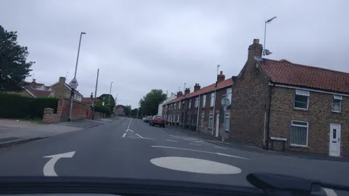
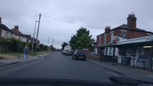
Leven is a village and civil parish in the East Riding of Yorkshire, England. It is situated approximately 7 miles (11 km) west of Hornsea town centre, and north-west of the A165 road.
From the Wikipedia article Leven, East Riding of Yorkshire (this version), under CC BY-SA 4.0.
Museums and landmarks1

Parks, trails and playgrounds2


Restaurants and cafes4

Where to stay6


History
It is believed that the village of Little Leven - immediately west of the present village - began as far back as the days of the Ancient Britons, though Neolithic and Bronze Age human occupation of the area is known. Finds from Leven 'Carrs' (marshy land) have included axe heads, leaf-shaped swords, and a spearhead.
Three quarters of a mile west of Little Leven, at Hall Garth, is the site of Leven's former parish church - St Faith's - which was in use between 1350 and 1843. It is thought that the original village of Leven was sited in its immediate vicinity though archaeological understanding of that area is sparse.
In 1823 Leven (then spelt 'Leaven'), was a civil parish in the Wapentake and Liberty of Holderness. The patronage of the church was under Sir William Pennyman. Population at the time was 658. Occupations included eight farmers, three wheelwrights, two blacksmiths, two butchers, three corn millers, five shoemakers, two maltsters, two grocers, a bricklayer, a schoolmaster, a parish clerk, and the landlords of The Minerva and the Blue Bell public houses. Four carriers operated between the village and Beverley and Hull twice weekly. There were two other carriers: one taking post by foot to Hornsea four times a week; and another to Hull once a week by water transport. Residents included the parish rector, three yeomen, a gentleman, and a merchant.
Read more of the history
The 1892 Bulmer's Directory of Hull and the East Riding states that the Manor of Leven was given to the Church of St John of Beverley by Edward the Confessor, and is listed in the Domesday Book as being amongst its possessions.
There was a proposal to build a Leven railway station as part of the North Holderness Light Railway but despite appearing on tile maps at several North Eastern Railway stations, the line was never constructed.
Leven was a small village with 683 inhabitants until 1961, after which a private housing estate was built (Barley Gate, Mill Drive, Westlands Way, Balk Close), and the village expanded to become a dormitory for workers mainly from Hull and Beverley. The population is now over 2,500. The village has two public houses: The New Inn and The Hare and Hounds as well as a member's club featuring live entertainment each week. Leven has amateur football, cricket and bowling teams.
After a long campaign by residents, a bypass was built for the A165 road around the eastern side of the village and opened in May 1994.
From the History section of Leven, East Riding of Yorkshire on Wikipedia, under CC BY-SA 4.0.
Churches and places of worship5
Schools, colleges and libraries2
Healthcare1
Map of Leven
21 places. The map loads OpenStreetMap tiles when you open it.
Getting there and nearby towns
Humberside Airport (HUY) is the nearest airport with scheduled flights listed in OpenStreetMap, 22 miles away.
- Brandesburton 2 mi northeast, about 3 min by car
- Tickton 3 mi southwest, about 5 min by car
- Beverley 5 mi southwest, about 8 min by car
- Dunswell 7 mi south, about 11 min by car
- Cherry Burton 8 mi west, about 12 min by car
- Walkington 9 mi southwest, about 14 min by car
- Nafferton 9 mi north, about 15 min by car
- Skidby 9 mi southwest, about 15 min by car
- Kingston upon Hull 10 mi south, about 16 min by car
- Driffield 10 mi northwest, about 15 min by car
Drive times are estimates from straight-line distance, not routes.
Towns near Leven


Keep exploring
Local news
Headlines from INDB.
Reviews, tips and questions
Loading what members have shared...
Sources and licences
- GeoNames (CC BY 4.0): population, coordinates, regions and time zone
- Mapillary (see each image): photos
- OpenStreetMap contributors (ODbL 1.0): places, airports, map data
- Wikidata (CC0 1.0): elevation, founding date, time zone, website, landmarks and historic places
- Wikimedia Commons (see each image): photos
- Wikipedia (CC BY-SA 4.0): overview and history text
Photo credits
- Leven, East Riding, Stephen Horncastle, CC BY-SA 2.0
- Holy Trinity Church Leven 2, JThomas, CC BY-SA 2.0
- Holy Trinity Church Leven 1, Peter Church, CC BY-SA 2.0
- St Marys Church Brandesburton, Trish Steel, CC BY-SA 2.0
- Church of St Michael - Catwick, David Wright, CC BY-SA 2.0
- Street-level photo, aidan573, CC BY-SA 4.0
- Street-level photo, aidan573, CC BY-SA 4.0
Page built November 10, 2026. Spotted a mistake? Tell us or suggest a place.