


Nafferton, United Kingdom
Nafferton is a town of 2,433 people in England, United Kingdom.
Why visit Nafferton
Townapedia lists 2 museums and landmarks and 5 places to eat in and around town.
Highlights include Danes Graves and Driffield Castle.
Weather in Nafferton
Forecast from MET Norway (CC BY 4.0). Full forecast
About Nafferton
Nafferton is a village and civil parish in the East Riding of Yorkshire, England. It is situated approximately 2 miles (3.2 km) north-east of Driffield town centre and lies just south of the A614 road.
From the Wikipedia article Nafferton (this version), under CC BY-SA 4.0.
Museums and landmarks2

Danes Graves
Monument and historic site · 3.3 mi
Archaeological site in Nafferton, East Riding of Yorkshire, England, UK
Driffield Castle
Monument and historic site · 2.0 mi
Motte-and-bailey castle in Driffield, East Riding of Yorkshire, England, UK
Restaurants and cafes5



Churches and places of worship10


All Saints' Church, Kilham
Church · 3.2 mi
Church in Kilham, East Riding of Yorkshire, England, UK
Church of All Saints
Church
Church in Nafferton, East Riding of Yorkshire, England, UK

Church of All Saints
Church · 2.2 mi
Church in Driffield, East Riding of Yorkshire, England, UK

Church of Saint John of Beverley
Church · 2.7 mi
Church in Harpham, East Riding of Yorkshire, England, UK

Church of St Martin
Church · 1.8 mi
Church in Lowthorpe, East Riding of Yorkshire, England, UK

Church of Saint Nicholas
Church · 1.5 mi
Church in Ruston Parva, East Riding of Yorkshire, England, UK
Church of St Mary
Church · 2.9 mi
Church in Little Driffield, East Riding of Yorkshire, England, UK
Gas and EV charging1

History
Archaeological evidence for settlement in the area dates back to the Mesolithic. Early hunter-gatherers established temporary camp sites throughout the area, subsisting from woodlands foraging, deer, boars, bears, and wild cattle.
The nearby Yorkshire Wolds were later the site of substantial human activity during the Neolithic and the area features burial mounds, with frequent finds of lithic technology.
According to A Dictionary of British Place Names the name Nafferton probably derives from "Nattfari", an Old Norse person name, with "tun", the Old English word for a farmstead or enclosure.
Nafferton is listed in the Domesday Book as "Nadfartone". At the time of the survey the settlement was in the Hundred of Torbar, and the East Riding of Yorkshire. There were 6½ households, 13 villagers, 17½ ploughlands, a meadow, and a mill. In 1066 Karli son of Karli held the Lordship, this had transferred by 1086 to William of Percy, who also became Tenant-in-chief to King William I. A second Domesday entry for Nafferton shows Bark as a further 1066 Lord, whose land and authority had been taken in entirety by William I.
Read more of the history
In 1823 Nafferton was a parish in the Wapentake of Dickering. The ecclesiastical parish was under the patronage of the Archbishop of York. A Methodist and an Independent chapel, and a small endowed school existed. Population at the time was 917. Occupations included sixteen farmers & yeomen, two blacksmiths, four bricklayers and one brick maker, two carpenters, six grocers, five shoemakers, three tailors, two drapers, an earthenware dealer, a gardener, a plumber & glazier, a horse dealer, a cabinet maker, a rope & twine and a linen manufacturer, a schoolmaster, and the landlords of The Bell, The Cross Keys, The King's Head, and The white Horse public houses. Residents included the parish curate and two gentlemen. A Hull to Scarborough coach was routed through Nafferton "during the bathing season". A carrier operated between the village and Driffield, and Bridlington, once a week.
The oldest surviving building in the village is the church, parts of which date from the 13th century. The Anglican All Saints' Church, Nafferton was designated a Grade I listed building in 1966 and is now recorded in the National Heritage List for England, maintained by Historic England. Its best-known vicar was the parson-naturalist Francis Orpen Morris (1810–1893), author of highly successful books on birds, butterflies and moths.
The Mere, a large expanse of water fed by natural springs, was formerly a mill pond. The mere is drained via sluice gates into a mill race running through private gardens. The race feeds a non-functioning but still existing wood and steel overshot waterwheel. The mill race drains into Nafferton Beck, and subsequently into the River Hull
From the History section of Nafferton on Wikipedia, under CC BY-SA 4.0.
Notable people from Nafferton
 Henry HollandNew Zealand politicianPhoto: Stanley Polkinghorne Andrew (died 1964), Public domain
- Donald EcclesBritish actor (1908-1986)
Born in Nafferton, according to Wikidata (CC0). Each name links to its Wikipedia article.
Schools, colleges and libraries1
Healthcare1
Map of Nafferton
20 places. The map loads OpenStreetMap tiles when you open it.
Getting there and nearby towns
Humberside Airport (HUY) is the nearest airport with scheduled flights listed in OpenStreetMap, 31 miles away.
- Driffield 2 mi southwest, about 4 min by car
- Brandesburton 8 mi southeast, about 13 min by car
- Bridlington 9 mi northeast, about 15 min by car
- Tickton 11 mi south, about 18 min by car
- Cherry Burton 11 mi southwest, about 18 min by car
- Beverley 12 mi south, about 19 min by car
- Bempton 12 mi northeast, about 19 min by car
- Walkington 14 mi south, about 23 min by car
- Scarborough 18 mi north, about 29 min by car
- Kingston upon Hull 19 mi south, about 31 min by car
Drive times are estimates from straight-line distance, not routes.
Towns near Nafferton


Keep exploring
Local news
Headlines from INDB.
Reviews, tips and questions
Loading what members have shared...
Sources and licences
- GeoNames (CC BY 4.0): population, coordinates, regions and time zone
- Mapillary (see each image): photos
- OpenStreetMap contributors (ODbL 1.0): places, airports, map data
- Wikidata (CC0 1.0): elevation, founding date, time zone, website, landmarks and historic places
- Wikimedia Commons (see each image): photos
- Wikipedia (CC BY-SA 4.0): overview and history text
Photo credits
- Nafferton Pond, Stephen Horncastle, CC BY-SA 2.0
- All Saints Church Kilham 1, Peter Church, CC BY-SA 2.0
- All Saints Church Driffield 2, Keith D, CC BY-SA 3.0
- St John of Beverley Church Harpham, Stephen Horncastle, CC BY-SA 2.0
- St Martins Church Lowthorpe 1, Paul Glazzard, CC BY-SA 2.0
- All Saints Church Nafferton, JThomas, CC BY-SA 2.0
- Cross Keys Nafferton, JThomas, CC BY-SA 2.0
- Kings Head Nafferton, Victuallers, CC BY-SA 3.0
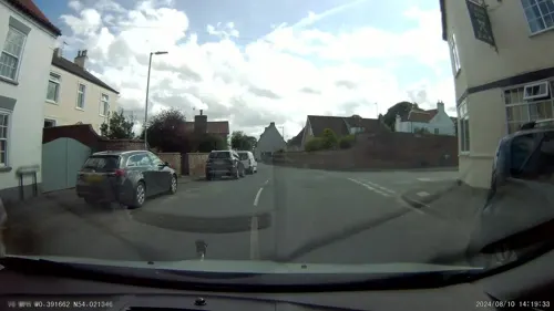
- Street-level photo, aidan573, CC BY-SA 4.0
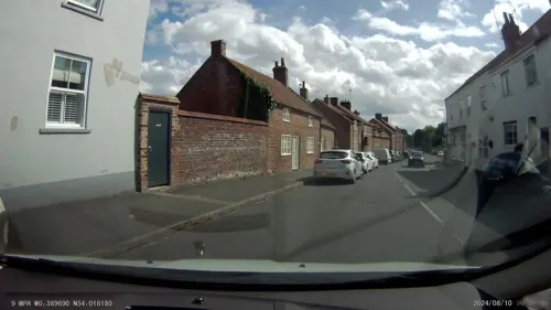
- Street-level photo, aidan573, CC BY-SA 4.0
Page built November 10, 2026. Spotted a mistake? Tell us or suggest a place.