


Why visit Llandeilo
Townapedia lists 4 museums and landmarks, 5 parks and trails, 14 places to eat, 2 places to stay and 2 attractions in and around town.
Highlights include Llandeilo Bridge, Dinefwr Castle, Dinefwr Castle Museum and Gelli Aur country park.
Weather in Llandeilo
Forecast from MET Norway (CC BY 4.0). Full forecast
About Llandeilo
Llandeilo (Welsh pronunciation: [ɬanˈdeilɔ] ) is a town and community in Carmarthenshire, Wales, situated where the River Towy is crossed by the A483 on a 19th-century stone bridge. At the 2021 census the community had a population of 1,784. It is adjacent to the westernmost point of the Brecon Beacons National Park. The town is served by Llandeilo railway station on the Heart of Wales Line.
From the Wikipedia article Llandeilo (this version), under CC BY-SA 4.0.
Travel tips from other travellers: Llandeilo on Wikivoyage (CC BY-SA 4.0).
Photos of Llandeilo

Things to do2


Museums and landmarks4




Parks, trails and playgrounds5



Gelli Aur country park
Park · 2.6 mi
Country park in Carmarthenshire, Wales

Restaurants and cafes14

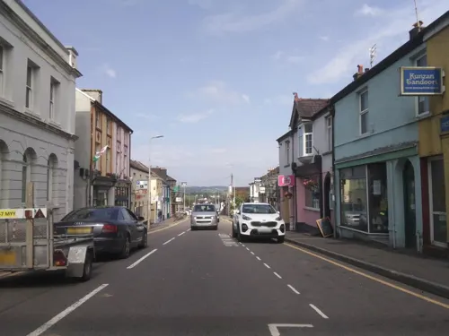
Kunzan Tandoori
Restaurant
Indian Takeway
93 Rhosmaen Street
Mo-Sa 17:00-23:00; Su 17:00-22:00



Torbay Inn
Bar and pub · 0.8 mi
27 Heol Cennen, Ffairfach
Mo 15:00-22:00; Tu-Fr 15:00-00:00; Sa 12:00-00:00; Su 12:00-22:00

The Rook
Cafe
54 Rhosmaen Street, Llandeilo
Mo,We-Fr 12:00-21:30; Tu closed; Sa 11:00-22:00; Su 11:00-20:00
2 more on the map.
History
Roman soldiers were active in the area around Llandeilo around AD 74, as evidenced by the foundations of two castra discovered on the grounds of the Dinefwr estate. The fortifications measured 3.85 hectares and 1.54 hectares, respectively. Roman roads linked Llandeilo with Llandovery and Carmarthen. A small civil settlement developed outside the gates of the fort and may have continued in use as the embryonic town after the Romans left in around AD 120.
Llandeilo is named after one of the better-known Celtic saints of the 6th century, Saint Teilo. The Welsh word llan signified a monastery or a church. Saint Teilo, who was a contemporary of Saint David, the patron saint of Wales, established a clas (a small monastic settlement) on the site of the present-day parish church. There is reasonable evidence to suggest, however, that Saint Teilo was buried in Llandeilo. The parish church of Llandeilo Fawr ("Great Llandeilo") is dedicated to Saint Teilo, and until 1880 its churchyard encompassed his baptistery.
Read more of the history
The early Christian settlement that developed around the Saint Teilo's Church prospered, and by the early 9th century it had attained considerable ecclesiastical status as the seat of a Bishop-Abbot. The Church of St Teilo soon became a "mother church" to the surrounding district, acquiring an extensive estate, and possessing one of Wales' most beautiful and finely illustrated manuscripts – the Gospel Book of Saint Teilo. The discovery of fragments of two large Celtic crosses from this period provides further testimony to Llandeilo's importance and prestige as an early ecclesiastical centre. Towards the end of the 9th century, the importance of Llandeilo as a spiritual centre had started to decline.
Dinefwr Castle (anglicised as Dynevor) overlooks the River Tywi near the town. It lies on a ridge on the northern bank of the Tywi, with a steep drop of about 250 feet (76 m) to the river. Dinefwr was the chief seat of the kingdom of Deheubarth.
The estate of Golden Grove lies near the town, and further away, the impressive Carreg Cennen Castle, another Welsh stronghold. The remains of Talley Abbey can be seen 6 miles (9.7 km) away to the north of the town. 10 miles (16 km) further north are the remains of the Roman Dolaucothi Gold Mines.
In the centuries that followed the Norman conquest of England, the Bishop of Llandaff and Bishop of St David's both claimed Llandeilo for their respective dioceses. By the early 12th century, Llandeilo came under the patronage of the Bishopric of St David's, an ecclesiastic borough that became responsible for the affairs of the town including its development as an important medieval market centre to an extensive agricultural hinterland. Until the middle of the 20th century, a fair called St. Teilo's Fair, which had been authorised initially by Edward I of England in 1291, was held annually in the churchyard. Some of the agricultural produce and other goods offered for sale are recorded to have been displayed on the tombstones.
The town was put to the torch during Owain Glyndŵr's march through the Tywi Valley in July 1403. Nearby Carreg Cennen Castle was besieged by Yorkist forces in 1461 during the Wars of the Roses and partially demolished.
At the Reformation, the town was at the centre of the parish known as Llandeilo Fawr. It was in the Diocese of St Davids and part of the archdeaconry of Carmarthen. In 1560, the bishop of St Davids recorded the population of Llandeilo Fawr as 620 households (perhaps amounting to 2,790 people), many of whom would have lived in Llandeilo itself.
In the middle of the 17th century, Llandeilo was in the area of influence of the royalist general Sir Henry Vaughan. A royalist skirmish took place in the town in April 1648, defeating elements of the New Model Army.
In 1887, John Bartholomew's Gazetteer of the British Isles described Llandeilo as having a population of 1,533. He observed that “the principal trade of the town is in corn and flour; the other industries include woollen cloth mills, timber and saw mills, and tanneries”.
From the History section of Llandeilo on Wikipedia, under CC BY-SA 4.0.
More about Llandeilo
Arts and culture
Llandeilo hosted the National Eisteddfod of Wales in 1996, held on the meadow across the river at Ffairfach. The town sign was moved to the far side of the bridge at this time. At the Eisteddfod, the society for traditional musical instruments of Wales, Clera, was officially launched.
At one time Llandeilo produced its own 'Llandeilo Style' banknotes, and this is recorded on a blue plaque on the wall of the building which used to house Llandovery Bank, also known as The Bank of the Black Ox.
Near Llandeilo, at Pant-y-llyn, near the village of Carmel, Carmarthenshire is Great Britain's only known turlough (or ephemeral lake). There is a nature reserve at the site, the Carmel National Nature Reserve.
Llandeilo has been twinned with Le Conquet in Brittany since 1980.
Llandeilo Fawr Festival of Music (Est 2000). Each July Llandeilo hosts an international Classical Music event.
The Llandeilo Festival of Senses - an event involving food stalls, crafts and fireworks - takes place each year in November.
Llandeilo was named one of the best places to live in Wales in 2017.
From the Wikipedia article Llandeilo, under CC BY-SA 4.0.
Notable people from Llandeilo
 Rhys ap ThomasSoldier and landholder who rose to prominence during the Wars of the RosesPhoto: Tipcake, CC BY-SA 4.0
- Thomas ThomasWelsh architect
- David PughBritish politician
- Carey MorrisBritish artist (1882-1968)
- Iwan LewisWelsh actor
- David Jonesfounder of David Jones Limited in New South Wales, Australia (1793-1873)
- George Daviesrugby player
- Hubert JonesBritish flying ace (1890–1943)
- Francis GulstonBritish rower
- John JonesWelsh politician
Born in Llandeilo, according to Wikidata (CC0). Each name links to its Wikipedia article.
Where to stay2
Churches and places of worship9
Shopping2
Gas and EV charging1
Schools, colleges and libraries5
Healthcare2
Map of Llandeilo
46 places. The map loads OpenStreetMap tiles when you open it.
Getting there and nearby towns
Swansea Airport (SWS) is the nearest airport with scheduled flights listed in OpenStreetMap, 20 miles away.
- Llandybie 4 mi south, about 7 min by car
- Ammanford 6 mi south, about 10 min by car
- Pontyberem 11 mi southwest, about 17 min by car
- Ystalyfera 12 mi southeast, about 19 min by car
- Carmarthen 14 mi west, about 22 min by car
- Clydach 14 mi south, about 23 min by car
- Gorseinon 15 mi south, about 24 min by car
- Llanelli 16 mi southwest, about 25 min by car
- Neath 17 mi southeast, about 28 min by car
- Swansea 18 mi south, about 30 min by car
Drive times are estimates from straight-line distance, not routes.
Towns near Llandeilo


Keep exploring
Local news
Headlines from INDB.
Reviews, tips and questions
Loading what members have shared...
Sources and licences
- GeoNames (CC BY 4.0): population, coordinates, regions and time zone
- Mapillary (see each image): photos
- OpenStreetMap contributors (ODbL 1.0): places, airports, map data
- Wikidata (CC0 1.0): elevation, founding date, time zone, website, landmarks and historic places
- Wikimedia Commons (see each image): photos
- Wikipedia (CC BY-SA 4.0): overview and history text
Photo credits
- Llandeilo seen from hill to the south, Nigel Davies, CC BY-SA 2.0
- Prospect House, Llandeilo, Dave.Dunford, CC BY-SA 4.0
- 14 Bank Buildings, Llandeilo 01, Dave.Dunford, CC BY-SA 4.0
- 14 Bank Buildings, Llandeilo 02, Dave.Dunford, CC BY-SA 4.0
- 13 Bank Buildings, Llandeilo, Dave.Dunford, CC BY-SA 4.0
- Llandeilo Car Park Public Conveniences, Peter Glyn, CC BY-SA 3.0
- Landilo Bridge, South Wales, Unknown author, Public domain
- St Tyfi's Church, Dynevor 01, Dave.Dunford, CC BY-SA 4.0
- Dinefwr Castle (30551882917), Andrew Bone from Weymouth, England, CC BY 2.0
- Llandeilo Angel Hotel Rhosmaen Street, Ken Day, CC BY-SA 4.0
- Yr Hen Vic, Peter Glyn, CC BY-SA 3.0
- Newton House 1 (35442497371) cropped, Tony Hisgett from Birmingham, UK, CC BY-SA 4.0
- Dinefwr castle at sunrise, Daniel Phillips, CC BY-SA 4.0
- Dinefwr Park and House, Capt' Gorgeous - 31725175898, Ben Salter, CC BY 2.0
- Penlan Park Bandstand in Llandeilo under snow with the roofs of the town below, Ken Day, CC BY-SA 4.0
- Cafe Braz, Llandeilo, Dave.Dunford, CC BY-SA 4.0
- Street-level photo, southglos, CC BY-SA 4.0
- Street-level photo, trigpoint, CC BY-SA 4.0
- Street-level photo, southglos, CC BY-SA 4.0
- Street-level photo, southglos, CC BY-SA 4.0
- Street-level photo, southglos, CC BY-SA 4.0
- Street-level photo, southglos, CC BY-SA 4.0
- Street-level photo, southglos, CC BY-SA 4.0
- Street-level photo, southglos, CC BY-SA 4.0
- Street-level photo, southglos, CC BY-SA 4.0
- Street-level photo, southglos, CC BY-SA 4.0

Page built November 10, 2026. Spotted a mistake? Tell us or suggest a place.