


Why visit Llangefni
Townapedia lists 3 museums and landmarks, 4 parks and trails, 23 places to eat, 2 places to stay and 2 attractions in and around town.
Highlights include Theatr Fach, Llangefni Market, Oriel Môn and Rayner Memorial Clock Tower.
Weather in Llangefni
Forecast from MET Norway (CC BY 4.0). Full forecast
About Llangefni
Llangefni (Welsh for 'church on the river Cefni'; Welsh pronunciation: [ɬaŋˈɡɛvni]) is the county town of Anglesey in Wales. At the 2011 census, Llangefni's population was 5,116, making it the second-largest town in the county and the largest on the island. The population of the town at the 2021 Census for the built up area was 5,561 residents. While the surrounding community was 5,795 residents.
From the Wikipedia article Llangefni (this version), under CC BY-SA 4.0.
Travel tips from other travellers: Llangefni on Wikivoyage (CC BY-SA 4.0).
Photos of Llangefni

Things to do2


Museums and landmarks3


Rayner Memorial Clock Tower
Monument and historic site
Grade II listed building in Anglesey
Parks, trails and playgrounds4



Restaurants and cafes23
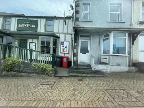
The Railway Inn
Bar and pub
52 High Street, Llangefni
Tu-Th 16:00-23:00, Fr 16:00-24:00, Su 00:00-22:30, Sa 12:00-24:00;...
Lizzy Lee's
Cafe
49 High street, Llangefni
Tu-Fr 12:00-15:30;Sa 11:00-16:00;Mo-Fr 12:00-15:30


The Foundry Vaults
Bar and pub
High Street, Llangefni
Mo-Sa 12:00-23:00, Sa 12:00-24:00, Su 00:00-23:00
Aran Fish and Chips Shop
Restaurant · Fish And Chips
Arcadia Buildings Bridge Street, Llangefni
Mo-Sa 11:30-21:00

Market Inn
Bar and pub
Bulkeley Square, Llangefni
Mo,Tu 11:00-22:00; We-Fr 11:00-23:00; Sa 11:00-24:00

gwalia
Bakery
1 Bridge Street, Llangefni
Mo-Sa 09:00-04:00, Mo-Su 07:00-16:00, Mo-Fr 07:00-16:00
11 more on the map.
History
The town of Llangefni, located at the geographic heart of Anglesey, Wales, has a long history that evolved from an ancient, isolated church enclosure into the thriving administrative and commercial capital of the island.
In the Middle Ages, it was part of the commote of Menai in the can tref (hundred) of Aberffraw.
Read more of the history
Its name translates directly as "Church on the River Cefni"; it grew from a small hamlet around St Cyngar's Church and developed as an organised market centre with origins dating back to the 13th century. The town's history begins in the 5th and 6th centuries around the historic church site. Established in a wooded valley alongside the River Cefni (now known as The Dingle), this early Christian settlement gave the town its original name, Llangyngar. In 1750, the first Baptist meeting place on Anglesey was founded in the town as a small cottage (Tŷ Cildwrn), paving the way for the grander Capel Cildwrn built in 1781, establishing Llangefni as a centre for religious nonconformity. On 30 September 1785, the town hosted the first Llangefni Market. It grew rapidly to become the largest livestock and cattle market on Anglesey, a key venue for the island's farmers. Between 1828 and 1833, the prominent Melin y Graig (Craig Mill) windmill was erected on a rocky crag, and in 1824, the parish church of St Cyngar was completely rebuilt in its spacious, modern layout. In 1864, the Anglesey Central Railway opened its line through Llangefni, which allowed the seamless transport of livestock, wool, and leather goods to the rest of the UK. Llangefni became the official administrative headquarters for the Anglesey County Council in 1899.
The town centre clock was built at the expense of the friends and relations of Lieutenant George Pritchard-Rayner, one of the island's major landowners, who lived at Tre Ysgawen but died in the Boer War.
The clock tower was built in 1902–03 of limestone from Traeth Bychan near Marian-Glas on the eastern coast of the island. In the 1880s the town hall had been built of the same material; it was opened on 10 March 1884.
From the History section of Llangefni on Wikipedia, under CC BY-SA 4.0.
Notable people from Llangefni
- Kyffin WilliamsWelsh landscape painter (1918–2006)
- Huw GarmonWelsh actor
- William JonesBritish politician; (1859-1915)
- Richard DaviesWelsh MP; (1818–1896)
- Siw HughesBritish actress
- Myfanwy HowellBritish television presenter (1903-1988)
Born in Llangefni, according to Wikidata (CC0). Each name links to its Wikipedia article.
Where to stay2
Churches and places of worship21
Shopping9
Bevan Caravan and Camping Supplies
Shop
Unit 1 - 2 Smithfield, Church Street, Llangefni
Gas and EV charging3
Schools, colleges and libraries5
Healthcare3
Map of Llangefni
75 places. The map loads OpenStreetMap tiles when you open it.
Getting there and nearby towns
RAF Valley - Anglesey Airport (VLY) is the nearest airport with scheduled flights listed in OpenStreetMap, 9 miles away.
- Menai Bridge 6 mi east, about 10 min by car
- Bangor 8 mi east, about 12 min by car
- Rhosneigr 9 mi west, about 14 min by car
- Tregarth 10 mi southeast, about 17 min by car
- Valley 11 mi west, about 17 min by car
- Holyhead 14 mi west, about 22 min by car
- Penygroes 14 mi south, about 22 min by car
- Penmaenmawr 16 mi east, about 25 min by car
- Llandudno 20 mi east, about 33 min by car
- Colwyn Bay 24 mi east, about 39 min by car
Drive times are estimates from straight-line distance, not routes.
Towns near Llangefni


Keep exploring
Local news
Headlines from INDB.
Reviews, tips and questions
Loading what members have shared...
Sources and licences
- GeoNames (CC BY 4.0): population, coordinates, regions and time zone
- Mapillary (see each image): photos
- OpenStreetMap contributors (ODbL 1.0): places, airports, map data
- Wikidata (CC0 1.0): elevation, founding date, time zone, website, landmarks and historic places
- Wikimedia Commons (see each image): photos
- Wikipedia (CC BY-SA 4.0): overview and history text
Photo credits
- Llangefni town centre, Eric Jones, CC BY-SA 2.0
- Derelict Cinema at Llangefni (1544339), Geoff Charles, CC BY-SA 4.0
- St Caian's Church, Tregaian, Stephen Elwyn RODDICK, CC BY-SA 2.0
- South side of St Cristiolus, Llangristiolus, Bencherlite, CC BY-SA 3.0
- Sant Cyngar, Llangefni, Ynys Mon, Cymru 04, Monsyn, CC BY-SA 4.0
- Moreia Chapel, Prosiect Wici Mon, CC BY-SA 3.0
- Smyrna Welsh Independent Chapel, GeraintTudur2, CC BY-SA 3.0
- Penuel Chapel, Llangefni (24701461609), grassrootsgroundswell, CC BY 2.0
- Theatr Fach Llangefni, Prosiect Wici Mon, CC BY-SA 3.0
- Rhun ap Iorwerth's office, Rathfelder, CC BY-SA 4.0
- Street-level photo, debigc, CC BY-SA 4.0
- Street-level photo, debigc, CC BY-SA 4.0
- Street-level photo, debigc, CC BY-SA 4.0
- Street-level photo, debigc, CC BY-SA 4.0
- Street-level photo, debigc, CC BY-SA 4.0


Page built November 10, 2026. Spotted a mistake? Tell us or suggest a place.