

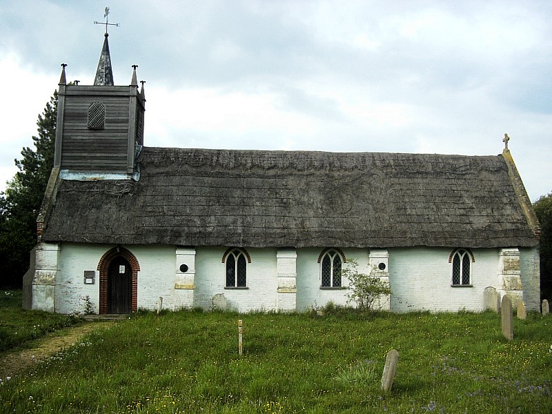
Why visit Loddon
Townapedia lists 2 museums and landmarks, 6 parks and trails, 12 places to eat, 2 places to stay and 1 attraction in and around town.
Highlights include Saint Ethelbert and Miners' Welfare Park.
Weather in Loddon
Forecast from MET Norway (CC BY 4.0). Full forecast
About Loddon
Loddon () is a town and civil parish in Norfolk, England, about 12 miles (19 km) south-east of Norwich. The town lies on the River Chet, a tributary of the River Yare within The Broads. The name "Loddon" is thought to mean muddy river in Celtic in reference to the Chet.
From the Wikipedia article Loddon, Norfolk (this version), under CC BY-SA 4.0.
Things to do1

Museums and landmarks2

Parks, trails and playgrounds6




Restaurants and cafes12



Loddon Deli and Coffee
Cafe · Coffee Shop, Deli, Cake, Sandwich, Tea
Unit 1 Unit 1 Church Plain, London, Norwich NR14 6EX, Norwich
Mo-Sa 08:00-15:00
Rosy Lee's Tearoom
Cafe
A small, friendly cafe serving a wide range of locally sourced food and drink.
48 Bridge Street, Norwich
Th-Tu 09:00-17:00; We closed
Indian Palace Restaurant
Restaurant · Indian
23 Bridge Street, Norwich
17:00-23:00

Spooncake
Bakery
A family run cafe, bakery and craft shop in the heart of Loddon.
17 Bridge Street, Norwich
Tu-Sa 10:00-16:00

Loddon Fish and Chips
Fast food · Fish And Chips
11 Bridge Street, Norwich
Tu-Th 11:45-13:30,16:45-20:30; Fr,Sa 11:45-13:30,16:30-20:30
History
The earliest written mention of Loddon (Lodne) is in the will of Ælfric Modercope written in 1042 or 1043. In the will Ælfric split his land holdings in Loddon, Bergh Apton and Barton between the Bishops of Bury, Ely and St Benet of Holme. Ælfric held 450 acres (1.8 km2) of land in Loddon and was by far the biggest landowner. His manor house is believed to have been close by the church overlooking the river and the fields are known as Manor Yards.
The Parish Council adopted Ælfric for Loddon's town sign in 1961 and the bronze statue still stands on Farthing Green.
Although Loddon and Chedgrave have been flooded many times through history, the worst or at least the best documented occasions were in August 1912 and September 1968.
At about midnight on 27 August 1912 a portion of the roadway was washed away and soon afterwards part of the bridge caved in. The footbridge across the river between the two industrial sites disappeared downstream. The mill was in great jeopardy and forty men worked hard to preserve as much of the road as possible. The piling and the banks of the Chet were washed away and some of the wherries broke their moorings.
Read more of the history
On 12 September 1968 a great storm followed a very wet summer, so when the heavy rain came that night the ground was too waterlogged to let the rain drain away. According to the Eastern Daily Press it had been Norfolk's wettest ever September day. The torrential rain was accompanied by thunder and lightning and many roads were many inches deep in water.
From the History section of Loddon, Norfolk on Wikipedia, under CC BY-SA 4.0.
More about Loddon
Arts and culture
Today the River Chet is one of the focal points for boating tourism within the southern Broads area and is the only such centre within South Norfolk District.
Further downriver still can be found Hardley Flood, a good spot for bird watching.
Education
Loddon is home to three state schools: Loddon Infant and Nursery, Loddon Junior and Hobart High School, one of the few schools in the country to have a 'classroom of the future'. There is also Loddon nursery school education. An independent school Langley School, lies just to the North of Loddon at Langley Park.
The first records about schooling in Loddon mention the school in what is now called the Priest's room in the Holy Trinity Church in 1781. The 19th century saw considerable changes, including a rise in the population and consequently in the number of children. It also saw a rise in the popularity of nonconformist religions and a certain amount of competition in the provision of education for the young.
As well as the established schools there were several private schools in the town at one time or another. The 1851/61/71 census figures show a private school on the east side of Bridge Street.
By 1856 it was decided to build a new school in Loddon for 180 pupils on the site of the old guildhall on Church Plain. Two-thirds of the cost was to come from the Town Estates, which was revenue derived from the renting of Town Farm and other town lands. The rest came from public subscription and an appeal was set up to raise money from the community. The eventual result was a flint faced Gothic Revival building which is still used today as the Loddon Branch Library.
From the Wikipedia article Loddon, Norfolk, under CC BY-SA 4.0.
Notable people from Loddon
- Ann Charlotte BartholomewEnglish flower and miniature painter, and author (1800-1862)
- David WalkerEnglish cricketer (1913-1942)
- James WallaceRoyal Navy admiral (1731-1803)
- Allen ClarkeBritish schoolteacher (1910-2007)
- Harry CullumBritish sports shooter
Born in Loddon, according to Wikidata (CC0). Each name links to its Wikipedia article.
Where to stay2
Churches and places of worship10
Shopping2
Gas and EV charging1
Schools, colleges and libraries6
Healthcare2
Map of Loddon
44 places. The map loads OpenStreetMap tiles when you open it.
Getting there and nearby towns
Norwich Airport (NWI) is the nearest airport with scheduled flights listed in OpenStreetMap, 13 miles away.
- Thurlton 3 mi east, about 5 min by car
- Reedham 4 mi northeast, about 7 min by car
- Ditchingham 5 mi south, about 8 min by car
- Brooke 5 mi west, about 8 min by car
- Beccles 6 mi southeast, about 10 min by car
- Acle 8 mi north, about 12 min by car
- Norwich 10 mi northwest, about 16 min by car
- Bradwell 10 mi east, about 15 min by car
- Great Yarmouth 12 mi northeast, about 19 min by car
- Lowestoft 12 mi east, about 19 min by car
Drive times are estimates from straight-line distance, not routes.
Towns near Loddon


Keep exploring
Local news
Headlines from INDB.
Reviews, tips and questions
Loading what members have shared...
Sources and licences
- GeoNames (CC BY 4.0): population, coordinates, regions and time zone
- Mapillary (see each image): photos
- OpenStreetMap contributors (ODbL 1.0): places, airports, map data
- Wikidata (CC0 1.0): elevation, founding date, time zone, website, landmarks and historic places
- Wikimedia Commons (see each image): photos
- Wikipedia (CC BY-SA 4.0): overview and history text
Photo credits
- St Gregory's church Heckingham Norfolk (4234511282), David from Colorado Springs, United States, CC BY 2.0
- Sisland, Bernd Jatzwauk Pommes104, CC BY-SA 3.0
- Street-level photo, VelvetThunderFox, CC BY-SA 4.0
Page built November 10, 2026. Spotted a mistake? Tell us or suggest a place.