


Marshfield, United Kingdom
Marshfield is a town of 1,441 people in England, United Kingdom.
Why visit Marshfield
Townapedia lists 1 museum or landmark, 2 parks and trails and 3 places to eat in and around town.
Highlights include Bury Camp and Dyrham Park.
Weather in Marshfield
Forecast from MET Norway (CC BY 4.0). Full forecast
About Marshfield
Marshfield is a village in the local-government area of South Gloucestershire, England, on the borders of the counties of Wiltshire and Somerset. Its toponym derives from the Old English word "march", meaning "a border", hence "Border Field" would be a literal translation. The name has nothing to do with "marsh" in the sense of a bog.
From the Wikipedia article Marshfield, Gloucestershire (this version), under CC BY-SA 4.0.
Museums and landmarks1

Bury Camp
Monument and historic site · 2.5 mi
Site of an Iron Age multivallate hillfort located in Wiltshire, England, UK
Parks, trails and playgrounds2

Dyrham Park
Park · 2.5 mi
Park in Gloucestershire, England, United Kingdom

Restaurants and cafes3


Churches and places of worship4

Church of St Peter, Dyrham
Church · 2.6 mi
Grade I listed church in South Gloucestershire, England, UK

Church of St Catherine, St Catherine
Church · 2.1 mi
Church in Bath and North East Somerset, England, UK
History
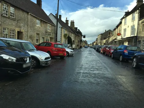
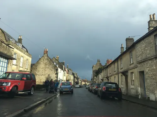
The village is rich in history because of its location in the heart of Cotswold wool country, near to Bath and Bristol. Located within an agricultural area, Marshfield gained market status in 1234. The layout conforms to that of a typical market town with long narrow burgage plot gardens extending back from the narrow frontages, and served by two rear access lanes (Back Lane and Weir Lane).
The majority of buildings lining the street are of 18th-century origin although several buildings date from the 17th century. The building style is largely Georgian. The facades of the buildings are unified by the consistent use of local stone and other materials, which adds character to the village.
Read more of the history
Marshfield was a casualty of the Battle of Lansdown (July 1643) during the Civil War. A Royalist army under Prince Maurice and Sir Bevil Grenville were hoping to link up with Charles I at Oxford and avoid a confrontation with the Parliamentary Forces gathered at Bath under Sir William Waller. Marshfield, which had about 300 houses at that time, on 4 July was used as an overnight billet and provision store for the King's army of 6000. Next day the royalists were tempted into an abortive Battle at Lansdown, each side withdrawing with heavy losses. Sir Bevil Grenville (whose monument now stands on the site of the battle) died in Cold Ashton rectory and as the Royalists fell back on Marshfield for repairs almost every house had wounded men on its hands. When the depleted army moved on the reinforced Cromwellian army soon followed. There was little time to stow away the church's simple treasures before the invading despoilers were at work. As a piece of local doggerel composed 200 years later had it "The empty niche above the door, where Mary's image stood, And ravaged reredos testify to their revengeful mood."
It is not known just what damage may have been done as a result of the Civil War. Canon Trotman, a prominent authority in Marshfield's more recent past, speculated publicly about the likely missing treasures. He noticed the large stones on either side of the east window, with rough infilling under them. The large stones evidently formed canopies for figures now missing and which have been the marble figures found in 1866 during alterations at the Angel Inn (now 42 high Street) and later removed from the parish. Two or three other figures probably completed the statuary. Canon Trotman further presumed that the figure of the Virgin may have been taken from its niche in the porch by the Parliamentary troops, but adds forcefully, "Even they could scarcely have done more havoc with the church than the hand of the so-called restorer in 1860 who, while substituting the pitch pine seats...for the old carefully locked pews and capacious gallery, effaced at the same time much that should have been interesting to us today." Canon Trotman (1906).
With Cromwell's victory in the Civil War, the period of the Commonwealth ensued during which time marriage was treated as a secular rather than religious ceremony. John Goslett as a magistrate therefore married 92 couples during that period from the parish and around, in may cases the banns having been called on three successive market days in the market Place at Marshfield (as an alternative banns could still be read in church). There was clearly no long-term disadvantage in all this for Mr Goslett for a tablet to his memory was nevertheless placed in the church, beside the east window of the north aisle.
David Long, from Pennsylvania, reports that on the flat open land between his village and the lane you can often find musket balls, on the battlefield of Lansdown. Looking towards the battle site from the field it would appear to be a logical distance away particularly as they would have been firing uphill at about 45 degrees thus landing some distance from the battle site.
The village fire engine was purchased in 1826 for £50:00 and was still in use in 1931. It had to be operated by a gang of men on either side of it using a hand pump.
In 1896 the Fire Brigade had its capabilities tested to the utmost. Two houses with thatched roofs, in the main streets, caught fire at midday, when all hands were engaged in the fields, but the Brigade mustered quickly in sufficient force to prevent fire spreading to other houses.
St Mary's parish church with its tower provides an important focal point that can be observed from numerous points in the village and is a landmark visible from miles around. The church is on the eastern side of the village. A church has stood on that site for more than 1,000 years. The first was dedicated to St Nicholas, and at west Marshfield there was another, of which no traces remain, to St Pancras. It is thought that a field called St Pancras Close marks the site. In Bristol Museum there is an ancient deed of about 1125 confirming to the Abbot of Tewkesbury various tithes and ecclesiastical benefices, among them Marshfield church, at that time very much smaller than the church we see today.
It is recorded in the annals of Tewkesbury Abbey that on 1 June 1242, in the reign of Henry III, Walter de Cantilupe, Bishop of Worcester, in whose diocese Marshfield then stood, came to dedicate a newly built church at Marshfield. The monks of Tewkesbury Abbey restored and rebuilt the church in the perpendicular style in about 1470. After the Dissolution of the Monasteries the right of presentation of the benefice was given to the warden and fellows of New College, Oxford, by Queen Mary, in lieu of property of which they had been robbed by Henry VIII of England. The college's first incumbent came into residence in 1642, only to be disposed during the English Civil War. New College still has the benefice in its gift.
From the History section of Marshfield, Gloucestershire on Wikipedia, under CC BY-SA 4.0.
Notable people from Marshfield
 John MerewetherantiquarianPhoto: Engraver Charles Baugniet, Public domain
- David CorbettEnglish footballer (1940-2020)
- John HazlittEnglish miniature and portrait painter (1767-1837)
Born in Marshfield, according to Wikidata (CC0). Each name links to its Wikipedia article.
Gas and EV charging2
Schools, colleges and libraries1
Healthcare1
Map of Marshfield
14 places. The map loads OpenStreetMap tiles when you open it.
Getting there and nearby towns
Bristol Airport (BRS) is the nearest airport with scheduled flights listed in OpenStreetMap, 18 miles away.
- Bath 6 mi south, about 10 min by car
- Corsham 6 mi east, about 10 min by car
- Yate 7 mi northwest, about 11 min by car
- Warmley 7 mi west, about 11 min by car
- Kingswood 8 mi west, about 13 min by car
- Mangotsfield 8 mi west, about 13 min by car
- Chippenham 8 mi east, about 14 min by car
- Keynsham 8 mi southwest, about 13 min by car
- Melksham 10 mi southeast, about 16 min by car
- Bristol 12 mi west, about 19 min by car
Drive times are estimates from straight-line distance, not routes.
Towns near Marshfield


Keep exploring
Local news
Headlines from INDB.
Reviews, tips and questions
Loading what members have shared...
Sources and licences
- GeoNames (CC BY 4.0): population, coordinates, regions and time zone
- Mapillary (see each image): photos
- OpenStreetMap contributors (ODbL 1.0): places, airports, map data
- Wikidata (CC0 1.0): elevation, founding date, time zone, website, landmarks and historic places
- Wikimedia Commons (see each image): photos
- Wikipedia (CC BY-SA 4.0): overview and history text
Photo credits
- Marshfield school, My another account ( talk ), Public domain
- Dyrham Park lower park, Rwendland, CC BY-SA 3.0
- Dyrham Park, house and church, from lawn, Rwendland, CC BY-SA 3.0
- Street-level photo, southglos, CC BY-SA 4.0
- Street-level photo, southglos, CC BY-SA 4.0
- Street-level photo, southglos, CC BY-SA 4.0
Page built November 10, 2026. Spotted a mistake? Tell us or suggest a place.