


Why visit Basford
Townapedia lists 36 museums and landmarks, 54 parks and trails, 269 places to eat, 20 places to stay and 14 attractions in and around town.
Highlights include Albert Hall, Nottingham Playhouse, National Justice Museum and War Memorial Cross, Beeston.
Weather in Basford
Forecast from MET Norway (CC BY 4.0). Full forecast
About Basford
Basford is a northerly suburb of Nottingham, in Nottinghamshire, England, incorporated into the city in 1877. It gave its name to Basford Rural District, which existed from 1894 to 1974. The ward population at the 2011 census was 16,207, estimated at 16,779 in 2019. Next to Old Basford is New Basford, which is mainly Victorian.
From the Wikipedia article Basford, Nottingham (this version), under CC BY-SA 4.0.
Photos of Basford


Things to do14


Nottingham Playhouse
Cinema and theater · 1.4 mi
Theatre in Nottingham, Nottinghamshire, England, UK
Wellington Circus, Nottingham


Wilford Suspension Bridge
Bridge · 3.0 mi
Footbridge and aqueduct which crosses the River Trent in the UK


Royal Concert Hall
Cinema and theater · 1.5 mi
Theatre Square, Nottingham

Lace Market Theatre
Cinema and theater · 1.9 mi
Theatre in Nottingham, Nottinghamshire, England, UK
New Theatre
Cinema and theater · 2.0 mi
Theatre on University Park Campus, Nottingham, England
Nottingham Arts Theatre
Cinema and theater · 1.8 mi
Theatre in Nottingham, England
2 more on the map.
Museums and landmarks36

National Justice Museum
Museum · 2.0 mi
Museum housed in a former courtroom, gaol and police station in Nottingham, England, United Kingdom
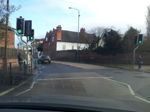
War Memorial Cross, Beeston
Monument and historic site · 3.2 mi
Grade II listed war memorial in Broxtowe, United Kingdom

Wollaton Hall
Museum · 1.7 mi
Country house museum in Nottingham, England


City War Memorial
Monument and historic site · 2.9 mi
War memorial in Nottingham, England

Nottingham Castle Ducal Mansion
Museum · 1.7 mi
Former home of Duke of Newcastle, now museum and art gallery in Nottingham, Nottinghamshire, England, UK
Nottingham Industrial Museum
Museum · 1.8 mi
Museum in the 17th century stables block of Wollaton Hall, Nottingham, England
24 more on the map.
Parks, trails and playgrounds54

Highfields Park, Nottingham
Park · 2.0 mi
Park in Nottingham, Nottinghamshire, England, UK

Forest Recreation Ground
Park · 1.0 mi
Park in Nottingham, United Kingdom


42 more on the map.
Restaurants and cafes269
Caffè Nero
Cafe · Coffee Shop · 1.5 mi
1 Angel Row, Nottingham
Mo-Fr 07:00-18:00; Sa 08:00-18:00; Su 08:30-17:30
Costa
Cafe · Coffee Shop · 1.3 mi
Within Premier Inn
Goldsmith Street, Nottingham
Mo-Fr 08:00-15:00; Sa,Su 08:00-15:00
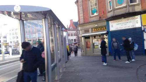
Starbucks
Cafe · Coffee Shop · 1.5 mi
72-74 Upper Parliament Street, Nottingham
Mo-Fr 08:00-17:00; Sa 08:30-17:00; Su 09:30-16:30
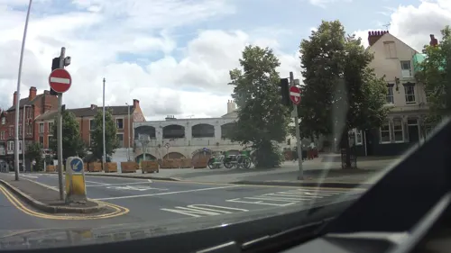
The Falcon Inn
Bar and pub · 1.1 mi
1 Alfreton Road, Nottingham
We-Th 17:00-23:00, Fr 14:00-23:00, Sa 12:00-23:00, Su 12:00-21:00
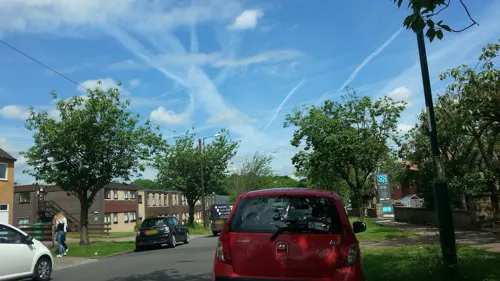
The Wollaton
Bar and pub · 1.3 mi
2B Lambourne Drive, Nottingham
Mo-Th 12:00-23:00; Fr 12:00-24:00; Sa 09:00-01:00; Su 09:00-22:00


Las Iguanas
Restaurant · Latin American · 1.5 mi
4 Chapel Quarter, Chapel Bar, Nottingham
Mo-Th 11:00-22:30; Fr-Sa 11:00-23:00; Su 11:00-22:30

Crocus Cafe
Cafe · 1.3 mi
18 Lenton Boulevard, Nottingham
Mo-We 10:00-17:00; Th-Sa 10:00-22:00; Su 10:00-18:00; PH closed
257 more on the map.
History
"Basford Parish lies principally in the vale of the Leen, where that river is augmented by two small streams called the Day Brook and White Moor Spring; but its eastern extremity rises to the lofty hills of Mapperley. It extends from one and a half to three miles north of Nottingham, and comprises 2270 acres of land, of which 1158 acres were enclosed in 1792, and several large tracts have since been covered with thriving plantations. It has generally a rich sandy soil, and lets for upwards of 30s per acre; but some small allotments are let for more than double that amount. It was anciently divided into several manors, and held of the fee of William Peverel, whose Honour Court was formerly held here.
The Duke of Newcastle is lord of the manor, and owner of a large portion of the land. At Scottom, near the Leen, are three covered springs and a large reservoir, formed in 1827, for the purpose of supplying the Nottingham Old Water Works. It is to the lace and hosiery manufacturers and its contiguity to Nottingham, that Basford Parish owes its present wealth and consequence; and from which causes its population has increased during the last fifty years, from 2,124 to 10,093 souls in 1851; in consequence of which, several new villages have been built in the parish, which now contains eight bleaching establishments, a great number of stocking frames, and bobbin net machines."
Read more of the history
Close to Basford Register Office is the site of a former workhouse. This was used for Basford and for neighbouring parishes. The workhouse later became a maternity hospital and then a psychiatric hospital.
Near Vernon Park there used to be a complex of high-rise flats which consisted of horizontal and vertical blocks connected by aerial concrete walkways. These were demolished in 1983.
Basford has a range of shops in its extensive area. Home to Vernon Park, Basford also has football teams who play there. The senior Football Club in the area is Basford United (formed 1900) who play home games at Greenwich Avenue and currently play in the Premier Division of the Northern Premier League.
For many years one of the largest industries in Basford was soap manufacturing – a factory was established in the 1890s by Gerard Bros., which in 1955 was acquired by Cussons Sons & Co, manufacturer of Cussons Imperial Leather soap. In 2005 the factory was closed and production moved to Thailand.
Basford was well served by railways, with three stations bearing its name in one form or another. Basford Vernon was the earliest, on the Midland Railway's Nottingham to Mansfield Line. The next to be built was Basford North on the Great Northern Railway, which was originally called Dob Park from the land it was built on, then later Basford & Bulwell. Finally came New Basford on the Great Central Main Line. Basford North and New Basford closed along with the lines on which they were situated. Basford Vernon closed in 1964 but the line on which it stood remained open for freight and was subsequently reopened to passengers as the Robin Hood Line. The station itself did not reopen, but it is now the site of Basford tram stop on the Nottingham Express Transit.
The headquarters of the Nottinghamshire Miners' Association were in Basford for many years.
Basford had three breweries, of which Shipstones is most widely known. The other two were Basford Brewery (taken over via Shipstones) and the Prince of Wales Brewery in Old Basford, which is long closed, although its buildings remain much as built, now serving as Murphy's Chemical Works in Alpine Street.
In the late 19th century, grocer F. G. Garton established a pickles and sauce factory near his home in Sandon Street to prepare a brown sauce, registering its name, “HP Sauce”, in 1895 (it is now made by Heinz in the Netherlands).
In 1891 the civil parish had a population of 22,781. On 1 April 1899 the parish was abolished and merged with Nottingham.
From the History section of Basford, Nottingham on Wikipedia, under CC BY-SA 4.0.
More about Basford
Education
Children in the Basford area usually attend Southwark Primary and Infants School, Heathfield Primary School, Whitemoor Primary School or Old Basford School. The only secondary school in the area is the Ellis Guilford School and Sports College in Bar Lane. This has been refurbished with a new school building, changing rooms, sports hall, tennis courts and football pitches.
From the Wikipedia article Basford, Nottingham, under CC BY-SA 4.0.
Notable people from Basford
 Marshall HallBritish neuroscientist (1790–1857)Photo: Unknown author, CC BY 4.0
 Edwin Arthur WardBritish painter (1859-1933)Photo: Edwin Arthur Ward, Public domain
- William RoacheEnglish actor
- David BrabenBritish computer programmer
- Ian HallamBritish bicycle racer
- Frederick StapletonBritish swimmer and water polo player (1877–1939)
- Alfred DobsonEnglish footballer (1858-1932)
- Jimmy CantrellEnglish footballer (1882-1960)
- Charles DobsonEnglish footballer (1862-1939)
- George BroughBritish motorcycle racer (1890-1970)
- Walter AnthonyEnglish association football player (1879-1950)
- Mandy HorsepoolBritish speed skater
Born in Basford, according to Wikidata (CC0). Each name links to its Wikipedia article.
Where to stay20
Churches and places of worship122
Greek Orthodox Church of the Virgin Mary Eleousa
Church · Greek Orthodox · 1.1 mi
184 Derby Road, Nottingham
Mansfield Road Baptist Church
Church · Baptist · 1.1 mi
Gregory Boulevard, Nottingham
Shopping50
Gas and EV charging8
Schools, colleges and libraries64
The Trinity Catholic School A Voluntary Academy
School · Roman Catholic · 1.0 mi
Beechdale Road, Nottingham
Healthcare19
Nottingham City General Practice Alliance
Clinic and pharmacy · 1.5 mi
79a Upper Parliament Street, Nottingham
Carrington Pharmacy
Clinic and pharmacy · 1.3 mi
343-345 Mansfield Road, Nottingham
Map of Basford
250 places. The map loads OpenStreetMap tiles when you open it.
Getting there and nearby towns
Nottingham City Airport (NQT) is the nearest airport with scheduled flights listed in OpenStreetMap, 6 miles away.
- Nottingham 2 mi southeast, about 3 min by car
- Kimberley 4 mi west, about 6 min by car
- Chilwell 4 mi southwest, about 7 min by car
- Hucknall 5 mi north, about 7 min by car
- Stapleford 5 mi southwest, about 8 min by car
- Eastwood 5 mi northwest, about 9 min by car
- Heanor 8 mi northwest, about 13 min by car
- Kirkby in Ashfield 10 mi north, about 15 min by car
- Ripley 10 mi northwest, about 16 min by car
- Mansfield 12 mi north, about 19 min by car
Drive times are estimates from straight-line distance, not routes.
Towns near Basford


Keep exploring
Local news
Headlines from INDB.
Reviews, tips and questions
Loading what members have shared...
Sources and licences
- GeoNames (CC BY 4.0): population, coordinates, regions and time zone
- Mapillary (see each image): photos
- OpenStreetMap contributors (ODbL 1.0): places, airports, map data
- Wikidata (CC0 1.0): elevation, founding date, time zone, website, landmarks and historic places
- Wikimedia Commons (see each image): photos
- Wikipedia (CC BY-SA 4.0): overview and history text
Photo credits
- Lady Bay Bridge, Kate Jewell, CC BY-SA 2.0
- Malt Cross Upstairs, Veggiebacon, CC BY-SA 4.0
- High Pavement and the National Justice Museum, Nottingham (cropped), Roland Turner, CC BY-SA 2.0
- Wollaton Hall, Nottingham (1), Harry Mitchell, CC BY-SA 3.0
- Highfields Park Cascade 9121, Photograph by Clem Rutter, Rochester, Kent. ( www.clemrutter.net )., CC BY-SA 3.0
- Nottingham-cathedral, The original uploader was David Newton at English Wikipedia ., CC BY-SA 3.0
- AllSaintsNottingham, Andrewrabbott ( talk ), Public domain
- AlbertHallNottingham, Andrewrabbott ( talk ), Public domain
- Heart Church, Talbot Street, Nottingham (June 2025) (3), User:Hassocks5489, CC0
- St John's, Carrington 3110, ClemRutter, CC BY-SA 4.0
- HolyTrinityLenton, Andrewrabbott ( talk ), Public domain
- St Margaret's, Aspley Lane by-David-Lally, David Lally, CC BY-SA 2.0
- St. Mary's Church, Wollaton Park, Andrewrabbott ( talk ), Public domain
- St Peter, Radford by-John-Sutton, John Sutton, CC BY-SA 2.0
- Albert Hall Conference Centre - 28 September 2026, Aethonatic, CC0
- Heart Church, Talbot Street, Nottingham (June 2025) (1), User:Hassocks5489, CC0
- St Barnabas Cathedral, North Circus Street, Nottingham (NHLE Code 1247533) (June 2025) (5), User:Hassocks5489, CC0
- Albert Hall Nottingham 5, MatthewDavid41, CC BY-SA 4.0
- Nottingham Playhouse 3, MatthewDavid41, CC BY 4.0
- Wilford Suspension Bridge 0356, Photograph by Clem Rutter, Rochester, Kent. ( www.clemrutter.net )., CC BY-SA 3.0
- Wilford Toll Bridge by chrisw at 2015-08-03 12.17.14, Chris j wood, CC BY-SA 4.0
- Nottingham MMB 37 Royal Concert Hall, mattbuck ( category ), CC BY-SA 3.0
- Bonington Gallery, Nottingham, Viencl09, CC BY 4.0
- Street-level photo, victuallers, CC BY-SA 4.0
- Street-level photo, adam2, CC BY-SA 4.0
- Street-level photo, southglos, CC BY-SA 4.0
- Street-level photo, sk53_quint, CC BY-SA 4.0
- Street-level photo, southglos, CC BY-SA 4.0
- Street-level photo, southglos, CC BY-SA 4.0
- Street-level photo, mappo2, CC BY-SA 4.0
- Street-level photo, southglos, CC BY-SA 4.0
- Street-level photo, southglos, CC BY-SA 4.0
- Street-level photo, adam2, CC BY-SA 4.0
- Street-level photo, sk53, CC BY-SA 4.0
- Street-level photo, sk53_quint, CC BY-SA 4.0
- Street-level photo, sk53_quint, CC BY-SA 4.0
- Street-level photo, sk53_quint, CC BY-SA 4.0
- Street-level photo, sk53_quint, CC BY-SA 4.0
- Street-level photo, southglos, CC BY-SA 4.0
- Street-level photo, victuallers, CC BY-SA 4.0
- Street-level photo, mappo2, CC BY-SA 4.0
- Street-level photo, sk53, CC BY-SA 4.0
- Street-level photo, adam2, CC BY-SA 4.0
- Street-level photo, adam2, CC BY-SA 4.0
- Street-level photo, adam2, CC BY-SA 4.0


Page built November 10, 2026. Spotted a mistake? Tell us or suggest a place.