


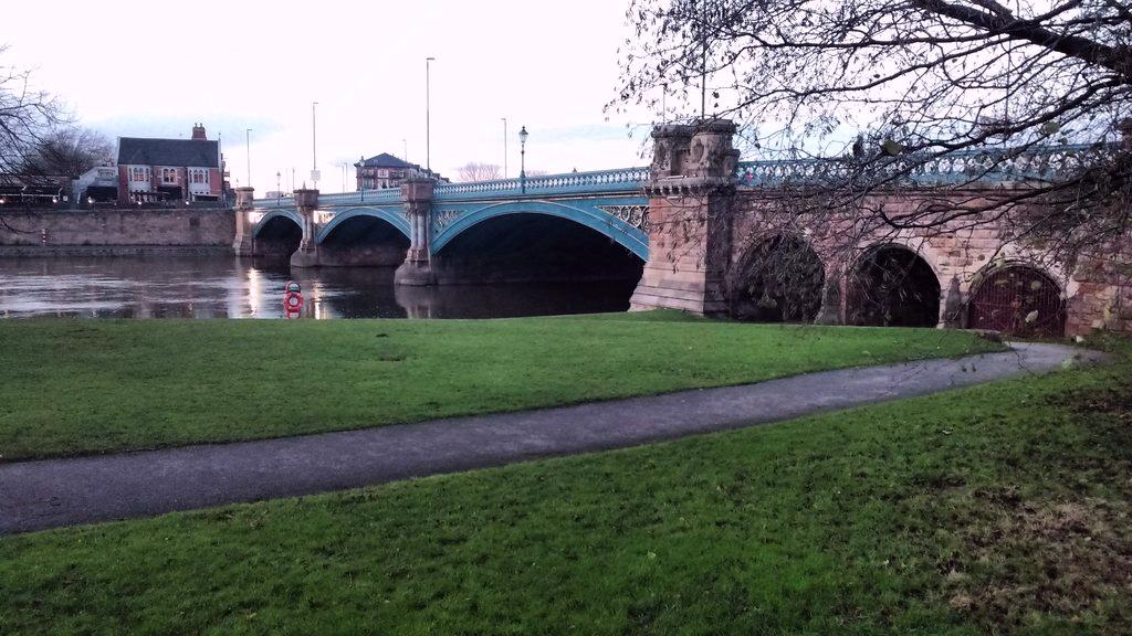


West Bridgford, United Kingdom
West Bridgford is a town of 36,487 people in England, United Kingdom.
Why visit West Bridgford
Townapedia lists 38 museums and landmarks, 36 parks and trails, 155 places to eat, 10 places to stay and 17 attractions in and around town.
Highlights include Lady Bay Bridge, Malt Cross, Holme Pierrepont Hall and National Justice Museum.
Weather in West Bridgford
Forecast from MET Norway (CC BY 4.0). Full forecast
About West Bridgford
West Bridgford () is a town and the administrative centre of the borough of Rushcliffe, in the county of Nottinghamshire, England. It lies south of Nottingham city centre, east of Wilford, north of Ruddington and west of Radcliffe-on-Trent; it is also south-west of Colwick and south-east of Beeston, which are on the opposite bank of the River Trent. The town is part of the Nottingham Urban Area and has an estimated population of 37,181 as of 2024.
From the Wikipedia article West Bridgford (this version), under CC BY-SA 4.0.
Photos of West Bridgford

Things to do17


Nottingham Playhouse
Cinema and theater · 2.1 mi
Theatre in Nottingham, Nottinghamshire, England, UK

Theatre Royal
Cinema and theater · 2.1 mi
Theatre in Nottingham, Nottinghamshire, England, UK


Waterside Bridge
Bridge · 0.9 mi
Pedestrian and cycle bridge in Nottingham, England

Wilford Suspension Bridge
Bridge · 0.6 mi
Footbridge and aqueduct which crosses the River Trent in the UK


Lace Market Theatre
Cinema and theater · 1.7 mi
Theatre in Nottingham, Nottinghamshire, England, UK
New Theatre
Cinema and theater · 3.0 mi
Theatre on University Park Campus, Nottingham, England
Nottingham Arts Theatre
Cinema and theater · 1.9 mi
Theatre in Nottingham, England
Rectory Junction Viaduct
Bridge · 3.3 mi
Railway viaduct in Nottinghamshire, England, UK
5 more on the map.
Museums and landmarks38

Holme Pierrepont Hall
Museum · 2.6 mi
Grade I listed country house in Nottinghamshire, England, UK

National Justice Museum
Museum · 1.7 mi
Museum housed in a former courtroom, gaol and police station in Nottingham, England, United Kingdom


City War Memorial
Monument and historic site · 0.7 mi
War memorial in Nottingham, England

Nottingham Castle Ducal Mansion
Museum · 1.8 mi
Former home of Duke of Newcastle, now museum and art gallery in Nottingham, Nottinghamshire, England, UK
Marshall Foch's Tribute to the Sherwood Foresters
Monument and historic site · 0.7 mi
26 more on the map.
Parks, trails and playgrounds36


Highfields Park, Nottingham
Park · 2.7 mi
Park in Nottingham, Nottinghamshire, England, UK



Colwick Country Park
Park · 1.8 mi
Country park in the English city of Nottingham
Forest Recreation Ground
Park · 2.8 mi
Park in Nottingham, United Kingdom

24 more on the map.
Restaurants and cafes155


200 Degrees
Cafe · Coffee Shop, Sandwich · 1.6 mi
99-101 Carrington Street, Nottingham
Mo-Sa 07:00-18:30; Su 08:00-18:30
Asda Café
Cafe · Coffee Shop · 0.7 mi
184 Loughborough Road, Nottingham
Mo-Sa 08:30-18:00; Su 10:00-16:00

Yumacha
Restaurant · Tapas
17 Central Avenue, Nottingham
Tu-We 10:00-23:00, Th-Sa 10:00-01:00, Su 10:00-23:00

Brew Tavern
Bar and pub · 1.5 mi
Cabmans' shelter
1A Queen's Road, Nottingham
Su-Th 12:00-22:00, Fr-Sa 12:00-23:00
Caffè Nero
Cafe · Coffee Shop
2 Central Avenue, Nottingham
Mo-Fr 07:00-19:00; Sa 07:30-19:00; Su 07:30-18:00
Grounded Kitchen
Restaurant
21 Tudor Square, Nottingham
Mo-We 12:00-20:30, Th-Sa 12:00-21:30, Su 12:00-20:00
143 more on the map.
History
West Bridgford was founded between 919 and 924, when defences and houses were built at the south end of Trent Bridge. It was established by Edward the Elder to protect Nottingham and the surrounding area against incursions from Danes in the North of England. A survey during Edward's reign indicates that the population at this time was 192 people, 19 of whom were farmers. In 1086, the Domesday survey recorded the village of Brigeforde as part of the Manor of Clifton. In 1523, the Musters family won the West Bridgford estate after winning in a game of cards.
Some main roads in central West Bridgford are named after wealthy families that dominated its early history, such as Musters Road.
Read more of the history
At the end of the First World War, the Musters family sold the Trent Bridge Inn and Trent Bridge cricket ground to the county cricket club. The club owned the inn briefly, then sold it at a profit to a brewery. After pressure, the Musters sold land for building, but strict planning regulations were stipulated for the West Bridgford Estate. This was planned over a grid of tree-lined roads. The main roads, such as Musters Road, had restrictions on housing density and size. All houses had to contain a specified number of bedrooms. Smaller houses were permitted on side roads and terraces were erected on roads such as Exchange Road for the servants of wealthy Nottingham merchants who had bought West Bridgford property.
40 people were killed by bombs, ten men, 25 women, and 5 children. There were 63 high explosive bombs, with 62 of those during the Nottingham Blitz.
Though some services like business waste and cycling park provisions are carried out or provided by Nottingham City Council.
In Nottingham, West Bridgford was sometimes negatively dubbed "Bread and Lard Island", suggesting that its residents had spent so much on big houses and fur coats that they could only afford to eat bread and lard. It grew from a small village in the mid-19th century into a town of over 36,000 inhabitants by 2021.
From the History section of West Bridgford on Wikipedia, under CC BY-SA 4.0.
More about West Bridgford
Geography
The northern boundary of West Bridgford is the River Trent. The river is spanned by two road bridges and a pedestrianised bridge allowing access from the town to the city of Nottingham. The bridges link to cycling routes in the city centre, railway station and the university areas.
Education
The West Bridgford School and Rushcliffe School are secondary schools with academy status. The Becket School and The Nottingham Emmanuel School are Catholic and Church of England schools respectively, both in West Bridgford, but operated through Nottingham City Council. The Becket School is fed by primary schools around Nottingham, but by only one school in West Bridgford: St Edmund Campion Catholic Primary School. The other feeder schools are Blessed Robert, St Edmund Campion, Our Lady and St Edward's.
The West Bridgford School's feeder primary schools are West Bridgford Infant and Junior School, Jesse Gray Primary School, Heymann Primary School and Greythorn Primary School. Rushcliffe School's feeder primary schools are Abbey Road Primary School, Pierpont Gamston Primary School, Edwalton Primary School, Lady Bay Primary School and St Peter's School in Ruddington.
From the Wikipedia article West Bridgford, under CC BY-SA 4.0.
Notable people from West Bridgford
 Kenneth ClarkeBritish politician (born 1940)Photo: Chris McAndrew, CC BY 3.0
 Anjli MohindraBritish actressPhoto: BennyOnTheLoose, CC BY-SA 4.0
 Ellie BrazilEnglish association football player (born 1999)Photo: James Boyes from UK, CC BY 2.0
 Gary ImlachBritish author, journalist and broadcasterPhoto: Cs-wolves, CC BY-SA 4.0
- Paul EsswoodEnglish countertenor and conductor
- Colin WellsBritish historian (1933-2010)
- John ClayEnglish cricketer (1924-2011)
- Peter FormanBritish cricketer (born 1934)
- John HodgkinsEnglish cricketer (1916-1988)
- John BirchEnglish luthier
- George Gunn juniorcricketer (1905-1957)
- David Beaumontcricketer (born 1944)
Born in West Bridgford, according to Wikidata (CC0). Each name links to its Wikipedia article.
Where to stay10
Churches and places of worship84
Friary United Reformed Church
Church · United Reformed · 0.5 mi
Musters Road, Nottingham
Shopping30
Gas and EV charging6
Schools, colleges and libraries32
St Edmund Campion Catholic Primary School
School · Roman Catholic · 0.5 mi
Tewkesbury Close, Nottingham
St Patrick's Catholic Primary and Nursery School
School · Roman Catholic · 1.3 mi
Coronation Avenue, Nottingham
Healthcare18
Singh's Lady Bay Pharmacy
Clinic and pharmacy · 0.7 mi
Trent Boulevard, Nottingham
Map of West Bridgford
250 places. The map loads OpenStreetMap tiles when you open it.
Getting there and nearby towns
Nottingham City Airport (NQT) is the nearest airport with scheduled flights listed in OpenStreetMap, 2 miles away.
- Nottingham 2 mi northwest, about 3 min by car
- Basford 4 mi northwest, about 6 min by car
- Chilwell 5 mi west, about 8 min by car
- Stapleford 6 mi west, about 10 min by car
- Kimberley 7 mi northwest, about 11 min by car
- Hucknall 8 mi northwest, about 13 min by car
- Eastwood 9 mi northwest, about 14 min by car
- Heanor 11 mi northwest, about 18 min by car
- Kirkby in Ashfield 13 mi northwest, about 20 min by car
- Derby 15 mi west, about 24 min by car
Drive times are estimates from straight-line distance, not routes.
Towns near West Bridgford


Keep exploring
Local news
Headlines from INDB.
Reviews, tips and questions
Loading what members have shared...
Sources and licences
- GeoNames (CC BY 4.0): population, coordinates, regions and time zone
- Mapillary (see each image): photos
- OpenStreetMap contributors (ODbL 1.0): places, airports, map data
- Wikidata (CC0 1.0): elevation, founding date, time zone, website, landmarks and historic places
- Wikimedia Commons (see each image): photos
- Wikipedia (CC BY-SA 4.0): overview and history text
Photo credits
- Lady Bay Bridge, Kate Jewell, CC BY-SA 2.0
- Malt Cross Upstairs, Veggiebacon, CC BY-SA 4.0
- TrentBridge2016, George Jordan, CC BY-SA 4.0
- Waterside Bridge (2) - 10 November 2025, Aethonatic, CC0
- Holme Pierrpoint Hall (listed grade I), Nottingham, MichaelMaggs, CC BY-SA 4.0
- High Pavement and the National Justice Museum, Nottingham (cropped), Roland Turner, CC BY-SA 2.0
- Highfields Park Cascade 9121, Photograph by Clem Rutter, Rochester, Kent. ( www.clemrutter.net )., CC BY-SA 3.0
- Rushcliffe Country Park (3 August 2008), Ruddred0 ( talk ), CC BY-SA 3.0
- Friary United Reformed Church, West Bridgford, Roger Templeman, CC BY-SA 2.0
- Albion Congregational Church, Andrewrabbott, CC BY-SA 4.0
- AllSaintsNottingham, Andrewrabbott ( talk ), Public domain
- Nottingham the city ground stadium forest, Arne Müseler, CC BY-SA 3.0 de
- Nottingham county fc notts stadium, Arne Müseler, CC BY-SA 3.0 de
- Trent Bridge MMB 01 England vs New Zealand, Mattbuck, CC BY-SA 3.0
- Castle Rock Brewery front, Ljtr24, CC BY-SA 4.0
- St. Saviour's in the Meadows, Nottingham by-Mick-Garratt, Mick Garratt, CC BY-SA 2.0
- Nottingham Memorial Park Victoria 0391s, Photograph by Clem Rutter, Rochester, Kent. ( www.clemrutter.net )., CC BY-SA 3.0
- Nottingham Memorial Gardens 0384, Photograph by Clem Rutter, Rochester, Kent. ( www.clemrutter.net )., CC BY-SA 3.0
- CityGroundFromAboveTrentBridgeCricketGround, Stadisimo, CC BY 4.0
- Nottingham Playhouse 3, MatthewDavid41, CC BY 4.0
- Nottingham MMB 73 Theatre Royal, mattbuck ( category ), CC BY-SA 3.0
- Wilford Suspension Bridge 0356, Photograph by Clem Rutter, Rochester, Kent. ( www.clemrutter.net )., CC BY-SA 3.0
- Street-level photo, victuallers, CC BY-SA 4.0
- Street-level photo, adam2, CC BY-SA 4.0
- Street-level photo, victuallers, CC BY-SA 4.0
- Street-level photo, adam2, CC BY-SA 4.0
- Street-level photo, adam2, CC BY-SA 4.0
- Street-level photo, adam2, CC BY-SA 4.0
- Street-level photo, adam2, CC BY-SA 4.0


Page built November 10, 2026. Spotted a mistake? Tell us or suggest a place.