


Burton upon Trent, United Kingdom
Burton upon Trent is a city of 122,199 people in England, United Kingdom.
Why visit Burton upon Trent
Townapedia lists 10 museums and landmarks, 19 parks and trails, 149 places to eat, 6 places to stay and 6 attractions in and around town.
Highlights include Ferry Bridge, Bailey Bridge (Walton on Trent), Burton upon Trent War Memorial and Sinai Park House.
Weather in Burton upon Trent
Forecast from MET Norway (CC BY 4.0). Full forecast
About Burton upon Trent
Burton upon Trent, also known as Burton-on-Trent or simply Burton, is a market town in the borough of East Staffordshire in the county of Staffordshire, England, close to the border with Derbyshire. At the 2021 census, it had a population of 76,270. The demonym for residents of the town is Burtonian. Burton is located on the River Trent 11 miles (18 km) south-west of Derby and 20 miles (32 km) south of the Peak District National Park.
From the Wikipedia article Burton upon Trent (this version), under CC BY-SA 4.0.
Travel tips from other travellers: Burton upon Trent on Wikivoyage (CC BY-SA 4.0).
Photos of Burton upon Trent


Things to do6

Ferry Bridge
Bridge · 1.1 mi
Footbridge in Burton upon Trent, Staffordshire, England

Bailey Bridge (Walton on Trent)
Bridge · 3.6 mi
Bridge in Staffordshire
Monks Bridge
Bridge · 2.8 mi
Bridge across the River Dove between Stretton (Staffordshire) and Egginton (Derbyshire), in the United Kingdom
St Peter's Bridge, Burton upon Trent
Bridge · 1.1 mi
Road bridge in Burton upon Trent, Staffordshire

The Ritz
Cinema and theater · 0.4 mi
Former cinema in Burton upon Trent, England, now a restaurant
Museums and landmarks10

Burton upon Trent War Memorial
Monument and historic site · 0.7 mi
War memorial in Burton upon Trent, Staffordshire, England, UK


Claymills Victorian Pumping Station
Museum · 2.0 mi
Pumping station in Burton, Staffordshire, England, UK
Parks, trails and playgrounds19


Branston Golf & Country Club
Golf course · 1.6 mi
18 hole Par 72 Course & 9 hole Par 30 Course
Burton Road, Burton-on-Trent


Pirelli Stadium
Sports field and stadium · 1.2 mi
Princess Way, Burton-on-Trent

7 more on the map.
Restaurants and cafes149
Inn Uendo's Bar
Bar and pub · 0.4 mi
Station Street, Burton-on-Trent
Th 16:00-22:30; Fr-Sa 13:00-23:00; Su 13:00-19:00


Bilash Spice
Restaurant · Indian · 1.9 mi
James Brindley Way, Burton-on-Trent
Mo-Sa 18:00-23:30
137 more on the map.
History
Rykneld Street, a Roman road, ran north-east through what later became the parish of Burton, linking settlements at Letocetum (Wall), near Lichfield and Derventio (Little Chester) near Derby.
Between 666 and 669 Wilfrid, the pro-Roman bishop of York, exercised episcopal functions in Mercia, whose Christian king, Wulfhere, gave him land in various places, on which he established monasteries. Burton was almost certainly one of the sites: the name Andresey given to an island in the river Trent near the parish church means "Andrew's isle" and refers to a church there dedicated to St Andrew. The island is associated with the legend of St Modwen or Modwenna, an Irish abbess. It is likely that any surviving religious house would have been destroyed during the Danish incursion into the area in 874. Place names indicate Scandinavian influence, and several personal names of Scandinavian origin were still used in the area in the early 12th century. In 1003 a Benedictine abbey was established on a new site on the west bank of the Trent at Burton by Wulfric Spott, a thegn. He is known to have been buried in the abbey cloister in 1010, alongside his wife.
Read more of the history
Burton Abbey was mentioned in the Domesday Book of 1086, where it was said to control lands in Appleby Magna in Leicestershire, and Mickleover, Winshill, Stapenhill, Coton in the Elms, Ca(u)ldwell (in Stapenhill Parish) and Ticknall, all then in Derbyshire. The monastery was the most important in Staffordshire and by the 1530s had the highest revenue. It is known that there were frequent Royal visits to the abbey, including those by William I, Henry II and Edward I. In the 12th and 13th centuries, streets were laid out off the west side of High Street, the earliest being New Street, which stretched from the abbey gates towards the line of Ryknild Street. Horninglow Street at the north end of High Street was part of a major east–west route using the bridge over the river.
A royal charter was granted on 12 April 1200 by King John to the Abbot to hold a market in Burton every Thursday. This charter was later renewed by King Henry III and King Edward IV. There were four annual fairs for trade in horses, cattle and produce: on Candlemas Day, 5 April, Holy Thursday, and 29 October (the feast of St Modwen) although as in other British towns this practice has died out.
While Burton's great bridge over the Trent was in poor repair by the early 16th century, it served as "a comen passage to and fro many countries to the grett releff and comfort of travellyng people", according to the abbot. The bridge was the site of two battles, first in 1322 when Edward II defeated the rebel Earl of Lancaster and also in 1643 when the Royalists captured the town during the First English Civil War.
Under Henry VIII the abbey was dissolved in 1539, to be refounded in 1541 as a collegiate church for a dean (who had been the last abbot) and four prebendaries. It was again dissolved in 1545 and granted to Sir William Paget. Paget began planning to expand the manor house within the abbey precincts, known to have existed since at least 1514, into a grand mansion. To provide the materials for this project, the old abbey buildings were to be cannibalised. There were major alterations to the house over the next three centuries. Sir William died in 1563.
In 1585 it was suggested that Mary, Queen of Scots might stay at Burton while Tutbury Castle was cleaned, but it was said that it was "a ruinous house, the buildings scattered and adjoining a very poor town, full of bad neighbours". The Paget family was implicated in Catholic plots against Queen Elizabeth I, the manor house along with most of the family estates were confiscated, with the manor house leased to Richard Almond in 1612. Parts of the abbey church may have been retained for parish use, however these were demolished and replaced by a new church in 1719–1726. Some fragments remain of the chapter house nearby, but little of the rest remains. Two buildings were converted to residential use—a part known as the manor house and the former infirmary. The infirmary became known as The Abbey and is now an inn.
The Paget family's lands and title were restored to them by James I in 1604 and they owned considerable estates around Burton for over 150 years. In 1699, William Lord Paget obtained an Act of Parliament to extend navigation on the River Trent from Nottingham up to Burton, but nothing was immediately done. In 1711 Lord Paget leased his rights to George Hayne, who in 1712 opened the River Trent Navigation and constructed a wharf and other buildings in the precinct of the old abbey. This led to the development of Burton as the major town for brewing and exporting beer, as it allowed Burton beer to be shipped to Hull, and on to the Baltic Sea and Prussia, as well as to London, where it was being sold in 1712. A number of breweries opened in the second half of the 18th century. The Napoleonic blockade badly affected overseas trade, leading to some consolidation and a redirection of the trade to London and Lancashire via canals. When Burton brewers succeeded in replicating the pale ale produced in London, the advantage of the water's qualities, in a process named Burtonisation allowed the development of the trade of Burton India Pale Ale (an ale specially brewed to keep during the long sea voyage to India). New rail links to Liverpool enabled brewers to export their beer throughout the British Empire.
From the History section of Burton upon Trent on Wikipedia, under CC BY-SA 4.0.
More about Burton upon Trent
Geography
Burton is about 109 miles (175 km) north west of London, about 30 miles (48 km) north east of Birmingham, the UK's second largest city and about 23 miles east of the county town Stafford. It is at the easternmost border of the county of Staffordshire with Derbyshire, its suburbs and the course of the River Trent forming part of the county boundary. It is also near the south-eastern terminus of the Trent and Mersey Canal.
Burton lies within the northern boundary of the National Forest.
The town centre is on the western bank of the River Trent in a valley bottom; its average elevation is about 50 metres above sea level; the village of Winshill and the suburb of Stapenhill rise to 130 m and 100 m respectively.
Burton became a centre for the brewing industry due in part to the quality of the local water, which contains a high proportion of dissolved salts, predominantly caused by the gypsum in the surrounding hills. This allowed a greater proportion of hops, a natural preservative, to be included in the beer, thereby allowing the beer to be shipped further afield. Much of the open land within and around the town is protected from chemical treatment to help preserve this water quality.
Economy
For centuries brewing was Burton's major trade, and it is still an important part of its economy. The town is currently home to eight breweries.
Coors Brewers Ltd produces Carling and Worthington Bitter, and was known as Bass Brewers Ltd until it was acquired by the American brewers Molson Coors Brewing Company in the late 1990s.
Marston's Brewery produces its own brands, draught Marston's Pedigree, draught Hobgoblin and also draught Bass under licence from InBev. Formerly Marston's, Thompson and Evershed plc, it was bought by Wolverhampton & Dudley Breweries and now renamed Marstons plc.
Burton Bridge Brewery is based in Bridge Street, with six pubs in and around Burton. It produces a number of traditional beers including Bridge Bitter, Stairway to Heaven, Damson Porter and Golden Delicious. Tower Brewery is a microbrewery off Wharf Road. Old Cottage Brewery is based in Hawkins Lane. Its beers include Oak Ale and Halcyon Daze. Black Hole Brewery is based at the Imex Centre. Gates Brewery microbrewery is in Reservoir Road.
Burton is also the corporate headquarters of the pub operators Punch Taverns plc and Spirit Pub Company which was bought by Greene King so doesn't have a headquarters there anymore, which were spun out of Bass in 1997. In addition, the White Shield microbrewery remains open alongside the former National Brewery Centre (at times, the Bass Museum of Brewing).
Arts and culture
The main venue for live theatre and other performing and visual arts is The Brewhouse, which is run by East Staffordshire Council. During the 1970s and 1980s a number of well known rock bands appeared at the 76 Club nightclub in Burton, including Dire Straits and the Sex Pistols.
Bloodstock Open Air is an annual festival of heavy metal music, which takes place in August and has been held at Catton Hall in Walton-on-Trent, 8 miles south-west of Burton since 2005.
Burton Operatic Society is a musical theatre company based in Burton and produces two productions each year. The town was also home to the Burton School of Speech and Drama on Guild Street where many professional and amateur actors and actresses learned their craft. Following the closure of the school in July 1984, its in-house amateur company, the Little Theatre Players, continued life as an independent amateur drama company called The Little Theatre Company. LTC currently stages at least four productions a year in the town: two plays, a musical and a youth production.
Education
Burton & South Derbyshire College (BSDC) is a general further education college and is situated in the town centre. It attracts approximately 13,000 students from Burton and the surrounding towns and villages. It delivers a wide range of courses for all ages including 14- to 19-year-olds, adults into part-time study, employer training and higher education. Recently a 'university centre' has been developed within the college to enable students to study on franchised higher education courses, but is not in itself a university.
The University of Wolverhampton's School of Health and Wellbeing has a presence at Burton Health Education Centre located at the Queen's Hospital, which specialises in nursing.
From the Wikipedia article Burton upon Trent, under CC BY-SA 4.0.
Notable people from Burton upon Trent
 Paddy ConsidineBritish actorPhoto: Miguel Discart, CC BY-SA 2.0
 Joe JacksonEnglish musician (born 1954)Photo: David Gans, CC BY 2.0
 Emily NelsonBritish cyclistPhoto: Pbalicki1, CC BY-SA 4.0
 David MacaulayBritish-born American illustrator and writerPhoto: Alvintrusty, CC BY-SA 3.0
 Michael Thomas BassBritish politician (1799-1884)Photo: Victuallers, CC BY-SA 3.0
 Bryan BirchBritish mathematicianPhoto: William Stein, CC BY 3.0
 Alison LapperEnglish artistPhoto: Hrse12, CC BY-SA 4.0
 Edward Stanley, 11th Earl of DerbyEnglish noble and politicianPhoto: Henry Pickering, Public domain
- Amanda MillingBritish Conservative politician
- Craig DaviesBritish footballer (born 1986)
- George NewberryBritish racing cyclist (1917–1978)
- Frederick ChristianBritish cricketer (1867-1934)
Born in Burton upon Trent, according to Wikidata (CC0). Each name links to its Wikipedia article.
Where to stay6
Travelodge Burton upon Trent Central
Motel and hotel
Derby Street, Burton-on-Trent
Churches and places of worship40
St John the Divine
Church · Anglican · 1.1 mi
Horninglow Road North, Burton-on-Trent
Shopping33
Gas and EV charging8
Schools, colleges and libraries45
Blessed Robert Sutton Catholic Voluntary Academy
School · Roman Catholic · 1.8 mi
Bluestone Lane, Burton-on-Trent
Holy Rosary Catholic Voluntary Academy
School · Roman Catholic · 1.1 mi
Alexandra Road, Burton-on-Trent
Healthcare23
Map of Burton upon Trent
250 places. The map loads OpenStreetMap tiles when you open it.
Getting there and nearby towns
East Midlands Airport (EMA) is the nearest airport with scheduled flights listed in OpenStreetMap, 13 miles away.
- Derby 11 mi northeast, about 17 min by car
- Sutton Coldfield 18 mi southwest, about 29 min by car
- Walsall 21 mi southwest, about 34 min by car
- Nottingham 23 mi northeast, about 37 min by car
- Leicester 24 mi southeast, about 39 min by car
- Birmingham 25 mi southwest, about 40 min by car
- Wolverhampton 25 mi southwest, about 41 min by car
- West Bromwich 25 mi southwest, about 40 min by car
- Stoke-on-Trent 26 mi northwest, about 42 min by car
- Coventry 28 mi south, about 45 min by car
Drive times are estimates from straight-line distance, not routes.
Towns near Burton upon Trent


Keep exploring
Local news
Headlines from INDB.
Reviews, tips and questions
Loading what members have shared...
Sources and licences
- GeoNames (CC BY 4.0): population, coordinates, regions and time zone
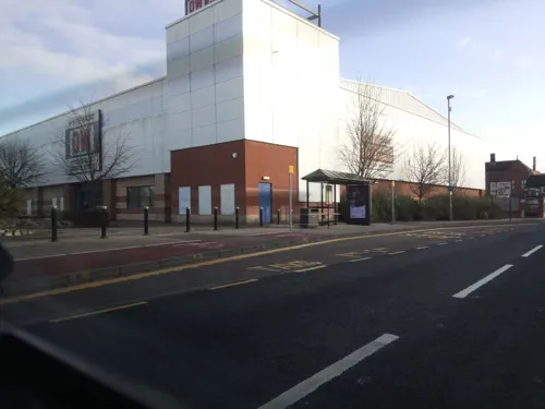
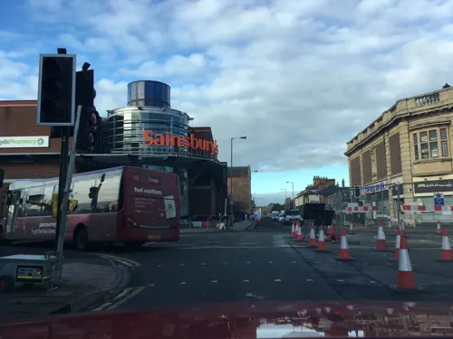
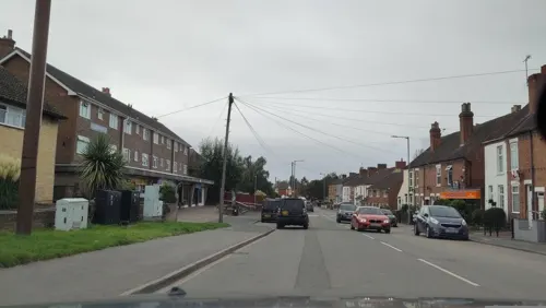
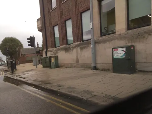
- Mapillary (see each image): photos
- OpenStreetMap contributors (ODbL 1.0): places, airports, map data
- Wikidata (CC0 1.0): elevation, founding date, time zone, website, landmarks and historic places
- Wikimedia Commons (see each image): photos
- Wikipedia (CC BY-SA 4.0): overview and history text
Photo credits
- Burton upon Trent Railway Station, John Sutton, CC BY-SA 2.0
- 66709 & 66715 , Burton upon Trent, Phil Sangwell from United Kingdom, CC BY 2.0
- Bridge in Burton upon Trent, stephen jones, CC BY 2.0
- War memorial garden - Burton upon Trent - war memorial (26919668285), Elliott Brown from Birmingham, United Kingdom, CC BY-SA 2.0
- St Mary, Tutbury, Alan Murray-Rust, CC BY-SA 2.0
- Newton Solney St Mary's Church, Gammock, CC BY-SA 4.0
- Rolleston on Dove in 2006, Michael Patterson, CC BY-SA 2.0
- St Modwen, Burton upon Trent, Stanley Walker, CC BY-SA 2.0
- StChadBurton1, Andrewrabbott ( talk ), Public domain
- Winshill St Marks Gates, mikejamestaylor, Public domain
- Burton-on-Trent railway station MMB 14, mattbuck ( category ), CC BY-SA 3.0
- Burton-on-Trent railway station MMB 13, mattbuck ( category ), CC BY-SA 3.0
- Burton-on-Trent railway station MMB 18 220003, mattbuck ( category ), CC BY-SA 3.0
- Burton-on-Trent railway station MMB 17, mattbuck ( category ), CC BY-SA 3.0
- Burton-on-Trent railway station MMB 20, mattbuck ( category ), CC BY-SA 3.0
- Burton-on-Trent railway station MMB 19, mattbuck ( category ), CC BY-SA 3.0
- Burton-on-Trent railway station MMB 11, mattbuck ( category ), CC BY-SA 3.0
- Burton-on-Trent railway station MMB 15, mattbuck ( category ), CC BY-SA 3.0
- Burton-on-Trent railway station MMB 12, mattbuck ( category ), CC BY-SA 3.0
- Trent mersey canal near branston water park, Sue Adair, CC BY-SA 2.0
- Looking back to the tee on the 2nd green, 9 hole PETER ALLIS course BRANSTON GOLF & COUNTRY CLUB. - panoramio, JOHN SIMPSON, CC BY 3.0
- Street-level photo, jamestait, CC BY-SA 4.0
- Street-level photo, southglos, CC BY-SA 4.0
- Street-level photo, southglos, CC BY-SA 4.0
- Street-level photo, southglos, CC BY-SA 4.0
- Street-level photo, southglos, CC BY-SA 4.0
- Street-level photo, southglos, CC BY-SA 4.0
- Street-level photo, southglos, CC BY-SA 4.0
- Street-level photo, southglos, CC BY-SA 4.0
- Street-level photo, southglos, CC BY-SA 4.0
- Street-level photo, southglos, CC BY-SA 4.0
- Street-level photo, jamestait, CC BY-SA 4.0
- Street-level photo, southglos, CC BY-SA 4.0
- Street-level photo, southglos, CC BY-SA 4.0
- Street-level photo, southglos, CC BY-SA 4.0
- Street-level photo, southglos, CC BY-SA 4.0
- Street-level photo, southglos, CC BY-SA 4.0
- Street-level photo, jamestait, CC BY-SA 4.0


Page built November 10, 2026. Spotted a mistake? Tell us or suggest a place.